Good day to all.
Today is Saturday, which means that everyone has a long-awaited day off. Therefore, I want to talk about one interesting trip that happened to me in the fall of 2011.
My dad works on Volgo-Balt 138. This is a sea-going ship, river-sea class. On this moment, due to the fact that the documents for flights abroad have expired, so the ship operates on domestic routes in the northwestern region.
After Karelia, I went on a ship to make one voyage with my dad. I didn’t waste any time, I shot a video and took a bunch of photos.
How loading, transportation, unloading is carried out, who is the captain and what to eat with him and much more. I'll tell you about this.
I’ll start with a description of the vessel, so that you have at least a little idea of what Volgo-Balt is like.
The project of the vessel 2-95A was released in March 1971. The length is 114 m, the width is 13 m and the freeboard height is 5.5 m. The maximum loaded draft (freeboard height, below the waterline) is 4 meters. The maximum speed is 10 knots (18 km/h), oh yes, at sea speed is determined not in miles or km/h, but in knots.
Let's start.
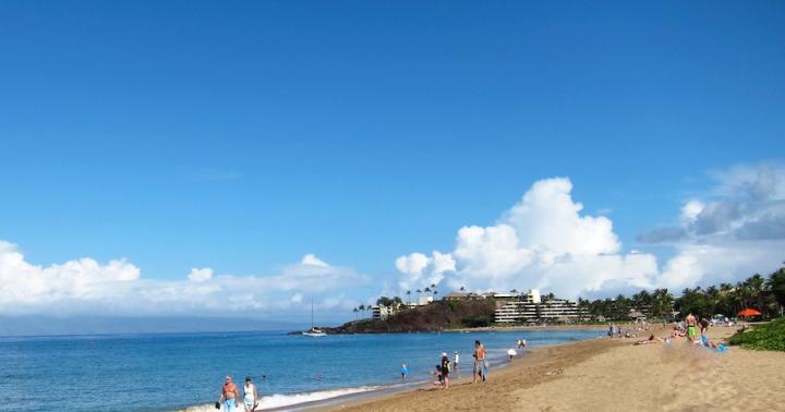
In this story, the ship is transporting crushed stone from a small village in Karelia called Ropruchey.
All around are solid rocks and Lake Onega.
The ship approaches the pier, which is equipped with a conveyor. The essence of the conveyor is that trucks carry crushed stone from quarries, everything is poured into a pit, from where stones and sand are moved along a conveyor belt into the hold of the ship. You can see all the details in the general video at the end of this post.
Volgo-Balt has four holds, which are closed with four lids so that nothing else gets into the hold except cargo. The covers move using a hydraulic mechanism, which is controlled from the Main Command Deck (Main Command Deck, in common parlance the Cabin)
Below are a few photographs of the loading of the vessel itself. Initially, the aft hold is loaded so that the ship does not simply break down, and is gradually filled towards the bow hold. The person on duty monitors the loading. By the way, watches are usually 4 hours after 8 (three people in the command staff) and 6 hours after 6 hours (two people, respectively). The degree of loading of the vessel is determined by the draft. There are marks on each side of the side that indicate that the vessel has sunk to a certain depth. Every person who monitors loading clearly knows the mark when the ship is in “Ballast” and when it is loaded.
Every half hour, marks of the vessel's load level are taken. Everything is documented and entered into the ship's log in order to avoid disagreements during inspections.
After a certain loading, the surveyor arrives. This is an inspector responsible for monitoring the loading of the vessel and for the cargo itself on the part of the customer for transportation. He checks and prepares documents for the cargo, counts how many tons have fallen into the hold of a particular ship and, based on this data, releases the ship on its voyage, or solves problems of underloading or overloading.
In our case, everything went perfectly. Loading was completed at 21:00. It was getting dark and the weather was beginning to deteriorate. The wind blew up the waves; according to the forecast, the wave height reached up to 3 meters in some areas of Lake Onega. My dad's watch had just begun.
The mooring lines were released, and in full reverse against the wind, the ship left the backwater. After which it turned around and set off on a certain course. It was dark and cold, so there weren't many night photos. More videos filmed.
Then the route was like this. Several hours on Lake Onega, request to the village dispatcher. Ascension, which gives the go-ahead for the descent along the Svir River. The watch ended and I went to bed.
At five o'clock it began to dawn. I woke up and went to Rubka to shoot a video. The ship was moving at full speed along the Svir River to the city of Podporozhye, to the Black Beach pier.
Then the ship moored to a crane with a 5-ton grab (bucket). And just like that, little by little, little by little, unloading takes place on shore. From there, the crushed stone is transported by dump trucks to construction sites, roads and other needs.
Next, a new order for transportation arrives, the ship is cleaned and proceeds for loading at the designated port. It's simple
Watch the video and if you like it, give it a thumbs up!
Several technical photographs of the vessel.
Photo from the Rubka, from where there is complete control of maneuvers, engines, everything, everything, everything
Two main engines that drive propellers, which in turn propel the ship
P.S.
You probably think that all waste is thrown overboard? Well, I do not. Everything is strict with this, environmental services monitor all this, control every waste discharge.
To ensure that the team does not pollute the environment, there are storage tankers and processors. A small ship approaches the ship, where everything is merged. Sometimes this process happens even on the go.
Thank you all for reading, commenting and telling your friends.
Dry cargo ships class "river-sea" type "Volgo-Balt" (project 791, 2-95, 2-95A, 2-95A/R), designed for transportation of bulk cargo (coal, ore, grain, crushed stone, etc.) over large inland waterways of Russia with access to the sea.
Vessels of this type have four holds with hatch covers, with a forecastle and a poop, with double sides and a double bottom, with an engine room and a superstructure in the aft part.
The main project of these vessels was Project 791 of the early 1960s, on the basis of which Project 2-95 and its variants were developed, which are distinguished by a modified design of the deckhouse, providing all-round visibility, and a reduced camber in the bow. Project 2-95 ships have two small chimneys, later ships (project 2-95A, 2-95A/R) have one. As a continuation of the Project 2-95 series, a series of ships of the Amur type were built.
Motor ships of this type were built in the USSR at the Krasnoe Sormovo plant (Russia, Nizhny Novgorod); Shipbuilding "Red Barricades" (Russia, Astrakhan), Gorokhovets Shipyard (Russia, Gorokhovets), as well as abroad - Slovenske Lodenice (Komarno, Slovakia).
Dry cargo ship "Volgo-Balt 156": IMO: 8867442, flag Russia, home port of Arkhangelsk, was built on April 28, 1974 according to project 2-95A (building number 1356) at Slovenske Lodenice (Komarno, Slovakia). Currently owner: Arcus Shipping Company LLC (bareboat charter). Reg. owner: Gervessa Shipping Co Ltd.
Main characteristics: Displacement 2498 tons, deadweight 3143 tons. Length 114 meters, width 13 meters, draft 3.8 meters. Speed 10 knots. Power is supplied from two main engines with a power of 515 kW. Has one deck, five bulkheads.
The completed vessel "Volgo-Balt 156" was delivered to the White Sea-Onega Shipping Company of the MRF of the RSFSR. Operator of the State Enterprise Petrozavodsk repair and operational base of the fleet of the BOP MRF of the RSFSR. Home port Petrozavodsk, flag Russia. In January 1975 it was renamed “Komsomol of Karelia”, home port is Petrozavodsk, flag is Russia.
In March 1993, OJSC White Sea-Onega Shipping Company became the owner of the vessel. It was again renamed "Volgo-Balt 156". Home port St. Petersburg.
Until February 1997, the ship sailed under the name "Central", then until November 1997 under the name "Enely". Owner and port of registry unknown.
In September 1998, the ship was renamed "Anton", flag of Saint Vincent and the Grenadines, home port of Kingstown.
In April 2012, the owner of the vessel became Arcus Shipping Company LLC, which renamed the vessel Volgo-Balt 156, flag Russia, home port of St. Petersburg.
July 24, 2013 at 10:40 in the Cherepovets region at 568 km of the Volga-Baltic waterway with a load of crushed stone on board.
In June 2015, Arkhangelsk became the ship’s home port.
Dry cargo vessel "Volgo-Balt 195": IMO: 8865999, flag Russia, home port of St. Petersburg, was laid down on March 17, 1976 according to project 2-95A/R (building number 1923) at Slovenske Lodenice (Komarno, Slovakia), built September 13, 1976.
RMRS class: KM*L4 R3-RSN.
Main characteristics: Gross tonnage 2516 tons, deadweight 3197 tons. Length 113.87 meters, width 13.02 meters, side height 5.5 meters, maximum draft 3.86 meters. Speed 10 knots. Power is supplied from two main engines with a power of 515 kW. Has one deck, five bulkheads.
Until March 1993, the ship belonged to the State Enterprise White Sea-Onega Shipping Company of the Ministry of the Russian Federation of the RSFSR, flag of the USSR, home port of Leningrad.
Until August 2003, it belonged to OJSC White Sea-Onega Shipping Company, flag Russia, home port of St. Petersburg.
Until December 2007, it belonged to OJSC SK Onego-Balt, flag Russia, home port of St. Petersburg.
Currently owned by Neva-Balt LLC.
Dry cargo vessel "Volgo-Balt 199" (until 2006 "Volgo-Balt 199"): IMO: 8850279, flag of Saint Kitts and Nevis, home port of Basseterre was laid down in 1976 according to project 2-95A/R (building number 1927 ) at Slovenske Lodenice (Komarno, Slovakia), built December 21, 1976. Shipbuilder: Slovenské lodenice Komárno a.s., Komárno, Slovenia. Owner: Valship LLC, Ukraine.
Main characteristics: Displacement 4761 tons, deadweight 3474 tons. Length 113.87 meters, width 13.0 meters, side height 5.5 meters, draft 3.86 meters. Speed 10.0 knots.
Built on December 21, 1976, the ship entered the White Sea-Onega Shipping Company and was operated along the rivers and seas of the Soviet Union. After the collapse of the Soviet Union, like most other ships, it passed in a certain way from state to private ownership.
December 04, 2012 off the coast of Turkey in the Sile region near Istanbul. There was a Russian-Ukrainian crew of 12 people on board. The ship was traveling from Mariupol to Antalya with a cargo of coal. Three crew members were rescued.
Dry cargo vessel "Volgo-Balt 210": IMO: 8230376, flag Russia, home port of Kaliningrad, was laid down on December 8, 1977 according to project 2-95A/R (building number 1939) at Slovenske Lodenice (Komarno, Slovakia), built on April 10 1978. Shipbuilder: Slovenské lodenice Komárno a.s., Komárno, Slovenia. Owner: JSC Transonega-Shipping.
RMRS register class formula: KM*L4 R3-RSN.
Main characteristics: Displacement 2516 tons, deadweight 3165 tons. Length 114 meters, width 13.23 meters, side height 5.5 meters, draft 3.6 meters. Speed 10.0 knots. Has one deck, five bulkheads.
Built in April 1978, the ship entered the White Sea-Onega Shipping Company and was operated along the rivers and seas of the Soviet Union under the flag of the USSR, home port of Leningrad.
In June 1995, Transonega-Shipping CJSC, flag Russia, home port of Kaliningrad, became the owner of the vessel.
On the night of October 1, 2011, it ran aground beyond the edge of the shipping channel at 876.5 km of the Vytegorsk Reservoir. The ship was transporting 1.5 thousand tons of Vologda timber from Belozersk to Kaliningrad. On September 3 at about 10:00 o'clock the operation to refloat the vessel was successfully completed.
On May 29, 2017, I was at the pier of the Lieutenant Schmidt embankment, Big port Saint Petersburg.
Dry cargo vessel "Volgo-Balt 227" (formerly "Volgo-Balt 227" until December 2009): IMO: 8841723, flag of Saint Kitts and Nevis, home port of Basseterre, was built on November 28, 1980 according to project 2-95A/R (building number 1958) at Slovenske Lodenice (Komarno, Slovakia). Owner and operator: Orbital Shipmanagement, Istanbul, Türkiye.
Main characteristics: Displacement 2516 tons, deadweight 3492 tons. Length 113.87 meters, beam 13.23 meters, draft 3.9 meters. Speed 10 knots. Has one deck, five bulkheads.
Built in November 1980, the ship entered the White Sea-Onega Shipping Company and was operated on the rivers and seas of the Soviet Union under the flag of the USSR, home port of Leningrad.
In March 1993, the owner of the vessel became OJSC White Sea-Onega Shipping Company, flag Russia, home port of St. Petersburg.
In October 2000, the owner of the vessel was JSC SK Onego-Balt, flag Russia, port of St. Petersburg.
In December 2009, Orbital Ship Management, Reg. Owner: Primavera Marine Co, Istanbul, Türkiye. The vessel was renamed “Volgo-Balt 227”, Cambodian flag, home port Phnom Penh.
According to a report dated October 11, 2013, the captain of the vessel, a citizen of Azerbaijan, was imposed by the Coast Guard Department of the Georgian Border Police in connection with the fact of sea pollution.
In November 2015, the ship was registered under the flag of Saint Kitts and Nevis, with its home port of Basseterre.
MINISTRY OF EDUCATION AND SCIENCE OF UKRAINE
Kyiv STATE ACADEMY OF WATER TRANSPORT
Department of Navigation
GRADUATE WORK
by discipline:
"Ensuring navigational safety of navigation"
Subject: " Navigation project for the passage of a vessel of the "Volgo - Balt" type along the route Odessa port - Trieste port
Specialization: " Navigation on sea and inland waterways"
Kyiv 2006
Exercise
Initial data:
1) transition route: port of Odessa - port of Trieste; vessel type: "Volgo-Balt";
release date and time: 04/01/2006, at 10:00;
2) navigational weapons: standard for this type of vessel; Additionally, the vessel is equipped with GNSS and RNS "Loran-S" receiver indicators;
3) the condition of the vessel - loaded;
4) transit speed: 9 knots;
5) notation accuracy coefficient: 0.5;
6) root-mean-square errors in measuring navigation parameters from the RShSU - 98;
7) height of the observer’s eye: e = 9 meters;
8) swimming along the DBC φ n =20 0 20.0’S λ n =57 0 40.0’E; φ k =32 0 03.0’S λ k =115 0 46.0’E.
Reporting materials:
An explanatory note prepared in accordance with the methodology for course work.
Graphic plan for the transition to photocopies from the general map No. 30115.
Graphic plan of the passage of the Bosphorus Strait on a photocopy from map No. 36128.
Plan of the port of arrival on photocopies from the navigation plan of the port No. 38337.
Head of robots:
Designer:
annotation
The route for the transition Odessa - Trieste passes through the Black Sea, the Bosphorus Strait, the Sea of Marmara, the Dardanelles Strait, the Aegean Sea, the Ionian Sea, the Adriatic Sea. The path described below was chosen based on several conditions.
The choice of path was influenced by:
Register class and maneuverable elements of the vessel;
presence of navigational hazards;
length of sections and economic feasibility of passing the chosen route;
All measures and requirements for navigational safety of the passage are specified in accordance with the recommendations for organizing navigational service on ships (RSHSU-98).
When calculating the robot, a microcalculator of the following brand was used:
Exercise
annotation
Introduction
1. Navigation preparation for the transition
1.1 Selection of maps, manuals, manuals
1.2 Replenishment, storage, correction and write-off of cards and books
2.3 Hydrometeorological conditions
1.4 Navigation and hydrographic conditions
1.5 Port information
1.6 Choice of the transoceanic route
1.7 Preparation of technical navigation aids
Chapter 2: Transition Design
2.1 Development of a graphical transition plan
2.2 Pre-laying
2.3 Raising cards
2.4 Natural light
2.5 Tidal phenomena
2.6 Estimation of location accuracy
2.7 Observation plan
Conclusion
List of used literature
Introduction
With the development of international trade and scientific and technological progress, the need to provide the fleet with new ships has increased. Quantitative, and mainly qualitative changes in the composition of the fleet pose the task of a more in-depth scientific approach to navigation issues.
Currently, with the development of maritime transport, ship speeds have increased to 17-25 knots and displacement to several tens of thousands of tons, in connection with this, quantitative and sufficiently accurate data are required to ensure the safety of ships.
In the overall task of ensuring the safety of navigation, the problem of ships diverging from each other occupies one of the most important places.
In this regard, the most important is navigational preparation for the transition: equipping the ship’s collection with nautical charts, manuals, manuals, scientific materials for proofreading the ship’s collection, selecting navigational nautical charts, choosing a route, preparing and testing the operation of technical navigation aids, checking the availability of information about the maneuvering characteristics of the vessel.
The main task of maritime transport is the safe transportation of goods and passengers in the shortest possible time. Fulfilling this task, as well as increasing the efficiency of maritime transport, requires careful voyage planning. The basis for voyage planning is determined by the SOLAS 74 convention (Safety and Life at Sea Convention, 1974) and the International Management and Safety Codes (ISM Codes). These conventions define in general terms how a ship should be equipped (in terms of navigation) for a voyage and the basic principles of voyage planning.
According to various data from organizations related to maritime shipping, from 70 to 90 percent of all navigation accidents occur due to the fault of ship crews. The likelihood of accidents can be significantly reduced by working out and planning flights in advance.
INFORMATION ABOUT THE MOTOR SHIP "Volgo-Balt".
Main tactical and technical characteristics of the vessel.
Information about the ship is given in accordance with and with use.
Type - single-deck, twin-screw cargo ship, with a double bottom and double sides, with a forecastle, with an engine room and deckhouses located in the stern, with 4 cargo holds. The vessel is designed to transport coal, timber and general cargo along deep-water river and lake routes and coastal sea areas.
Title - “HEROES OF TRIPOLIA"
Call sign - UELS
Year and place of construction - 1977, Kamarno, Czechoslovakia.
Register class - M-SP river register of the RSFSR (ice 30).
Home port - Kherson, Ukraine.
Project number - 1743.1
IMO number is 169364.
Length: greatest - 114.0 m
between perpendiculars - 107.35 m
Width - 13.2 m
Side height - 5.5 m
Fully loaded draft
with full reserves: 3.77 m
in ballast: 2.68 m
empty: 1.12 m
Displacement: fully loaded - 4062 t
empty - 1212 tons.
Registered tonnage: gross - 2,584 registered. T.
net - 1,075 reg. T.
Deadweight - 3,192 tons.
Type and power of the main 2 engines - marine irreversible,
power plant: with direct fuel injection,
type SKODA 6 - 27.5 A2 A supercharged
No. = 700 l/s. n = 600 rpm.
Operating speed: loaded - 9.0kt/hour.
in ballast - 10.5 knots/hour.
The inertial and maneuvering characteristics of the vessel are given in tables 1.1 and 1.2, as well as in figures 1.1 and 1.2
Table 1.1 - Inertial characteristics of the vessel
|
Type of maneuver |
In ballast |
|||
|
Time, min. |
Distance, kb. |
Time, min. |
Distance, kb. |
|
|
PPH - STOP |
||||
|
PSC - STOP |
||||
|
PMH - STOP |
||||
|
PSMH - STOP |
||||
|
PPH - ZPH |
||||
|
PSH - ZPH |
||||
|
PMH - ZPH |
||||
|
PSMH - ZPH |
||||
|
STOP - PPH |
||||
Table 1.2 - Maneuverable characteristics of the vessel
|
Circulation time |
|||||
|
In ballast |
|||||
Dangerous traffic lane ± 27.1 m from the traffic path.
Figure 1.1 Vessel circulation in ballast.
Figure 1.2 Vessel circulation in cargo
Navigation equipment.
Information about technical navigation aids (TSA) is given in Table No. 1.3.
Table 1.3 - Technical navigation aids available on board the ship
|
Device, system |
Type, brand |
Year of issue |
Installation location |
|
|
Magnetic compass (basic) |
direction finding deck |
|||
|
Magnetic compass (travel) |
navigation bridge |
|||
|
Gyro-compass |
"Amur - 2M" |
gyrocompass post |
||
|
Radar (main) |
"Donets - 2" |
navigation bridge |
||
|
Radar backup |
navigation bridge |
|||
|
Direction finder |
"Fish M" |
navigation bridge |
||
|
Receiver indicator RNS "Loran S" |
navigation bridge |
|||
|
Hydrodynamic log |
navigation bridge |
|||
|
Navigation echo sounder |
navigation bridge |
|||
|
navigation bridge |
||||
|
Satellite navigation system “GPS-GLONASS” |
navigation bridge |
Table 1.4 - Deviation of the magnetic compass UKP M-3 (main)
|
|
|
||
Coefficients: A=+0.3 o, B=+0.3 o, C=+0.4 o, D=+0.35 o, E=+0.67 o.
Table 1.5 - Radio deviation of the direction finder "Rybka - M"
Coefficients: A= +0.4є D= +0.9є E= +2.3є B= +1.0є C= - 0.9є λ=410 kHz
H=14.6m
H=16.0m
Figure 1.3 - Plan diagram of a vessel of the "Volgo-Balt" type
Radar "Donets - 2" Radar "Mius"
Figure 1.4 - Scheme of shadow sectors and dead zones of the radar
1. Navigation preparation for the transition
1.1 Selection of maps, manuals, manuals
According to RShSU-98, the selection of navigational sea charts, manuals, manuals for the upcoming passage (voyage) is carried out according to the catalog of maps and books in accordance with the requirements of the rules for proofreading, completing and storing charts and manuals for navigation on ships of civil departments 9038.
Maps are selected from the corrected catalog of maps and books as follows:
in any part of the catalogue, using the sheet “Cutting parts of the catalogue”, which is placed at the beginning of the book, determines the required part of the catalogue;
in the selected part of the catalog, according to the collection sheet of the collection sheets of maps placed at the beginning of the “Charts” section, the numbers of the collection sheets of the upcoming navigation area are written down;
in the same section “Charts”, using the written out collection sheets, the numbers of the necessary maps for the upcoming sailing route are selected and written out; The numbers of the general maps on which the points of departure and arrival are located are written out first, and then the numbers of plans, private and travel maps;
To select sailing directions and other navigation manuals, use the “Books” section of the catalog of maps and books. The boundaries of sailing directions, descriptions of lights and signs and other guidelines are indicated on the corresponding collection sheets in the “Books” section, and the numbers on these sheets indicate the publication numbers. We select maps, guides and manuals for sailing along the crossing route according to the catalog of maps and books No. 7202 (Part III. Mediterranean, Black, Azov, Aral Seas and Lake Issyk-Kul).
Table 1.1.1 - Maps
|
Admiralteysky card number |
Title (title) of the card |
Scale (1:), |
Ship date |
|
|
GENERAL CARDS |
||||
|
Black and Aegean seas |
||||
|
Middle Mediterranean |
||||
|
Western part of the Black Sea |
||||
|
Aegean and Marmara seas |
||||
|
Ionian Sea |
||||
|
Adriatic Sea |
||||
|
From Sevastopol to Constanta |
||||
|
From Constanta port to Amasra port |
||||
|
North Aegean |
||||
|
Southern Aegean |
||||
|
From Cape Tenaron (Matapan) to the port of Benghazi |
||||
|
Eastern Ionian Sea |
||||
|
Southern Adriatic Sea |
||||
|
Northern part of the Adriatic Sea |
||||
|
TRAVEL AND PRIVATE MAPS AND PLANS |
||||
|
Port Odessa |
||||
|
Approaches to the port of Odessa |
||||
|
Approaches to the port of Odessa, Ilyichevsk and Yuzhny |
||||
|
From Odessa to Sulina branch |
||||
|
From 44є11΄N to 45є24΄N From 30є00΄E to 32є20΄E |
||||
|
From St. George's Arm to Cape Kaliakra |
||||
|
From 43є05΄N to 44є20΄N From 30є00΄E to 32є20΄E |
||||
|
From Cape Kaliakra to Michurin Bay |
||||
|
From 42є10΄N to 43є25΄N From 29є36΄E to 31є56΄E |
||||
|
From Michurin Bay to Cape Shile |
||||
|
From Inebolu port to Zonguldak port |
||||
|
Approaches to the Bosphorus Strait |
||||
|
Bosphorus |
||||
|
Approaches to the Bosphorus Strait |
||||
|
Sea of Marmara. Middle part |
||||
|
Sea of Marmara |
||||
|
Sea of Marmara. West Side |
||||
|
Dardanelles Strait |
||||
|
Approaches to the Dardanelles Strait |
||||
|
Central part of the Dardanelles |
||||
|
Southern part of the Dardanelles |
||||
|
From the Dardanelles to Skyros |
||||
|
From Skyros Island to Ikaria Island |
||||
|
From the Kafirefs (Doro) Strait to the Gulf of Argolikos |
||||
|
Strait of Kafirefs (Doro) |
||||
|
The straits of Keos, Kythnos and Serifos |
||||
|
From Argolikos Gulf to Crete |
||||
|
From the island of Andikithira to the island of Sapienza |
||||
|
From Kythira Island to Belopoulo Island (Parapola) |
||||
|
Lakonikos Bay with approaches |
||||
|
From Sapienza Island to Zakynthos Island |
||||
|
From Zakynthos Island to Lefkada Island |
||||
|
From Lefkada Island to Cape Mullet |
||||
|
Strait of Otranto |
||||
|
From the port of Brindisi to Cape San Francesco |
||||
|
From Cape Voluvica to the island of Mljet |
||||
|
From Lastovo Island to Mulo Island |
||||
|
From the town of Peschici to the harbor of San Benedetto del Tronto |
||||
|
From the port of Ancona to the port of Sibenik |
||||
|
From the port of Ancona to the harbor of Porto Garibaldi |
||||
|
Venice Bay |
||||
|
Eastern part of the Gulf of Venice |
||||
|
Port of Trieste |
||||
|
REFERENCE CARDS |
||||
|
Hydrometeorological maps of the Mediterranean Sea |
||||
|
World map. Horizontal (H) and vertical (Z) components of the geomagnetic field strength of the era ... 1975 (maps of the elements of terrestrial magnetism) |
||||
|
Map of world time zones |
||||
|
Maps of radio navigation systems (LORAN-S) |
||||
|
Ionian Sea 7990-Х 7990-Y 7990-Z |
||||
|
North Aegean Sea 7990-Х 7990-Y 7990-Z |
||||
|
Southern Aegean Sea 7990-Х 7990-Y 7990-Z |
||||
|
Eastern Ionian Sea 7990-X 7990-Y 7990-Z |
||||
|
Southern Adriatic Sea 7990-X 7990-Y 7990-Z |
||||
|
Northern Adriatic Sea 7990-X 7990-Y 7990-Z |
||||
|
AUXILIARY CARDS |
||||
|
Maps - grids |
||||
|
Latitudinal zone 34є22΄ - 35є56΄ |
||||
|
Latitudinal zone 35є44΄ - 37є16΄ |
||||
|
Latitudinal zone 37є03΄ - 38є33΄ |
||||
|
Latitudinal zone 38є21΄ - 39є50΄ |
||||
|
Latitudinal zone 39є38΄ - 41є05΄ |
||||
|
Latitudinal zone 40є52΄ - 42є17΄ |
||||
|
Nomogram for determining the initial course when sailing along the DBC |
||||
Table 1.1.2 - Manuals and manuals
|
Admiralteysky |
Name of the benefit |
Ship date |
Notes |
|
SWIMMING GUIDELINES |
|||
|
Black Sea pilot |
with additions |
||
|
Pilotage of the Sea of Marmara and straits Bosphorus and Dardanelles |
|||
|
Pilot of the Aegean Sea |
|||
|
Pilot of the Ionian Sea |
|||
|
Pilotage of the Mediterranean Sea Part-6 |
|||
|
Lights and signs of the Black and Azov seas |
|||
|
Lights of the Mediterranean Sea Part-1 |
|||
|
Lights of the Mediterranean Sea Part-2 |
|||
|
Description of radio stations leading fax transmissions hydrometeorological information |
|||
|
Radio navigation systems |
|||
|
Navigation program schedule warnings |
|||
|
Hydrometeorological schedule messages for seafarers |
|||
|
Admiralty List of Lights and Fogs signals. Part-E |
|||
|
Radio equipment navigation equipment, Black and Mediterranean seas |
|||
|
Istanbul Strait and Canakkale Strait |
|||
|
Convention on COLREGs at Sea |
|||
|
Collection of treaties and legislation acts of foreign states on Navigation Issues, Volume-2 |
|||
|
IALA Guides |
|||
|
REFERENCES |
|||
|
Vessel navigation regime in Cherny and Seas of Azov (summary description) |
|||
|
Catalog of maps and books. Part-3 |
|||
|
Tide tables for 2006 Volume-3 |
|||
|
Atlas of surface currents Black Sea |
|||
|
Atlas of surface currents Mediterranean Sea |
|||
|
Atlas of waves and wind Mediterranean Sea |
|||
|
Conventions, abbreviations and design samples for nautical charts and GDP maps |
|||
|
Directory of Ports of the World |
|||
|
Description of the ship's features lights of warships and signals, supplied by ships and vessels to ensure navigation safety |
|||
|
Ocean ways of the world |
|||
|
COMPUTING AID |
|||
|
in areas of traffic separation |
|||
|
VAS-58, Volume-2 |
|||
|
VAS-58, Volume-3 |
|||
Before going on a voyage, the vessel is checked for the availability of basic navigational documentation in accordance with the requirements of RShSU-98, these include:
ship's log;
register of ship's logs;
forms, technical passports and/e for ship TSN;
chronometer correction log;
compass correction log;
a log of water measurements in bilges and tanks;
radio deviation table;
lag correction table;
diagrams of shadow sectors and meter zones of the radar;
information about the maneuvering characteristics of the vessel;
catalogs of maps and books;
filing of notices to seafarers and proofreadings;
magazines PRIP, NAVAREA, NAVTEX;
weather forecast log;
order to announce the list of mandatory ship collection.
1.2 Replenishment, storage, correction and write-off of cards and books
To ensure navigation safety, each vessel must always have the necessary charts and navigation manuals available, a mandatory list of which for the vessel is determined by the shipowner's navigation service, taking into account the type of vessel, transportation plan, securing the vessel to one or another shipping line, as well as possible options for change navigation areas.
The compilation, selection and proofreading of maps, manuals and manuals for the upcoming flight is carried out in accordance with the requirements of the current Proofreading Rules.
The ship's chart collection must be kept up to date at all times.
To obtain the necessary maps and manuals for navigation, the third mate draws up an application in the form, in two copies, signs it with the captain and no later than 10 days before receiving the maps and manuals, submits it to the ERN. In case of application from another port, the time required for forwarding must be taken into account. When submitting an application from the sea by radio, it must be sent at least 10 days in advance, indicating the date and time of the vessel’s arrival at the port. The use of maps and manuals is permitted only to persons directly related to these documents, without removal from specially designated office premises.
Maps of the ship's collection should be stored in the drawers of the chart table, or on specially adapted racks or in pencil cases, and navigation manuals - in cabinets or on special shelves. The chart room (or other room in which charts and manuals are stored) is a service area, access to which is determined by the captain.
The maps and manuals received by the ship are entered into the Number Index of the Catalog of Maps and Books. Quantitative records of maps and manuals are kept in the inventory book for the deck section.
The numbers of outdated maps and manuals that are subject to withdrawal from use are periodically announced. As a rule, such announcements are made after the publication of new publications for the same areas. Upon receipt of an announcement about the release of new publications, the third mate is obliged to inform the captain of the ship and, with his permission, apply for new publications.
Maps from the ship's collection are replaced with new ones:
in the event of an announcement in the appendices to the IM VCO and MO or in the II department of issues of the IM VCO and MO about their unsuitability for navigation purposes.
Due to their physical wear and tear due to constant use while sailing on the same voyage.
Maps, books and navigation manuals that have become unusable are destroyed on board by burning or submitted for mechanical recycling in accordance with the procedure established by the ERN.
Destruction of charts and navigation manuals is carried out only after new editions of charts and manuals arrive on the ship.
In all cases, the write-off of maps and manuals is carried out according to an act that indicates the numbers of the publications being written off, the total amount of cost, the basis or reason for the write-off and notes. The decommissioning act, in two copies, is signed by the crew members headed by the senior mate, the act is approved by the captain of the vessel. After this, appropriate changes are made in all documents for recording ship navigation aids. Write-off of cards occurs when, in addition to the Notice of write-off of a particular card, a new card arrives on the ship, but with printing changes and does not require adjustments. Otherwise, you should take the old, available card as a working card and store it together with with the rest of the charts suitable for navigation until a new card is received that completely replaces the out-of-use one, according to the Notices to Mariners of the IM GUNiO, its expired, outdated analogue.
Maps and guides are periodically corrected based on proofreading documents.
The following types of map corrections have been introduced:
a new edition carried out in cases where, due to the large number
corrections require the production of new originals;
major proofreading: consists of releasing a new edition without rebuilding the originals, but taking into account all changes in the navigational situation;
pasting newly printed individual sections with the necessary
corrections;
minor proofreading: issuing an additional edition of cards when the previous one
circulation has been used up;
reissue: carried out when the volume of corrections reaches 15% of the circulation volume or manual text;
addition: published periodically as corrections are added;
consolidated proofs: usually published annually.
Navigation guidelines are adjusted only based on regular Notices to Mariners, which are issued once a week. Correction of charts in port and at sea is carried out by the third mate. If the ship is at sea, then the charts are corrected using radio notifications or fax notifications, which contain information about changes in the navigation situation, which is urgent for mariners before they receive regular Notices to Mariners only in pencil, and after receiving regular Notifications, depending on the information - with a simple pencil or ballpoint pen with red paste.
When receiving notices to seafarers of the IM GUNiO on a ship in a port, if next to the number of one of the notices there is an addition “B” - Temporarily or “P” - Preliminary, then the proofreading should be carried out strictly only with a simple pencil, if next to the number of the notice there are no designations, then the change in the navigation situation according to such a notice is permanent and requires permanent adjustment using a ballpoint pen with red paste in this pen.
You must start with the last notice accepted for adjustment. Data on changes in the navigation situation, which urgently need to be brought to the attention of mariners before they receive regular Notices to Mariners, are transmitted by radio.
In the port, navigational sea charts are corrected according to notifications from IMGUNIO, the correction is made in red, and temporary and preliminary corrections are applied in pencil. At sea, proofreading is done only in pencil using PRIP, NAVIP, NAVAREA and NAVTECH messages.
World Radio Navigation Warning Service (WWWWW).
Three types of navigational warnings are transmitted within the framework of the WSNR - regional, coastal and local.
1) To coordinate the radio transmission of area warnings, the World Ocean is divided into 16 geographical areas. Where necessary, the term NAVAREA followed by the area number is used to abbreviate the area. Area warnings are
long-range radio navigation warnings compiled by the area coordinator and transmitted via a high-power radio station.
2) COASTAL WARNINGS are radio navigational warnings relating to an area or part of an area, announced by the national coordinator through national coast radio stations.
3) Local warnings (LOCAL WARNINGS) are radio navigation warnings related to the area within the jurisdiction of port authorities.
Navigation warnings within the framework of the WWN provide mariners of all countries with navigational information in English.
NAVTEX - International Automated Navigation and Meteorological Information System. Coastal stations operate on a frequency of 518 kHz, and transmit information about navigational and hydrometeorological warnings, ice conditions and weather forecasts. Vessels of 300 gross tonnage. tons and more, those put into operation since 1990 must have NAVTEX receivers.
2.3 Hydrometeorological conditions
Black Sea.
In spring, the difference in air temperature between the northern and southern
in some areas it gradually smoothes out. If in March the average
the temperature on the coast varies from 2 °C in the northwest to
9 °C in the southeast, then in June in the open sea and on the coast
it is 15-17 °C. Relative humidity in
during the year on average ranges from 60 to 88%, and from May-
June to September it is lower than in other months.
Winds.
In April there is no clearly defined predominance at all
any specific wind direction. At all points from
In April-May, winds from SW, E and S are most often observed; repeatability
August, at some points the prevailing wind is from W (22-33%).
Storms from the NW are most often observed in the spring, they are accompanied by
cloudy weather. Breezes on most of the coast - from May.
Fogs.
In the open part of the Black Sea, the frequency of fogs is in
on average 1-5% during the year. There are fogs in the central region of the sea
are observed more often than in other areas: their frequency is on average
per year is 5%.
Visibility.
In the described area, visibility is 5-10 miles or more.
The best visibility conditions are observed from April to October -
november. Reduced visibility is observed during fog and precipitation.
In the Black Sea, normal radar observability prevails throughout the year.
Cloudiness and precipitation.
Average monthly cloudiness over a significant part of the described area
from April to October is 3-6 points. Precipitation in the open part
The average annual rainfall in the Black Sea is 170 mm. In the northwest up to 900
mm. in the southeast.
The hydrological regime of the Black Sea is formed under the influence
water exchange with the Marmara and Azov seas, fresh water flow from land and
climatic conditions. Through the Bosphorus Strait, surface waters of the Black Sea
the seas fall into the Sea of Marmara, and the deep waters of the Sea of Marmara
flow into the Black Sea and fill its deep-water part.
Continental runoff causes significant distribution
surface layer of water. In general for the hydrological regime
the described area is characterized by: high water temperature at
throughout the year, the predominance of waves less than 2 m high and the system
stable currents.
Level fluctuations and tides.
The level of the Black Sea changes mainly under the influence
surge and seiche fluctuations, as well as river water flow.
Seasonal fluctuations in the Black Sea level are most clearly
expressed in areas influenced by continental runoff; the magnitude of these
fluctuations usually do not exceed 0.4 m. Level decrease
observed in October - November (in some areas in January -
February), and an increase in April-July.
Currents.
The general pattern of Black Sea currents is a single system of closed, predominantly cyclonic flows (gyres) for the entire sea. The current speed is on average 0.6-1.2 knots, and on the current axis it increases to 1.4 knots. The main current in the general circulation system is most pronounced, its stability is 90% in the summer.
Excitement.
In spring, weak waves prevail everywhere; the frequency of waves less than 1 m high is 55-70%. Waves are 2-3 m high, their frequency reaches no more than 12%. The maximum possible wave height is 11 m.
Temperature, salinity and density of water.
The sea surface temperature is quite high throughout the year. Salinity of the surface layer of the sea in the central part of the sea it is about 18‰, as it approaches the shores it decreases to 16‰. The density of the sea surface layer is about 1.013t/m3.
Hydrometeorological conditions for navigation of ships in the Black Sea are generally favorable. Difficulties can be caused by strong winds, reduced visibility due to fog and sometimes due to intense precipitation. The formation of the climate of the Black Sea and its coast is determined by the geographical position of the sea, the conditions of atmospheric circulation over it and over the adjacent land areas, as well as the geographical complexity of its coasts.
Sea of Marmara, Bosphorus and Dardanelles.
Air temperature and humidity.
The warmest month of spring is April; its average monthly temperature is 17 - 20°. The highest temperature in these months is 22°-27°. Relative air humidity throughout the year is significant in the spring, 60-70%.
Winds.
In a significant part of the described area, winds from the NE prevail throughout the year; Of the winds from other directions, the most likely winds are from N (frequency rate 15 - 20%) and SW. In certain areas of the eastern coast of the Sea of Marmara, from November to February, winds from S prevail, from March to August from NE and W.
Winds from the SW usually do not reach great strength and are accompanied by hot weather in the summer and warm in the rest of the seasons. The average monthly wind speed on the coasts of the region ranges from 2 to 4 m/sec. .
Calms are observed quite often, their frequency on most of the coast is 10 - 20%, in some places 30 - 35%. Storms are rare.
The average annual number of days with them does not exceed 20.
The exception is certain points, such as the city of Canakkale, where on average there are 53 days with storms per year, and the average monthly number of days with them ranges from 2-4 from April to November. Breezes are most developed from May to September.
Fogs.
Fogs at sea are observed very rarely, especially in the warm season.
Their recurrence throughout the year does not exceed 2%.
Visibility.
Visibility in the described area is good. The frequency of visibility of 5 miles or more throughout the year is about 90%, less than 2 miles throughout the year is less than 4%.
Radar observability.
In this area, normal conditions prevail throughout the year.
radar observability.
Cloudiness and precipitation.
From April to September, clear skies prevail, the frequency of which in April, August and September is especially high and reaches 70-90%; The frequency of cloudy skies in these months is usually 10-20%. The average annual number of clear days ranges from 70 to 115 miles. From April - June to September - October the greatest number of clear days is observed:
on average up to 10-25 per month. On average, there are from 80 to 115 cloudy days a year. From April to October, the average monthly number of cloudy days is no more than 7.
Navigation preparation for the passage along the route Poti - Izmir: measures taken by the navigator during the preparation and execution of the transition, selection of maps and their correction, study of the navigation situation along the route, hydrometeorological conditions.
The procedure for selecting maps, manuals for navigation along the transition route, storage, proofreading and write-off. Basic information about traversed ports. Choosing a route in sea areas, preparing technical means of navigation. Vessel passage design.
Navigation project for the passage along the route Yalta - Naples for a vessel of the Sormovsky type. Presence of navigational hazards. Length of sections and economic feasibility of the route. Recommended ways and systems for regulating vessel traffic.
Choosing a safe and economical route from the port of Skadovsk to the port of Marseille. Maps, guides and manuals. Register class and maneuverable elements of the vessel. Presence of navigational hazards. Recommended ways and systems for regulating vessel traffic.
Navigation project for the passage of a vessel of the "Orel" type along the route Novorossiysk port - Trapani port
Selection of a safe and economical route for the transition from the port of Novorossiysk to the port of Trapani for a vessel of the "Orel" type. Maps, guides, sailing manuals, graphic plan. Preliminary navigation plot. Hydrometeorological conditions, information about ports.
Calculations for choosing a safe and economical route for the passage of the vessel "St. Olga" along the route port of Tuapse - port of Duress. Navigation conditions, selection of necessary maps, navigation manuals, preliminary navigation route planning.
Choosing a safe and economical crossing route, taking into account the navigation conditions along the crossing route. Necessary charts, guides and aids for sailing; graphic plan of the transition, preliminary navigational plotting taking into account tidal phenomena.
Preparation of technical means of navigation of the vessel "Dnepr". Hydrometeorological conditions of the Aegean, Ionian and Mediterranean seas. Choosing a route in offshore areas. Preliminary route planning, calculation of the vessel's passage and assessment of the location accuracy.
Stages and rules for designing a project for the passage of a vessel along the route Anapa port - Port Said port. Preliminary preparation: selection and storage of maps, description of conditions and information about ports, preparation of technical navigation aids. Drawing up a transition plan.
Transit route: port of Yalta - port of Brindisi. Vessel type: "Sormovsky". Information about ports, route selection in sea areas. Preparation of technical navigation aids. Navigation and hydrographic conditions, selection of maps, manuals and manuals for the route.
A selection of maps, guides and manuals for sailing along the crossing route. Hydrometeorological and navigation-hydrographic conditions. Choosing a route in offshore areas. Preparation of technical navigation aids. Methodology and stages of transition design.
The sinking of the Volgo-Balt 214 ship and the death of sailors once again exposed the problems of shipping in the Black Sea, which has long been known to trade unions and seafarers as the “sea of shame.”
The river-sea class vessel Volgo-Balt 214 (Panamanian flag) sank off the coast of Turkey on January 7, 2019. The cargo ship left the Russian port of Azov heading for Samsun. Before reaching Turkey, Volgo-Balt 214 could not withstand the shock of the wave and broke in half. There were 13 people on board, only seven of them were pulled out of the water. Rescue and search efforts continue.
The ship was built back in 1978. Its last operator was the notorious Orbital Ship Management from Turkey. By the way, it is Turkish companies that often buy up old Soviet ships and operate them in the Black Sea to the last.
According to Equasis, the last inspection of the state port control of the m/v Volgo-Balt 214 took place on December 23, 2018 in the port of Azov. Then the inspectors had only seven comments, which, apparently, did not interfere with the ship’s departure on the fateful voyage.
If you look at the ship’s role of the Volgo-Balt 214, published on the Internet, you can see that two welders worked on the sunken bulk carrier, which is very unusual for such small ships. What terrible technical condition was the ship in that it required as many as two such workers on board? Apparently, the holes had to be patched on the fly.
The Volgo-Balt 214 tragedy is the face of shipping in the Black Sea. It’s not for nothing that it was called the “sea of shame.” The ships operating here do not meet safety requirements and should have been decommissioned a long time ago. Add to this the absence of ITF collective agreements - it turns out that crews cannot count on normal working conditions or any guarantees of wages or compensation.
Six more Volgo-Balt type vessels operate under the flag of Panama and managed by Orbital Ship Management: Volgo-Balt 217 (built in 1979), Volgo-Balt 235 (built in 1981), Volgo-Balt 213 (1978), “Volgo-Balt 220” (1979), “Volgo-Balt 226” (1980), and “Volgo-Balt 227” (1980).
“On all Volgo-Balts, the flag, companies, classification societies have repeatedly changed, many of them were delayed by port controls, and since 2014, the crews have repeatedly turned to the ITF for help,” comments Olga, an inspector of the International Transport Workers’ Federation (ITF) in Novorossiysk Ananina. “Today, dry cargo ships operate under the flag of Panama and under the management of Orbital Ship Management: all the ships are old and problematic.”
Judging by the federation's database, all ITF Black Sea inspectors - in Turkey, Georgia, Ukraine and Russia - took part in providing assistance to seafarers working on the Volga-Balts. “Non-payment of money, meager wages (lower than the rates of the International Labor Organization (ILO), lack of food, water, work clothes and cleaning supplies – this is the usual state of affairs on the rusty coffins that drown every year in winter, claiming the lives of sailors," says O. Ananina .
The Russian Union of Seafarers (RPSM) strongly recommends that seafarers do not work on these ships. All dry cargo ships pose a threat to the safety of navigation and the lives of sailors.