Primorsky Krai, part of the Far Eastern Federal District, is located on the shores of the Sea of Japan, at the very edge in the southeastern part of the Russian Federation. It has a length of about 900 km and borders on China in the west and the DPRK in the southwest. Includes 12 large cities and 25 districts and 46 municipalities.
Satellite map of Primorsky Krai represents satellite photo of Primorsky Krai in high resolution. Use + and – in the left corner of the map to enlarge the satellite image of Primorsky Krai.
Primorsky Krai. Satellite view
You can view it in both schematic map mode and satellite view by switching the view modes on the right side of the map.
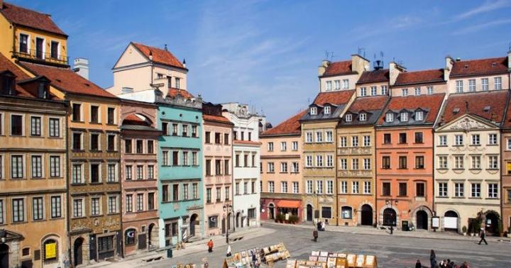
The capital of the Vladivostok district, once a military outpost of Russia, is today a major scientific, cultural and industrial center of the Far East. Sea voyages to Sakhalin and Kamchatka begin and end here, and trade routes pass through. In addition to the administrative center of the region, its main cities include Artem, Ussuriysk and Nakhodka, with a population of over 100 thousand people.
Vladivostok. Satellite map online
(The map is controlled using the mouse, as well as signs in the right corner of the map)
In addition to the mainland, the Primorsky Territory also includes islands that received their names in honor of the great navigators. The islands of Russky, Putyatin, and Petrova have long become part of Russian history.
About 6,000 rivers flow through the territory of the region, with a total length of more than 18,000 km. Large water arteries of the Primorsky Territory are Ussuri, Arsenyevka, Bolshaya Ussurka. Conventionally, all rivers in the region can be divided into 2 watersheds. Rivers flowing from the Sikhote-Alin mountain into the Sea of Japan and flowing into the Peter the Great Gulf. In addition, here is the largest lake in the Far East, Khanka, rich in fish and birds. Of particular interest to connoisseurs of beauty is Lake Orekhovoye, where you can admire the most beautiful lotuses.
The climate of the Primorsky Territory is monsoonal, temperate with a lot of sunny days. Winters are usually short and with little snow, and summers are warm, without sweltering heat. The wealth of flora and fauna in the local latitudes is simply amazing. Large areas are occupied by broad-leaved forests, and the mountain peaks are covered with tundra vegetation.
There are also unique attractions in the Primorsky Territory, which include the monument of defensive architecture Vladivostok Fortress, Smolny Waterfalls, the Kingdom of Caves near the Artemovka River, and the ancient Lozovy Reef. Traveling around Primorye, one cannot help but visit Livadia Bay, the Call of the Tiger national park, and the historical and literary museum in the village of Chuguevka, where the writer A. Fadeev spent his childhood and adolescence. Do not see the Sikhote-Alin volcanic field, Kravtsovskie waterfalls. And in the large cities of Primorye there are many interesting museums, galleries and exhibition halls. Seaside cities surprise with their architectural monuments, ancient houses with elegant decorations and irresistible temples.
It is simply impossible to describe all the unusual and fascinating places in the Primorsky Territory; it contains the most interesting sights that you definitely need to see with your own eyes. Primorye is rightfully considered one of the most beautiful corners of Russia.
Primorsky Krai is a region located in the south of the Far East of the Russian Federation. A map of the Primorsky Territory shows that the region borders the Khabarovsk Territory, the Sea of Japan, the DPRK and the People's Republic of China. The area of the region is 164,673 square meters. km.
Today Primorsky Krai is divided into 22 municipal districts and 12 districts. The region includes 116 villages and 29 urban settlements. The largest cities in the region are Vladivostok (administrative center), Ussuriysk, Nakhodka, Arsenyev and Artyom.
The region has a well-developed mining industry. Brown coal, non-ferrous metals, oil, gas, gold, boron, etc. are mined in the Primorsky Territory. Large sectors of the economy are the forestry and fishing industries.
Historical reference
The territory of modern Primorsky Krai belonged to the Bohai state. The fall of the Jurchens occurred in the 13th century due to attacks by the Mongol-Tatars. Later, the lands went to the Jin Empire, and after the Treaty of Beijing they began to belong to the Russian Empire.
In the 19th century, the Russians began to explore the Far East. The Primorsky region was created, which in 1920 was transformed into the Far Eastern Republic, and then into the Far Eastern Territory. In 1938, Primorsky Krai was created.

Must Visit
On a detailed satellite map of the Primorsky Territory you can see various natural attractions: the Brother and Sister hills, the Far Eastern Marine Reserve, the Sikhote-Alin and Ussuri reserves, the Borisov Plateau and Vasilkovsky nature reserves, the Udege Legend and Call of the Tiger national parks. .
Among the natural attractions, it is worth noting the numerous bays, waterfalls, mountains, caves, capes and islands of the Primorsky Territory.
Satellite map of Primorsky Krai
Map of Primorsky Krai from satellite. You can view the satellite map of the Primorsky Territory in the following modes: map of the Primorsky Territory with names of objects, satellite map of the Primorsky Territory, geographic map of the Primorsky Territory.Primorsky Krai is located in the southernmost Far Eastern part of Russia on the coast of the Sea of Japan. The regional center is the city of Vladivostok.
The climate of the region is moderate monsoon. Weather conditions in the Primorsky Territory are greatly influenced by cyclones coming from the Pacific Ocean. In winter they bring cold air, creating windy but sunny weather; and in the summer there are strong destructive typhoons. Therefore, in general, the weather in the Primorsky Territory is windy and humid.
On the territory of the Primorsky Territory you can still see the ruins of fortifications and sites, which are reminiscent of that distant time in the Middle Ages, when the Primorsky Territory was part of the Bohai state. The largest settlements are Nikolaevskoye and Shaiginskoye. Many historical and architectural monuments can be seen near the city of Arsenyev. These are more than 40 archaeological sites, which include caves, settlements, and ancient settlements. www.site
One of the main attractions Primorsky Krai– Vladivostok fortress. This fortress is the only surviving sea fortress in Russia. Today, the fortifications of the fortress are museum complexes and one of the most popular tourist destinations.
Thanks to the diverse nature and landscapes, relaxing tourism is harmoniously combined with sports and extreme tourism. Fans of active sports will have a great time doing diving, parachuting, surfing, caving, etc.
Those who prefer a relaxing holiday in nature should give preference to eco-tourism. Numerous travel agencies offer not only holidays in sanatoriums and boarding houses, but also various tourist routes that run through the most picturesque areas of the Primorsky Territory. Also popular in
Primorsky Krai is located in the south of the Far East. This region is located on the border with China and North Korea. Use a satellite map of Primorsky Krai to view its location, settlements, roads and other objects. Move around the area by zooming in and find out where the main train stations and airports are in the region.
The northern part of Primorye borders on the Khabarovsk Territory. These 2 regions are connected by road, rail and air. And in the south and east, as can be seen on the map of the Primorsky Territory with diagrams, its territory is washed by the Sea of Japan. The coastal zone is dotted with a large number of small bays, including the following:
- Ussuri;
- East;
- Shooter;
- Posyet;
- Amursky.
The coastal area is mountainous. The cities and towns that the map of Primorsky Krai with districts displays are located in the lowlands. Primorye includes several large islands:
- Popov;
- Russian;
- Askold;
- Reinecke;
- Putyatina.
Of the water bodies, the largest ones can be especially highlighted - Lake Khanka and the Ussuri River. On the banks of these reservoirs there are many tourist centers, fishing and hunting.
Districts on the map of Primorsky Krai
Primorye is divided into 22 districts, 4 of which are included in the Far North zone:
- Terneysky;
- Dalnegorsky;
- Olginsky;
- Kavalerovsky.
These areas on the map of Primorsky Krai are characterized by the least developed infrastructure, a small number of settlements and difficult living conditions. There are almost no economic facilities or industrial enterprises here, and trade is poorly developed.
There are numerous hunting grounds in the region. In Chuguevskaya and Terneysky there is hunting for wapiti and elk, and in Lazovsky and Pozharsky there are wild boars and bears. On a detailed map of the Primorsky Territory you can find suitable places for active recreation, hunting and ecotourism. Also in the region is Lake Elma with a large supply of mineral springs and healing mud.
The largest districts in Primorye:
- Spassky;
- Krasnoarmeysky;
- Terneysky.
The railway runs along the western border of the region. From here the Trans-Siberian railway runs to Moscow. In the northern regions, transport links are poorly developed. A detailed road map of the Primorsky Territory shows that the main highways pass through the southern and western regions.
Near Vladivostok there is the Knevichi International Airport. There are also several major ports in the region, whose main activities are related to fishing and container cargo transportation.
Map of Primorsky Krai with cities and villages
There are 29 cities and 116 villages in Primorye. The most significant city in the region is Vladivostok. It is a large industrial, port and economic center of the region. The population of the regional capital is more than 600 thousand people. If you use a map of the Primorsky Territory with settlements, then on it you can find all the objects of Vladivostok, look at its streets, find train stations and the airport.
The second most important city is Ussuriysk. The largest cities in the region are connected by the A-184 highway. North of Ussuriysk on the border with China is the main attraction of Primorye - Lake Khanka. This is a clean fresh lake, which is home to a huge number of fish. There are several small settlements located here, which can be seen on a map of the Primorsky Territory with villages:
- Mayskoe;
- Novonikolaevka;
- Trinity;
- Astrakhan.
In these villages there are main recreation and fishing centers. Fishing here is carried out all year round.
Another “calling card” of the region is the 6-lane road bridge across the bay, which connects the districts of Vladivostok, and its length is almost 1.5 km. You can find the bridge on a map of Primorsky Krai with cities and villages. In the evening, tourists and city residents love to stroll along it. Numerous lights and bright illumination make it a very romantic place.
Economy and industry of Primorsky Krai
Thanks to its natural resources, location on the border of neighboring developed countries, as well as a large number of plants and factories, Primorye is a large industrial region. The regional economy is represented by such industries as:
- metallurgy;
- mechanical engineering;
- mining;
- energy;
- tourism;
- international trade.
Millions of tons of cargo are shipped annually from the ports of the region, which can be found on Yandex maps of the Primorsky Territory. Fishing makes a significant contribution to the economy of Primorye. Enterprises in the region also produce spare parts for cars, food, electricity and heat. Gold, diamonds and other rare minerals are mined in the region.
Tourism is of great importance for the region. Primorye has the largest reserves and hunting grounds. Tourists are offered rafting on rivers, visiting natural and archaeological monuments, hunting wild animals and waterfowl. Big cities welcome those arriving in the region with modern, comfortable hotels. Also in small settlements there are recreation centers for those who love active tourism.