The next day, after arriving in Slyudyanka, my friends and I went in different directions. Sashka went to Ulan-Ude to visit his relatives, our “non-mountainous” friends decided to “hang out” on the shores of Lake Baikal, and we had plans to go to Sobolinoye Lake. The trail to the lake starts from Vydrino station and runs along the border of Russia and Buryatia along the Snezhnaya River, along which people often raft on catamarans. Zhenya and I took the bus to the point we needed and hit the road. After the mountain trails, walking along a flat, albeit unpaved, road was very difficult; we got tired quickly. Plus, we never found a clear map of the route to Sobolinoye Lake, we only knew that it went somewhere into the forest in the area of the 2nd power line. In the area of this line, we peered into the forest for a long time, trying to find a path, but it felt like no one had walked here for a long time. We decided to go aside and try to walk along the banks of Snezhnaya. However, we lost a lot of strength and dug into some swampy place where boletus and cattails grew in heaps. As a result, we decided not to get lost anymore, to go back and stop for the night, because... It was starting to get dark. On the side of the road we found a cozy clearing, where they apparently often stop for the night with tents and laid out their uniforms. While we were busy with the tent, several people passed by, but we were so tired that we didn’t even want to hear about Sobolinoe Lake. When they decomposed, I stayed to light the fire, and Zhenya went to get water, bringing back the following footage:


And while I was lighting the fire, I felt some kind of anxiety. Although the clearing seemed cozy, I felt uncomfortable being in it. Or maybe the nearby road had this effect on me; I apparently became wild during those few days while I was in the mountains. And only a little black mouse running in the clearing and picking up crumbs of food from previous tourists distracted me from dark thoughts... But at night this very mouse did not let us sleep at all. Apparently, she decided to crawl up to our gingerbread cookies in a bag that stood in the vestibule of the tent, and all night we listened to scratching sounds and knocked on the walls of the tent, trying to drive away the mouse, but it turned out to be not the timid one. As a result, after a huge number of attempts to fall asleep, we hung the bag from the tent lines and finally fell asleep!
In the morning we returned to the highway and walked along the other side of Snezhnaya to Tyoplye Ozera. Warm lakes are a complex of 3 lakes: Izumrudny, Mervtogo and Lake Skazka. Despite the fact that the lakes are very close to each other, their chemical composition is completely different, which suggests that these lakes are not related to each other.
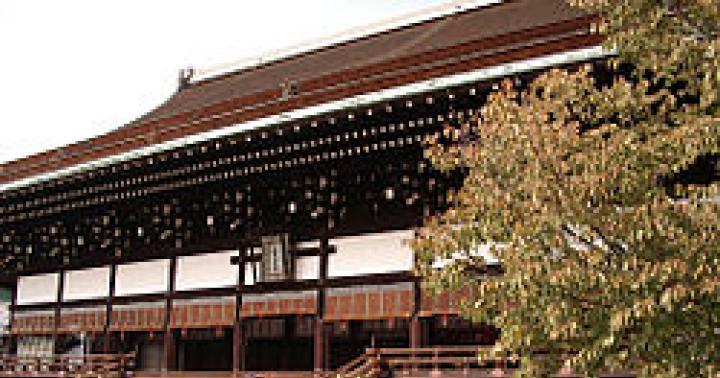
During the day the river looked like this 
And along the roadsides there were centuries-old thick poplars and huge ferns growing, giving this place its beauty and mystery. 
The road led us to a recreation center, which was located on the shore of Emerald Lake, so we decided to stop in the forest on the shore of Snezhnaya. Coming out to the river we gasped. The forest was divided into areas where people who came here by car rested. Although we must pay tribute, people cleaned up 90% of the forest after themselves and put the garbage in bags, which were prudently laid out near the tents by the guys who cared about the cleanliness of the forest. Despite the huge number of people around, we decided to stand right there. And then we went to look around the surroundings 


At Warm Lakes we had our own task - to climb to the top of the Monomakh Cap mountain located here. It has the shape of a pyramid and its height is only 685 meters, but climbing it is not easy, because... you have to climb almost like a monkey, clinging to all sorts of ledges and tree roots with your hands. The mountain is located at the foot of the Dead Lake, which really makes such an impression. We climbed to the top in the beginning of a light rain. The view from the top was amazing. The feeling that this mountain was so small at the top did not arise at all; on the contrary, it seemed that you were high above the world. At the top there was nowhere to make room - a small patch strewn with coins in gratitude to the spirit of the mountains for such beauty, we also left our coins... 


And in the evening it started to rain heavily, which then turned into real bad weather. Early in the morning, under the sniffling of all the people sleeping peacefully in their tents and cars in the forest, we collected our wet things and set off on the way back. At the Vydrino station I had to stand for a long time waiting for the minibus, because... The train to Slyudyanka was expected only after lunch. We were pretty cold in the cold rain and we weren’t able to buy anything at the nearest store because... Our money was big. But finally, after 3 hours, a minibus arrived and took us to Baikalsk, where we managed to swallow a sausage in dough with coffee from a plastic cup and ran to the minibus to Slyudyanka, whose driver was waiting for us while we had a snack. And in Slyudyanka I had to wait for the last train to Irkutsk, because... our guys were already there, and we had no other transport. When we loaded onto the train in the evening, it turned out that repair work was being carried out on the railway tracks and instead of the required 3 hours, we traveled for the entire 5. Upon arrival in Irkutsk, tired, hungry, cold, we fell out of the carriage and piled into a taxi, which and drove us to the airport. Outside, “the bad weather was getting worse,” the rain was still pouring down, and on top of that, a gusty wind was blowing. We looked with envy at people in raincoats, jackets and boots. At the airport, a board showed that a lot of flights were delayed due to bad weather. We didn’t want to stay in such an exhausted state at the airport and we kept our fingers crossed that our plane would be sent on time. Although it seems that Moscow did not accept planes because of the strong smog, we were so cold that we wanted to fly somewhere, and then we would be able to see... But there was still a whole night left before the plane, and in the meantime we went to eat in our "Christina", we went to the nearest supermarket to buy Buryat liqueurs, returned to the airport, where we met a sleeping family, and ourselves found ourselves on iron chairs, passing out at the moment. In the morning the plane was boarded and we happily trudged to the exit. It was still raining outside, and the plane, with a roar and shaking, tore us out of the gloomy clouds and took us to the stuffiness of Moscow... 
This is how our trip turned out this time. Not all plans were realized, but we are not upset. The trip turned out to be very eventful and interesting, and most importantly, we managed to avoid the days when smog and smoke in Moscow were at their peak. And this summer we are going to Baikal again!
People in clothes made of fish skins, painted with spiral patterns, walked up the embankment in an endless line, carrying earth in their hats. They climbed to the top, at a sign from the guard, they poured out the earth and, in single file, walked back. A little further away, in a thin chain, feathered arrows placed on the bowstrings of their tight bows, the guard soldiers froze. Closer to the river, on the ready-made tip of a man-made mountain, a richly dressed leader sat like a stone idol. The guttural screams of the overseers were heard, and hat after hat was toppled over in the hands of the slaves...
Thus, according to an ancient legend, retold by many generations of residents of the village of Poyarkovo and nearby villages, a lonely mountain appeared at the confluence of the Zavita River with the Amur. They called her Shapka.
Local residents claimed that people lived on this mountain a long time ago. But when this happened, what kind of people they were and where they had gone, no one knew. The secret of Shapka was revealed only in 1961 by the expedition of Academician A.P. Okladnikov, which established that there was an ancient settlement here.
Now archaeologists, scientists and students have come here - a detachment of the North Asian Complex Expedition of the Novosibirsk Institute of History, Philology and Philosophy of the Siberian Branch of the USSR Academy of Sciences. They set up a tent camp on the southwestern slope and began excavating the ancient settlement.
After the first working season, the head of the detachment, candidate of historical sciences Evgenia Ivanovna Derevyanko could say:
The hat was not poured by human hands; this hill is the remnant of the second terrace of the Amur River above the floodplain. On a mountain very convenient for settlement, there is a settlement, or rather, its remains: ditches and ramparts ringing the peaks, undoubtedly built by people. The first excavations allowed us to date the discovered structures to the 10th and 11th centuries.
Nakhodki
A steep narrow road runs up to the top of the hill. Our UAZ jumps from the pits onto the ledges. Sometimes the car tilts, but the young driver steers it toward the middle of the road with a confident and even artistic movement.
The ascent took a matter of minutes. The car rolled out onto a tiny plateau, where at that hour almost the entire detachment had gathered. After a short introduction, the deputy head of the detachment, Sergei Nesterov, or simply Seryozha, led us to show the excavations.
Under the carpet of thick and tall grasses, regular cup-shaped depressions with swollen edges are clearly visible. These depressions, as archaeologists call them, are traces of the dwellings of ancient inhabitants. Here and there between them and to the side, mounds of soil from exploration pits turn yellow.
Not far from the western ditch and a steep three-meter rampart, scientists set up an excavation, the total area of which has already reached three hundred square meters. Strictly marked with pegs and strings, the excavation slightly shines with cleanly cut walls of lintels. On their vertical planes, gray and dark stripes and red calcined spots are clearly visible - this is a cultural layer. The guys deftly wield the tools. In their hands are small, like toy, scoops, brushes and cues, and like painters. Archaeologists clear a ridge of dirty gray stones. In the neighboring excavation, already completely cleared, earthen columns covered with flat stones are visible. These are the remains of a hearth and a chimney system that heated the house. The almost rotten bases of wooden pillars, the former supports of walls and roofs, are turning brown.
These dwellings, explains Seryozha Nesterov, were semi-underground. The walls were made of wooden blocks, and the roof was most likely two- or four-slope. But unlike similar buildings of the 7th and 8th centuries, which had a hole in the roof as an entrance to the dwelling, here there were ordinary doors that opened to the south or southeast. Look: this is the heel stone on which the door pillar at the entrance to the house rotated...
Archaeologists have found iron tools, spearheads, iron and bone arrowheads, shards of pottery with patterns of dissected molded rollers. Among the finds there is a stone button, a horse pastern covered with a transverse notch along the bone, an object of a game or a ritual object, a receptacle for the “soul” of the deceased. At the mouth of the fireplace lay the jaws of a pig. The pig is a sacred animal among the Jurchens; it was worshiped and sacrificed.
Based on the nature of the finds, it can be assumed that “black” people lived in this part of the ancient fortress. Apparently, farmers and pastoralists.
There are many questions, but answers to them will come only after thorough research. But scientists can answer one question quite definitely today.
Who are they?
In the X-XIII centuries, the vast territories of our Amur region, Primorye and the northeastern part of modern China were inhabited by the mysterious Jurchen people. According to previously known archaeological sites and written evidence, the Jurchens, who led a sedentary lifestyle, had developed tribal relations by the 10th century. Here is some information from the historical essay by M.V. Vorobyov “The Jurchens and the State of Jin.”
Until the 10th century, these tribes were independent, then they came under the rule of the Khitans, who already had statehood. In 1114, the Jurchen leader Aguda, who had recently united his fellow tribesmen, rebelled against his enslavers. As a result of his victory, the Jurchens created the independent state of Jin, or, as it is also called, the “Golden Empire,” which lasted until the invasion of Genghis Khan.
They waged constant wars with their neighbors. Their military power was such that in just a year they destroyed the Khitan kingdom of Liao. And then they captured vast territories in the north of the Song Empire and made its remnant Southern Song, which paid a large tribute to the Jurchens, their vassal.
During the invasion of the Mongol conquerors, the Jin state was destroyed, and the Jurchens again split into a number of tribal groups. And only at the end of the 15th century the Nüzhi tribe (Nüzhi one of the later transformations of the name Jurchen) marked the beginning of a new unification of a number of half-blooded and other tribes, which later received the generalized name of the Manchus. Their settlements were located along the banks of the Amur and Zeya.
Thus, ethnically, the Jurchens are the ancestors of the Tungus-speaking peoples of Primorye and Amur region - the current Nanais, Ulchis, Orochs and Udeges.
Judging by the design of the dwellings and defensive structures of the settlement on Shapka, and by the objects found during excavations, the carriers of the ancient culture of this region were the Jurchens.
If in Primorye the monuments of the Jurchen civilization have been studied and excavated for a long time, then in the middle Amur their settlement is being uncovered for the first time. This fact is of great value; it speaks about who exactly inhabited these places in very ancient times.
Jurchen battle "guitar"
When you look out the window of the An-2, which makes regular flights along the Poyarkovo Blagoveshchensk highway, Mount Shapka resembles a pear or a guitar without a neck. Its two sloping-flat peaks are ringed by a deep ditch and a powerful rampart, and half of the “guitar” is also separated by internal ramparts. The narrow part of the mountain faces northeast, towards the mouth of Zavitinka. The steep, sometimes vertical slopes below are densely overgrown with hazel trees.
Surrounded on both sides by rivers, swamps and lakes, the hill was at that time a strategically advantageous place for a stronghold combat post. And it is no coincidence that archaeologists are inclined to think that the settlement on Shapka could have been a military-administrative center, in the vicinity of which peaceful settlements of the Jurchens may have been located.
The ditches and ramparts surrounding the Shapka are undoubtedly intended for defensive purposes. From written sources and archaeological finds in Primorye it is known that the Jurchens watered the outer slopes of the ramparts and natural steep slopes with water in winter. Frozen ice often became an insurmountable obstacle for enemies.
The rampart, cutting part of the lowland to the hill in a semicircle, probably served as protection and at the same time as a fence for livestock, which were driven here from surrounding settlements during military operations or siege.
Excavations have not yet begun on the northeastern peak of Shapka. This part of the mountain is separated by three more rows of ditches and ramparts. Scientists suggest that there could have been a fortress within a fortress, which possibly housed warehouses, grain storage facilities, temples, and blocks of houses in which leaders and nobles lived. This speculation is not without a real basis, since scientists have not yet found traces of public premises on the hill and in its immediate surroundings. And yet, with such a stronghold administrative point, they should have been there.
Three kilometers from Mount Shapki there is a burial ground. The Jurchens had a custom of burying their dead in family and tribal cemeteries, which were most often located within a radius of up to 15 kilometers from settlements. Burial grounds are of great interest to science, since it is in them that the largest number of cultural objects of ancient tribes are found. Therefore, in parallel with the excavations of the ancient settlement, extensive burials will also be studied.
Studies of the excavated dwellings have shown that they are well preserved: there are no traces of fires or severe destruction, which would indicate a long siege of the fortress or a rapid enemy raid. The absence of human remains and the relative paucity of items found indicate that the inhabitants left their homes in a calm, most likely peaceful, environment.
It is possible that the Jurchens, not having the strength to defend the fortress, abandoned it in anticipation of the onslaught of the Tatar-Mongols, whose terrible cruelty was probably known in this region. After all, it was the Jurchens who offered the most fierce resistance to the hordes of Genghis Khan. And they knew that Genghis Khan’s warriors, having burst into the fort, literally wiped it off the face of the earth and completely destroyed the population, young and old.
Where did the remnants of the Jurchens go? Maybe far to the north, deep into the impenetrable taiga? This also remains unclear. But the painstaking work of scientists continues. And although the search is designed to take many years, and maybe even decades, scientists already know for sure today: sooner or later the day will come when Shapka will reveal all its secrets to them.
V. Galuzin, corr. newspaper "Amurskaya Pravda" specially for "Around the World"
Poyarkovo village, Amur region
The village of Psebay is becoming more and more popular every year among tourists who prefer the so-called “Wild Holidays”. Mostly people strive to get to these regions to fully enjoy the beauty of the surrounding nature. Moreover, there are quite a lot of places here that deserve attention.
A little history
The village was created back in 1857, but it became truly populated in 1862. During these years, families of Cossacks and soldiers began to come here. Psebai developed quite slowly. Rapid development began in 1888, when Nicholas II’s cousin, Sergei Romanov, moved here. He leased a huge amount of land. He ordered the building of a church and a hunting lodge. They have survived to this day, are considered historical monuments and are among the sights of the village.
In Soviet times, the route (on foot) to Krasnaya Polyana, through the Caucasus Nature Reserve, began here. Over time, it was abandoned and only in the year 2000 it was not only resumed, but also new routes were planned. These places are especially popular among tourists who are interested in hang gliding, rafting, jeeping, and so on.
Caves around Psebay

In the area around the village of Psebay there are a lot of mountains, and therefore caves. Many of them have become part of tourist routes. Gunkin caves are the most impressive in these parts. They are located in a beam with the same name, there are four of them in total. A river flows from the largest and most popular one. It has three halls, united by a narrow and low peculiar corridor. The first hall is the smallest, the second is a little larger and the third is the largest. Its height is about 10 meters, and its width is from 12 to 25, with a length of 80 meters. While the first hall is only forty-five meters long, 20 meters wide and three meters high. The total length of the Gunkin caves is about one kilometer, but during the flood period, most of them are simply not accessible.
Malaya Laba - river

The peculiarity of this river is always clean and cold water. The riverbed is fed by glaciers, so the water here is always ideal. Along the entire route the Laba is “restive”, right up to the place where it flows into the Great Laba. The river is turbulent and is very popular among rafting enthusiasts. Almost throughout the entire territory of the village the banks are steep and steep. And only outside of it do they become even. During floods the river becomes dangerous. Spills begin and the current is very strong. The river is very popular among fishing tourists. At the same time, fishing here cannot be called calm. You have to be a real professional to catch trout, which is abundant here, or chub.

These places are extremely popular at all times of the year. The water temperature in them reaches 80 – 90 degrees. While in the baths it is 37 - 42. The water here is rich in minerals, for example: potassium, fluorine, calcium and others. Which has the most positive effect on problems of the musculoskeletal system and respiratory tract. Water sources are also useful for people who are susceptible to severe stress and experience nervous exhaustion. At the same time, the healing effect lasts for a fairly long period of time. People come here in any weather.

The mountain is strewn with giant trees and boulders. An incredibly beautiful place, from the top of which there is a stunning view of the village of Psebay, the Caucasus Range and the Laba River. A visit to Mount Shapka is included in most tourist routes and is the most popular place.

They are located not in Psebay itself, but in the mountains near the village of Nikitino, which is why they are called that. On the way to them, tourists enjoy the view of the cascades. The places here are very beautiful, the route to the Nikitinsky waterfalls themselves is without steep climbs.

Another natural attraction of these places. The road to them is much more difficult than to Nikitinsky, but the view is more breathtaking. Approximate height is about 40 meters. The last few tens of meters just before the waterfall are the most difficult. With steep climbs.

The route is quite difficult. First, you need to drive to the village of Solenoye by car. Then walk a few kilometers. The path runs along the Kyzyl-bek river, through the mountains. But by car you can get to the largest of these waterfalls, almost right next to it. A huge number of tourists cannot resist the temptation to plunge into the bowls of lakes at the foot, created by these waterfalls.
The easiest way to get to the village of Psebay is by car. Public transport rarely comes here. Several transplants are required. Reviews from people who have already been here more than once will help you decide how to get to Psebay.
Last minute tours abroad
3 395
More on the topic:
- Beaches of Gelendzhik: “Central”,
- The best beaches of the Black Sea are…
- Recreation centers on the Black Sea -…
- Pensions in Crimea - photos, prices...
- Children's camps on the Black Sea...
- Beaches in Sochi – “Riviera”, “Mayak”:
- Beaches of Tuapse – “Central”,…
In the Far East, at the confluence of the Zavitaya River with the Amur, there is a mountain that the local Russian population called Shapka. Maybe it reminded the early settlers of their hats. And according to a humorous legend, it was they who poured it with caps for the construction of fortifications for self-defense.
Of course, all the names of these near and far places come from the more ancient Chinese and Manchu populations. But it just so happens that everyone puts all the toponymy they encounter on their block.
The most famous Russian researcher N.M. Przhevalsky, who began his hiking activities in the Shapka region, in his further travels around Central Asia in the 70-80s of the 19th century tried to give Russian names to the mountains he discovered and studied: the Outskirts (Maomaoshan), Moscow (Achchikkeltag) ridges, etc. But they did not take root, since local names existed. After the death of the explorer, the Russian Geographical Society assigned his name to the Mysterious Ridge, but on maps and reference books it remained Arkatag (translated from Turkic as “back ridge”). At best, Przhevalsky's name is added to it in parentheses. By the way, the traveler saw the highest peak in this ridge and called it not just a cap, but exalted it to the “Monomakh Cap”.
Let's return to the Cap at the Cupid. The Chinese suspected that the Russians in Przhevalsky’s expeditions were not just exploring unexplored territory, but were looking for something specific and important. In particular, treasures... Scientists of the Chinese imperial court found ancient documents, from which it followed that at the confluence of the Zavitaya and Amur rivers there was a capital of the ancient state of the Jur-Chen.
This people, somewhat similar to the Cossacks, inhabited the farthest outskirts of the Middle Empire. Organized by former oppressed fugitives, a powerful state even captured Central China for a time. Under the pressure of Genghis Khan's troops, the Jurchens retreated to their capital, then joined the hordes of the Mongols and left with the invaders to Central Asia and Europe.
But they hid their treasures in a mountain, later called Shapka. These jewels and their storage itself were described in detail in documents. The settlement on the mountain and at its foot fell into disrepair due to another plague epidemic. Religious teachers and rulers from nearby villages declared that mountain and its surroundings a cursed place and, for fear of plague, forbade anyone from entering there on pain of death. The lifeless city was destroyed and forgotten. But there was a reason to remember the treasures.
The note from the learned men of the imperial court said that the treasure on Mount Shapka had not yet been plundered by anyone, and it was recommended to send a detachment of Chinese there to get those Jurchen treasures. Attached to the note was a plan for the location of the storage facility. There was only a significant snag - Mount Shapka was considered a disputed territory and was under the jurisdiction of the Russians. As for Przhevalsky, the sons of the Celestial Empire cared little about the fact that during his four long journeys through Central Asia he covered over 32 thousand km, explored and mapped more than 20 ridges and 7 large lakes, and often climbed “ terrible absolute height,” was on the verge of survival. In Beijing, he was seen primarily as an officer of the General Staff, and his Cossacks were seen as reconnaissance soldiers. And now also the miners of treasures hidden on the Cap...