Mount Matterhorn is one of the most recognizable peaks in the world. If you have never been lucky enough to visit the border of Switzerland and Italy, you will still easily recognize the characteristic outlines of the mountain in the shape of a tetrahedral pyramid. The Matterhorn peak annually attracts hundreds of thousands of tourists who come just to look at it and about 3 thousand climbers who want to conquer the peak. However, Mount Matterhorn in Switzerland is not only beautiful, but also dangerous. People regularly die here, so before the trip you need to carefully prepare and assess your strength. In any case, no tourist will be disappointed.
General information

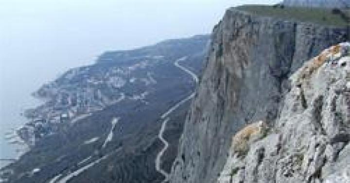
 South Face of the Matterhorn
 Let's start with information - where Mount Matterhorn is located. The attraction is located in the Pieniny Alps and passes between two countries - Switzerland and Italy. The slope in the south is located on Italian territory, the other three sides belong to Switzerland.
The Italian name of the mountain - Monte Cervino - comes from the French Mons Servinus and means “forest mountain”, and with German language The name "Matterhorn" translates as "meadow" (Matte) and "peak" (Horn)
Interesting fact! The peak is located at a distance from other peaks of the Alps, this makes it possible to see the mountain and feel its magnetism.
The height of the Matterhorn is almost 4.48 km (4478 m to be exact). Behind the visual appeal lies steep slopes and rockiness. That is why for a long time the landmark in Switzerland was not conquered by climbers.
The mountain profile clearly shows two peaks located one hundred meters from each other. The state border runs directly between the peaks, respectively, one is called Italian, and the second – Swiss.
Good to know! The height of the Italian peak is only 1 m lower than the Swiss one.
The mountain in the Alps is notable for its strict, geometric proportions. Outwardly, it resembles an irregularly shaped pyramid, the edges of which are located in the cardinal directions.

During the cold season, the mountain is completely covered with glaciers and snow. However, in summer the sun melts the snow, a small amount remains only on the eastern and northeastern sides.
Good to know! The mountain in the Alps has steep slopes, for this reason rockfalls and avalanches often occur here.
Practical information

 Zermatt
 Tourists stop in one of the villages:
- in Switzerland - the town of Zermatt;
- on the territory of Italy - the settlement of Breuil-Cervinia.
The villages are separated by the Theodul Pass. The ski slopes are laid at an altitude of 4 km, but real extreme sports enthusiasts and professionals prefer to climb higher into the Alps.


Historical facts


At the foot of the Matterhorn in the Alps, the first people settled during the Roman Empire. In the 1st century BC. Theodul Pass was used for trade communications between the north and south of Europe.
Interesting to know! Ancient tribes did not dare to settle on the slopes because they believed that this was the habitat of the devil. Most likely, the belief arose due to the terrifying appearance of the mountain and frequent avalanches.
In the 19th century, a movement of like-minded people appeared in England who wanted to conquer the most dangerous slopes. Groups of climbers went to all the slopes of the Alps, but even Mont Blanc conquered people faster than the Matterhorn peak. Those who wanted to reach the peak gathered at the foot many times, but did not dare to climb.
Climbing to the top of the Matterhorn
Considering the features geographical location mountains - in Switzerland and Italy - there are two ways to travel - from the territory of each state.


Thanks to its unusual shape - an almost equilateral pyramid - the mountain has attracted climbers for many centuries and has rich history with extraordinary and tragic facts. Walking route on slopes requires:
- rope skills;
- skills of movement on rocky terrain;
- ability to organize insurance;
- compliance with safety rules.
Before climbing, you must take a training course, and on the way, use the help of a guide.
It is important! From the Swiss side the path is as simple as possible, in the most dangerous places ropes have been secured, insurance has been arranged, huts for rest have been arranged; if the tourists are caught in bad weather during the ascent, they can wait it out in an emergency shelter.


The height of the mountain in the Alps is about 4.48 km, so the issue of preparing to conquer the Matterhorn peak in Switzerland should be worked out in advance and make sure that you have enough strength and endurance for this difficult test. You should also pay attention to acclimatization in the mountains. IN good weather On narrow sections of the climbing routes you can meet dozens of tourists, so guides recommend using maximum caution and attention.
What to watch out for
The main danger of Mount Matterhorn in Switzerland is unpredictable weather. The clouds here are low and envelop the peaks, forming a persistent, thick fog. Sometimes you can’t see anything at a distance of one meter. The weather can change within a quarter of an hour. In addition to fog, climbers are faced with storms and snowfalls. Given the speed at which the weather changes, finding shelter from the elements can be difficult.


The greatest danger in the Alps is rockfalls. In some cases, they are provoked by tourists, and sometimes the stones are torn off under the weight of glaciers. Experts call this fact amazing - despite numerous avalanches and rock falls, the mountain has not changed appearance for centuries.
What you need to climb


If you wish, you can take a camera or video camera.
Climbing history
The Alps have always attracted travelers; today all the slopes have been conquered by man, but Mount Matterhorn in Switzerland is the last on this list. For a long time, beginning climbers experienced a superstitious fear of a mountain in the Alps.

First successful ascent

A significant event was recorded in 1865, when Whymper developed and implemented a new plan for climbing the southern slope of the mountain. An attempt to climb to the peak on June 21 was unsuccessful - the path was blocked by a strong rockfall. Another attempt - on June 14 - was crowned with success, but was marred by the death of climbers.
The ascent in Switzerland was made by: Edward Whymper, the Scotsman Lord Francis Dushlas, Charles Hudson, Robert Douglas Hadow, father Peter Togwalders, his son and Michel Crozat.
The group began climbing the Hörnli slope; Whymper noted in his notes that the route turned out to be easier than the route along the Italian slope. However, as we moved towards the top, the mountain became steeper and more dangerous. The first to reach the target were Edward Whymper and Michel Croze. A tragic incident happened when the group was descending - Hadow, Croz, Hudson and Douglas fell and crashed. Only three climbers were buried because Douglas' body was not found on the glacier. The bodies of the other three men are buried in Zermatt.

 Jean-Antoine Carrel
 Who else managed to climb:
- July 1865 – Jean-Antoine Carrel;
- in 1871 - Lucy Walker;
- August 1931 – Franz Schmid and Tony Schmid.
Rising to the top today
Today, routes of varying difficulty levels have been laid to the Matterhorn peak in the Alps, but all of them are designed for trained climbers familiar with climbing techniques. It is possible to climb at any time of the year, but it will not be an easy walk.

In the warm season, it is best to climb the Hörnli ridge; the route has a difficulty rating of AD. Safety ropes are installed throughout the entire ascent. From Zermatt to Lake Schwarzsee. From here you will have to walk to the Hörnli hut, where climbers spend the night. The next day, the further journey must begin no later than 3-30 in the morning, only in this case you can have time to descend before dusk.
Good to know! If an emergency arises on the road, the Solvay Hut is available to tourists.
Other routes:

 Lion's Ridge
 - Leo Ridge – difficulty AD;
- Zmutt ridge – difficulty D;
- the northern part of the mountain - in the Alps this part is considered the most difficult and has a difficulty level of TD+.
Statistics: 70% of climbers climb the Hörnli route, 25% along the Lyon ridge. The remaining routes account for no more than 5% of all ascents.
Tragic cases
Despite the fact that safety ladders are laid along the entire route, climbers die on the Matterhorn every year. Main reasons:
- lack of preparedness of tourists;
- choosing a difficult route;
- a large influx of people wanting to climb the peak;
- natural disasters - convergence of glaciers and rockfalls.
Statistics! Between 1981 and 2012, 223 climbers died on the slopes of the Matterhorn, of which 203 fell and crashed. In total, the mountain claimed the lives of more than 500 people. This peak is officially recognized as the deadliest among the peaks in the Alps.
Compare accommodation prices using this form

Find out PRICES or book any accommodation using this form
Now you know where the Matterhorn peak is located, how to organize a trip and climb to your cherished goal. The trip will surely become one of the most unforgettable and emotionally intense in your life.
For those who like to tickle their nerves, watch this short video.
Related posts:

The Matterhorn is perhaps one of the most recognizable peaks of the Alps. The Swiss are so proud of it, you can see the profile of the Matterhorn on almost every corner. And the mountain is truly impressive. Towering over Zermatt, it attracts the eye. The neighboring peaks, as if bowing before his power, parted, leaving the Matterhorn to rule here alone.
Last year I was already lucky enough to climb to the top. However, fate was willing to lead me again to its foot. This time my friends and I chose a non-traditional climbing route along the Furggengrat ridge.

We don’t leave very early, the beginning of the route is just a few steps from our shelter. With the first glimpses of dawn, we get ready and start working. From our bivouac we can only see the beginning and middle part of the ridge - we are getting serious, because we were never able to get a description. But after the first two pitches we reach the gentle slope of the eastern wall and it becomes clear that the further path will not be difficult. We meander along the shelves of the eastern wall, slowly gaining height. Next door to the right on the Hernli ridge climbers are also climbing up. We are glad that we are here, on our route alone and there is no need to overtake or give way.

Logically we reach the main ridge. Still not getting involved, we approach the base of the top tower. It doesn’t look as scary as historical notes about the first ascents along this route indicate. But the terrain is rotten - destroyed rocks and remnants of snow in flat areas. Then we decided to go with a rope. Carefully, the first one goes out to the full length, followed by the others. Gradually, the rocks become steeper and now the key to the route is visible - a vertical internal corner, or rather not a corner, but some kind of implicit chute. The relief is rich, but even from here you can see that the rocks are very destroyed. This part of the wall most time is in the shade, the remains of scum ice are visible. Climbing in rock shoes is quite cold, but much more confident than in boots. So you have to be patient. Luckily, the scum ice in the upper part of the area was able to peel off the rocks. The site leads back to the main ridge. I receive my comrades and warm up in the sun.


There is a relatively easy ridge ahead. We are moving forward quite quickly. Overcoming the next takeoff, I am happy to recognize a tiny statue under the Swiss peak. A little more and here it is the top! This is not the first time we have been together on such ascents, everything happens in a reserved, businesslike manner - we understand that there is still a descent ahead. We traverse to the Italian peak, take a few more photos and begin the descent.


And this is our team:


When Carrel, during his next attempt at first ascent, was hiding from a rockfall a hundred meters from the top, he was extremely surprised. Where does a rockfall come from at such a time on completely dry rocks?
And only when he looked towards the top he discovered the British hats. Whymper, accompanied by his Swiss guides, celebrated the conquest of the inaccessible peak.
Carrel had no choice but to go down to Italy without the desired trophy. It was quiet at the top then.
Now the conditions have changed and what with the Swiss, what with Italian side- The Matterhorn is a highly popular destination for pilgrims from all over the world.
This route is one of the brightest gems of the Alps. It passes through fairly monolithic rocks. The art of success lies in ideal conditions on the route and the speed of its passage.
The path to the top of the Matterhorn along the “Italian classic route”, the Lion ridge, starts from the town of Broil Cervino, north of Aosta (Italy).

APPROACH TO THE SHELTER
Leaving Broil (2006 m.) in a northerly direction you will find yourself on the road that leads to the shelter of the Count of Abruzzo (2802 m.). Along this road you can reach the shelter in two hours.
From the shelter along the path north, to the first rocky rises. They are easily traversed using the shelf system. Further along the snow and scree to the southern slope of the Testa del Leone tower.
Along the right side of this slope to the rocky edge at the top of the tower. Without climbing the tower, traverse to the right. While crossing couloirs and rocky ridges, without gaining altitude to the Col del Leone saddle (3580 m.). From time to time there are rock pitons on this traverse.
From the saddle, climb further along the ridge. Starting from the saddle, all difficult sections are secured with bolts and, in some places, even marine ropes. Pretty soon there are rock slabs along which rope railings are laid. Behind the slabs along light rocks (II) to the vertical inner corner.
Straight along the corner, using the railing, up. Further more or less directly along the ridge up. After about four hours, after leaving the Abruzzo refuge, you will reach the Carrel refuge at an altitude of 3829 m.


COMBET LYON
Immediately behind the shelter, a little further from the old Savoy bivouac, the first fixed ropes of the route begin. Along them you will ascend to the southern side of the “Big Tower”. Along its southern wall, past the ruins of an old hut, up.
Further to the right, through the passage between two rocks to a rocky rise. It is very often icy. The takeoff is overcome with the help of a railing rope. This is followed by a 30-meter traverse to the right. Then along the inner corner and slabs to the beginning of a small couloir.
Along it you will again climb out to the tip of the ridge. Small gendarmes move around on the right side until you find yourself on a small snow and ice field.
Along its left edge up through rocky steps and rises to the base of a vertical 30-meter wall. It is overcome along the fixed ropes, rather strenuous climbing, to the edge of the ridge at an altitude of 4080 m. Further along the ridge and not very pleasant slabs upward. Along the wide terrace to the right of the ridge you will reach the summit of Tyndall Peak 4241 m.
From here the path to the top is clearly visible. And the stationary railings will prevent you from getting lost. From Tyndall Peak along the ridge, partially descending, continue moving in a northerly direction. Snow cornices often form on the ridge, so extra care is required when passing them.
Having descended to the saddle called Enjambee, you need to take long strides to the other side of the ridge. Further along the wide, sometimes scree, sometimes snowy ridge up to the summit tower.
You need to go out onto a rocky platform at the base of a vertical wall. The takeoff is overcome on the left, and the ridge is filled with tedious steep sections. First to the left of the rib, then to the right of it to the base of the 12-meter railing rope. Having climbed up them, traverse to the shelf with the next railing. These railings lead to a rope ladder, which helps you overcome the overhanging rocks.
Tense moment.
Three more sections of railings and steep rocks lead to the “Italian Peak”. The main one is the “Swiss Peak”, which is reached along a simple connecting ridge.
The descent from the summit can be carried out along the ascent route or along the “Swiss” ridge of Hoernli.
"I think every climber has a lot
their reasons to climb the Matterhorn.
But the main reason is the same for everyone:
climb the Matterhorn!
Gaston Rebbufa
It seems to me that there is a need to prepare a description of the classic route to the Matterhorn. It has matured for several reasons. Firstly, I am often asked for help in finding a clear, Russian-language description. As far as I understand, it still doesn’t exist. Secondly, according to my feelings, out of 10 groups trying to climb Horn, 8 leave with nothing. These are just some of the bands I've only heard about. Unsuccessful ascents, as a rule, are caused primarily by insufficient information. A trip to Switzerland is in order more expensive than a trip to the Caucasus, so it is doubly offensive if the reason for the failure was the lack of basic information on the mountain.

Photo: © GunnarF
Let me make a reservation right away: if you understand English, read the site SummitPost, there you will find the most extensive route descriptions on the Internet. If you are going to the Matterhorn along a route other than the classic one, then you will still have to look for information on your own. I didn’t go to the Matterhorn from Italy, I wasn’t interested in the possibility of climbing from that side and I don’t intend to be interested, therefore I won’t be able to advise. So, let's begin...

Photo: © badyl
The Matterhorn, 4478 meters above sea level, is located in the Pieniny Alps on the border between Switzerland and Italy. Coordinates: 45.97627 N / 7.65738 E.
Difficulty category: sections of category III+, on railings III-/A0, throughout the rest of the route mainly I and II, on fairly long sections just on foot. Subject to the use of all railings on the route, the proposed Russian category is 3B.
Equipment: The proposal for the choice of equipment is made based on going out in ideal weather, in two in mid-August (ideal season). If the conditions are not ideal, there are more than two of you, or it is not the season, then the list will have to be supplemented. What to supplement and by how much - you should be able to determine for yourself. If you are not able to do this, then you most likely should not climb the Matterhorn out of season, or in bad weather or in a large group.

Photo © A. Abramov
Most bundles come with a main rope 40-50 meters long. In difficult areas it is used to its full length, in simple areas it can be “shortened”, on pedestrian sections it can be taken “in circles” and walked at the same time. Of course, you can use a double or longer rope, but you won’t get much benefit from this. Guys and other “hardware” are not needed on the route. Under normal conditions, it is enough to have loops with you for intermediate points: 4-5 loops 60 cm long and 3-4 loops 120 cm long. If you find this recommendation a little thin, then of course, additionally equip yourself with everything you deem necessary.
Despite the fact that many people go to the summit without a helmet, I would not recommend leaving it at home. Rockfall, according to statistics, is the most common cause of accidents on the Hernley ridge. For the upper part of the route, from the "shoulder" and above, crampons and an ice ax will be needed. The crampons can be anything you want, they must fit well on the boots. You can, of course, take Rambos and two ice tools in your hands instead of ordinary crampons, but this will not cause anything other than condescending smiles.
Clothes and shoes: For climbing in normal weather conditions, high-quality soft-shell clothing is quite sufficient. Pants and jacket with a hood. In case of unexpected and sudden deterioration in the weather, you should definitely take a membrane jacket with you and, optionally for the cold, membrane pants. If you don’t know how to quickly and confidently move along “three-point” rocks in bad weather, then it won’t hurt you to take an insulated vest (light down jacket) with you. Of course, gloves made of membrane fabric are also important, but such little things should always be with you.
It’s difficult for me to give any definite advice regarding shoes. Go with what you have on this moment available. You must understand that in ideal weather conditions you will be hot in plastic, and in bad weather conditions in light membrane boots (like La Sportiva Trango) you will be cold. In both the first and second cases, you will have to be patient, but patience is one of the main qualities necessary for mountaineering.
Additional equipment: Be sure to take a headlamp with you (early departure, late arrival). Of course, you can take a thermos with you; before leaving the shelter you can fill it with hot tea for 8 francs. Or if you live in a tent, you can prepare hot tea yourself. Personally, I haven’t carried a thermos with me in the summer for a long time. A 3-liter volume “sippy cup” with a hose is enough for me, and for unforeseen circumstances I carry a jet boiler with one micro-cylinder inside. You can also throw in a few tea bags, a couple of hermetically sealed bags of sugar (taken from any coffee shop for free) and, to taste, a few bouillon cups sealed in plastic. This "gentleman's set" is lighter than a full thermos, but much more versatile than it. If you have an easy one bivy bag, take it too.
TACTICAL SCHEDULES OF THE EVENT:
Taking into account bad weather, days and trips to souvenir shops, you will need about 10 days to visit the Matterhorn project. Switzerland is famous for its excellent train connections, so if you arrive in Zurich/Geneva early in the morning, you will probably check into a hotel in Zermatt or Jugendherberg in the evening. The latter can be imagined as something reminiscent of a pioneer camp with multi-bed rooms and “divine” prices. Among other things, there is a campsite near Zermatt, but those who are especially thrifty can find a quiet corner in the surrounding area. I will not suggest/recommend such corners to anyone. It is not very legal to spend the night there and everyone must make this decision on their own.
The first day should be spent getting to know the village, believe me, it’s worth it. Along with numerous chic shops, increasingly aimed at the “Rublev” crowd, Zermatt has many historically significant places. Museums and mountaineering cemetery. You can find out more about all this at the tourism office. I won’t focus on this information; anyone who needs it can deal with this problem on the spot. It is much more important to take care of obtaining the latest weather reports and, if possible, information about the condition of the routes in general and the Hernley Gratt in particular. You can get all this information at the Alpine Center in Zermatt City.
Zermatt is surrounded beautiful mountains! Everyone can tailor the acclimatization program to their own taste. To do this, you just need a map of the surrounding area, a guidebook (in German or English language) and desire. Anyone who lacks one of the ingredients can use the standard program practiced by both independent athletes and guides serving their guests. The essence of the acclimatization program consists of two ascents. One of them takes place on Rifelhorn 2927 meters above sea level. m., the second on Breithorn 4164 meters above sea level. m..
Rifelhorn
This peak is located southeast of Zermatt and is easily reachable on a one-day hike. Surrounded by dozens of “four thousand meters”, Rifelhorn somehow gets lost with its less than three kilometers of height. And yet it is very interesting mountain. Composed of serpentinites (one of the igneous monolithic rocks), it provides an excellent vantage point over Zermatt. And for fans of multi-pitch routes, the southern face of the Rifelhorn is a real “Klondike”. I see it as ideal for acclimatization with a "fun factor". Not a difficult climb, the ridge route (also known as descent) from the Murishloch saddle (2775 m) to the top of the Rifelhorn can be rated as easy 2B, and multi-pitch on the south face, up to 300 meters long, varies between French categories 4a and 5c .

Rifelhorn with the Matterhorn in the background. The classic ascent route follows a sunlit ridge and then a series of takeoffs to highest point(here the ridge is clearly visible in profile). More interesting are the multi-pitches along the south wall. She is on the left in the photo. To access the routes you need to go down to the terrace at its base.
There are two ways to get to the Murishlokh saddle. It is more sporting and useful for acclimatization to climb on foot. To do this, you need to leave Zermatt in the direction of the town of "Rifelberg" located at an altitude of 2582 m and further past Lake Rifelsee to the saddle. This will take you, taking into account breaks, about 2.5 or 3 hours. It can be done faster, but it’s better to go slower. In the end, there is nowhere for you to drive here. More relaxed, but not cheap way- take the train "Gornergratbahn" to Rothenboden station. The carriage passes directly under the northern wall of the Rifelhorn. Rothenboden is located opposite the Murishloch saddle. From the station to the saddle it is a 10-minute slow walk.
Rifelhorn at the summit post
Breithorn

Foto: Great view of Monterosa, Liskam and Breithorn (far right) © ferrom
After climbing Rifelhorn, you need to get even higher altitude acclimatization. The ideal location here is Breithorn, located south of Zermatt and, thanks to the cable car, "Klein Matterhorn" has become very accessible. You must at least go to the top station cable car and walk the remaining 300 altitude meters to the top. This is not God knows what a feat, but it fully fulfills its acclimatization function.
To climb, you can choose one of two popular routes. The easiest option is to climb to the top using the “classic” method. To do this, you just need to walk from the Klein Matterhorn station along the supports of the rope tow about 400 meters to the south, after which the well-trodden path turns east and, having reached the saddle of the Breithornpass pass (3824 m, very unclear), turn north. Further the route passes along the snow-ice slope and leads to the western ridge of the peak. Along the ridge there are still a few tens of meters to the highest point. As a rule, this route is well trodden and quite clearly legible. Since this is the most easily accessible “four-thousander” in the Alps, it is wildly loved by both representatives of “collective” mountaineering and candidates for the Matterhorn who want to get quick acclimatization.
More interesting, both from the sporting side and in terms of enjoying the process, is the traverse of the central and main peak of the Breithorn. To climb the central peak, a combined route along the eastern ridge is used. The approach at the beginning is like a “classic”, but from the Brighthorn Pass pass do not turn north, but continue moving east towards the rocky outcrop with an elevation of 3831 m. To the right of it further, to the right of the southern edge to the Selle saddle (4022 m.) east of the central peak of Breithorn. The exit to the saddle is quite cool ice slope up to 50 degrees. In the upper part you may encounter a rather unpleasant bergschrund.
The route itself is very pleasant, running along the eastern ridge of the central peak. The maximum difficulty of the climb does not exceed the French climbing category 3b. If in the upper part of the route you climb directly through the Spitz gendarme, then the difficulty of climbing in this section rises to 4a, but if desired, the gendarme can easily get around the shelves on the north side. Having reached the dome of the central peak (4159 m), continue moving west to the saddle at an altitude of 4070 m and climb along the eastern ridge to the main peak of the Breithorn. This route can be rated as Russian "2B". The descent from Breithorn follows the “classic” route.
There are several other routes to climb Breithorn. You will have to learn about them, organize and go through them yourself. In the end, I did not have the task of writing an online guidebook on the Pieniny Alps. For those who would like to climb the Breithorn “to be honest,” I can immediately say that this event will not evoke particularly positive emotions in you. The route from Zermatt goes along ski slopes, which are not very picturesque in summer. In the upper part you will again walk along the tracks, but they are already active and for my taste this is a pointless activity, but not to mention the fact that you are wasting time and energy on it. If you’re really feeling bored, it’s better to go to Zinalrothorn or Obergabelhorn, it can entertain you a lot more.
Breithorn at the summit post

Photo: Excellent view of the eastern ridge of the central peak of the Breithorn © Bernd Stahl
TACTICAL DIRECTIONS FOR CLIMBING THE MATTERHORN:

Let's stop at the fact that you have acclimatized, found out the weather report for the next 3-4 days, rested and are ready to go to the top, which became the actual reason for your trip. First of all, you need to decide whether you live in Hernley shelter or not. Actually, there are not many alternatives. One of them is in the tents to the left of the shelter. This option is readily used by Spanish, Eastern European and other money-saving climbers. There are no particular problems with overnight stays at the shelter. Water can be "mined" from the glacier behind the ridge (on the north side of the Hernli ridge) or purchased at the shelter. Czech friends told me a story about how they went to a shelter to get water from the toilet, where they could get it from a tank, but were caught and shamefully escorted outside the hut.
If you don’t want to carry a tent, bivouac, food, etc., then you have only two options. One is to check into a shelter, I’ll tell you about the other below in the text. In order to check into the shelter, you absolutely need to reserve a place. If it's July or August and on the mountain good conditions, and the weather is beautiful in the sky, then it is quite possible to fly past the reservation, then only the option of a tent will save you. Although I once saw such a situation that there was nowhere to put a tent. In general, the sooner you decide on the start day, the better for you. It is better to reserve immediately with half board. It involves a fairly extensive dinner and a very meager breakfast. You can simply reserve an overnight stay, but then you will have to prepare for dry meals or cooking outside the shelter.

Matterhorn, Hernli and shelter
You can get to the shelter either by foot or by using a cable car. In my choice, I am inclined to use the cable car, it saves energy and time. But if you have both in abundance, then you can easily climb to Lake Schwarzsee on foot. This will extend your approach time to the shelter by an extra 2 hours. From the center of Zermatt you need to walk in the direction of the Matterhorn, which is clearly visible all the time, and already in the village of Furi there are signs on the walking paths, one of which leads to the Schwarzsee. If you want to take the cable car to "Schwarzsee" then at the southern tip of Zermatt you will see the Furi cable car station from which, with one change, you will get to the upper cable car station. From there you can, following the signs, go down to Lake Schwarzsee and then follow the path to the shelter in a couple of hours.

Photo: Matterhorn in the rays of the rising sun © A. Abramov
If you climbed the Schwarzsee with the first cable car, then you will have time to both climb the hut and settle in it, and explore the lower part of the route. It makes sense to walk 2-3 hours along tomorrow's route in order to be able to remember key points for night orienteering the next day. It’s better to go to bed early, because the standard wake-up time at the shelter is around 3 am. I do not recommend that you get up before the general rise. You will probably not be able to leave the sleeping area silently; you will rattle, sniffle, and turn on a flashlight.
Most likely you will wake someone up with your fussing. But this is not the worst thing, it will be worse immediately after. Awakened climbers are unlikely to fall asleep peacefully. Most likely, overwhelmed by internal anxiety, they will also begin to get up and get ready. In this way, you will cause a chain reaction and, most likely, no one, and especially the shelter servants, will thank you. Therefore, sleep peacefully until the first wake-up call. Get up with everyone, go out, if possible, in the first rows. Of course, by climbing earlier you may gain a couple of hundred meters, but this is unlikely to save you from being overtaken by turbo guides with their crazed “guests” on a rope.

Photo: Anchor driven into the rock for insurance © A. Abramov
Let's get back to the climb. I would recommend that you also buy sausages, cheeses and Snickers for breakfast in Zermatt. Breakfast at the hut - tears of the occupiers. These are two slices of bread, a small briquette of butter and one bowl of marmalade for the table. Maybe in the couple of years that have passed since my visit to the shelter, a buffet has appeared there - I don’t know, but I have vague doubts about it. Most likely, everything remains the same, so just take all the pickles with you.
Don't waste time at breakfast. You absolutely need to finish in the top ten. Firstly, in this way you will avoid the queue on the first ropes, and secondly, you will be able, as far as circumstances allow you, to stand in the fairway of the guide and try to follow him without wandering along the route. Most likely you won't succeed. But it's not scary. If the weather is good, there are always a dozen guides with “guests” on the route. Losing sight of one simply slows down your pace. Move forward carefully and carefully. Having waited for the next “locomotive”, you get “on the rails” and try to keep up with them as much as your “breathing capacity” and your personal “relief development speed” allow. But you will fall behind - just to wait for the next tour guide.

Photo: Unforeseen overnight stay at the Solvay shelter © A. Abramov
Around the third hour (and you scouted everything yesterday, right?) it will dawn and you can calmly continue the route in accordance with the description. Above, I promised to talk about another tactical option for climbing. On the ridge of Hernli, at an altitude of 4003 meters above sea level. m. there is another hut, it is called the Solway shelter. There is no caretaker at this hut. It is open all the time and there is nothing on it except for bunks for 6 people (this is if half-sitting across, in fact these are ordinary two-story bunks for 2 people), a table and a bench. There is also a stationary radio station installed, through which you can contact either the hut or the Zermatt rescue service. I do not know exactly. Usually it is used by climbers who, due to circumstances, are unable to go down on their own. A helicopter comes after them and “rescues” them.
I suspect that some climbers, having slept at the shelter and waited for dawn, begin to leisurely climb along the ridge to this very hut. Some manage to do this quite quickly and, leaving the bag with a torch and whatnot, they calmly work further to the top. Having reached it quite late, they go down to the Solway shelter and stay there for an “emergency” (that is, not planned) overnight stay. Those who are even slower simply climb up to it and immediately stay there overnight. The next day, early in the morning, they continue to climb the Matterhorn and turn back within a day. Whether to stay there for the second night or go down depends on how early they “returned” to the Solway shelter.

Photo: Descent along the route in unpleasant weather © A. Abramov
Here I wanted to emphasize that such tactical arrangements are not entirely legal and are not always honest. This hut was erected for the sole purpose of saving climbers' lives in case of emergency. If you are found at this shelter, having checked in in advance, rather than hiding in bad weather or not making it down, then you are very likely to have problems. I don’t know what kind of problems these will be and how the retribution for such unethical behavior will be implemented, but it seems to me that it is already clear that this should not be done. If you ended up in this hut simply by “getting there” on the route, you can spend the night peacefully, just don’t forget, when passing the Hernley shelter on the way down, to pay the caretaker for that night. In general, this third tactical alignment is very unethical. That's all I wanted to say on this topic.
Climbing route: 1200 m. 4 hours, ↓1200 m. 4 hours, ↓ 8 hours
The route starts in the immediate vicinity of the hut; it takes at most ten minutes to get there. Leaving the shelter, you turn right, go around the house and behind it climb the path to the ridge leading to the first wall on the route. Along it, using a rope (the railings on the route are made of ropes similar to those that hung in Soviet gyms) up to the first balcony. Follow it a couple of meters further to a crack, along which again up to the next balcony. Follow it again to the left, along simple terrain, partially covered with scree, and climb, adhering to the ridge, to the first couloir.

Photo: © Marcus Liwicki
Along the couloir, which looks very welcoming, just a couple of meters (!!! despite the fact that further ascent seems quite logical!!!) up, and then again along the terrace to the left to the fireplace, which you need to cross and go out to the left onto the slope. Cross the slope and enter the second couloir, along which you climb 25 meters up and further along a clear inner corner going up to the right. In the very corner the view is quite limited. Climb along it until a large scree-covered terrace opens on the left. Along the terrace again to the left and cross it to enter the third couloir, along which you do not need to climb up at all (!!!), and after passing across it, exit on the other side at the same height.

Photo: The first meters of the route. Wall with ropes © hansw
Then traverse to the left until a logical and simple path opens directly up to the edge of the ridge (it’s worth scouting the route to get here the previous day). After walking along the ridge for some time you will find yourself at the foot of one tower. There is no need to climb it, but after making a traverse at its foot, climb up along its left side. Following several successive inner corners you will again emerge on the eastern slope of the mountain. Further along a very simple path, running along the eastern slope parallel to the next take-off of the ridge, more and more to the eastern wall, until you realize that you can climb along a not clearly defined rocky edge to the ridge itself above this take-off. Following this, the sharp gendarmes on the ridge again walk along the slope of the eastern wall, which is slowly beginning to become steeper.

Photo: Section of the Hernli ridge with the Solway hut in the middle © Velten Feurich
Along the eastern slope to the next rocky edge, characterized by its fault, and climb up along it (bolts) until you have 50 meters of height left to the ridge. Next come successive shelves of stones and smooth rock slabs. Follow them until you see the upper, wooden Solway shelter. Here begins one of the famous "Matterhorn places", the so-called "lower plates of the Moselle". First, along the slab (safety points in the form of reinforcements driven into the stone) straight up. When icy, these slabs can be slightly unpleasant. The difficulty of the climb does not exceed category III. Further along simple rocks to the hut.

Photo: Top slabs of the Moselle © skywalker
From the hut along the shelves to the left to the eastern wall, and from there along the next slab (“upper slabs of the Moselle”) back to the right, almost to the very edge of the ridge. In the immediate vicinity of it, to the left up to the base of the “red tower”. Climb directly over it, and go around the next tower on the left and go out again to the very ridge. At this moment you will be directly under the famous “shoulder of the Matterhorn”. Along the ridge or along the snow patch to the left of it, climb to the very top and along the sharp firn knife approach to the left to the base of the summit tower.

Photo: On the “shoulder” of the Matterhorn © skywalker
Now to the right of the ridge along the icy slope that formed the roof of the northern wall of the summit up to the beginning of the railing ropes. Now several ropes along the icy rocks of the edge of the summit tower upward. If you don’t use railings, the difficulty of climbing can reach category IV. More often than not, the whole thing becomes icy and there is not much joy from climbing. This place serves as one of the “eyes of the needle” of the entire route. You can get around the “protruding” ligaments only along the northern wall, on which there are not many opportunities for belaying.

Photo: Upper part of the “roof” © Michael Rauter
When the roof goes down, the ropes end. But even here, after 25 meters, crowbars are driven into the rocks on which you can throw a stirrup for insurance. In principle, you can walk on the roof at the same time, but you have to be damn careful so as not to slip or get pulled off by the rocks climbing below. At the end, the roof falls completely and you can walk to the higher “Swiss” peak. There is a statue of some saint on it (I don’t know which one and I’m really ashamed). If you are interested in going to the Italian peak, then it will take you about 20 minutes there and back. The descent follows the path of the ascent. Be vigilant in finding the right route and be careful when descending with rocks. There will be people below you, probably a lot of people.

Photo: At the top of the Matterhorn © A. Abramov
PHOTOS FROM THE BOOK "Faszination MATTERHORN"


I've finished mine this time, virtual ascent and wish you success in planning and implementing your ideas on the most recognizable and one of the most beautiful peaks in the world. If this description helps you climb to the top of the Matterhorn, then everything is not in vain. Your thanks are enough for me.
Sincerely,
Guiding in the Alps: [email protected]
Cool! Thank you!
Offtopic: Breithorn's traverse through the gendarme.

Expand discussion thread
Expand discussion thread
What climber doesn't know about Mount Matterhorn? If you have not yet added this top to your list of victories, then it’s time to plan climbing the Matterhorn. Climbers call this peak differently - picturesque, harsh, difficult, but they all agree that the mountain is worth making every effort to conquer.
Those who want to climb the Matterhorn should already have experience in such events; beginners should not “warm up” here. In addition to high snow, strong gusts of wind, and bad weather, here you will have to make titanic efforts to climb steep, cold rocks. However, literally every report says that the adventure was worthwhile; photo and video reviews often contain promises: this event is definitely worth repeating.
The weather tests your strength
The weather here is very changeable in summer and winter, so it is very important to have the latest forecast when planning a hike. The Matterhorn can present an unexpected “surprise” when a wonderful sunny day is shrouded in fog, a gusty wind rises, after which everything is covered heavily with snow. Moreover, this often happens on calm summer days.
If climbers find themselves in the mountains in these weather conditions, they will have to organize an overnight stay. Therefore, it is not surprising that the list of necessary equipment turns out to be quite impressive, and the total cost cannot be small when a tour is planned. The Matterhorn requires more careful preparation than, for example, the conquest of Elbrus.
However, by planning your ascent, you can “catch” favorable days. At least until now we have managed to make more than a dozen such trips, which were crowned with success. Each client is accompanied by a guide; Matterhorn, with a professional approach, turns out to be very friendly.
Rockfalls - how to avoid getting into trouble
Rockfalls often occur here due to natural processes, as sudden temperature fluctuations destroy the rock. Let's add to this the snow avalanches that move these masses of stones and drop them.
However, sometimes rockfalls occur due to the carelessness of climbers, so we strongly advise you to abandon amateur activities and contact us so that a professional expedition can be organized for you. The Matterhorn is not a mountain that forgives a frivolous attitude.
Should you be afraid of rockfalls? No, they need to be taken into account and it is better to book a tour from a professional agency, where experienced specialists sense dangers on an intuitive level and have already carried out more than one successful ascent.
When you can't climb
You need to completely trust your guide for everything to be successful and, most importantly, safe. If our specialist has reasonable doubts about the weather, this is a compelling argument to delay setting out on the route. Although you may think that everything is fine, however, as already mentioned, the lull here can be insidious.
Climbing will also be impossible if serious health problems appear during the acclimatization process. The cost of neglecting your condition can cost your life. Perhaps next time everything will be much more successful.
And finally, we will give practical advice: when climbing this peak, serious dehydration occurs, so every traveler should take at least 1.5 liters of water with him. This is especially important in view of the fact that in the Hernley hut water has a cosmic price, so stock up on life-giving moisture in advance.
In this program, we invite you, under the guidance of our experienced guides, to climb one of the most famous and beautiful peaks on the planet. The program also includes a number of training climbs in the Saas Valley: traverse of the Dri Horlini rock, ascent to the peaks of Portjengrat and Weissmies.
Conquer the Matterhorn with ExtremeGuide!