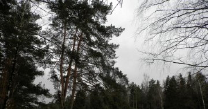
Almost the entire route passes near settlements, but it is good because it is close to Moscow and little time is spent on the road, and it itself is not very long. In addition, almost all of it can be walked along asphalt and concrete roads. We usually walk here in late autumn and early spring, when the days are not yet very long, there is a lot of mud and water in the forest, and there is little snow - that is, when skiing is no longer comfortable, and it is too early for hiking in the forests (or vice versa; )). By the way, in winter, there is a ski track along almost the entire route and you can ski. The only inconvenience is the need to periodically remove your skis to cross roads.
The length of the route is 12-17 km.
The path begins from st. Chelyuskinskaya, where we arrive by train from the Yaroslavsky station (schedule). We pass to the right in the direction of the train. Then there are two options for the path. You can go through the destroyed checkpoint of the sanatorium to the pond known as the lake. Chocolate and further along the paths through the Chelyuskinsky forest in the southeast direction to the Akulovsky Vodokanal, here it passes underground in a wide basin. A little before reaching the Yaroslavskoe highway, you need to cross the water canal (locals simply call it "canal") and go to the highway leading along it. This path is good if the paths in the forest are not too muddy.
If it is not comfortable to walk through the forest, then after getting off the train, we go forward along the paths to the crossing and turn right along the highway that runs along the "channel".

We cross the Yaroslavskoe shosse along the overhead passage, which is located to the left (along the course) of our path, about 150 m. After crossing the highway, we return to the "channel".


A bit of history: The Eastern water supply canal (also - the Akulovsky water canal; the Akulovsky waterworks canal) is designed to supply the Volga water from the Uchinsky (Akulovsky) reservoir to the first rise of the Eastern (former Stalin) waterworks. Built in 1933-1937 during the construction of the Stalin pumping (pumping and treatment) station.
The problems of water supply, constantly growing in Moscow in the 1920s and 1930s, demanded their cardinal resolution. The General Plan for the reconstruction of Moscow, developed and adopted in 1935, was also accompanied by the Plan for the watering of Moscow. In the same year, the Planning Department of the Moscow City Council prepared and published the "Scheme of the main highways, watering and landscaping of Moscow."
One of the elements of the planned flooding of Moscow was the Eastern Canal, which was supposed to become part of a large water ring to the north and east of Moscow, starting from the Klyazminskoye reservoir, passing through Mytishchi, Kuskovo and connecting through a system of locks with the Moscow River in the area of \u200b\u200bthe Yuzhny port. This project, which remained unrealized, found its reduced embodiment during the construction of the supply lines of the Stalin pumping station.
The main reason why nothing was reported for tens of years about the fate of hundreds of thousands of people employed in the construction of Moscow-Volgostroi (MVS) facilities was the special secrecy regime observed at these facilities. This applied not only to prisoners, but also to civilian workers, specialists who come to work in this system. Violation of the prescriptions provided for criminal liability, which at that time was almost tantamount to death.
In 1990, the Moscow Archaeological Expedition carried out a comprehensive study of the Losiny Ostrov State Natural National Park (GNP). During it, the stories of local residents, old-timers from the villages of Shchitnikovo, Oboldino, related to the time of the construction of the canal were recorded. The camp barracks were located 1.4 km north-west of the village of Oboldino, in the village of Oboldinsky. The local residents called the prisoners "canalists". Their graves were dotted with forests around the canal. 
With the beginning of the Great Patriotic War, serious measures were taken to protect the Moscow water supply facilities from enemy air raids. The Akulovskaya dam with a height of 24.3 meters, containing a water pressure of 23 meters, was especially dangerous. From the first days of the war, all structures of the waterworks were repainted in a masking color. The cadets of the Bolshevsk Military Engineering School were sent to protect the Akulovsk dam. The first aerial bombs were dropped on the dam already in 1941, one of them hit right into the canal. The pit was filled with sandbags and the canal continued to function.
The further journey can be continued along the highway, but it is much more interesting and pleasant to walk along the embankment of the water supply system. Previously, it was prohibited - there were permanent posts and police patrols, but now the bans have been lifted and you can walk along the entire "channel" with the exception of the pumping station territory.

To our right there will be a forest with a strange official name "45 quarter", and to the left of the highway, behind which there are cottage villages.

Approximately in the middle of this section of the way we cross the Dulev stream, better known as the "Govnotechka River". Now it is a dirty ditch, but at the beginning of the 20th century ide and bream were caught here, even crayfish were found.

After 1.4 km we come to Bolshevskoe highway. It is necessary to cross it carefully - there is no pedestrian crossing, the traffic is quite active and due to the terrain, drivers cannot see pedestrians well.

We continue our way along the "channel". On the left is the Committee Forest, on the right is the Zavokzalny District of the town of Korolyov. If we are walking along the embankment of the water supply, then we should get off it at the pedestrian crossing and continue along the road to the left - there will soon be a pumping station.


Go along the highway to the Moninskaya branch of the Yaroslavl railway. On the right, about 600 m, you can see st. Podlipki-Country. If necessary, you can finish the route here, but this is not rational, since the most beautiful and interesting places are still ahead.

The territory of the town of Korolev begins behind the railway.
Along the embankment of the aqueduct we reach Korolev Avenue, cross it and turn right into Victory Square, where you can see the Alexander Nevsky Chapel, as well as the Victory Memorial.


Behind the park begins a small, but the most boring section of the path - you need to turn right onto Oktyabrsky Boulevard, walk along it to st. Pionerskaya, go to the other side and, turning left, walk to the territory of the Akulovsky water pipeline. If the weather is dry, then you can not make this detour, but go straight along the "channel" or through a small forest behind the Memorial of Glory past the Church of St. Vladimir.

The further path departs from the water supply route, since a protected area begins here very soon, where water flows in an open channel.
We continue our journey, turning right from the street. Pioneer, and walk along a long concrete fence. On the left are plantings of birch, pine and spruce. Having reached the end of the fence, we continue our way in the southern direction along a wide clearing in the forest - this is already the territory of the Losiny Ostrov reserve.


A bit of history: "Losiny Ostrov" is located in the northeast of Moscow and the near Moscow region, starts from Sokolniki Park and continues beyond the Moscow Ring Road to Mytishchi, Korolev, Shchelkovo and Balashikha, forming a kind of green wedge between Yaroslavskoye and Shchelkovskoye highways. The greatest length from west to east 22 km, from north to south 10 km. Slightly less than 1/3 of the park's territory is located within the city of Moscow. This is one of the first national parks in Russia.
Losiny Ostrov has been known since 1406 from the 15th to the 17th centuries. the lands were part of the Taininskaya palace volost, the lands of which since ancient times have served as hunting grounds for Russian princes and tsars. So, in 1564 Ivan IV hunted bears here. In general, the nature reserve regime was preserved for Losiny Ostrov. In 1799 the forests were transferred to the Treasury and the first topographic survey was carried out; the forest is divided into quarters, the area of \u200b\u200beach is equal to a square verst. The first forestry was founded here in 1842, at the same time the first forest ordering was completed by the senior taxator Yegor Grimme and the junior taxator Nikolai Shelgunov. According to its results, the dominance of spruce (67%) was noted in the forest fund, which was subsequently replaced by pine and birch.
In 1844, forester Vasily Gershner initiated the creation of man-made forests in Losiny Ostrov. Active forestry work, mainly sowing and planting pine, has been carried out for 115 years. These plantings are still resistant to intense anthropogenic impact.
In the middle of the 19th century, the Losinoostrovskaya forest dacha (Pogonno-Losino-Ostrovskoye forestry) was organized, a period of systematic forestry began.
The idea of \u200b\u200bcreating a national park back in 1912 was put forward by the head of the forestry collegiate councilor Sergei Vasilyevich Dyakov. In 1934 Losiny Ostrov was included in the 50-kilometer "green belt" around Moscow.
Most of the forest was cut down during the Great Patriotic War. In 1979, by a joint decision of the Moscow City and Regional Councils of People's Deputies, Losiny Ostrov was transformed into a natural park, and on August 24, 1983, by a decision of the Council of Ministers of the RSFSR, a national park was formed.
Geographically, the park is confined to the junction of the Meshcherskaya lowland and the Klinsko-Dmitrovskaya ridge. It consists of six forest parks: two of them, Yauzsky and Losinoostrovsky, are located within the city, the rest - Mytishchinsky, Alekseevsky, Losinopogonny, Shchelkovsky - in the region.
On a relatively small territory of the National Park (about 12 thousand hectares), you can find coniferous forests of the taiga zone, birch forests, swampy meadows, swamps of various types, as well as man-made plantings of different tree species, glades, meadows, ponds. On the territory of the park are the sources of the Yauza and Pekhorka rivers.
The fauna numbers over 230 species of vertebrates, including over 160 species of birds, 38 species of mammals; 15 species are fish, 10 - amphibians and 5 - reptiles. According to the staff of the service for the maintenance and improvement of the national park, at the beginning of 2013, 70 elk, 300 sika deer, 200 wild boars, 300 hares lived on the territory of Losiny Ostrov; There are also foxes, American minks, raccoon dogs, squirrels, hazel dormouse, beavers, muskrats, bank voles, forest mice, goshawks, white-tailed eagles and many others.

A. Savrasov "Elk Island in Sokolniki"
We go along the forest road past a large felling and further through the forest in the direction to the south.


After 1 km we cross an overgrown clearing and 200-300 m behind it we go out onto the road.

You can go along it to the right and after 1.2 km go out onto a wide clearing NJ along which the road is laid. Turning to the right (to C), we will soon exit to the town of Korolev, on st. Pioneer. If we continue the route, then we should continue to follow it in a southerly direction. After 700 m we cross the wide swampy valley of the Nekhlyudov branch.

A bit of history: On old maps this place was called the Nekhlyudova Polyana tract, the locals often call it Pervaya Torfyanka. Perhaps the name came from the border of the monastic and princely possessions. "Princely Khludnevskaya land" and non-Khludnevskaya. The mention of the "princess Khludnevskaya land" is found in the Razezzhaya letter around 1477-1484.
After the Nekhlyudov branch we pass another 900 m through the forest and go to the Torfyanka lake. It was formed on the site of an old quarry. Now there is a recreation area with a beach and a cafe, in the warm season you can swim and have a snack.


From the lake you can walk to the nearby village. Peat enterprise, from where buses go to the station. Bolshevo Yaroslavl railway.
Our path lies to the west, by the edge of the forest past the Verkhneyauzkiye bogs - the source of the river. Yauza. Here, the classic swamp landscapes of the middle zone are surprisingly combined with areas of almost northern tundra.


After 1.6 km from the lake we turn north along a clearing (you can turn to the previous clearing, but this path is more pleasant). After passing 2 km along it, we go out onto the road going in the direction of the pollutant, cross it and continue our way in the northern direction along the forest path.


After 460 m we cross a clearing of the heating plant and along a clearing in a birch forest (on the C) we go to the outskirts of the town of Korolyov.


We pass a small section of the path between the fences and go to the park complex "Korzhevskie Kultury".

If you have time, you can turn right and stroll through this beautifully landscaped park.
A bit of history: The park bears the name of the famous architect Mikhail Petrovich Korzhev, who is the author of this amazingly beautiful man-made area of \u200b\u200bnature. Together with forester D.N. Marinin, in the early 1950s, a park-type landscape was laid with a radially located system of alleys and paths alternating with decorative glades. The secret of this park is that if you compare its map with the famous Sokolniki park, you can see the same style of landscape design: radially outgoing ray paths from the central meadows ... This is not surprising, because these parks have one author - M.P. Korzhev. By the way, he took part in the design of the Central Park of Culture and Leisure. Gorky. This park is an integral part of the Losiny Ostrov National Park, it is a recreational zone that plays a buffer role. Today it is a stable biosystem, habitat and nesting area for rare birds and animals.
Or you can continue along the edge of the park, leaving the territory of the Khimmash Design Bureau on the left. After 500 m we go out to a small street, along which, past the buildings of TsNIIMASH and the Mission Control Center (MCC), we go out to st. Pioneer.

More on the street. Tereshkova walk 700 m to the central square of Korolev. Here in the building of the Palace of Culture you can visit the Museum of the History of Korolyov.
From the square, on the street. Kalinin, we go to the Privokzalnaya square (600 m from the central square). From here you can go to Moscow by bus to VDNKh metro station (
The current schedule of trains Moscow - Chelyuskinskaya includes 70 electric trains (commuter trains, diesel engines), which connect these stations, among which there are night, morning, afternoon, evening. The fastest commuter train (suburban train) is recommended, which departs at 09:05 from the Moscow station and arrives at Chelyuskinskaya station at 0933 hours.If you need to spend the longest time on the way, you should choose the train number 6012 in the schedule with the Moscow- Yaroslavskaya - Pushkino, in this case the trip will take 0 h 45 m. Between the stations Moscow and Chelyuskinskaya, this electric train passes 9 stops. Among them are Malenkovskaya (09.52), Losinoostrovskaya (10.05), Taininskaya (10.14), on which it is possible to change trains to electric trains of other directions. On this page you can always find out the schedule of trains Moscow - Chelyuskinskaya, including the seasonal one, valid in summer and winter. Before planning a trip on the Moscow Chelyuskinskaya route, first read the schedule on our website, and also check this schedule at the nearest train station, as some operational changes are possible.
Train tickets Moscow - Chelyuskinskaya can be purchased at the box office of the nearest station.
Railway station "Chelyuskinskaya" is located on the line of the Yaroslavl direction of the Moscow Railway, located in the city of Mytishchi, in the Moscow region. The platform got its name from the Chelyuskinsky microdistrict, which was previously called the village of Old Bolsheviks, known as Sosnovy Bor.
The station was opened in 1936, it houses two landing platforms near which electric trains pass. One of the platforms has a lateral configuration, the other is an island landing platform. The platforms are straight, slightly curved to the north. Near the platforms, through the territory of the station, there are three tracks and one more is being built.
Under the railway lines there is an underground passage that connects the platforms. The ticket office is located on the side passenger platform. A little to the north of the station there is a car crossing over the railway tracks. There are no turnstiles at the station.
From the west, near the station, there is a residential sector of the dacha village of Sosnovy Bor, Starykh Bolsheviks Avenue, Chelyuskinskaya Street approaches the railway, Koralova Street is nearby, and Privokzalnaya Street runs near the platform. A little to the north of the station are Vtoraya Vodoprovodnaya and Vodoprovodnaya streets. Vodoprovodnaya street connects the territory of the station with the Yaroslavl highway. The Yaroslavl track runs one kilometer from the platform.
Near the western part of the station there is a private sector, small country houses, garden plots. A kilometer from the station there is an industrial area where a reinforced concrete plant is located, the territory of Stroyperlit OJSC, other enterprises are located, and a military unit is located. Behind the manufacturing sector is the Stroyplastmass residential area.
A vast natural area stretches to the east of the station; there is a small Shokoladka pond. Not far from the platform is the Podlipki sanatorium. The natural area runs to the Yaroslavl highway.
The village of Cherkizovo is located near the station. A hundred meters west of the station, the residential sector of the Chelyuskinsky village begins.
The central part of the city of Mytishchi is located six kilometers from the station.

New residential buildings are located not far from the platforms, and new residential buildings are under construction.
In the information sections of our portal, the characteristics of residential complexes in Moscow and the Moscow region are presented, photos of apartments, external territories, public sites are collected, the history of the development of development organizations, information about investors, information about contractors, real estate agencies are presented. On our portal you can choose a property that suits you in terms of price and required characteristics, buy living space. The site pages are updated daily with data on discounts, discount promotions, offers from developers in various complexes. The site also contains information about railways, highways, train stations, airports, metro, route stops.
Residential project "Newton" is located in the town of Mytishchi near Rozhdestvenskaya street. The complex has several multi-storey buildings, underground parking is designed for six hundred cars. Near the project there are training centers, trade departments, social enterprises, and other infrastructure facilities in the city of Mytishchi.
The Chelyuskinskaya platform is located nine kilometers from the Moscow Ring Road.