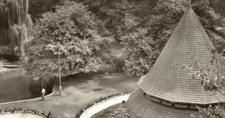
Tserik-Kel
Scientists have found that Nizhny blue Lake in the Chereksky region of the republic is much deeper than previously thought. This lake is also called Tserik-Kel. It is located at an altitude of 809 meters above sea level. Temperature all year round+9 degrees. Researchers suggest that it was formed due to the collapse of an underground karst cave.
A river flows out of the lake - more than 70 thousand cubic meters per day. But what feeds the reservoir itself was not clear for many years; the flowing sources are not visible from the outside. Until recently, it was believed that the depth of the lake was 258 meters. But recently it turned out that this is not so.
“The Center for Underwater Research of the Russian Geographical Society, professors and scientists from all over Russia (about 60 people in total) carefully studied the Lower Lake,” says Mukhamed Kozhokov, chairman of the Kabardino-Balkarian branch of the Russian Geographical Society. - More than 90 deep-sea descents were carried out in a couple of months. First used underwater vehicles- controlled robots. With their help, scientists discovered three caves in the deep-sea part of the lake. The most deep point, which we managed to descend to - 279 meters. It also turned out that underwater rivers feed Tserik-Kel. The water is incredibly clear, every pebble is visible, even at a depth of 25 meters. Further, the water becomes azure-turquoise due to hydrogen sulfide. There is no flora and fauna in the lake - hydrogen sulfide kills all living things. But why the water temperature is constant and what is at the very bottom is still unknown.”
Let's go to the bottom “I have gone down to the Lower Lake several thousand times,” says Eduard Khuazhev, head of the KBR Underwater Research Center and president of the Kabardino-Balkarian Underwater Sports Federation. - The task of the last expedition was to determine a more accurate depth. And understand where the water comes from. In the bowl of the lake we discovered several cracks from different sides, three of them are 1.5 meters wide, with powerful streams coming from there.”
At the bottom of the lake, not far from the shore, there are several sunken cars. Empty, without people. Old-timers say that in the 30s of the last century, a truck loaded to the top with boxes of port wine fell into the water. Researchers have debunked this myth: there really is a “LAWN” at the bottom, but there is only a box of port in it. We took out one bottle, tried it, and assessed its aging.
Local residents avoid the lake due to superstitions. It is believed that you cannot even get your feet wet in Tserik-Kel.
By the way, it’s really impossible to swim there even in summer. Cold water causes muscle cramps in an unprepared person, but at depth it is very dangerous.
Four lakes
“There are four lakes in the Cherek Gorge - Nizhneye, Sukhoe, Secret and Verkhneye,” says local historian Khadis Tetuev. “The “bottomless” lakes of the Caucasus were first mentioned in 1864 in the notes of the Russian officer Fyodor Tornau.”
The first special observations of the group of Blue Lakes were carried out in 1892-1895 by geologist Konstantin Rosikov. Scientists have found that all lakes are of karst origin. But they are all completely different. If you go northeast from the Lower Lake, then on the mountain plateau 187 m above the Lower Lake there is a huge, now dry, Kel-Kechkhen failure. Translated from Balkar - “the lake has flowed away”. The depth of the failure is 177 meters. Below you can see a lake, which from above seems very small - the size of a saucer. It is called “Dry”. According to legend, its waters once reached the upper edge of the sinkhole, but the mountains shook and the water flowed into the Lower Lake.
Modern researchers suggest that the Lower and Dry lakes are indeed connected. The secret lake seemed to be hidden in dense thickets of bushes and trees. On the opposite side of it lies the Upper Blue Lake. At the beginning of the 20th century, in its place there were three small reservoirs, which eventually merged into one big lake. The water in the Sekretny and Verkhny lakes freezes in winter, but in summer you can swim and fish in them - there are a lot of living creatures in them.
Many myths and legends are associated with these amazingly beautiful places.
Location
The blue lakes of the CBD are located in the unique Cherek Gorge, located on the territory of the region of the same name. It is considered the most densely populated in Kabardino-Balkaria, and also has a large area. There are mainly mountains here: five of the seven peaks of the Caucasus, the height of which reaches 5 km. This is where the longest European glacier is located. Is in these amazing places oh, and one of the oldest mountaineering camps, “Bezengi”, where the foundations of Soviet mountaineering were laid.

Natural monument
The blue lakes of the KBR are considered unique Chirik-Kol - the second deepest karst spring in the world. It is a karst aquifer with steep walls. The maximum width on the surface of the lake is 130 meters, length - 235 meters. There is an expansion in the upper part, so the depth difference is determined from 0 to 40 meters. Chirik-Kol has no tributaries; a small river flows out of it.

Temperature
The weather on the Blue Lakes of the CBD is determined by the time of year, but the water temperature is constant and amounts to 9 degrees. This lake is absolutely transparent; in good weather, visibility remains about 30-50 meters.
History of the study
The Blue Lakes of the KBR were first described by the geographer I. Dinnik in his work “A Trip to Balkaria in 1887-1890.” The author emphasized the beauty and pristine nature of these unique places, described the climate features of the CBD, Blue Lakes.
How to get to this natural monument? This question interests many tourists. At the beginning of the last century serious geographical studies V this region conducted by I. Shchukin. In the thirties of the last century, he was engaged in the study of the Blue Lakes. It was he who was awarded the Russian Geographical Society with a personal silver medal for the unique results obtained during the experiments. He managed to find out that the reservoir of this lake is a deep well, the steep walls of which are lined with layered limestones. Water comes here from below under strong pressure.
In the summer of 1980, an expedition from the Geographical Institute named after. Vakhushti Bagrationi, owned by the Georgian Academy of Sciences. The leader of the research group was Doctor of Geographical Sciences G. Gigineishvili. The expedition confirmed information about the depth of the lake, and during the work new data was revealed about chemical composition water. It turned out that only algae live in these places, there are no living creatures, and mineral salts in Blue Lake are present in minimal quantities.

Legends of Blue Lake
The history of the appearance of a dive center on Blue Lake begins in the summer of 1982. In June, Roma Prokhorov, a Moscow student, appeared on the shore of the lake. In addition to a huge number of trunks, he had oxygen cylinders, as well as diving equipment.
It was he who later became the Russian record holder for founding the Blue Lakes camp. The CBD is famous all over the world for its diving center, founded by Prokhorov. Now the buildings, built with the assistance of the government of Kabardino-Balkaria, have two tiers. The lower one is carved directly into the rock, there is an exit to the descent platform. There are showers, locker rooms, rooms for storing equipment, as well as a pressure chamber room.

How to get there
Have you decided to visit the Blue Lakes of the CBD? How to get to these amazing places? First, get to Nalchik. From Moscow you can get here by railway, as well as by road. Along the gorge up beyond the Blue Lake there are the Cherek tunnels; part of the old road has been preserved. A narrow path to the reservoir begins at a small waterfall and winds along a cliff, the height of which is about one hundred and fifty meters.
A stunning view opens up on the way to the Blue Lakes. After driving a few kilometers, you can get to the village of Upper Balkaria. The attraction of this settlement is unique suspension bridge, leading to the old settlement. It was destroyed during the resettlement of the Balkars by order of Stalin. But the foundations and remains of the walls have still been preserved; when you look at them, you can imagine the narrow winding streets where the inhabitants of the ancient mountain village once walked. The Abai-Kala tower, surrounded by apricot trees, is also unique in its beauty. On a solid stone, the height of which is ten meters, to the left of Abai-Kala, there is a watchtower.
Over the course of fifty dives, they tested unique equipment and came close to creating a three-dimensional model of the reservoir. Almost a quarter of a kilometer deep, it is fraught with many mysteries.
The mini-submarine dives into Blue Lake - one of the deepest karst lakes in the world - 258 meters.
The lake was first examined in the 20s, then in the 80s, but then there was no talk of using such deep-sea vehicles.
“I didn’t dare to dream of such an opportunity, when in the most comfortable conditions and without any preparation we can dive to the bottom of the lake and examine it. It greatly facilitates our further interpretation of the results that we obtain,” notes geologist, candidate of geological and mineralogical sciences, deputy director for scientific work of the Natural Science Institute of Perm State National Research University Nikolai Maksimovich.
To study the lake, two more mini-submarines are used, with the help of which specialists from the underwater research center of the Russian Geographical Society take samples of soil and rock from the very bottom.
“The fact that we see this surface is just part of the total volume of the lake, since it has the shape of a bottle or jug, that is, a rather narrow neck, after which expansion occurs. “We would gasp if we saw the entrance to a cave, a tunnel, or the entrance to some neighboring hall,” says Sergei Fokin, executive director of the Center for Underwater Research of the Russian Geographical Society, head of the group of manned underwater vehicles.
According to experts, it is according to underground caves water flows into the lake. After all, there are no tributaries on the surface, but the river flows out of the lake. At the same time, the level of the reservoir does not change in any way. Using special measurements, it was possible to find out what the water consumption is.
“The depth and width here are such that 77 thousand cubic meters of water flow here per day; it must come from somewhere,” says geologist, junior researcher at the Natural Science Institute of Perm State National Research University Artem Demenev.
Another goal of scientists is to determine exactly what the bottom of the lake looks like. And this small robot, using sound, can explore any areas under water that are inaccessible even to mini-submarines.
These pictures were taken using a submersible. Every five meters as you dive, the sonar sends a signal that is reflected from the walls of the lake. Here they are shown in separate colors. In the future, these images will be used to create a three-dimensional underwater map.
If underwater vehicles operate at great depths, then divers explore the lake at a depth of no more than 120 meters. In addition to research, divers are testing new underwater equipment that records all dive parameters.
“Very stable conditions, it’s like an ideal training base, good visibility, again, stable temperature, no current, no waves, very convenient entry and exit from the water,” notes the head of the diving group, Sumbat Aleksandrov.
Why does the lake have a constant temperature all year round - nine degrees above zero? Or where does the hydrogen sulfide come from? These are questions that the expedition has yet to answer. It will last a month in total.
Mysterious blue lake Tserik-KelBlue Lakes are a group of five karst lakes in the Chereksky region of Kabardino-Balkaria. Located at the foot of the rocky ridge, where the Cherek-Balkarian gorge begins. The uniqueness of the Lower Blue Lake lies in the fact that with a relatively small surface (only 235x130 m), it has a depth of 258 meters. The surface water temperature in winter and summer is about +9.3C. Not a single stream or river flows into the lake, but about 70 million liters of water flow out every day. The lake level remains unchanged, which is explained by powerful underwater sources. The water is blue due to the presence of hydrogen sulfide in it and the refraction of light rays in a deep pool.

Located at the entrance to the gorge, Blue Lake is a unique natural phenomenon, interesting not only for Kabardino-Balkaria, but also on a national scale. The Lower Blue Lake has several names: Chirik-kel (bulk) - rotten (smelly) lake; Sherej-ana (kab.) - Cherek’s mother; Psykhurey (kab.) - round water (lake), natural artesian well. Animal and vegetable world The lake is very poor due to the presence of hydrogen sulfide.
There is a legend among the local population about the origin of this lake. Once upon a time, on the territory of Kabardino-Balkaria there lived a fearless hero, Bataraz, who defeated an evil dragon in a duel. And when the dragon collapsed, a hole formed in the mountains, which filled with water. To this day, the dragon lies at the bottom of this lake and sheds tears, thereby filling the lake with water and an unpleasant odor.

However, the nature here is quite picturesque: green hills, dense beech forests on steep slopes, and in the distance, in the blue haze, peaks sparkling in the sun. Closer to Babugent the greenery becomes brighter and juicier. Near the village of Babugent there is a fork in the road. At the beginning of the road to the lake in the rock there is a cave in which traces of an ancient parking lots V-X centuries AD. Now many bats live there, and sometimes, in bad weather, shepherds with flocks of sheep take shelter.


Before reaching the lake 200 meters, a gravel road leading to the Upper Blue Lakes goes left in a serpentine uphill from the main road. On a plateau, 500 meters above the lower lake, there is Dry Lake. The Balkars call it Kel-ketkhen (Gone Lake), since the lake itself (in area water mirror 2 times larger than the lower lake) is located in a hole 160 meters deep.

On a slope, 2 km from the lower lake, in a beech forest, there is the Secret Lake (so named because it is difficult to discover) 17 meters deep and smaller in area than the lower lake. Balkars call it Tasha-kel (Stone Lake).