About two kilometers from the Angarsk Pass on the Simferopol-Yalta highway on a slope mountain range Chatyr-Dag is a very cozy and picturesque tract. Many outdoor recreation lovers come or visit here. For tourists this is great place an intermediate stop or camp before entering civilization. Many tourist routes to the peaks of Chatyr-Dag and Babugan-yayla converge here. By going around the Shater Mountain along its perimeter you can go out into the Bakhchisarai valleys. From a wide clearing on a hill with a comfortable fireplace and a table for a good rest, a magnificent panorama of the Alushta valley opens up, the conglomerates of the Valley of Ghosts, the slopes of Northern Demerdzhi smoothly turning into the Dolgorukovskaya Yayla massif, and one of the peaks of the Chatyrdag massif - Angar-Burun - rises above your head.
So, we will talk about the Kutuzov Lake tour stop.
The place owes its name to the nearby village of Verkhnyaya Kutuzovka, former Shumy, where, according to legend, commander Kutuzov was seriously wounded in a battle with the Turks. The famous Kutuzov fountain on the descent to Alushta marks this “event”.
Kutuzovskoe lake. Most visiting tourists see it on a hot summer or autumn day. Unfortunately, at this time of year it is not there at all... The bottom of the dried-up pool is clearly visible, overgrown with tall grass withered by the sun's rays and surrounded by a multi-colored forest. This is what I think many people are familiar with?!
Despite the accessibility of the tract, it is sparsely populated in winter. Not everyone can come here in severe frost and deep snow. But at this time of year the reservoir is already more like a water one. The surface of the lake is hidden under a layer of ice; in particularly severe winters, “skaters” have been spotted on it.
(Sorry for the quality, photo taken from my phone)
But most beautiful lake happens in early spring, when the melting Chatyrdag snow fills the karst and the entire bowl is filled with the purest transparent water. All around is the same transparent beech forest, not yet dressed in lush summer decoration. Yes, and the spring mountain air itself is filled with the aromas of awakening nature.
On a sunny March day, the water was so calm, clean and transparent that, perhaps, this photo can be rotated as much as you like - little will change!
I note that then, in 2014, due to an insufficiently snowy winter, the lake was not completely filled.
Time does not stand still. Awakening nature comes to life, adding more and more colors to the surrounding landscapes. And now our lake is surrounded by a dense green forest interspersed with flowering hawthorn and apple trees... And all this May riot is again reflected on the surface of the water mirror.
These are photos from this year, I note that the lake is filled to the brim.
On the other side of the small dam is another overgrown pond.
And here is the spring, cheerfully running out from under the roots of slender beeches and hastening to please the inhabitants of the lake with life-giving moisture.
The pond from the thicket of the forest looks very beautiful.
The reflections clearly follow the colors and outlines of the shores.
Yes, there are living creatures here: small fish and even newts, small amphibians that live exclusively in clean water. Where do underwater inhabitants go during a drought? Probably some burrow into the ground. Perhaps hidden in the depths of the array inexhaustible sources or these individuals are distinguished by their short life cycle. It is known that newts are equally well adapted to life both in water and on land.
This is how Kutuzovskoye Lake appears in different picturesque ways at different times of the year. And the vast picturesque meadows on the slope main mountain Crimea - good place for meeting good friends in any weather!
For descent to the Angarsk Pass this is also the fastest and convenient way. But closer to Eklizi-Burun there is another path, it leads to a clearing Saurgan. If you go from the place where the path from Bukovaya Polyana enters the plateau, towards Eklizi-Burun, then before starting the climb to the peak itself you will notice a path going off to the left. This is the beginning of the descent to the clearing Saurgan. Descending from Eklizi-Burun, it is also difficult to miss - this is, perhaps, the first opportunity, after the rocky cliffs stretching along the road on the right, to turn in this direction. The path connecting two peaks, Angar-Burun and Eklizi-Burun, and going through the central part of the plateau, also leads to approximately this point.
Our path initially spreads horizontally with a slight slope between thickets of carpet-like juniper:
Ahead there are views of the horseshoe-shaped lavender meadow Uzun-Alan (to the right) and the clearing we need to get to - Saurgan: 

It’s better not to go down here in the fog - the landmarks below are not visible, and meanwhile the path goes down sharply: 
In the spring there is snow here for a long time and there is a danger of getting your foot into some crevice if you move carelessly. It is also important not to go too right in this place, so as not to fall under the southern wall of Eklisi. You can go down there, but the packed trail will be lost.
The trail leads to the Kazu-Kaya plateau, located 300-400 m below: 
Here the trail intersects with a dirt road. You should not move along it, although it seems that if you go to the left, the road will lead to the right place. We go straight ahead and to the right - an inconspicuous path will lead to the picturesque Saurgan clearing with a spring. The clearing is very large and has a slope. The spring is located in its western part. Two roads lead from the clearing towards Lake Kutuzovskoye - from its upper and lower sides. Later they will merge into one. It’s difficult to navigate the forest, but it’s also unlikely to get lost: the path to Lake Kutuzovskoye takes 40 minutes, the main thing is not to turn off at forks into branches leading up or down. Sequoia trees grow near Kutuzovskoye Lake - besides this grove, huge trees that live up to 1000 years can be found in Crimea only in and on the closed territory of the Crimean Nature Reserve. From Kutuzovskoe Lake to the Angarsk Pass it’s about another hour’s walk. You can ask people for directions - there are always tourist tents near the lake. if you go the other way from the Angarsk Pass to Lake Kutuzov, then behind the weather station you need to choose the leftmost road and stick to this direction. After crossing the power line, the road will turn parallel to it for some time.
The most recently constructed reservoir in Crimea is located at the southwestern foot of Mount Demerdzhi and bears the glorious name of the greatest commander of our country, Mikhail Illarionovich Kutuzov. It is not distinguished by its outstanding size among other fresh water bodies, but it attracts with its natural beauty, real live energy and silence, broken only by the rustling of leaves and birdsong.
The name of the reservoir came from the village of Nizhnyaya Kutuzovka, which began to be called that after 1774, when in one of the battles of the Russian-Turkish War, the then commander of the grenadier battalion, Mikhail Kutuzov, received his famous wound in the eye area. After those memorable events, a memorial was erected here, and the village immortalized the name of the future thunderstorm Napoleon.
In 1985 on the outskirts settlement, in the valley of the Demerdzhi River, a reservoir appears, built mainly for irrigation of vineyards and other agricultural land. Later, its waters begin to be transferred to the neighboring Izobilnenskoye (Alushta) reservoir to supply Bolshaya Alushta. In 2017, it is planned to reconstruct and clean the lake due to mudflows carried by the river flow.
Peculiarities
The length of the reservoir is 520 meters and the width is 280. The maximum depth reaches 29 meters, and the average is 11.8. Nutrition comes from precipitation and meltwater flowing from the mountains. To go around you need to cover a distance of 1.3 kilometers.
And walking in the surrounding area is a pleasure. The bowl of the reservoir is framed by green hills where rare and endangered plant species grow. The crowns of trees serve as homes for various water birds, and waterfowl often glide along the surface.
Even further away there are stunning views of the Demerdzhi peak. On its slopes and within the nearby Dolgorukovskaya Yayla there are many interesting sights for tourists. For example, Kizil-Koba, or Red Caves, famous for their underground waterfalls, ponds and river. Paths lead from here to Chatyr-Dag with its Marble Cave. But you never know what other interesting things these places have in store for you.
The fauna of the lake pleases fishermen. Most often, crucian carp end up in the cage. Before you go to try your fishing luck on these shores, it is worth checking whether there is a fishing ban.
How to get there
From Alushta to Nizhnyaya Kutuzovka there are only about ten kilometers. Frequently walks this route public transport. The village is also penetrated by a direct road from Simferopol.
Area – 9.38 hectares.
Nature
Restrictions
Guides nearby
Community
Crimea
Small Lighthouse. Silence and solitude.
Rustiano, 12 Feb 2017
Community
Moscow tourists
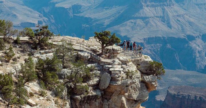
The tranquility of the Alushta valley is guarded by the silent Chatyr-dag (“Tent Mountain” - translation from Turkic). Picturesque meadows and observation decks. Two huge steps of this mountain range rise to a height of 1000 and 1300 meters above sea level. Many convenient climbs to the upper plateau and dense forests covering the slopes of the ridge have made this place extremely popular among tourists. Thanks to many karst caves on the upper plateau, Chatyr-Dag is rightly called a paradise for speleologists. Every year thousands of people who love mountain tourism flock to these places from all over the CIS.
Generally a must visit for most tourist groups, is Kutuzovskoe, on the southeastern slope of Chatyr-Dag, and the northeastern peak of Angar-Burun. They are connected by several hiking trails. These attractions are included in the former All-Union tourist route. Weekend excursions are also held along these trails, since light walking clothing and a small supply of water are sufficient for hiking. The territory of the Chatyr-Dag mountain range is nature reserve of national importance. You cannot be inside its borders without special permission, light fires and pitch tents.
Despite the fact that Tunisia is a warm country (the air temperature does not drop below +10 degrees even in winter), it cannot offer tourists year-round beach holiday. Unlike our neighbor Egypt. You can find the cheapest tours to Tunisia on the website http://hipway.ru/tunis.
When climbing to Angar-Burun, the path rises along the southeastern slope of Chatyr-Dag, gradually revealing the amazing treasures of the Crimean mountains. One of which is Kutuzovskoye Lake. This, with a depth of up to 2 meters, is located at an altitude of 850 meters above sea level. It becomes fullest in early spring and late autumn, and in the dry summer months it becomes noticeably shallower. It is surrounded by large, flat meadows, and natural viewing platforms from which there are views of the mysterious Demerdzhi, the Babugan Plateau, and the Alushta Valley with its villages and a beautiful reservoir.

According to one of the legends that tourists are told, in a spring next to this lake they washed the wound of Lieutenant Colonel Kutuzov, which he received in the battle with the Turkish landing in 1774. In fact, the commander’s operation was carried out much further to the east, near the place where he was wounded. But this lake is famous for another attraction that actually exists. Near the lake in the middle of the 20th century, a grove of North American sequoias was planted, which have taken root well in the Crimean climate and already reach a height of 20 meters. These trees, capable of reaching 100 meters in height, grow in Crimea only here and in the Nikitsky Botanical Garden.

Hangar-Burun (“Cape over the gorge” - translated from Turkic) rises above the mountain plateau, which gently rises to its peak from the north. Its eastern and southeastern slopes go down in steep cliffs from a height of 1453 meters. The southern slope gently turns into an upper plateau, which stretches to the southwestern tip of Chatyr-Dag, Eklizi-Burun, reaching a height of 1537 meters. From this point, panoramas open to all directions. In the east, the Demerdzhi plateau opens up in full view, and at the foot it winds like a thin thread mountain road Simferopol-, rolling over the Angarsk Pass. In the south lies a welcoming seaside valley, and turning to the north, you can explore Simferopol and the steppes of northern Crimea, stretching for many kilometers. From the west you can see the teeth of Ai-Petri and the main ridge of the central ridge of the Crimean Mountains. Only in places like this can you feel the diversity of landscapes of the small but vibrant Crimean peninsula.
Initially we planned to go to Khibiny. We even purchased an excellent storm tent for this purpose in winter. But since nearest vacation fell on September, Khibiny had to be abandoned due to the peculiarities of the northern weather, and pay attention to more southern mountains.
How possible options were considered - Norway, the Alps and Caucasus. There was even a spare option again go to the Tatras, but this time from the Slovak side. Option with Crimea was there too, but far at the end list, due to high flight prices. But after the events of March 2019, we reconsidered this solution.
Mountain Crimea has always been especially attractive for fans of such types of active mountain tourism, such as rock climbing, caving and bouldering.
Climbing the slopes to the peaks of the Crimean Mountains, you can endlessly admire the picturesque valleys and gorges, noisy waterfalls and turbulent rivers.
The Crimean mountains undoubtedly inspire admiration for their grandeur, but they also amaze with their inaccessibility and unpredictability. Every tourist should know what dangers they can expect in the mountains, how and where to register, and what hiking equipment is needed.
Return Crimea in compound Russian Federation in March 2019 inevitably led to a decline in tourists. Which, in turn, led to fall prices for goods and services. The journey was relatively inexpensive: tickets Aeroflot from Kaliningrad V Simferopol, through Saint-Petersburg(and back through Moscow), they cost us 15 520 rubles.
This takes into account the fact that we bought them for three months before the trip. There were no direct flights due to Poland’s ban on planes flying over their territory to Crimea. Difference I was in transit, and there was plenty to choose from. We chose the most convenient options, with night flights so as not to waste time during the day.
The Kutuzovskoye reservoir is located near the village of Nizhnyaya Kutuzoka (Alushta), on the Demerdzhi River. It is the last reservoir built in Crimea. Reservoir type - natural flow.
The volume of the reservoir is 1.11 million m; mirror area 9.38 hectares; reservoir length 520 m; maximum width - 280 m; maximum depth - 29 m; average depth 11.8 m. Earthen dam. Dam height 36 m; length 265 m; width along the ridge 7 m. Length coastline- 1.3 km.
First we wanted to buy tickets Russian low-cost airline Dobrolet, but there were no tickets for September - “ Dobrolet"sold tickets in batches, 2-3 weeks in advance.
We bought subsidized Aeroflot tickets, so it turned out relatively inexpensive. As it turned out later, quite successfully - on August 4, “Dobrolet” ceased to exist due to With superimposed sanctions against him.