In order to fully reveal the diversity of Spain, we have created several completely different treks: trekking in the Pyrenees, the Canary Islands and mountainous Andalusia. Let everyone find their perfect track!

Active holidays in the Canaries
The Canary Islands offer breathtaking scenery, extraordinary black beaches with volcanic sand, a stormy ocean and fresh seafood. The Canaries have preserved pristine relict forests and tropical jungles that covered the islands back in Paleolithic times. Tenerife is not called “the island of eternal spring” for nothing - the weather is always pleasant here :). Legends about pirates are in the air and, according to legend, Tenerife is part of the mythical sunken Atlantis. Local tourism infrastructure - on top level: diving, surfing, aquariums, the largest show of dolphins, killer whales and sea lions in the world, the richest botanical gardens and an incredible number of restaurants, bars, cafes... You are guaranteed to bring back many colorful photographs and vivid impressions!


We will meet dawnon Teide(3718 m) - the top of Spain. The views of Tenerife and the ocean will melt even the most experienced hearts.
Let's get acquainted with landscapes that are difficult to even imagine on Earth:huge craters, de Garcia rocks, surreal Maska gorge, lunar landscape ( Paisajes Lunar ) .
Let's enjoy the panoramas in the Anaga mountains, where the routes are lost among the riot of tropical jungle and rare blue laurel forests. A riot of flowers and giant ferns will take you back to prehistoric times...
We'll have a good swim in the foamy waves of the ocean, relax on the divine beaches, taste delicious dishes, sweet fruits and fine wines.


Trekking in the Catalan Pyrenees
Catalonia is not only Barcelona and 580 km of Mediterranean coastline. This proud, independent province with a proud history has its own mountains - the Catalan Pyrenees. They border France and are distinguished by steep slopes, picturesque canyons, wild forests and inimitable historical monuments. Medieval fortified cities huddle among the steep cliffs; the number of ancient Roman churches is off the charts - there are more than 100 of them in the vicinity! This is where you can admire the most deep canyon in Europe, which was washed away by the Ordesa River. A slightly unbridled temper local residents and their commitment to tradition will provide the best possible understanding of this delightful country.


Our trek in Spain is part of a trek that starts in France and ends in Catalonia. The final destination is the famous Barcelona.
Trekking in the Catalan and French Pyrenees with Pohod V Gory
We will conquerpass Bujaruelo (Puerto deBujaruelo, 2273m),where we can enjoyrockyalpine landscapes, amazingAndviewAmi to the topMonte Perdido (3355m)and the valley of the Ordesa River.
Let's go down toOrdesa Canyon, the deepest in all of Europe. Its steep walls are not inferior in beauty to the Grand Canyon, and an incredible number of animals roam in the surrounding boxwood forests. This place is one of the few where you can see the pristine nature of the European continent. By the way, national park Ordesa y Monte Perdido is the oldest in these mountains and is protected by UNESCO as natural heritage humanity. And among this splendor we will spend the whole night :).
Let's visit cities- fortresses Torla and Broto. Let's see real medieval castles, p let's walk around cobbled streets where knights once rode,Carolingians and rulers of Aragon...
Let's admire the brilliantBarcelona , its irrepressible energy and unique architectural diversity. Mixing styles creates contrasts that amaze the imagination. Gothic quarters, baroque, neoclassical quarters coexist harmoniously here With icism and colonial coastal buildings. But the city’s world fame was ensured by Gaudi’s creations. For one thingExpiatory Temple of the Holy Family (Sagrada Familia,Templo Expiatorio de la Sagrada Familia ) you can safely go trekking in Spain!
In France we will visit Lourdes, Toulouse, climb Petit Vignemal (3032 m) and the Roland Gap Pass, visit the Gavarnie circus and be sure to enjoy delicious cheeses.


Whether hiking in the Pyrenees or on the volcanic islands,through emerald alpine meadows or tropical jungles,acquaintance with historical cities or traditional fishing villages - trekking in Spain will not leave you indifferent and will be remembered for many years.
Hiking in the Andalusian mountains
The Iberian Peninsula combines the most unusual features of three parts of the world. It has its own Limestone Alps, and modern skyscrapers adorn the cities. The vegetation, climate and classic whitewashed Berber villages are clearly closer to Africa. On high, vast plateaus stand unique Moorish castles, decorated with Arabic script and characteristic Asian ornaments. In Andalusia, three very different cultures collided and gave the world something completely new and unique.


Trekking in the Sierra Nevada
This is a hike onalpujarram - deep valleys surrounded by steep rocky mountain slopes.
Getting to know unique Berber settlements, walking along cobbled alleys with colonnades and characteristic courtyards.
Climbing highest peaks peninsulas - Mulacen (3478 m) and Alcazabu (3371 m), high-mountain trekking along the picturesque Sierra Nevada ridge.
Excursion to amazing world masterpiece of the Moorish style - the Alhambra.
The brilliant cities of Seville, Malaga, azure beaches Mediterranean Sea or the stormy waves of the Atlantic - your choice :).
Andalusia offers the opportunity to combine easy, picturesque mountain trekking with a wonderful world of unique history, culture and art.Withstva.


Weather in mountain trekking in Spain
The Pyrenees serve as a barrier between the continental and Mediterranean climate zones. Technically Spain is the latter, but climatic features within the country vary greatly depending on the region.
You can go to Tenerife at any time of the year - there are always excellent conditions for active and beach holiday. In summer average temperature+25º, in winter +19...20º. But in order to fully taste the delights of the Canaries, we recommend going there from May to November, when the islands are surrounded by sunshine, fragrant flowers and sweet fruits. Sometimes in winter snow falls in Anaga and Teide, which complicates the route and affects the comfort of climbers.
The coast of the mainland part of the country is dominated by the mild Mediterranean: warm, wet winters (+17º) and dry, hot summers (+30...40º).


IN high mountains Alpine climate: snowy, cold winters (-10...-30º) and moderate summers (+15...+25º). The wettest months are April and May, so the trekking season in Spain opens in June and ends in September with the arrival of rain and snowfall. As in the Alps, it is better to get up early here, because in summer evenings there are clouds and precipitation, and good visibility is ensured only in the morning. This part of Catalonia is called “Wet”, so stock up on reliable membrane boots and ponchos. Ski resorts have been in full swing since November.
When is the best time to go trekking in the Spanish Pyrenees?
Despite the average height of 2500 m, these mountains are generally difficult to pass, which is explained by the complex rugged terrain. Even in summer, a hike requires preparation and endurance, but in winter this idea seems completely dubious. Starting in October, mountain shelters close and the weather becomes unpredictable. In January it stabilizes, but by then the passes are buried under a deep blanket of snow. “Mountain trains” - avalanches - start in February;). Spring is the rainiest period here. Based on this, it is better to plan a hike in this harsh massif in season - from June to September. You can't go wrong!


Documents for trekking in Spain
Citizens of Russia A valid visa is required for entry. Consular fee for opening a Schengen visa is 35 €, visa center services are 15-20 €. Required documents:
application form in English or Spanish;
2 photos;
original and copy of passport;
medical insurance;
certificate from place of work;
confirmation of solvency (if the salary is below 25,000 rubles, you may need a document confirming the presence of a sponsor);
confirmation of ticket and hotel reservations.
All necessary information can be found on the visa center website.
Citizens am The Republic of Belarus a similar package of documents is required. Since October 2016 Visa Center Spain does not work in Minsk. Those wishing to obtain a visa should contact the Latvian Embassy.
Since June 2017 citizens of Ukraine have the opportunity to cross the border without first obtaining a visa. All you need is to present your biometric passport, health insurance and cash to stay in the country and return home.
Why you should go trekking in Spain
Despite the popularity of the country among tourists, most come here in pursuit of warm sea and historical sites. But the situation is changing quickly: leisure and trekking in the Spanish mountains is gaining momentum. Have time to visit wild places nature, as long as they maintain their purity and virginity. And the active recreation club Pohod V Gory will help make this dream come true. Just fill out the application for your ideal trip - we'll take care of the rest. Sorceress Spain is waiting for you;) Join us!


Spain is a colorful, cheerful country that attracts the interest not only of those who love the sun, beaches and skiing activities. Spain, being one of the highest located countries in Europe - the mountains here occupy most country, is interesting for its landscape and for those who love the hiking format of travel and are interested in mountain hiking and trekking.
The Canary Islands are a unique area of volcanic origin - there are more than six hundred volcanoes, and the Teide volcano on the island of Tenerife is the most high point countries. Its height is 3718m. You can also find absolutely unique vegetation here, the representatives of which do not grow anywhere else except this island.
Documentation:
To visit Spain you need a Schengen visa. Also, to carry out trekking in Tenerife you need to get special permission local authorities, therefore the acceptance of applications for participation in the hike stops 15 days before the start date of the event.
Each participant of the trip must be insured! Since insurance is not included in the price of the trip, you will need to insure yourself before leaving. We strongly recommend that you do not skimp on insurance and choose a program that covers activities such as trekking and mountaineering, and also does not have a deductible for any type of evacuation if necessary.
Hiking routes through nature reserves, natural parks, canyons and other natural landscapes have been very popular among tourists for many years, designed to give the traveler enjoyment of the scenery and good physical training. Spain is a paradise for lovers walking routes. There are a great many mountain ranges and natural parks here, and local authorities are very concerned about nature conservation and attracting ecotourism local residents and arriving travelers, and therefore, wherever possible, routes for comfortable walking are equipped. We have prepared for you the TOP10 walking routes in Spain.
 1. Route Ruta del Cares in Asturias
Without exaggeration, this is one of the most beautiful and most popular routes in the entire Picos de Europa National Park. It starts in the town of Poncebos in Asturias and ends in the village of Cain, which is already in the province of Leon. The route is not the easiest from a physical point of view, as it involves difficult climbs with a height difference of up to 1000 meters, but the effort is worth it. You will enjoy the breathtaking landscapes of the valley, cross a mountain river and admire the amazing panoramas that suddenly open up from a height of up to 2000 m above sea level! The duration of the route is about 2.5 hours one way.
We have already talked about this route in one of the photo reports; it was once considered one of the most dangerous in the world! But, after restoration, it became available not only to extreme sports enthusiasts, but also to simply those who like to have an “interesting walk.” This road in the province of Malaga was once used by builders to build the Conde del Guadalhorce dam. After the completion of construction work, King Alfonso XIII walked along the path, after which it received the sonorous name “El camino del Rey” or “The Royal Path”. Walking along narrow paths and hanging bridges at an altitude of 70 meters, you can admire the beautiful scenery of the gorge. The total length of the trail itself is 4.8 km, but in the end it is necessary to cover a much larger distance - about 7.7 km in one direction. On your way you will encounter fragments of the old trail (before reconstruction) and it will become clear why this route was once considered one of the most dangerous in the world.

3. Camino de Santiago in northern Spain
Perhaps this is the most popular route of all those highlighted in our rating, since, in addition to the idea of a pleasant and picturesque walk, walking the Way of St. James carries a deep religious load. There are many options for this route, all of different lengths and with different starting points, but they all have one thing in common - the final goal of travelers is the Santiago Cathedral in the city of Santiago de Compostella - the largest pilgrimage center, which houses the relics of St. James. Pilgrims from different countries, since the Middle Ages. Undoubtedly, since those times the routes have become more comfortable in terms of the amenities that have appeared: hotels, restaurants, information support centers. There is even a service for delivering your luggage from one overnight stay to another.

4. Yellow route nature reserve Torcal de Antequera in Andalusia
Torcal Natural Park, famous for its limestone mountain ranges unusual shape and beautiful scenery, located just 35 km from Malaga. There are several hiking routes in the park, of which we recommend that you choose the “Ruta amarilla” option. This trail, about 3 km long, goes around the entire park and provides an opportunity to get acquainted with different biological zones, differing in humidity levels and vegetation. In addition, the route includes several observation platforms, from where stunning panoramas of the surrounding area open up.
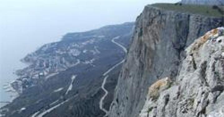
 5. Trail to the Masca Gorge (El barranco de masca) on the island of Tenerife
This, one of the most picturesque hiking routes in Spain, is located on the island of Tenerife in the Canary archipelago. After walking several kilometers through a picturesque gorge, travelers reach the shore Atlantic Ocean, where pirates once hid. Tourists have the opportunity to walk this route on their own, arriving at the starting point by car. In this case, after reaching the goal - the ocean shore, it will be necessary in the same way to return back through the gorge to the parking place. Or use the services of local agencies that will deliver you to the starting point by bus and pick you up from the ocean shore by boat.

6. Route El Cañón de Riolobos in Castile and Leon
The deep and picturesque canyon, formed over centuries along the Lobos River, is today a natural park. This real paradise for lovers of genderism! Travelers are offered several hiking routes, the most memorable of which, in our opinion, is the Torcon route. This is about 10 km of path, during which you will enjoy the unforgettable scenery of the canyon and mountain river. A pleasant end to the route will be Observation deck Costalago.

7. Routes by natural park El Monasterio de Piedra in Aragon
The real pearl of the province of Aragon is the monastery of El Monasterio de la Piedra and its surrounding natural Park. Here you can take an unforgettable walk and admire the waterfalls. Perhaps this is an ideal place for lovers of nature in all its manifestations, which will appeal to all family members, young and old. The park has designated picnic areas, as well as restaurants and a hotel for those wishing to extend the fun.
 8. Laguna Grande route national park Garajonay on the island of La Gomera, Canaries
Far canary island La Gomera deserves special attention, because the island consists almost entirely of untouched natural landscapes. The islanders are especially proud of the Garajonay Natural Park. The park offers several routes that go around it from the south or from the north. The impression of being in the tropical jungle does not leave the traveler for a second; it seems that this is the scenery for the film “Jurassic Park”. And from the final point of the route, located on a hill, a beautiful view of the neighboring islands archipelago.

9. Routes through the Gorbea Natural Park (Parque Natural del Gorbea) in the Basque Country
The Basque Country is famous for its abundance of greenery and beautiful nature, so it is not surprising that one of the best hiking routes is located here. We are talking about a walk through the Gorbea Natural Park. As in many similar parks, there are several route options to suit every taste. We recommend that you stop on the Ubide-Gorbea-Ubide route, for which you will need to partially use a car, since its length is about 32 km. On the way you encounter rare representatives of flora and sometimes fauna, because wild cats and deer have settled here.
 10. Route along the Borosa River (Río Borosa) in Andalusia
Our rating ends with a route through the Sierra de Cazorla Natural Park, in Jaen. This park is fraught with beauties that no traveler expects to see. The length of the route is about 20 km, so you need to be patient and have strong shoes, but the diligence put in is worth it: gorgeous landscapes, picturesque waterfalls, breathtaking lagoons - these are not all the beauties hidden in the greenery of the Sierra de Cazorla Park.
A little about trekking in Spain or what to do in the mountains of the province of Castellon. Having carefully studied the “50 treks in Spain” guidebook, purchased at a local decathlon a couple of years earlier, I concluded that the most promising mountain areas can be found somewhere in the region of Andorra and the northern provinces in general, and in the east of the country there is only sand and Nordic walking . But it’s a long way from Andorra, and if you go to the beach often, you can become a roach, and I decided to look around for something of interest for short walks up.
The most accessible mountains are located near Benicassim in the territory of the National Park "Desert and Palmas - already a forest" (Natural Area Les Palmas Desert), where the CV-147 serpentine road leads up to the 400m mark, on which there are more road cyclists than cars . On the territory of the park there are ancient ruins of a castle and chapels, a working monastery (obviously for women, otherwise why would they put so much asphalt at such a height), olive plantations, restaurants with views, and the mountains themselves. For the most part, the mountains are similar to the Khibiny Mountains, i.e. low (up to 800m) and so flat that primers lead upward to cellular stations. But among them there was an interesting ridge with two distinct peaks, unlike anything else around. If you take the E-15 Autostrada Mediterraneo route north to Barcelona, these rocks stand out clearly among the other hills. On the maps these are peaks under the general name Agujas de Santa Agueda, but we simply called them “feathers”.
To get there, I had to get up at 6 am. Mainly due to the fact that I wanted to go for freshness, and not immediately go to the sauna. There are at least three different trails from the coast to the ridge, but I drove up CV-147 as far as possible, i.e. in fact to the bottom.
The ascent “from the side of the road” begins at 330m, the peak of the ridge closest to the road is only 538m, it’s a kilometer walk to get to it, although at first the 500m path winds with a smooth climb among tenacious and biting thorn bushes, and then the climbing of the stairs begins with high steps. In fact, there are no difficulties, except for reaching the very top: there is a 10-meter rope hung there, behind which a half-meter-wide gap-corridor leads literally through the top to the eastern slope. It's simple.
1. This is what the ridge looks like from the east. If you wish, you can arrange an interesting trip for 6 hours from Benicassim to Oropesa. 
2. The path to the top is not difficult to find. I used the OruxMaps application with a topo4u layer, it clearly depicts the trails of at least this area (the trails are marked not by numbers, but by difficulty categories). The tour in the photo is one such tour, basically the trail is marked with small pyramids of two or three stones and a bunch of marks of various colors and shapes (Wikipedia generally says that making marks or signs with paint or other indelible materials is prohibited here). I came across at least four different markers on the path that already runs along the ridge, which does not prevent me from successfully losing this path, avoiding all sorts of ambushes. 
3. Early morning over the Miravet valley. The sun only warms the eastern slope and it is very comfortable in the shade. 
4. Natural Desierto de las Palmas, the Aguja del Salando ridge, and the next height with the ruins of Montornes Castle, for which they mainly go to this park de natural. The agglomeration on the horizon is the regional center of Castellon de la Plana (city, municipality, administrative center of the province). 
5. At the top the views are everywhere - a continuous song. It was half past seven, it took 40 minutes to get up. I sit and look around the surrounding area, for example the resort town of Benicassim: continuous beaches, villas, hotels. Upon closer inspection, the shining puddles turned out to be tangerine plantations; we will raid them later. 
6. In the background, the stone is the peak itself: it is impossible to climb it without equipment. There is not so much climbing on smooth stone, but an opportunity to completely fly away 15 meters and then transit along the slope with 12 photos. 
7. And since it’s impossible to climb to the top, all the “conquerors” are drawn where their hands can reach. And I thought this cute tradition was only with us. 
8. The entire eastern side of the Santa Agueda ridge is overgrown with mountain pine, which adds a “Needles” aroma to the atmosphere. The entire ridge is marked on the wiki as a micro-reserve where various endemics grow and therefore it is prohibited to “develop a mountaineering activity into a micro-reserve area unless specifically permitted for scientific or conservation purposes.” Most likely, mountaineering means drilling new routes, and not wandering back and forth along paths. 
9. You won’t get bored with a bed of dry needles: in some places they lie in a thick carpet, which begins to slide down the rock under your feet. But in the crevices you can find secluded shelves for a tent (not big, but you can stick a tent like the marmot eos1), where you don’t even need a rug. True, in light of the specially protected status, it is quite likely that for spending the night they could get caught. 
10. Twin rock of the Krasnoyarsk pillars. 
11. In addition to the pine trees, the endemic fan palm grows on the tops. 
12. I brought two huge cones from the mountain, the largest was 22 cm. "Especially for scientific or conservation purposes." 
13. The peak of Agujas de Santa Agueda is the western one, I climbed around it for an hour (photo 4-13), after which I walked along the ridge to the neighboring one. The eastern slope of the mountain is mainly asphalt-like slabs with a slope of up to 45°. 
14. There are many grottoes and small caves under the peaks, but I would not stay in them for a long time, since fresh layers of broken shale lay under my feet. 
15. The path along the ridge naturally leads not along the edge, but along the slabs of the eastern slope. Since the marks are partially erased, and the tours are not everywhere, in some places it is not readable and you have to either look for it or jump a lot and climb small walls. 
16. At some point I just went and climbed up the slab to take a clean look around. While I was climbing, I sweated three times, counted six eyelets leading to the very edge and slipped on pine needles a couple of times (even if you walk with a broom), but still made it to the edge. 
17. Panorama of Agujas de Santa Agueda and the valley. 
18. “Tongue” of the slab onto which the lugs led. Perhaps a route was made on the tongue from a steep slope, when this was not yet prohibited. In the background is the eastern peak, which I didn’t have enough time for (and I was too lazy to enter this massif from below, because you can’t climb head-on). Well, we need to leave something for the future. 
19. The neighboring rock and the western peak, which you can seem to reach with your hand, but in fact it’s half an hour of brisk walking. 
20. 
21. Glory photo! 
22. With the glory photo it turned out like a classic: I climbed in, but only had to jump back with the prospect of getting stuck. We had to look for a route through the steep western slope, where there was more microrelief due to weathering and shelves through which one could access the eastern slabs. He squirmed quite a bit. 
23. The main discomfort of the day for me was the lack of water. The nearest water is only in the valley, either in the form of restaurants or in the form of springs, the quality of which I have not checked (the closest one is near the “farm” from the 3rd photo, the springs appear on the map as Font). I took only 0.5, but it felt like I had to carry three times as much, because... the sun and humidity began to squeeze me out as soon as I left the shadow of the mountain. 
24. Miravet Valley. The bright illuminated rock on the right is the ruins of the castle of the same name, we will also go there a day later. 
25. I returned back to the car the same way, without going to the top it took an hour. In total, I spent 3.5 hours on the mountain, taking into account meditations and photos, and walked 5.1 km with a climb of 500 m. 
27. Outlier stone on the path just below eastern peak. 
28. The road along the Miravet Valley is marked on the map as a dirt road without a number. They don't know grief! 
29. Those same tangerine groves from the edge of the 5th photo. 
If you want to get to know Spain from all sides, I suggest you “walk” with me along the lines of “The Way of St. James.”
In short:
- the journey takes on average about 33 days (the French route, which is the most popular on given time)
- The minimum amount you will have to invest in “enlightenment” is 0 rubles.
- ahem. Let's be honest. From 70,000 thousand rubles. I will tell you more about the money item a little later.
- “enlightenment” comes, but for different reasons. From understanding the frailty of existence to understanding oneself, who will try their best.
- you will actually walk through the whole of Spain through the center and see the diversity and, alas, monotony of this wonderful country.
This was an introductory part, and now I will talk about my experience and share useful tips.
Days. Minutes. Time
In the first paragraph, I wrote that on average people walk for 33 days. I will say right away that these people are sprinters and are either always in good physical shape, or cannot go against their “guide”, which is bought in Saint-Jean-Pied-de-Port. This city is the starting point of your 800 km to go. The city is located on the border of Spain and France. If anything, now we are talking about the “French Way”. Its name comes from the point where you start.
So, in your paper navigator you are given mileage, heights to be overcome, and along the way - notes about the monuments you pass.
I’ll say right away that I’m not a very hiking person, so what was written here about 33 days didn’t work on me, because on average I had to walk 30 km a day. However, no matter how easy it may seem to you at first glance, in reality it is more and more difficult. Firstly, it’s hot, secondly, there are very slight changes in altitude, and thirdly, no one has canceled the blisters and pain from heavy backpacks. Therefore, if you set aside a month and a half for this journey, you will go through everything with pleasure and without suffering.
It is better to choose the time of year according to your mood:
- in winter there may be problems with crossing the Pyrenees,
- In spring it may still be cool if you want to sleep in tents. (yes, yes, it’s cool! In July it was +9 in the mountains)
- In summer, the sun burns relentlessly in the central part.
- In the fall, towards the end, there may also be problems with crossing the mountains.
In my opinion, the best time is the end of spring, the beginning of autumn.
Money. Money. Money
Before going on a pilgrimage, I read a huge number of reviews about this whole thing, and, to be honest, it turned out to be completely the opposite. They said that you can practically not take money, but live in houses for the fact that you will help someone with the housework (cook food, mow the lawn) or, for example, there was an opinion that you can save money by staying in the cheapest shelters (in general , of course, they are called albergues, but as for me, flophouses are a more appropriate word for such places).
I am a sociable person and ready to help anyone and everyone, no matter what, but you know, in 2017, it turns out that no one needs left-wing people who will cook in your home. Unexpected, right? It also turned out that money rules the world and the journey of pilgrims is no exception.
So, let's get down to the numbers:
Housing: minimum 10 euros per night. 10*40=400 euros
If anything, the accommodation is not like in hotels. And about 50 people can live in the room with you, at best 8-10. Very often there is no bed linen, sometimes there are no blankets, and everything doesn’t always smell nice.
Food: minimum 30 euros per day (breakfast, lunch, dinner)
If you buy it yourself and cook it, it’s cheaper. About 10-15 per person.
30*40=1200 euros.
15*40 = 600 euros.
The food in the cafe is generally delicious. There are cafes quite often along the way. They won't let you die of hunger.
Transport: if you are tired of walking and want to travel part of the way, there are many buses there and their ALSA bus system is well developed. Tickets are cheap, you can travel about 30 km for 3 euros.
But no one canceled the rides either.
Flight: We got a round-trip flight from Moscow to Madrid, via Germany - 14 thousand rubles, tickets were purchased in less than a month.
What to take with you
Take warm clothes too! Even if you go in the summer. It's really cold in the mountains. It could rain with hail or even snow at any moment. Take trekking shoes and some other comfortable sneakers, otherwise your feet will not rest.
It is advisable to take a sleeping bag, because very often there is no bed linen. Which is extremely unpleasant. There are many pharmacies there, so you don’t have to worry about a small first aid kit. BUT! As you know, they will not sell you antibiotics. Therefore, it is advisable to have something that will be useful to you. Plasters! Alcohol and iodine!
Enlightenment
I probably won’t talk much about this topic, because this path means something different for everyone. Some people go because of religious beliefs, others just for a walk. But, alas, many hope to become almost a saint along the way. If you are going there for this reason, then I advise you to save 120 thousand for something more interesting. Because you can only receive enlightenment when you are ready for it, and for this you need to make a huge journey within yourself and understand yourself, and not walk 800 km.
Here you can relax your soul, communicate with different people, learn about Spain and the Spaniards, but you can only find yourself within yourself. Actually, like God.
Beauty
Oh yes, this path is really beautiful. Especially at night when the stars illuminate your path. There is no crowd of Koreans walking next to you, with multicookers in their backpacks, the sun is not burning your head, the noise of the cities is not touching your ears. Night is generally a wonderful time, but when you walk with a wand through the fields and forests of Spain and think about something high and bright, the stars and night become even more magical. And it “goes faster”, to be honest.
There are many beautiful cities, and many others, large and smaller, many beautiful cathedrals and houses. Interesting nature, changing all the way.
In general, if you want to know Spain not only by its Barcelona, then the path is worth going through. French way.
There are a few more, in the north of Spain, through Portugal, but that’s... a completely different story. Thank you!