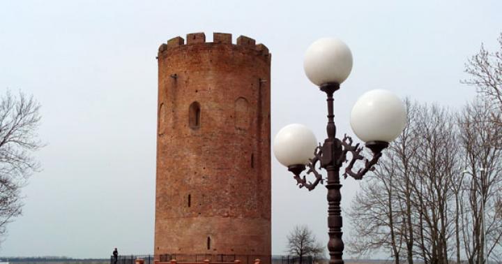
Wrangel Island is a deserted place surrounded by many legends. If you find it on a map, you can understand why people don’t live there. It is surrounded by the Arctic Ocean, almost all year round it's winter there. Research is constantly being carried out on the island.
Wrangel Island appeared on the map in the 18th century. It was designated by I. Lvov, a Russian researcher. Then, the island was put on the polar map by M. Lomonosov, who gave it the name “Doubtful. The existence of these lands became known to Russian sailors from the stories of the Eskimos. F. Wrangel tried to find him, organized search expeditions, but he failed to do this.
A discoverer is considered to be the one who first set foot on new land. This man was Eduard Dallmann, a merchant from Germany. This event took place in the 19th century. But Dallmann was not a navigator; he saw no interest in giving the island a name. He had an exclusively business interest in the island - he was connected by trade relations with the locals.
The second person to land on the island was whaler T. Long. He was interested in exploration, sailors. Long knew a lot about Ferdinand Wrangel and that Wrangel was looking for these lands. It was T. Long who gave the island the name in honor of the Russian explorer.
Over the next 14 years, these lands did not belong to anyone. Then the Americans landed here, looking for the missing expedition. Captain Hooper led this search. It was he who proclaimed the island New Colombia and planted the American flag there.
In 1911, an expedition from Russia arrived on the island. The icebreaker crew installed here Russian flag. Since then this land has been Russian. For a long time, there were conflicts between Russia and the United States over the island.
Today the island is a nature reserve and is included in the World Heritage List. Its area is about 7670 km 2. This is the watershed of 2 ocean areas. It is also the border between two seas, as mentioned above. Among other things, the island is the junction between the two hemispheres of the planet. The land here is divided in half by the 180th meridian.
This meridian is called the “date line”. The island is separated from Chukotka by a strait. Its length is 140 km. Today there are no inhabitants left on the island. The last of those who lived there permanently died in 2003. Now only polar explorers live there and conduct various scientific research.
Getting to the island is very difficult. IN summer time You can only get here by icebreaker. And in winter, the only transport that will allow you to visit these places is a helicopter. You can only get to the island with an expedition. There are organizations that give tourists this opportunity. The path to the island starts from the airport in Anadyr.
Island exploration
Wrangel Island, officially designated on the map in the 18th century, attracted the attention of many expeditions. In 1913, a Canadian group of researchers, led by anthropologist V. Stefanson, set out to explore Herschel Island on a ship called Karluk. But, not having reached the place some 300 km, the ship was trapped in the ice and drifted.

Several people from the team, including the expedition leader, went hunting, but they were unable to return to the ship due to drifting ice. The group had to go to Cape Barrow. The remaining crew members on board decided to go to Wrangel Island. The sailors were divided into 3 groups.
The first group, consisting of 4 people, commanded by Bjarne Mamen, mistakenly landed on Herald Island. They all died there. The cause was suspected to be either carbon monoxide or food poisoning. The second group (also of 4 sailors) went missing on the way to their cherished goal. And only the remaining team members managed to get to Wrangel Island.
In the summer of 1914, Russian icebreakers tried to get through to the sailors, but they failed. Soon, 3 team members died from the cold and eating spoiled food. In September 1914, the surviving people were taken from the island. In 1988, traces of the camp of the failed Canadian expedition were found. A memorial sign was installed in its place.
In 1921, V. Stefanson organized an expedition to Wrangel Island. His goal was to colonize the island. To gain support, the explorer tried to obtain official status for his expedition from the Canadian government.

In September 1921, a team of colonists assembled by Stefansson landed on the island. They planted the flags of Canada and Britain, and declared the land to belong to the King of Great Britain. As a result, a political conflict broke out between Canada and the United States. America was outraged by the seizure of the island. The US government believed that these lands belonged to the United States.
The colonists who were on the island could not return home for a long time because of the ice. Three polar explorers from the group assembled by Stefansson disappeared without a trace. One died of scurvy. An Eskimo woman who served as a cook managed to survive.
At this time, Russia declared its rights. L. Krasin demanded an explanation from the King of Britain regarding the illegal installation of his flags. Krasin said that the island is Russian possession and asked that in future raids from Canada stop and that the sovereignty of these lands not be violated.
Distinctive features
Wrangel Island is an Arctic tundra with no population. The people who once lived here left the island. And those who remained had already died. Only reserve employees, polar explorers, meteorologists and military personnel live here temporarily. They work on a rotational basis. On the map of the island you can only find a station; there are no residential buildings here. There are 6 people at the station.

The climate here is harsh. From mid-May until the last days of July there is a polar day. From mid-November to the end of January there is a polar night.
Winter on the island is long and frosty. Temperatures can stay below −30 °C for several weeks in a row. There are often snowstorms here. Wind speed can be above 40 m/s. In summer, the temperature is no higher than +3 °C, humidity is 83%, and snowfalls are frequent. In the center of the island the air warms up better, so the humidity there is slightly lower and the temperature is slightly higher.
The terrain on the island is mountainous. There are lakes. The mountains form several ranges, between which there are many rivers (5 large and 140 small rivers and streams). There are approximately 900 lakes. All of them are shallow, on average no deeper than 2 m.
The vegetation in these places is rich. There are more than 300 of its species. Many of them are ancient and rare. All plants in these protected areas are low-growing. Grasses and mosses predominate. There are willows in the mountains, the height of which is no more than 1 m. Due to the harsh climate, Wrangel Island cannot boast of a rich fauna. There are few animals here.
Live here:
- walruses;
- arctic foxes;
- lemmings;
- musk oxen;
- seals;
- wolverines and others.

About 20 species of birds can be seen here:
- sparrows;
- snow bunting;
- brent geese;
- blowers;
- tap dancer;
- fork-tailed gulls;
- red-throated loons and others.

Often guests of the reserve are representatives of other species of birds that fly here for a while.
What to see
Wrangel Island (this is noticeable on the map) is significantly removed from Big Earth. The climate here is harsh. It is for these reasons that few tourists come there. But every year there are tourist groups on the island. Guests travel on ATVs and all-terrain vehicles.
Island attractions:
- "Traitorous" Lagoon;
- Mount "Perkantun";
- Krasina Bay;
- Davydova Lagoon;
- Doubtful Bay;
- "Devil's Ravine";
- River "Predators";
- Popova Lagoon.
Peculiarities:

Tourism
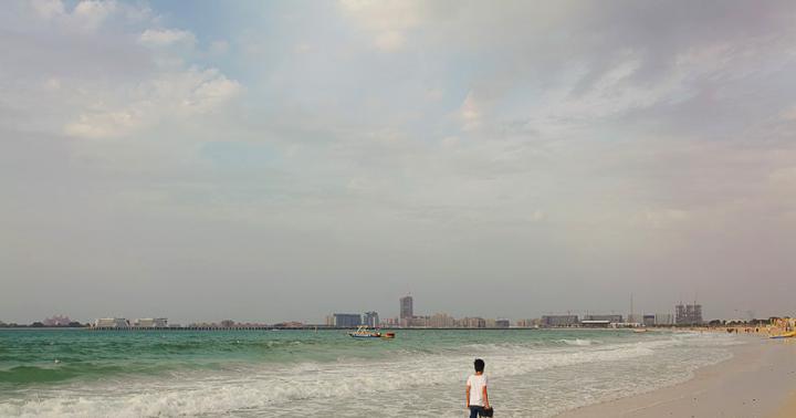
Wrangel Island on the map looks like it is “the end of the world.” And this is true - it is located on the “edge of the universe” - in the Arctic Ocean and is the most inaccessible of all reserves on our planet. It is because of this location that it is very difficult to get to the island. For this reason, tourism is poorly developed here. But you can still visit here.
Ecological and educational tourism is developing here. The best time to travel to Wrangel Island is from May to the end of July. At this time there is a polar day, it is always light, there is rarely snow, there is no frost. To visit this reserve, you must obtain permission.

Several routes have been developed for tourists:
| Tour name, route number | Route length | Accommodation and meals | Methods of transportation |
| №1 | 35 km | Short rest and meals at the Doubtful base. | ATVs, all-terrain vehicles, on foot |
| №2 | 21 km | Short rest, meals and overnight accommodation in the premises at the Doubtful base or at the field cordon. | ATVs, all-terrain vehicles |
| №3 | 100 km (3 days) | Overnight and meals at the Doubtful base on the 1st night, overnight at the Tundra Peak cordon on the 2nd night. Short rest at the “Middle Mamontovaya” cordon. | all-terrain vehicles |
| №4 | 160 km (3 days) | Rest, food and overnight at the cordons: “Doubtful”, “Medium”, “Red Flag”, “Tundrovy Peak”. A short rest with tea at the “Unknown” cordon. | ATVs, all-terrain vehicles |
| №5 | 350 km (5 days) | Overnight stays, meals and short rest at the Doubtful base, at the Unexpected cordon, at the Komsomol cordon and at Tundra Peak. Short rest and tea at the cordons: “Lower Gusinaya” and “Middle Mamontovaya”. | all-terrain vehicles |
| №6 | 250 km (5 days) | Overnight stays, rest and meals at the “Doubtful” base and at the “Pik Tundra” and “Unexpected” cordons. At the “Middle Mamontovaya” and “Nizhnyaya Gusinaya” cordons it is possible to organize a short rest with tea drinking. | all-terrain vehicles |
| №7 | 550 km (9-10 days) | Overnight, food and rest in the ghost village “Ushakovsky”, at the “Pik Tundra” cordon, at the “Doubtful” base, at the “Komsomol” and “Unexpected” cordons. Tea drinking and relaxation at the “Middle Unknown” cordon. | all-terrain vehicles |
| №8 | up to 50 km | Rest at the base "Doubtful". | zodiacs |
| №9 | 620 km | Rest, meals and overnight stays cruise ship. | cruise ship |
Route No. 1
Tourists go to explore the island from the guest house at the Doubtful base. Next, the group follows the shore of Krasina Bay, where they get acquainted with the features of the landscape. The path continues to the Devil's Ravine stream, where tourists can see the excavations of a Paleo-Eskimo site.

Next, guests of the island will climb to a plateau in the canyon, where the largest river on the island flows, which is called “Mammoth”. After this, guests will descend to the old road, which runs next to the “date line”. Further, through the canyon of the Devil's Ravine stream, the group again gets to Krasina Bay, where you can see ice, if there is any.
Depending on the season, tourists will also be able to view the animals at a safe distance:
- lemmings;
- polar bears;
- gray whales;
- arctic foxes;
- musk oxen;
- seals.
 Wrangel Island is filled with different animals, such as seals.
 After this, the group returns back to the base where the journey began. Tourists travel part of the route on ATVs or all-terrain vehicles. The group passes the canyon and plateau on foot.
Guests are taken along this route from July to September. Excursion groups are accepted no more than 2 per month. Each group can have a maximum of 15 people.
Route No. 1 is considered easy, so visitors of all age categories, including school-age children, are allowed on it.
Route No. 2
Along this route, excursion groups explore the island between July 20 and October 1. A maximum of 6 groups are accepted per month on route No. 2. The permissible size of each group is no more than 6 people. The tourist group goes on a hike along Wrangel Island from the Doubtful base.
Next, guests follow the beach and through the Basic Lagoon. If the river in the lagoon is open, then the path of tourists lies around the lagoon. Then the path continues through the airfield and a stream called “Base”. On the shore of Somnitelnaya Bay, tourists examine the ruins left from the hunters’ camp.

Next, travelers head to the Doubtful Spit and from there return to the base from which their journey began. This route is also considered easy, so tourists of all age categories, including school-age children, are allowed on it.
Route No. 3
According to it, the group sets off from the Doubtful base and completes the journey at the Tundra Peak cordon. Reserve specialists accept groups wishing to walk this route from August 1 to September 1.
On this route, guests of the island will visit the Khrustalny stream, explore the surroundings of the Doubtful base, and explore Mount Pyrkatkun. The route also includes several cordons, the “Tumanny” stream, and the “Bear” river. Guests make stops where they observe representatives of the animal world, examine landscapes and plants.

They have the opportunity to visit abandoned mines where rock crystal was mined and admire the Northern Mountains. During your journey, you can find mammoth bones or tusks. The route is difficult. It is designed for guests who are prepared for arctic conditions.
Route No. 4
This trip is designed for 3 days. Excursions along this route run from August 1 to October 1. The group is moving from the Doubtful base. Further, the path runs through a pass called “Vyuchny”. Guests move to Mount Perkatkun, then to the Khrustalny stream. It is planned to visit the Otrozhnaya River and the Unknown River.

The program includes several streams and passes. Guests get acquainted with the landscape, flora and fauna of the island. The route will be of interest to those who love birds, as well as schoolchildren. Tourists who go on a trip must be physically strong and resilient.
Route No. 5
Travel along it takes place in August and in the 1st half of September. The departure point of the tourist group is the Doubtful base. Along the way, guests will explore the Krasina Bay, visit the Mamontovaya River, and the Devil's Ravine stream. And also on the Gusinaya River, the Kamnesharka Creek, and the Bird Bazaar Cape. The route includes a visit to Dream Head Mountain.

Along the route you will inspect plants and get acquainted with animals and birds. Guests explore the Paleo-Eskimo site, the old adit and the landscape of the island's attractions. Stopping locations along the route may change depending on the weather. The trip is intended for tourists over 14 years of age with good physical fitness.
Route No. 6
It includes a visit and inspection:
- creek "Crane";
- river "Tundrovaya";
- "Khrustalny" stream;
- the Gusinaya River;
- "Perkatkun" stream;
- Sovetskaya river;
- slopes of the “Vorotsky Hills”;
- "date lines";
- Mountains "Whale";
- Cape "Bird Bazaar" and so on.

The route operates from August 1 to September 15. Tourists at least 14 years old and prepared for Arctic conditions are allowed to enter.
Route No. 7
A tourist group travels along it for 9-10 days. Excursions from tourists who want to travel along route No. 7 are accepted on the island in late summer and early autumn. There can be no more than 6 guests in a group.

Tourists have time to see a huge number of attractions, observe animals and plants in 10 days. There is an age restriction on the route - tourists under 14 years old are not accepted on this route. In addition, guests must be physically prepared.
Route No. 8
This is an easy route that involves traveling by boat. It is valid from mid-July until the end of September. Guests depart from the Doubtful base and explore the waters of Krasina Bay by boat. Tourists of all age categories are allowed on the excursion.
Route No. 9
It is called the "Ring Route". Guests travel around Wrangel Island and sail to Herald Island. Moves around excursion group on a cruise ship. The route's operating season is from mid-August to the end of September. The route is suitable for tourists of all ages, there are no restrictions.
What is prohibited for tourists, responsibilities and rules
Visitors to Wrangel Island arriving for tourism purposes are subject to a number of requirements that they must fulfill.
Guests are prohibited from:


Every tourist is obliged:
- move around the reserve only accompanied by an employee who ensures guests’ safety and monitors their compliance with the rules of stay on the island;
- approach birds and animals only with the permission of the inspector, and keep from them at the distance that he determines;
- drive an all-terrain vehicle or quad bike around the island at a speed of no more than 20 km/h;
- stop approaching birds and animals at the slightest sign of disturbance;
- if a bird brood is close to the road, reduce the speed to 7 km/h and proceed further without stopping;
- stop near baby animals and birds for no longer than 15 minutes;
- get out of the vehicle only in those places designated for disembarkation by the guide;
- immediately get into the boat and leave the shore by order of the guide, if a polar bear approaches the group;
- consider the leading boat, in which the reserve specialist is located, and accurately follow the algorithm of movement and behavior of the leading boat.

By observing all these rules, the tourist will ensure for himself, as well as those around him, an interesting and safe stay on Wrangel Island. Wrangel Island looks scary only on the map. In fact, it's very interesting place. Every moment of your stay here will be forever etched in the memory of any tourist. Everyone who has once visited the island is drawn to return here again.
Article format: Lozinsky Oleg
Video about Wrangel Island
Wrangel Island, nature, features, overview of the island:
No, the island is not named after the famous Russian military leader Pyotr Nikolaevich Wrangel.
It is a rare case when even in a dry academic reference on Wikipedia, the history of this island reads like a detective story.
So, Wrangel Island is a piece of land surrounded by ice in the Arctic Ocean.
The area is about 7670 square meters. km. Extremely harsh natural conditions. average temperature in July it is +3 degrees. In January-February it often drops to -37.
The first people, the Paleo-Eskimos, hunted on this island as early as 1750 BC. It is unlikely that the climate of those places was very different from what can be found now, therefore, these hunters had a very difficult time.
More than two thousand years passed before this island was first depicted on maps. The island received its first name, “Land of Kellett” in 1849, thanks to the English navigator Henry Kellett, who described it during his expedition to the Chukchi Sea.
Another 16 years passed and in 1866 the crew of a merchant ship under the leadership of Captain Eduard Dahlmann landed on the island.
The next year, in 1867, by a strange coincidence, the island received a different name, with which it is included in all maps of the world. American explorer and whaler Thomas Long, either unaware of Kellett's discovery, or simply due to a navigation error, names the island in honor of the famous Russian traveler, geographer, statesman, admiral, Ferdinand Petrovich Wrangel.
It may seem strange that an American would give a new island the name of a Russian traveler, but given the wide fame of Ferdinand Petrovich, who at that time already had three trips around the world and many other merits, the action seems quite normal.
In 1881, Captain Hooper landed a search party on the island in order to rescue the expedition of George De Long, which went to the North Pole on the ship Jeannette two years earlier and suffered a disaster. At the same time, Captain Hooper plants an American flag on the island and proclaims it the territory of the North American United States. Wrangel Island existed in this status for 30 years, until already in the 20th century, in 1911, the crew of the icebreaking steamship (!) Vaygach approached the island, took photographs of its shore, and planted the Russian flag, about which balls, a corresponding entry was made in the logbook.
1914
For about six months, from January to September, 15 crew members of the brigantine Karluk lived on the island awaiting a rescue expedition after their ship was crushed by ice 130 kilometers from the coast.
1921
Canadian polar explorer Williamur Stefanson establishes a settlement of five colonists on the island, proclaims the territory the property of Great Britain and raises the flag of the United Kingdom.

For two years the colonists lived on the island without contact with the outside world. Several ships, which during this time tried to bring provisions and equipment to the island, were unable to pass through the ice. And only in August 1923, the only survivor, 25-year-old Ada Blackjack, who had lived in absolute solitude for the last six months, was rescued from the island. The remaining colonists died.
In 1923, another attempt was made to colonize the island, this time by American geologist Charles Wells, who founded a camp, bringing with him 12 experienced inhabitants far north, with women and children. The colony existed for several months, until August 20, 1924, when it was taken out in its entirety by the Soviet warship Red October.
1926
A permanent settlement of 59 people is founded on Wrangel Island under the leadership of Soviet Arctic explorer Georgy Ushakov. The foundation of the polar station is being laid.
1948-1960s.
Reindeer were brought to the island from the mainland, a reindeer herding state farm was organized, 2 more settlements were founded, and several military infrastructure facilities were built.
One of the residents of the village, V. Pridatko-Dolin, describes the state of the settlement in his book “Ushakovskoe: how was it?”:
By the end of the 1970s, there was a village council, a boarding school, a kindergarten and a boiler room, a club-cinema, a reserve office (and later the Wrangel Island reserve) and a modest natural history museum, a store (TZP) and an underground glacier for storing meat products, temporary corral (for the autumn corral and slaughter of deer), post office, hospital, Rogers Bay polar station (Rogers), Rogers airport (for AN-2, MI-2, MI-6, MI-8) and a small air refueling station, a fuel and lubricants warehouse and bulk coal storage facilities, a library, a diesel power station and a bathhouse, and there was electricity in the houses.
During navigation, a temporary berth for barges was in operation. Since the beginning of the 1980s, a radiotelephone communication station, a border outpost, a canteen for reserve employees and air crews, television operated, and a lighthouse was restored on the Ushakov Spit.
But already at the end of the 1980s, military personnel and permanent residents began to leave the island due to lack of funding; in 1992, after the collapse of the USSR, the radar station was closed.
In 1997, all remaining residents of the village, except those who refused to leave their usual home, were transported to Cape Schmidt. A few years later, one of the residents of the village returned back, but in 2003 she died as a result of an attack polar bear.

The largest island is Wrangel Island. It is located at the intersection of the 180 degree meridian, which separates the western and eastern hemispheres. To the east of it, sixty kilometers away, is Herald Island. The area of Wrangel Island is only eight square kilometers. The Long Strait separates these islands from the mainland; this strait is covered with a thick layer of ice throughout the year. For this reason, the island remained unknown to people for a long time. By the way, the island itself was discovered in the forties of the 19th century. It happened when the famous geographer F.P. Wrangel, on the north coast of Chukotka, watched the flights of bird flocks. Later he suggested that between Chukotka and East Siberian seas there is an unknown land. Gradually, Wrangel carefully studied and checked his assumption, then accurately indicated the location on the map large island, which was named after him. In 1976, a nature reserve was founded on the territory of this island. Since 1968, the Soviet people have established a complex reserve regime here. This reserve also includes Herald Island. The natural world of Wrangel Island leaves a huge impression on eyewitnesses. Where they are, look here.
Features of Wrangel Island
Interestingly, on the island the sun does not appear above the horizon at all from November 18th, and the phenomenon continues until January 25th. For many, this time is known as the polar night. It is also impossible to say exactly where the sea begins and the land ends. Some things are only visible under the aurora or moonlight. As the moonlight reflects off the ice, the landscape takes on many shades. However, for many the most best time There is a period of northern lights on the island. At this time, everything around changes beyond recognition. Suddenly appearing light rays in the dark sky illuminate numerous crystals of ice and snow. This results in the formation of arches, fans and banners. Where to find .
During the polar day, the reserve takes on a completely different look. At this time, the sun does not go below the horizon from May to July. By the way, this does not make the climate very hot, but it noticeably revives animals and some plants. In other words, they develop more vigorously. A particularly amazing sight is the variety of birds that fly to the island to nest. Traditionally, during this period the snow melts and the Arctic islands are more reminiscent of blooming oases in the ice kingdom. Wrangel Island is different unique nature. Some species of animals and plants can be seen here. Visit. You will not regret.
The island's climate is gradually softening. Global climate warming is also affected by Pacific Ocean. The average annual temperature is -11 degrees, slightly lower than the sea water temperature. Wrangel Island is more characterized by cloudy, windy weather, which is often accompanied by fog. The reserve is rich in a large number of lakes, shallow rivers and streams. Since in winter time All reservoirs freeze, there are practically no fish here. There are approximately 310 plant species, among which lichens and mosses can often be seen growing on mountain slopes and plains.
Flora of Wrangel Island
Most of the island's plants are dwarf. After all, their average height reaches only ten centimeters. True, there is a meter-long shrub willow - the tallest plant. Since many plants do not have time to go through all their life cycles, they are perennials. In other words, they store immature seeds, flowers and leaves under the snow. This is an amazing phenomenon: evergreens grow in the Arctic desert. For example, these are crowberry, lingonberry and dryad. Unique plants of Wrangel Island include: Ushakov poppy, Wrangel cinquefoil and Lapland poppy. The island has a region with peculiar tundra and steppe vegetation, this place is called mammoth prairie.
Many local animals generally prefer the sea to the land. This can be explained by several reasons. After all, there is more food for animals and birds on the shore, and no one bothers them here. Note that the protected island is surrounded by a security zone. Scientists from various fields work in the island's natural laboratory. They observe unstudied plants and animals. Therefore, it should not be surprising that Wrangel Island has become a complex nature reserve.
According to some evidence, musk oxen lived on the island in the past. Today twenty heads were brought here from the island of Nunivak, in America. Wrangel Island is also known for the largest walrus rookery in Russia. By the way, Wrangel Island is included in the list of paleontological monuments of the earth.
Wrangel Island - on the border of the East Siberian and Chukchi seas, part of Russian Federation. Area approx. 7.3 thousand km2. Height up to 1096 m. It is located at the junction of the western and eastern hemispheres and is divided by the 180th meridian into two almost equal parts. Separated from the mainland ( north coast Chukotka) by the Long Strait, which is about 140 km wide at its narrowest part. Administratively it belongs to the Chukotka Autonomous Okrug. It is part of the reserve of the same name. Is an object world heritage UNESCO. It received its name in honor of the Russian navigator and polar explorer Ferdinand Wrangel.
The territory of Wrangel and Herald Islands, with the exception of the low-lying plains of Wrangel Island, remained dry throughout the Cretaceous period and the entire Cenozoic era. During powerful Pleistocene transgressions, the territories of the islands were repeatedly separated from the mainland, and during periods of regression of the sea, coinciding with the ice ages, they were part of the vast Beringian landmass, which united the shelves of the East Siberian, Chukotka and Bering seas and connecting Asia and North America. At the same time, the territory of the modern islands was located almost in the center of the Arctic part of Beringia, located north of the modern Bering Strait. It is especially important that throughout the Pleistocene the islands never experienced cover glaciation (there are only traces of mountain-valley glaciation in the central part of Wrangel Island), nor were they ever completely flooded (transgressions covered only the plains of Wrangel Island, and even then no more than half their length). That is, the organic world of the islands has developed continuously since the end of the Mesozoic era.
During the periods of the existence of the Beringian landmass, the territory of the modern islands found itself at the crossroads of migratory flows of plants and animals leading from Asia to America, from America to Asia and from Central Asia to the Arctic region (thanks to the existence during this period of a single “tundra-steppe” hyperzone throughout central arid to the highest latitude regions of Eurasia and North America) and, as is generally accepted, in the center of the largest area of evolution of modern Arctic biota. During periods of transgressions, when most of the shelf land was under water, the islands served as a refugium for many species and communities common on drained shelves. In addition, periodic isolation contributed to the activation of speciation processes on the islands themselves. All this was the reason for the initially high biological diversity of the territory.
The last separation of the islands from the mainland occurred about 10 thousand years ago, which coincided with the global restructuring of Arctic landscapes - the collapse of a single tundra-steppe zone and the massive expansion to the north of hypoarctic flora and fauna.
The latter, due to island isolation, appeared in a very weakened form on the islands, which, together with the peculiarities of the physical-geographical situation (landscape diversity, while maintaining the “refugia” of continental conditions), ensured the survival of many relict elements here, as populations of individual species, and entire communities.
At the same time, thanks to the same diversity natural conditions, relatively thermophilic hypoarctic elements survived here, having managed to penetrate the island and other similar territories at the Pleistocene-Holocene boundary, but in most cases disappeared as a result of the late Holocene cooling. Until the mid-Holocene, large mammals remained on the island, including the local subspecies of mammoth, which became extinct over the last 5-2 thousand years.
It is known that about 3.5 thousand years ago the island was inhabited by sea hunters, whose culture is classified as Paleo-Eskimo. The results of studies of the only known Neolithic site on south coast The Wrangel Islands indicate that this ancient population of the island used exclusively marine resources (no remains of terrestrial animals were found in the cultural layer of the site). By the time the Wrangel and Herald Islands were discovered by Europeans, there was no indigenous population on them. There were no traces of large land mammals.
The existence of a large island in this sector of the Arctic Ocean was predicted by M.V. Lomonosov. In 1763, Mikhailo Vasilyevich showed on a map the polar regions north of Chukotka big Island"Doubtful". The location of this supposed land turned out to be close to the real Wrangel Island.
In 1820, the Russian government sent two expeditions to the northern coast of Siberia. One, under the command of Anzhu, to search for the “land of Sannikov” and the other, under the command of Ferdinand Wrangel, to find the mythical “land of Andreev”
With amazing persistence, energy and courage during 1820-1824. Wrangel undertakes a number of trips across the ice on dogs. On some of these trips he is removed by sea ice 250 km north of the coast of Siberia. But all these trips were to no avail. Finally, when meeting with the Chukchi foreman (in Chukchi “kamakai”), he learned from him that “between Cape Erri (Shelagsky) and Cape Ir-Kaipio (Northern), near the mouth of one river, from low coastal cliffs on clear summer days High, snow-covered mountains can be seen in the north across the sea, but in winter they are not visible.
In previous years, large herds of deer came from the sea, probably from there, but, pursued and exterminated by the Chukchi and wolves, now they do not appear. He himself once, in April, chased a herd of reindeer for a whole day on his sleigh drawn by two reindeer, but at some distance from the shore the sea ice became so uneven that he was forced to return.” Other Chukchi confirmed to Wrangel and his companions that “they themselves saw the land on clear summer days from a place called Yakan.”
According to Chukchi legend, the elder of the Onkilons, a people who used to live along the northern shores of Siberia, Krekhai, retired with his people to this overseas land.
Convincing stories from the Chukchi forced Wrangel to attempt to achieve unknown land on the ice on dogs. Having reached Cape Yakan, Wrangel and his assistant midshipman Matyushkin did not see any signs of land in the north. However, Matyushkin decided to make an attempt to reach the island. April 9, 1723 He set out across the ice on three sledges, having provisions for 15 days. The huge ice holes he encountered along the way did not allow him to move further than 16 km from the coast. Thus, this attempt ended in failure. Nevertheless, Wrangel put this land on his map, noting: “The mountains are visible from Cape Yacana in the summer.”
Thus, based on the stories of the Chukchi, with great accuracy, the island was first mapped, which later received the name “Wrangel Land”, or “Wrangel Islands”.
For the first time I saw Wrangel Island Collet, who passed by the ship "Herald" and discovered the island called "Herald". From the top of o. He saw the Herald about. Wrangel (August 17, 1849). He failed to land on the island. He quite reasonably notes that the island he saw is a continuation of the land indicated by Wrangel.
The island has been seen by many whalers. It was put on the map by Long, who was passing (August 14, 1867) on the schooner “Nile” in sight of the island. Long first called the land he saw “Wrangel Island.” After much debate, this name was accepted by all outstanding geographers of that time. In 1879 north of the island Wrangel drifted in the ice of De Long on the ship "Zhannetta". "Zhannetta" died in the ice.
Ships were sent to search for “Jeannette.” Two of the braves managed to land on Wrangel Island for the first time. The first to arrive was the Thomas Corwin. On August 12, 1881, the captain of this ship, Hooper, landed at the mouth of the Clark River and declared the island to belong to the United States under the name "New Caledonia." On Skeleton Island at the mouth of the Clerk River, he planted an American flag, at the foot of which the New York Herald newspaper and two notes with the following content were left in a bottle
1. “United States Customs Fleet steamship “Corwin”, Wrangel Land, August 12, 1881 (n.s.).
United States Customs Fleet steamship "Corwin" Captain C.L. Hooper landed here to search for traces of the Jeannette. The box with provisions is placed in the second cliff, from here to the north. All is well on the ship."
We arrived here today, having previously landed on Herald Island. On the north-eastern hill of this island, a stone mound was erected in which the report was deposited. The finder is asked to send the contents of the bottle to the editors of the New York Herald.
12 days after the ship “Corwin” to the south-eastern part of the shores of Wrangel Island, having also previously visited the island. Herald, the Rogers has arrived, under the command of Captain Berry. On August 27, three parties were sent from Rogers to search for traces of the death of the Jeannette, to describe the island and its position on the map. The main party under the command of Berry went deep into the island, climbed to its highest point, called “Berry Peak,” and mapped the internal contours of the island. The other two, under the command of Waring and Hunt, almost completely described its coast. The ship stayed off Wrangel Island on September 12, 1881.
From 1881 to 1911, not a single ship was able to approach Wrangel Island. September 2, 1911 (old style) Russian hydrographic vessel “Vaigach” under the command of K.V. Loman dropped anchor off Cape Thomas, the southwestern tip of Wrangel Island. The ship remained off the coast of the island until September 4, 1911 (old style). During this time (within 24 hours), a short excursion to the shore was made, during which geologist I.P. Kirichenko collected geological collections. Dr. Arngold (the ship's doctor on the Vaigach) describes this excursion as follows: “The greatest interest was geological exploration; I call it that because in one day, apart from a cursory examination, nothing could be done. However, we managed to find many fossils, shells of different types, and plant imprints. Everything indicated that there had once been, if not a completely tropical, then at least a warmer climate here, and in the exposed layers of a mountain in the interior of the island, about 20 kilometers from our site, we discovered large deposits of coal.
Dr. Arngold's testimony is the first and only indication of the presence of minerals on the island. Wrangel. In a note by Academician Tolmachev, who processed the geological collections and diaries of I.P. Kirichenko, there is no indication of the presence of coals, nor is there any mention of prints of fossil flora, which Dr. Arngold so definitely speaks of in his diary.
After a short stop at Cape Thomas, "Vaigach" with a sea inventory was the first to go around the island from the north. Enemy and at the top of its northernmost tip he placed an iron sign with a copper plate, on which the year, month and date of Vaigach’s visit to Fr. Wrangel. To the north, no ice was visible anywhere to the horizon.
On January 10, 1914, the Stefanson expedition ship Karluk was crushed by ice. It sank 80 miles from the island. Wrangel and 200 miles from the coast of Siberia. The team under the command of Captain Bartlett, R. Peary's companion during his discovery of the North Pole, safely descended onto the ice, managed to unload food, clothing, dogs, sledges, etc., and headed across the ice on dogs to the nearest land - about. Wrangel. Of the 25 people who were on the Karluk, 8 people died for various reasons, the remaining 17 (including two children, girls 3 and 11 years old) reached the island. Wrangel. On March 18, Captain Bartlett, accompanied by one Eskimo, with seven dogs, having provisions for 60 days, set off across the ice from Fr. Wrangel to the Siberian coast for help for his comrades. Having safely reached the mainland and from there crossed to Alaska, he organized help for the people remaining on Wrangel.
On September 7, 1914, the schooner King and Wing, under the command of Olaf Swenson, approached the island and picked off the people. Among the Karluk team, who lived on the island for six months. Wrangel, there was a geologist Malloch, a Canadian by birth, but since he soon arrived on the island. Wrangel died (May 17, 1914), and before that he was ill, he probably did not do any geological survey.
In 1921, Stefanson sent a party consisting of Gell, Maurer and Knight to the island, under the command of Allan Crauford, the 22-year-old son of a famous Canadian professor; An Eskimo woman went with them as a cook and to sew clothes. The party arrived on the island on September 1, 1921; She only had food supplies for six months and missed the hunting season. The auxiliary vessel was able to arrive only in 1923. The head of the rescue party, Noyce, found only the Eskimo alive. Knight died June 23, 1923; Crawford, Gell and Maurer died trying to cross the ice to the shores of Siberia. Having removed the Eskimo, Noyce left a colony of 13 Eskimos on the island, under the command of prospector exploration geologist Wells. Landing a colony for the purpose of alienating the island was contrary to international laws on polar countries. To restore their rights, remove the colony and plant the Soviet flag on the island. Wrangel in 1924, the Soviet government sent the gunboat "Red October", under the command of hydrograph Davydov. August 12, 1924 at 2:50 a.m. "Red October" dropped anchor in Rogers Bay.
A mast and a hut were discovered on the shore. They immediately began building a new mast; the next day, August 20, 1924, at 12 o'clock. day, the Soviet flag was raised on the island for the first time, and the island was solemnly annexed to the USSR. After raising the flag, Red October went to Doubtful Bay, where it photographed the American colony together with Wells, who had a large geological collection. In 1926, the first Soviet colony was landed on the island, consisting of the head of the island G.A. Ushakova with his wife, Doctor N.P. Savenko and his wife, manager trading post of Pavlov, industrialist Skurikhin with his wife and eight-year-old daughter, industrialist Startsov and about 60 Eskimos.
Head of the island G.A. Ushakov, during his three-year stay on the island, put its coast on the map, and made very important changes to the previous maps of the island, collected a large botanical collection, processed by Academician Komarov, and a geological collection, subsequently processed by P.V. Wittenburg. .
Since during 1927 and 1928 not a single ship was able to approach Wrangel Island due to heavy ice, in 1929 an expedition was sent to the island under the command of Captain K.A. Dublitsky on a powerful ice cutter "F. Litke" with the task of reaching the island and changing the colony. Despite heavy ice, broken propeller blades, a hole through which water rose in the forepeak at three feet per hour, the ice cutter “F. Litke" reached the island, bypassing the island from the north. Herald and passing to Rogers Bay by Long Strait. A scientific unit headed by geophysicist Prof. was sent on the ship for scientific work. V.A. Berezkin, consisting of: hydrologist G.E. Ratmanov, zoologist P.V. Ushakov and geomorphologist V.A. Kalyanova [Dublitsky, 1931; Nazarov, 1932; Kalyanov, 1934]. The ship stayed off the island for six days, during which all the scientists did a lot of work for such a short period of time. Kalyanov walked to the upper reaches of the Klerk River, compiled an altitude profile (barometric), collected a collection of geological samples, and found fauna in the inner parts of the island - on the banks of the river. Clerk, took about 300 photographs. He also described the tundra of the interior of the island and the coast from Rogers Bay to Somnitelnaya Bay, collected a botanical collection (45 species), processed by M.I. Nazarov, took three soil monoliths and two fragments of hummocks. The work was greatly hampered by a two-day 8-point snow storm. Due to a strong storm, unloading of the ice cutter was even stopped.
The expedition of the ice cutter Litke removed the chief G.A. from the island. Ushakov and Doctor Savenko with their wives, the wife of the industrialist Skurikhin and their daughter, unloaded a three-year supply of food and left the head of the island, Comrade Mineev, his wife Comrade Vlasova, Doctor E.N. Sinadsky, radio operators Bogaiov and Shatinsky, meteorologist Comrade Zvantsev. From that moment on, regular weather reports began to be received from the island.
In 1932, geologist V.A. flew to the island. Obruchev and topographer K.A. Salishchev, who carried out an aerial topographic survey of the island. Wrangel, significantly correcting the map of the island compiled by sea captain E.D. Bessmertny based on materials by G.A. Ushakova.
As can be seen from the review of the discovery and exploration of the island, the most scanty information is available about its geology. There is no information in the press about mineral resources, with the exception of indications of Dr. Arngold's coal.
Wrangel Island lies within the Siberian shallow continental platform. The depths of the sea separating it from the mainland do not exceed 50-60 m. From the north towards the polar basin, the depths abruptly end. Thus, the Wrangel and Herald islands lie on the edge of the Siberian continental platform and represent a horst on the edge of a fault depression.
In 1948, a small group of domesticated reindeer was brought to the island and a branch of the reindeer-breeding state farm was organized. In addition to the main settlement in Rogers Bay (Ushakovskoye village), in the 60s the village of Zvezdny was built in the bay. Doubtful, where an unpaved reserve airfield for military aviation was built (liquidated in the 70s). In addition, a military radar station was established at Cape Hawaii. In the center of the island, near the mouth of the stream. Khrustalny, rock crystal mining was carried out for several years, for which a small village was also built, which was later completely destroyed.
In 1953, administrative authorities adopted a resolution on the protection of walrus rookeries on Wrangel Island, and in 1968, a reserve for the protection of walruses was organized on the island,
polar bears,
nesting grounds of the white goose, brant goose and colonial settlements of seabirds.
For a long time, the island was rarely visited by border guards, until hundreds of butchered walrus carcasses were discovered on its northeastern coast in 1967. Experts, having studied them, agreed that poaching was carried out by foreign fishing vessels. The very next year, an outpost on Wrangel, with a base in the village of Ushakovsky, was set up.
It existed until the end of the 90s of the last century, briefly outliving the once very populous “capital” of Wrangel. Then, due to a lack of funding, Moscow decided to remove the outpost from the island, but as soon as the border guards left Wrangel, scientists of the biosphere reserve created here began to report about mysterious ships passing near the island.
In the absence of sufficient material support, the command of the North-Eastern Border Department decided to set up a post in the summer consisting of several people led by an officer. And then it turned out that the island was indeed visited by foreign guests...
In 1975, an experiment on the acclimatization of musk oxen began. Two groups of animals were brought from North America from Nunivak Island. The first - consisting of 30 individuals - was released into the wild in Taimyr. The second, in the amount of 20 animals, will go to Wrangel Island.
The animals did not immediately adapt to local conditions, and in the first few years the population was halved. However, from the beginning of the 80s, the number of musk ox on the island began to grow steadily, and by 2003 the population reached 600 animals. Moreover, they turned out to be even more adapted to local conditions than reindeer. The reason, according to experts, is simple: in winter, the musk ox mainly feeds on accumulated fat reserves. He needs pasture in minimal quantities.
The well-known advantages of the musk ox over deer were clearly demonstrated in the winter of 2003-2004, when due to ice on Wrangel Island the deer could not reach the moss moss. From the total herd of eight and a half thousand heads, about 6 thousand deer died. The sight was terrible. The deer lay in herds. And among musk oxen, due to the peculiarities of their winter nutrition, losses were relatively small.
Currently, the musk oxen herd on the island reaches 900 heads and there are plans to relocate part of the herd to the mainland.
On March 23, 1976, Resolution N°189 of the Council of Ministers of the RSFSR was signed on the organization of the Wrangel Island state reserve, including Wrangel and Herald islands, to protect the unique natural complexes of the islands. 12/26/83. A resolution was signed by the Magazhan Regional Executive Committee on organizing a 5 km wide protective zone around the islands. By the 80s, the state farm branch on the island was liquidated and the village of Zvezdny was practically closed, and hunting was also stopped, with the exception of a small quota of marine mammals for the needs of the local population. In 1992, the radar station was closed and the only settlement left on the island was the village of Ushakovskoye.
In 1997, at the suggestion of the Governor of Chukotka Autonomous Okrug and the State Committee for Ecology of Russia, the area of the reserve was expanded to include the water area surrounding the island with a width of 12 nautical miles, by decree of the Government of the Russian Federation N° 1623-r dated November 15, 1997, and in 1999, around the already protected water area by decree of the Governor of Chukotka JSC N° 91 dated May 25, 1999, a security zone 24 nautical miles wide was organized.
Wrangel Island, in Chukotka the Island of polar bears “Umkilir”, is located in the Arctic Ocean between the East Siberian and Chukchi seas, 140 km. north of the coast of Chukotka.
Coordinates: 42°43’48 N 133°04’59 E The area of the island is 7670 sq. km. Highest point 1096 m.
Named after Ferdinand Wrangel, Russian explorer of the North. Included in the list of UNESCO World Heritage Sites
The history of the discovery of Wrangel Island
Back in the mid-17th century, Russian explorers heard from the inhabitants of Chukotka about an island in the Arctic Ocean where polar bears live, a lot of fur-bearing animals, and which they nicknamed “Umkilir” or the island of polar bears. In 1645, Cossack Mikhailo Stadukhin, the founder of the Nizhnekolyma fort, said: “There is a large island on the Arctic Sea that stretches opposite the Yana and Kolyma rivers and is visible from the mother of the earth.” Subsequently, this island was mentioned by many Russian businessmen who tried to open a new business in the north of Siberia. However, no one managed to get to this island. Due to insurmountable ice obstacles, the brave souls were forced to return with nothing.

However, attempts to find Mysterious Island didn't stop. In 1711, the Siberian governor Gagarin specially organized an expedition led by Vasily Stadukhin to search for this island, but their long search was not crowned with success. It was rumored that in 1720, the merchant Ivan Vilegin, having crossed the strait on the ice, was on a large island, but apart from an abandoned sledge and the ruins of an old home, he saw nothing. There were different stories from local residents about the Big Island north of Chukotka, but they were not documented.
After this, almost half a century later, during the famous Bering expedition, the Siberian governor Soimonov instructed the expedition member, Lieutenant Colonel Plenisner, to search for an unknown island. By his decree, in 1763, Plenisner sent Sergeant Andreev and the Russified Chukchi Nikolai Daurkin from Anadyr in search of an unknown island, providing them with dogs, provisions, weapons and escorts. The two groups spent more than a year searching for the island.

Upon returning, Daurkin said that “Opposite the Chukotka Peninsula lie both to the north in the Kolyma Sea and to the east in the Anadyr Sea, unknown lands. One of them in the north in the Kolyma Sea is large and is called Tikigen. Reindeer people live on it, whom the Chukchi call Khrakhoi.” To this he added all sorts of fables apparently heard among the Chukchi from their legends. However, his message that there is a large island to the north of Chukotka was valuable and interesting. Thus, for the first time, at least the approximate location of Wrangel Island was outlined.

“Geodesy Sergeant” Andreev set off in March 1763, accompanied by the Cossack Fyodor Tatarinov and the Yukaghir Efim Konovalov. Leaving Nizhnekolymsk at the mouth of the Krestovaya River, they crossed the ice to one of the small islands. But they could not move further. Difficult travel conditions ice hummocks and the lack of dog food forced them to return back to Nizhnekolymsk with nothing.

The following year, Plenisner sent Andreev again. But the second expedition did not add anything to the existing information. In a report from 1765 about Andreev’s second campaign it is written: “In 1764, Sergeant Andreev from the last of the Bear Islands spotted what he believed to be the greatest island in the great distance, where he set off on ice on dogs. But, not having reached it about twenty miles, we ran into fresh tracks of an excellent number of reindeer in sleighs of unknown peoples and, being sparsely populated, returned to Kolyma.” Andreev claimed that before turning back he saw something dark ahead, it looked like it was the ground. This information regarding the unknown land north of the Siberian coast served as the subject of numerous discussions, this land was even called “Andreev’s Land.” But no one has seen it, like the fabulous Land of Sannikov.

Why is Wrangel Island called that?
In 1820, an expedition was formed, led by Ferdinand Petrovich Wrangel. The terms of the expedition required Wrangel to find this unexplored land and make an accurate description of the coast of Siberia between the Yana and Kolyma rivers and further beyond Cape Shelagsky. The expedition was divided into two detachments: one, under the leadership of Lieutenant Anzhu, went to the Yana River, the other, under the command of Wrangel, to the Kolyma River to conduct searches from both sides. For four years, members of F. Wrangel's expedition, in incredibly difficult conditions, either by swimming, sometimes on foot, or on dogs, explored the entire northern coast of Eastern Siberia and Chukotka. The results of the expedition were descriptions and maps of the North of Siberia, but they did not find any island.

In summer they covered many thousands of kilometers by boat and on foot, and in winter on dog sleds. Sometimes moving 250-300 kilometers from the coast, Wrangel acquired extensive experience in moving on drifting ice and extensive experience in riding dogs. Many times, in search of land in the ocean, he directed his teams to the north. But despite all their efforts, they never saw the unknown island.
Although Wrangel did not find the new island, his confidence in its existence was so strong that on his map in a certain place the inscription was made: “The mountains are visible from Cape Yacona in the summer.” Subsequently, these coordinates coincided with the location of the island. In addition, the result of Wrangel’s four-year expedition proved that Chukotka is not connected to the American coast by an isthmus and they are separated by a strait. During Wrangel's expedition, the first meteorological service operated in the north of Yakutia for four years. His book “Journey through Siberia and the Arctic Sea” was the first printed publication covering nature, climate, animals and the life of northern people. It spread around the world and was translated into several languages. And the search for the unknown land continued.

In 1849, British explorer Henry Kellett discovered a new island in the Chukchi Sea. He named it Herald Island after his ship Herald. West of the island Gerald Kellett saw another island, which he put on the map under the name “Kellett Land”; perhaps this was the future Wrangel Island. It was on this island that the first European, Captain Eduard Dalman, landed in 1866, trading with the inhabitants of Alaska and Chukotka.
In 1867, the American whaler Thomas Long, sailing in the Chukchi Sea, approached the shores of an unknown island that did not appear on his maps. He believed that he had found this vainly sought island. At that time, the name of Ferdinand Wrangel was already widely known; he led an expedition to explore the northeastern coast of Siberia, completed three circumnavigations of the world, ruled Russian America for more than five years, and was one of the founders of the Russian Geographical Society. Being an educated and decent person and knowing about Wrangel’s many years of searching, paying tribute to him, the captain named the island in his honor. Since then, on all maps of the world this island began to be called Wrangel Island.

Who owns Wrangel Island?
At one time there were disputes about the ownership of Wrangel Island. The island is located near the coast of Russian Chukotka and has always been considered Russian. According to the 1867 agreement between the Russian Empire and the United States, after the transfer of Alaska to America, the western border of Russia's lands was to pass at an equal distance between the islands of Ratmanov (Russia) and Kruzenshtern (USA) along the meridian 169° west. longitude, and Wrangel Island is located significantly west of this meridian. This means that Wrangel Island unconditionally belongs to Russia.
However, in 1881, the Americans arrived on the island on the steam schooner Thomas Corwin and declared that the island was uninhabited, and therefore would belong to America. The ship's captain Stefanson tried to officially approve this at the level of the Canadian and British governments, but was refused. However, the Americans did not abandon their idea.

In 1911, during the Russian hydrographic expedition of the Arctic Ocean, the crew of the Vaigach steamship landed on the island, carried out a topographic survey and raised a Russian flag over the island, meaning that this was Russian land.

Ten years have passed and during Civil War in Russia, Americans and Canadians took advantage of the confusion and tried to take Wrangel Island into their own hands. On September 16, 1921, they founded a settlement on the island of five colonists: one Canadian, two Americans and one Eskimo woman. But the poorly provided colonists quickly ran out of food, hunting was unsuccessful, and they died, only the Eskimo Ada Blackjack survived.
The Americans did not rest on this and on August 19, 1923 they brought 13 more settlers a second time. No special conditions were created for them and they lived as best they could, barely subsisting on hunting. Their life can be seen in one of the old photographs.

However, the government is young Soviet Russia The Americans did not like the actions, and in 1924 a hydrographic expedition was sent to the island on the ship “Red October”. In difficult sailing conditions, the expedition arrived on Wrangel Island. Immediately upon arrival, the Pacific sailors hoisted the state flag of the USSR and carried out a topographic survey of the island.

After which the following were confiscated from the illegal colonists: 38 polar bear skins, 57 polar fox skins, 7 hard drives, and more than 4 thousand pieces of ammunition. And the colonists themselves, for illegal hunting of fur-bearing animals and polar bears, were arrested, removed from the island and taken to Vladivostok, where they were handed over to the People's Commissariat of Foreign Affairs. The evacuated colonists, especially women and children taken from Wrangel Island in 1924, owe their lives to Russian sailors. They simply would not survive another winter.

Development of Wrangel Island.
In 1926, a group was sent to the island led by explorer Grigory Alekseevich Ushakov, then still a young man, later a world-famous polar explorer. Several Eskimo families from the villages of Providence and Chaplino moved to the island with them. From this moment the settlement of Wrangel Island began. Ushakov and his colleagues founded a polar station and a village in which 59 people lived along with the settlers. The village was named Ushakovskoye.

The polar station on Wrangel Island was the first Russian meteorological station beyond the Arctic Circle. At that time, this was a completely modern service, armed with the necessary equipment, instruments and communications.

Ushakov lived on Wrangel Island for three years. And although every step of the pioneers who settled this harsh land required severe tests, they withstood them until the arrival of the expedition on the icebreaker Litke in 1928. During his stay on the island, Grigory Ushakov walked around it all, sometimes on dogs, sometimes on foot. He composed the first detailed map and collected extensive materials about its nature.

Grigory Ushakov shared grief and joy, hardships and trials with the first settlers. He helped them in everything, lending weapons, hunting supplies, and food against future booty, for which he received great respect from them. In memory of their first boss, the grateful inhabitants of the island erected an obelisk.

With the arrival of the icebreaker, the staff at the polar station changed, and Ushakov and his colleagues left for the mainland. The settlers settled on the island thoroughly. In Ushakovsky, several houses were built, forming a single street, which was called Lenin Street.

The settlers were engaged in hunting and fishing. An island rich in fur-bearing animals made it possible to earn good money in one season through good hunting to provide for their families. And the families of such hunters, even at that time, lived quite well and their number gradually increased.

However, there were some kinks. In 1934-35 the head of the winter quarters on Wrangel Island was K. Semenchuk. Being the full-fledged commander of the island, Semenchuk considered his duties as the right of unlimited, uncontrolled command. In relation to the local population, he behaved like foreign traders, considered the Eskimos to be quitters and slackers and did not give them any food or ammunition for hunting weapons. Having disrupted the natives' hunt and left them without meat. Semenchuk at the same time refused to advance them with products, although this system was practiced on Wrangel Island under the previous bosses and was fully justified, since the natives always honestly repaid their debts. As a result, not many survived the winter. And at the first opportunity, many moved to the mainland. A criminal case was opened against Semenchuk and his assistant musher Startsev. The case was considered by the Supreme Court of the RSFSR in 1936. The prosecutor was Vyshinsky, and the investigator was Lev Sheinin, writer, author of the book “Notes of an Investigator.” The Supreme Court sentenced both defendants to death.

After this event, life on the island slowed down somewhat for more than 10 years. The weather station continued to work there, but there were no more settlers. It was only after the Second World War that life on the island revived.
In the 1950-1960s, two more settlements were founded - Zvezdny and Perkatkun. Several military infrastructure facilities were built. Then several more small settlements were founded for reindeer herders and hunters. The village of Ushakovsky was considered the center. In the early 1980s, about 200 people lived in Ushakovsky - geologists, meteorologists, scientists, border guards, and hunters from among the indigenous peoples of the North.

Over time, the island began to operate: a village council, a boarding school, a club-cinema, a kindergarten and a boiler room, a reserve office, a museum, a store with an underground glacier for storing meat. There was a corral for the autumn driving and slaughter of deer, a post office and a hospital. The Rogers Bay polar station operated, and there was a small airfield for AN-2 aircraft and MI-2, MI-6 and MI-8 helicopters. There was an air refueling station with a fuel and lubricants warehouse and a coal storage facility. In Ushakovsky there was a good library, there was a lighthouse, and there was electricity in the houses. Today this is all that remains of the boarding school in Ushakovsky on Wrangel Island, where about 50 children once studied.

But with the beginning of perestroika in the USSR, life on the island began to fade. In 1986, the military facilities were closed, and in 1992 the radar station was also closed. Previously good supplies ceased and residents began to move to the mainland. In the 90s, the only island left locality- the village of Ushakovskoye, which by 2003 was also almost completely deserted. The island became uninhabited. Of the local residents, the last resident of the village of Ushakovskoye remained on the island - shaman Grigory Kaurgin.

Life on the island began to revive only in 2010, when the work of the weather station, where 6 people work, was resumed. Since that time, three caretakers of the reserve have also lived on the island. One of them is Igor Petrovich Oleynikov - the only person officially registered on Wrangel Island.

In 2014, hydrographic work was carried out on the island again, and a base for the Russian Pacific Fleet was established. By the end of the year, a new military camp was erected for employees of the radar post and aviation guidance point. Today on Wrangel Island there is Military base"Polar Star" which is one of the most modern structures in the Arctic. The Russian Naval flag flies again over Wrangel Island.

Reserve "Wrangel Island"
In 1976, a nature reserve was created on Wrangel Island, which included, in addition to the island itself, the territory of nearby Herald Island and the adjacent 12-mile sea area. The main task of this reserve is to preserve and study the fauna of the island part of the Arctic.

The climate of the Wrangel Island reserve is quite harsh. From February to March, temperatures rarely rise above -30 degrees, and the wind accompanying snowstorms reaches speeds of 40 meters per hour and above. Even in summer there are frosts and snowfalls. Ice masses on the islands remain all year round.
.jpg)
The topography of Wrangel Island is mountainous; mountains occupy more than half of the island's territory. Near the sea they end in cliffs. In places where the banks are flatter, there are sand and pebble spits. In addition, there are streams on the island - more than one and a half thousand, and about 900 lakes.
Herald Island is a high outlier that falls into the sea on all sides with rocky, steep ledges.

Vegetation of Wrangel Island
Despite the harsh conditions, the flora of Wrangel Island is quite diverse, although mainly low-growing shrubs, herbaceous plants and mosses. On the territory of the reserve grow 417 species of vascular plants, 4 types of algae, mushrooms: russula, champignons and others. There are 122 species of moss, several species of polar poppy, and saxifrage. foxtail, forget-me-nots, chickweed, valerian, buttercup, sorrel, Fischer's dupontia and many other plant species.

114 plant species are classified as rare and very rare; these are unique plants that survived the Ice Age. Areas with fertile soil are often covered with thickets of willows no more than 1 m high; in other places, shrubby willows spread along the ground. Some plants are endermics of Wrangel Island, such as: Gorodkova poppy, Wrangel's hollywort, Wrangel's emyatlik, Ushakov's poppy, Wrangel's cinquefoil, Lapland poppy and some others. In the short summer, the island's meadows are covered with a continuous carpet of flowering plants, representing real relict steppes.

Fauna of Wrangel Island
Despite the harsh conditions and scarcity of vegetation, both land and sea animals, as well as a large number of birds, live on Wrangel Island. The largest animals on Wrangel Island are polar bears, musk oxen, reindeer and walruses. Smaller animals include polar wolves, foxes, arctic foxes and a myriad of lemmings.
Wrangel and Herald Islands have long been favored by polar bears for breeding here. The distance from the mainland and the absence of other predators made Wrangel Island a kind of maternity hospital for these polar predators. Wrangel Island has the world's largest concentration of polar bear maternity dens. In the fall, polar bears flock to Wrangel Island from almost the entire Russian north, expecting cubs. Every winter, from 300 to 500 female bears lie down in dens to breed.

In the middle of the last century, many northern regions, including Wrangel Island, began to be intensively developed. The arriving people began to actively hunt polar bears, often not even for food, but simply out of excitement and for pleasure. The number of bears began to drop sharply, so much so that it threatened the complete disappearance of polar bears as a species in the Russian north.
To preserve these animals, they were listed in the Red Book and a hunting ban was introduced. Wrangel Island itself was declared nature reserve. This gave noticeable results and the number of polar bears stopped decreasing. Moreover, pregnant bears from all over the Russian Arctic region began to return to Wrangel Island. Here nothing disturbs the peace of the bears. Where they set up their dens, any type of activity and even just the presence of people are prohibited. As an exception, these places are visited by scientists studying the life of these animals.

Siberian and ungulate lemmings, common to this region, as well as arctic foxes make up the bulk of terrestrial mammals.

Occasionally, wolverine, fox and wolf are found here. These predators also have enough food on the island.

Walruses constantly live on the island; the largest rookery for these animals is located here. The island serves as a place for them to breed their offspring. Polar bears are frequent guests at such rookeries.
.jpg)
The island is home to quite a large number of musk oxen. They were brought to the island in 1976 from Canada and they took root well, because they had lived here before, but they would have been exterminated. Now there are several hundred of them and they feel great on the island.

Domesticated reindeer were brought here specifically. They took root well, over time they became somewhat wild and now make up some of the fauna of the island.
.jpg)
There are absolutely no amphibians or reptiles on the territory of the reserve, but 169 species of different birds nest here, for example, the common eider and combed eider, the Icelandic sandpiper, the peregrine falcon and the gyrfalcon. By the way, on Wrangel Island there is the largest colony of white goose in Eurasia.

Gray whales, fin whales, and beluga whales are not uncommon in these waters. Sometimes bowhead whales also swim in.

The island is also of paleontological value - sites have been found here ancient man, as well as traces of a population of small mammoths that outlived their mainland relatives by almost 6 thousand years. By the way, mammoths lived on Wrangel Island relatively recently - only 3.6 thousand years ago.


Tourism on the island
Tourism on the island has only begun to develop in recent years. This is prevented significantly by its removal. But nevertheless, several tourist groups annually come to the cordon called “Doubtful Bay”. Most of travel around the island is carried out on all-terrain vehicles.

Some people prefer to ride ATVs or walk. Here you can visit Mount Perkantun, located in the central part of the island, as well as the Paleo-Eskimo site on Devil’s Ravine. Many excursions include the landing site of Canadian settlers at the mouth of the Predator River, and the Davydov, Predatelskaya and Popov lagoons, where the hunting lodge is located. In cases where there is not much ice on the sea, water routes along Somnitelnaya Bay and Krasina Bay are also possible.
.jpg)
The most interesting activity while traveling around the island is contemplating pure northern nature and the opportunity to closely observe polar bears, walruses, seabirds, and deer in their natural environment.
.jpg)
Having visited Wrangel Island you have great opportunity Capture memorable moments and expand your photo collection. Every day and hour spent on this wonderful island will be remembered by you for the rest of your life. This northern region of real, untouched nature, remote from civilization, will always attract you, despite the difficulties overcome.