In Europe, on the territory of Hungary, Slovakia, Poland, Czech Republic, Ukraine and Romania (55% of the area of the Carpathians). It stretches for 1.5 thousand km from the Devinsky Gates (on the Danube River near the city of Bratislava) to the Iron Gates (on the Danube River), forming an arc convex to the northeast and east. The width in the northwest is about 250 km, in the northeast about 120 km, in the southeast up to 430 km. The area is about 210 thousand km 2. The prevailing heights are 800-1200 m, the highest is 2655 m (mountain Gerlakhovsky-Shtit).
Relief. The Carpathians are a complex system of echelon-shaped mountain ranges and ridges, separated by longitudinal and transverse valleys. Orographically, they are divided into the Western Carpathians (with the southwestern spur of the Lesser Carpathians, height up to 768 m), the Eastern Carpathians and the Southern Carpathians; the northern ranges of the Western and partly Eastern Carpathians form the Beskids. The Carpathians also include the Western Romanian Mountains and the Transylvanian Plateau adjacent to the Southern Carpathians from the north, and the Banat Mountains from the west (height up to 1446 m).
The mountains are characterized by rounded peaks and gentle slopes (except for the northwestern and southeastern parts). Along the outer side of the arc of the mountains stretches a strip of foothills (width 40-60 km), height 400-500 m, in the southeast up to 907 m. (with Mount Gerlachovski Shtit), Low Tatras, Rodna, Fagaras, Paryng, Retezat. The crests of the highest ranges bear traces of the Pleistocene glaciation, the most pronounced alpine landforms are expressed in the Tatra and Fagaras massifs. For many areas of the Carpathians, karst landforms are typical, especially pronounced in the massifs of the Slovak Karst (Slovak Kras) (for example, Agtelek Cave), Bukk, and others. River valleys often form canyons in limestone. A strip of volcanic massifs stretches along the inner side of the Carpathian arc. In the western part, their height usually does not exceed 1300 m (Kremnicke Vrchy, Shtiavnicke Vrchy, Vigorlat massif, etc.), sometimes they look like table mountains, in places they form sharp contours. In the east, the volcanic mountains are higher (up to 2100 m, Mount Pietros in the Caliman massif), they are separated by deep basins and river valleys. The relief of the Transylvanian Plateau (height 600-800 m) is a complex combination of hilly elevations, flat watershed surfaces and river valleys, mud volcanoes are found in its marginal parts.
The Carpathians are characterized by leveling surfaces of different heights, hollows, the bottoms of which in the foothills lie at an altitude of 200-300 m (Upper Moravian, Auschwitz, Sandomierz, etc.), in the mountains - at an altitude of 500-700 m (Dorn, Brasovskaya, etc.). Due to the relatively low height, the mountains are relatively easy to pass, especially in the central part. The main passes through which the railway and highway are laid are located mainly at an altitude of 500-1000 m (Dukljanski-Priesmik, Yablonitsky, Predyal, etc.).

Geological structure and minerals. Tectonically, the Carpathians are a fold-cover system of the Pyrenean-Elbursk branch of the Alpine-Himalayan mobile belt, which in the southeast merges with the Balkan fold system, and in the west is separated by a transverse superimposed trough of the Vienna Basin from the Alpine fold system. From the outside, the Carpathian system is bordered by the Carpathian foredeep, through which it borders on platform areas: the West European platform in the north, the East European platform in the east, and the epibaikal Moesian platform in the southeast. The forward trough is filled with Miocene molasses (in the east and southeast - Miocene Pliocene), containing strata of Middle Miocene salt rocks (evaporites). The arcuately curved fold system of the Carpathians surrounds the Pannonian (in the west) and Transylvanian (in the east) Neogene molasse depressions. At their base there are blocks of the pre-Mesozoic continental crust - Alkapa, Thissia and Dacia.
 In the structure of the folded system of the Carpathians, the Outer and Inner megazones are distinguished. The outer megazone is mainly composed of the Upper Jurassic-Paleocene terrigenous flysch overlain by the Oligocene-Lower Miocene clayey-siliceous series. Structurally, this megazone is a package of tectonic covers displaced for many tens of kilometers in the direction of adjacent platforms. Fold-cover dislocations also extend to the inner limb of the foredeep; in the southeast, in the axial zone of the trough (on the territory of Romania), salt tectonics is manifested with the formation of salt diapirs with piercing cores. The main deformations in the Outer Megazone occurred before the Middle Miocene, and in the foredeep - in the Pliocene (in the southeast - including the Quaternary). The structure of the Inner Megazone mainly involves Paleozoic metamorphic rocks and Late Paleozoic granitoids (fragments of the Central European Hercynian folded structure), as well as shelf carbonate and carbonate-terrigenous Mesozoic strata, which, together with Paleozoic rocks, experienced tectonic movement (shaping) in the middle and end of the Early Cretaceous, and also later. In the Inner Megazone, Middle Triassic - Upper Jurassic ophiolites (relics of the crust of the ancient Tethys Ocean) have been established. On the border of the Inner and Outer megazones in the Northern Carpathians, a narrow Peninskaya (Cliff, or Klippova) zone stretches, consisting mainly of large fragments of Triassic-Cretaceous carbonate rocks surrounded by marls. The main deformations in this zone occurred at the turn of the Cretaceous and Paleogene during the Laramian epoch of tectogenesis.
The Carpathian fold system arose in the Cenozoic, mainly at the site of the marginal sea basin in the northern part of the Tethys Ocean. This basin developed starting from the middle Triassic, in connection with the formation of rifts on the margin of the ancient European continent, crossing the Hercynian basement. The formation of the folded cover structure of the Carpathians was due to the collision (collision) of the Alkapa, Tissia and Dacia microplates (“outliers” of the African lithospheric plate) with the southern margin of the Eurasian Plate, as well as the underthrust (subduction) of the oceanic crust of the marginal sea basin under the microplates. An outbreak of volcanism in the rear of the Carpathian fold system was associated with the processes of collision and subduction. The Carpathians retain tectonic mobility (especially the Eastern Carpathians), accompanied by intense seismicity (Vrancea epicentral zone in Romania). Earthquakes occurring in the Eastern Carpathians are felt in the European part of Russia (for example, in Moscow in 1978 - up to 4 points).
In the Precarpathian trough, deposits of oil and natural combustible gas, ozocerite, rock and potassium salts, and native sulfur are concentrated. Oil deposits are known in the frontal part of the Outer Megazone of the Carpathians. In the Peniny zone there are deposits of dolomites, limestones, marbles, raw materials for stone casting. Deposits of pyrite-polymetallic, copper-pyrite, barite and ferromanganese ores are confined to the metamorphic complex of the Inner Megazone of the Carpathians; deposits of mercury, gold polymetallic and barite ores, as well as alunites, perlites, kaolins, and bentonite clays are associated with volcanic rocks. In the Transylvanian intermountain basin there are deposits of combustible gas, rock and potash salts, sulfur, brown coal. A special place among natural resources The Carpathians are occupied by mineral waters (including carbonic and nitrogen sulfate), brines of chloride and sulfate-chloride composition, thermal and subthermal waters of increased mineralization. There are sources of rare low-mineralized waters with a high content of organic matter (Truskavets).
 The climate is temperate, transitional from maritime to continental. The average January temperature in the foothills ranges from -5°С in the north and east to -2°С in the south, at the highest peaks it drops to -10°С. In some intramountain basins, temperature inversions are observed in winter. The average temperature in July in the foothills is from 17°C in the north and east to 20°C in the south; in the upper belt of mountains it drops to 4°C. The annual precipitation in the foothills varies from 600-800 mm on the outer side of the arc of the Eastern and Southern Carpathians to 900-1000 mm in the Western Romanian Mountains and the Western Carpathians. In the alpine belt, the amount of precipitation increases to 1400 mm in the south and 2000 mm in the northeast and northwest (in the Tatras). The maximum precipitation occurs in the summer, most of it falls in the form of rain. The duration of snow cover in the foothills is 2-3 months (in some areas it is formed sporadically), in the mountains 5-7 months. Frequent snow avalanches. The snow line in the Tatras is located at an altitude of about 2300 m. There are no modern glaciers in the Carpathians.
surface waters. The Carpathians are one of the main watersheds of Europe. Most of the rivers belong to the Danube basin (the largest are Tisza, Olt, Jiu, Siret, Prut and their tributaries), the rivers of the northern slopes belong to the Vistula and Odra basins, the rivers of the northeastern slopes belong to the Dniester basin. The rivers are fed by mixed snow and rain. Their regime is characterized by sharp fluctuations in water consumption during the year. The greatest runoff is observed in spring (due to snowmelt) and in the first half of summer (due to heavy rains). Floods and catastrophic floods, mudflows are frequent. The rivers of the Carpathians have significant reserves of electricity (cascades of hydroelectric power stations have been built), many of them are used for irrigation purposes. To combat floods, dams and canals have been built along the rivers. There are about 450 small lakes in the Carpathians, in the highlands they occupy mainly the bottoms of ancient glacial cirques.
Landscape types. The Carpathians are characterized by altitudinal zonality with a predominance of mountain forests (occupying 300 thousand hectares) and mountain-meadow landscapes. In the foothills in the past, forest-steppe, oak and beech-oak forests were common, now almost completely cut down. In their place - orchards, vineyards, arable land, secondary forests (steppe in the west). The landscapes of the basins have been greatly changed. In the mountains, natural landscapes are better preserved. The lower belt of mountains (up to a height of 500-600 m in the north and 600-800 m in the south) is occupied by oak and hornbeam-oak forests. Higher (up to 1100-1250 m in the north and 1300-1350 m in the south), they are gradually replaced by beech forests, which are most common in the Southern Carpathians, Western Romanian mountains and along the inner side of the mountain arc. In the Eastern Carpathians there are areas of beech-sycamore and beech-ash-sycamore forests. Up to a height of 1200-1300 m in the north and 1500-1550 m in the south there are mixed forests (beech, white fir and European spruce). They are especially developed along the outer side of the arc of the Carpathians, where they often descend to the foothills and often replace the landscapes of beech forests, and in the Western Carpathians. The upper border of the forest zone (up to 1500-1600 m in the north and 1700-1800 m in the south) is formed by coniferous forests (mainly from spruce, less often larch and pine), they are most developed in the Eastern Carpathians. As a result of human activities, coniferous forests in many places have been largely reduced, their upper limit has been reduced by 100-200 m compared to the natural limit. Forests in the Carpathians are formed mainly on brown soils, including podzolized ones.
The forest zone gives way to a belt of subalpine shrubs and meadows (up to a height of 1700-2000 m in the north and 2100-2200 m in the south). It is represented mainly by crooked forests - thickets of mountain (dwarf) pine, juniper, green alder - and areas of grass-forb meadows. Above (up to 2300-2400 m) there is a belt of alpine meadows and shrubs, which does not have a continuous distribution, is found mainly in the Western and Southern Carpathians, where it alternates with talus and rocks. The vegetation is represented by formations of alpine species of grasses and sedges with the participation of alpine forbs, as well as thickets of rhododendron and dwarf willows. Mountain peat-meadow soils predominate. On some peaks, rising above 2300-2400 m, there are fragments of the subnival belt with stone placers and rocks, bare or covered with lichen spots.
The Carpathians are characterized by high biodiversity and relatively well preserved ecosystems, mainly forest ones. There are 225 patches of primeval forests in the mountains (the area of each is more than 10 hectares), beech and beech-spruce forests of the Carpathians are the most extensive in Europe. There are 3988 species of plants (1/3 of all species of Europe), of which 481 species are endemic (aise-like grist, Salzburg eyebright, breakstone, Kochi rhododendron, etc.). There are many rare species, especially in the subalpine and alpine zones (alpine bartsia, eight-petal dryad, alpine diphasiastrum, chestnut rush, late lloydia, alpine aster, rosea rhodiola, arrow-shaped willow, narrow-leaved narcissus, etc.).
Environmental issues and protected natural areas. Intensive deforestation, construction of settlements, roads and recreational facilities in the Carpathians led to the appearance of secondary plantations and meadows on the site of primary forests, increased erosion, disruption of animal migration routes, an increase in the number of rare species, a decrease in biodiversity, etc. The area of planting spruce forests of the same age (including in the belt of beech forests) prone to windblows and diseases has been increased. There is degradation of forests due to acid rain, the waters of large rivers are polluted, but the small rivers of the Carpathians are still among the cleanest in Europe. Protected natural areas occupy 16% of the area of the Carpathians, the largest of them are the Tatra National Park (Slovakia, Poland), the Eastern Carpathians International Biosphere Reserve (Ukraine, Slovakia, Poland), the Low Tatras, Slovak Karst, Poloniny (Slovakia), Karpatsky biosphere reserve, Synevyr national parks, Skole Beskids, Uzhansky, Gorgani reserve, Nadsyansky landscape park (Ukraine), Retezat national park (Romania). In the Carpathians there are mountain climatic and balneological resorts. Tourism is developed; winter sports. In 2003, the countries of the Carpathian region at the 5th conference of ministers of ecology " Environment for Europe” the Framework Convention on the Protection and Sustainable Development of the Carpathians was signed.
Lit.: Geology of the USSR. M., 1966. T. 48: Karpaty. Part 1: Geological description; Geodynamics of the Carpathians. K., 1985; Ukrainian Carpathians. Nature. K., 1988; Nature of the Carpathian National Park. Kiev, 1993; Melnyk A.V. Ukrainian Carpathians: ecological and landscape studies. Lviv, 1999; The national parks and biosphere reserves in Carpathians: the last nature paradises. S. 1., 1999; Holt S. Ecoregion conservation in the Carpathians. S. 1., 2000; idem. The Carpathian mountains. S. 1., 2000; Khain V. E. Tectonics of continents and oceans (year 2000). M., 2001; Mosbach Webster R. The Carpathians: Kingdom of the Carnivores. WWF. Danube-Carpathian programme. Vienna, 2001.
M. N. Petrushina; V. E. Khain ( geological structure and minerals).
Carpathian mountains spread over the territory of Eastern Europe and ... the moon. Yes, mountain range with this name stretched along the southern "coast" of the lunar Sea of Rains. Perhaps in the near future, tourist groups will be sent there. However, at present, only the terrestrial Carpathians are of interest to us.
The mountain system begins near the Slovak capital Bratislava and ends near the Romanian city of Orsov. In a space image, the Carpathian Mountains resemble a writhing snake. Her head "bites" the Alps, and her tail is lowered into the Black Sea. One gets the impression that the Carpathians arose as a result of some kind of vortex process like an atmospheric cyclone.
A narrow mountain chain crosses the territory of several countries of Eastern Europe at once. Austria, Hungary, Serbia and the Czech Republic own only tiny pieces of it. Poland and Ukraine got much more. Slovakia and Romania own the largest pieces of the mountain pie. In the latter mountains occupy a significant part of the territory.
Scientists are still arguing about the name of the mountains. It is curious that in almost all languages of the peoples inhabiting the above countries, the word "Carpathians" sounds almost the same. In some cases, it literally means "mountain" or "stone wall". There is also a version that the "Carpathians" came from a tribe of carps who inhabited these places in the 1st century AD. At the same time, linguists cannot explain why this people acquired such a name.
It should be borne in mind that the Eastern Carpathians are considered an earthquake-prone region. Very strong earthquakes happened here. In Romania, there is the so-called Vrancea seismic zone. The force of the shocks in it reached 8.3 points on the Richter scale. Their echoes were recorded even in Finland. The elements played out most strongly in 1940 and 1977. Then Bucharest suffered greatly. However, in comparison with Japan, where earthquakes occur almost daily, the Carpathians seem to be an island of complete stability.
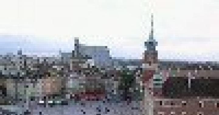
Between the Alps and the Black Sea

Southern Carpathians in late autumn
Despite their relatively modest size, the Carpathians have a complex structure. In the western part, the Outer and Inner Western Carpathians are distinguished. They are divided into 12 regions. And those, in turn, to 60 mountainous regions! Perhaps the most famous of them are the Czech Tatras. Next come the Outer and Inner Eastern Carpathians. There are fewer mountainous regions here - only about a dozen. They adjoin the Western Romanian, Southern, Serbian Carpathians and the Transylvanian Plateau. For simplicity, the Carpathians are conditionally divided into Western, Eastern and Southern.
On a physical-geographic map, the mountain system looks like a thin strip. With a total length of mountains of 1500 km, their width ranges from 100 to 340 km. The narrowest part is in Ukraine, and the widest part is in Romania. The highest peak is Gerlachovsky Shtit in Slovakia. Its height reaches 2654 m. The Carpathians are separated from the Alps by a narrow gap only 14 km wide!
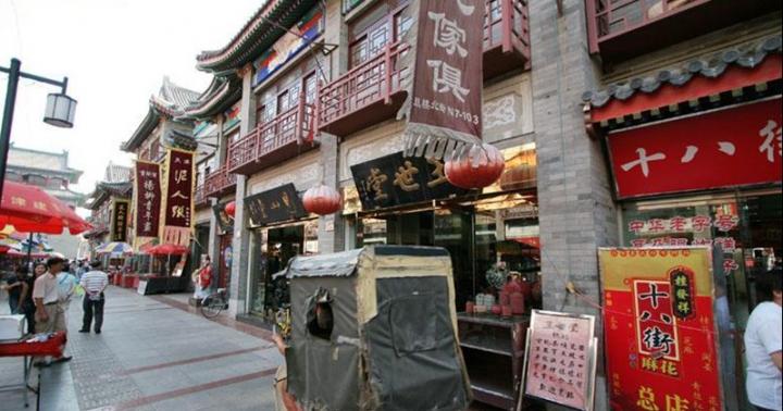
Only here

There is a whole collection of caves in the Lower Tatras
To get an idea of the most interesting places in the Carpathians, we will make virtual journey through the mountainous country. Let's start from the western part, then we will move to the east, and from there we will go down to the south. The natural border between the Czech Republic and Slovakia is the so-called White Carpathians. Here is the reserve of the same name, which is spread over the territory of two countries at once. In these places there are several types of orchids! But there is a stereotype that these delicate flowers are exclusively inhabitants of the tropics.
In Slovakia there is a mountain range Šarišská Vrhovina. It is known for its Lachnov Canyon with an unusual rock called the Moses Pillar. And the name "Slovak Paradise" speaks for itself. There is no better place for adventure lovers. Caves, abysses, canyons and waterfalls attract them like a magnet. In addition to natural objects, there are interesting man-made sights in these places. For example, in the Slovak mountains of Muranska Planina they go to see the ruins of the ancient Murano castle.
The High Tatras in Poland are really great - it is here that one of the highest points of the Carpathians is located. Tourists are attracted here beautiful lake called "Sea Eye". Located in an oval-shaped valley, it actually resembles a huge eye. No less picturesque is the largest Polish waterfall, which is called Siklava. Water falls here from a height of 70 m.
The Low Tatras are known for their panoramic points, the role of which is played by the peaks of Kraleva Gol, Khabenets and Dereshe. The Demänovská valley with its caves is considered to be the most beautiful in this area. It should be noted that in the local mountains there is a whole collection of various caves. One of them is called the Cave of the Dead Bats. Scattered along the mountain valleys and slopes are many centers from where tourist routes.
Hungary has the Matra mountain range. People come here to relax at the thermal springs and ride on skiing. At the foot of the mountains are vineyards, so the region is known for its wineries. The Böržon massif is popular among tourists. His property is considered national park Duna-Ipoy with a large number of springs, winding rivulets and turbulent streams.
Gorgany means "scree". The mountain range in the Ukrainian Carpathians has the same name. These places have long been chosen by extreme people, since the area is replete with wild tourist routes. Local hits are the Manyavsky waterfall and the mountain lake Synevyr, which is located on the territory of the national park of the same name.

Peles Castle in the mountains of Romania
The Southern Carpathians are also called the Transylvanian Alps. All this beautiful mountainous country is entirely located on the territory of Romania. Mount Moldoveanu (2544 m) is considered the highest point. Most of the country's ski resorts are located here. Do not forget that Romania is a country of castles. It is worth coming here to see with your own eyes the royal castle "Peles" in Sinai and Dracula's castle in the town of Bran.
Climbers and climbers go to the Romanian Muntenia. The Uniria salt mine, which is currently a museum and a balneological resort, is very spectacular. And the landscapes in Pyklele Mary look alien. Here, on an area of 30 hectares, mud volcanoes gurgle and spit slurry.
There are also places for lovers of alloys. For example, the Jiu River Gorge in Oltenia is one of the most popular rafting routes in Romania. Usually the Danube is associated with a calm current. However, in the Kazan Gorge, the water literally boils due to the narrowness of the canyon. This spectacle is worth seeing with your own eyes.
Mountain lake Eye of Bey, located in historical area Banat does not freeze even in winter, so during this period a lot of migratory birds gather on its shores. Along with them come lovers to observe the life of birds. The lake is worth a visit just to admire the beautiful landscapes and take spectacular photos.

There are places for rafting lovers in the Romanian Carpathians
And, of course, one cannot fail to mention Romanian Transylvania. About a hundred bears rescued from captivity live in the local reserve, located in the town of Zarnesti. Excursions around the reserve are organized for tourists. It is also worth seeing the fantastic stone columns in the Apuseni mountains, formed during the solidification of basalt lava. And at the former Turda salt mine, those who wish can rent a boat and ride on a luxurious underground lake.
The nuances of the Carpathian weather

Snow in the mountains lies from December to March. At other times, you can safely go to hiking
Since the Carpathian Mountains cover a large area and are characterized by different heights, weather conditions can vary considerably even in the same area. The higher, the colder. The further south, the warmer. In the mountain valleys, there may not be snow even in winter. The farther from the Black Sea, the more continental the climate. Despite such a variety of conditions, however, there are some climatic patterns.
January is considered the coldest month. The average temperature in the north and east of the Carpathians fluctuates around -5°C, in the south - about -3°C. However, on the tops of the mountains it can be colder - up to -10°C. By Russian standards, such temperatures are not considered frost. The average July temperature in the foothills in the north is +18°C, in the south +20°C. High in the mountains, even at the height of summer, the temperature can be no higher than +5°C. In general, the temperature regime in the Carpathians is favorable all year round.
If we talk about precipitation, then the least of them falls in the east and south of the Carpathians (800 mm per year). In the Western and Romanian Carpathians, their number grows to 1000 mm. In the highlands, this figure increases by 1.5-2 times. The maximum precipitation occurs in summer. Most often it is rain. The duration of snow cover in the foothills is 2-3 months. There are no glaciers and eternal snows in these places.
The moral is simple. The ski season in the Carpathians usually starts in December and ends in March. They ride at altitudes from 1000 m. This means that the rest of the year is quite suitable for hiking. At altitudes up to 1000 meters, this can be done in winter. But for high-altitude routes, warm clothes will be needed even in summer.
If you want to avoid rain, it is better to go hiking in spring or autumn. True, even in summer the risk of getting wet increases only in high mountainous areas. If the route passes through the foothills or slopes at low altitudes, you should not be afraid of rain. It is enough to stock up on a raincoat and a waterproof tent.
Hiking Hits
And now let's get acquainted with popular tourist routes in those countries where the Carpathians are located:
Czech

There are up to a thousand caves in the Moravian Karst
The Krkonoše mountains are very popular in the Czech Republic. They are located on the border with Poland. Here, the most popular route is the ascent to Mount Snezhka (1603 m). The path passes through a picturesque mountain valley with the unusual name Aubry Dul. Those who wish can climb up with the help of a cable car. It starts in the town of Pecs pod Sněžkou.
The destination of another popular route is the source of the Elbe. The powerful European river, on which Hamburg stands, originates in the town of Labsky Meadow. Here you understand that all the largest rivers of the world are born from springs or are formed from small streams. The starting point is the tourist center "Gorni Misechki". It is located next to the resort town of Spindleruv Mlyn. High-mountain routes along the Jeseniki ridge are also in demand. The local landscapes are considered the most beautiful in the country.
The most interesting tourist sites include Moravian Karst. The length of this mountain range reaches 25 km. Its unusualness is that the mountains are riddled with a system of caves, of which there are more than a thousand here. Under the ground you can see drawings of primitive people. In the same places there is another popular object - the Macocha Canyon, which is considered the largest in Central Europe. Its depth is 138 m.
Poland
The Tatras are to the Poles what the Alps are to the French. The main tourist center of these places is the city of Zakopane. It serves as a starting point for a hiking trail that includes the Koscieliska Valley, the Giewont and Kasprowy Wierch Mountains, the Eagle's Way, the Five Lakes Valley, the Morskie Oko Lake and the Rysy Mountain (2499 m), which is Poland's highest peak. The program usually includes a visit to the salt mine in Wieliczka.
Slovakia

There are many lakes of glacial origin in the High Tatras
Very attractive place for trekking, the Slovak Paradise reserve is considered. Tourist trails are equipped with bridges and stairs. Small rivers can be crossed along artificial fords. The trail passes by numerous waterfalls. The length of the gorge is 4 km. It can be accessed from tourist center"Undergrowth" near Hrabuszyc. The hike belongs to the medium category of difficulty.
The Slovak High Tatras have 26 peaks over 2500 m high. The most visited is the Gerlachov Peak with a height of 2654 m. It is quite easy to climb. It is from its top that the most spectacular panoramas open.
Another popular mountain is the Lomnitsky Peak (2634 m). The highest Slovak meteorological station perched on its top. You can climb to it on foot or by cable car from Tatranska Lomnica. In clear weather, a good half of Slovakia is visible from the mountain!
The High Tatras are the place where the largest number of reservoirs are concentrated, which were created by glaciers in the distant past. Now there are about a hundred of them. The transparency of the water in the lakes reaches 12 m. The so-called Mengusovskaya Valley stretches between the ridges. There are tourists in every season. At the end of the valley lies the lake Velke Gintsovo pleso. It is considered the deepest in the Tatras.
The Tatra valleys are also attractive for their cascades of waterfalls. One of the most visited waterfalls is the Studeny Stream waterfall. Obrovski waterfall, falling from a height of 20 m, is one of the famous ones. Big waterfall is no less spectacular. It is distinguished by a thirteen-meter cascade. Routes to them start from Tatranska Lomnica.
There are also hiking trails in the Low Tatras. Usually they pass along the central ridge, which stretches for as much as one hundred kilometers. The ridge consists of a chain of 55 peaks, the height of which exceeds 1700 m. Those who wish can choose either a difficult one-day alpine hike, or routes of medium difficulty, where the elevation changes are small.
Romania

Neighborhood Sinai
Very picturesque places in the vicinity of the famous Romanian resort of Sinai. There is a walking route that includes not only a visit to this colorful town, but also the famous Dracula's castle in the town of Bran. The route starts in the city of Brasov. The program includes an ascent to the Cross of Heroes on Mount Karayman, as well as a visit to Bolboch Lake and Omu Peak (2507 m).
Our tourist club offers the following hiking programs in the Carpathians:
- New Year in the Carpathians (accommodation in the estate and car tours)
- Snowy Carpathians: accommodation in estates and auto tours
Carpathian slopes

Ski areas in the Carpathians are located at altitudes from 800 to 2400 m
The ski season in the Carpathians lasts from December to March. Ski areas are located at altitudes from 800 to 2400 m. Many resorts use artificial snow, so the season can increase significantly.
In the Czech Carpathians there is a ski resort Bila. The trails are laid on the slopes of the Zbojnicka and Javorina mountains, which are part of the Beskydy massif. The resort has been operating since 1965. It is located at an altitude of 518 m. The length of the slopes is from 700 to 1000 m.
In Poland, ski centers are located along the border with Slovakia. These are the resorts of Szczyrk, Zakopane, Szczawnica, Krynica. Only in Zakopane there are about a dozen ski centers and about 90 lifts. Here is the largest Polish ski jump.
Most ski centers in Slovakia. Their number has exceeded a hundred, and all of them are in the Carpathians. A variety of conditions allow everyone to ride - from beginners to extreme sportsmen. Often the resorts have thermal springs. In winter, hiking trips to the Studenovsky waterfalls are organized, which turn into enchanting ice cascades in the cold.
In Romania, the main ski resorts are concentrated in the very center of the country in the districts of Brasov and Prahova. In the Prahova Valley there are well-known skiing centers Azuga, Bushteni and Sinai. The Poiana Brasov ski area also includes slopes near the town of Predejal. Ski slopes operate at altitudes from 1000 to 2400 m.
Close Carpathians

mountain village
The Ukrainian Carpathians are good because they are closer than others, and a visa is not required to visit them. The eastern tip of a large European mountainous country is spread over the territory of four regions - Transcarpathian, Ivano-Frankivsk, Lviv and Chernivtsi.
The length of the Ukrainian Carpathian section is 280 m, and the width is about a hundred kilometers. On average, the mountains are low - about 900-1000 m, but there are peaks over 2000 m. These, for example, include Goverla (2061 m). It is considered the highest point in the country.
The Carpathians united more than a dozen ski resorts - "Zakhar Berkut", "Zhdeniyevo", "Krasiya", "Slavske", "Pylypets" and others. All of them are located in picturesque places and away from major settlements. The visiting card of the local Carpathians is the Bukovel resort. The skiing season here lasts from November to mid-April. More people ride only on Dragobrat, where sometimes the season ends in mid-May.
In the mountains you can find many natural masterpieces. These, for example, include Mount Makovitsa (984.5 m) in the vicinity of the city of Yaremche. A huge scree on its slope looks like a giant elephant that came to the watering hole. It is often called that - Elephant Mountain. You can rest on the banks of the Prut River. This route cannot be called a hike. It's more of an easy walk.
There is an interesting route to the place where the Princess meteorite fell. This event took place in 1866. Scientists estimated the weight of the space guest at 280 kg. It is claimed that small fragments can be found today. You can get to the Chernye Mlaki tract, where the cosmic catastrophe occurred, from the villages of Knyaginya or Stuzhytsia. The trail goes past mineral springs and oaks that are over a thousand years old. The total length of the route is 14 km.
Another route allows you to walk along the bottom of the ancient sea! Once the Carpathians really were under water. A marked trail has been laid from the village of Verkhovyna-Bystraya in the Transcarpathian region to Mount Plishka. It overlooks the Uzhansky National natural Park. In 1968, a fossilized skeleton of a fish was found in these places, which swam here about 36 million years ago. Similar finds can be seen in the Transcarpathian Museum of Local Lore in the Uzhhorod Castle.

What a trip without a true friend!
The Ukrainian Carpathians are well developed in terms of tourism, so there are dozens of interesting routes. There are trips to the mountains "High Stone", "Parashka", "Pikuy", "Spits", "Khomyak", "Gemba" and others. A special route is dedicated to the two-thousander mountains - there are six of them in Ukraine.
The Gorgan Mountains are highlighted as a separate position. There is a combined version called "Five Carpathian passes". He goes along the Verkhovinsky ridge. There are routes along the Marmaros massif, the Svidovets ridge, to the Russian Way pass - you can’t list everything. One thing is clear - you won't get off in the Carpathians for two days. You need to come here for at least a week. Or better yet, two.
Without a doubt, the most famous and popular mountains in Europe are the Alps. But in this part of the world there is another mountain system that is inferior to the Alps in height, but surpasses them in size. And it also attracts great attention of tourists and lovers. winter holiday. Where are the Carpathians? In which countries are they located? When were these mountains formed, and why are they interesting?
"Stone Mountains"
The word "Carpathians" evokes approximately the same images and plots for everyone: a dark forest, thick fog creeping along the slopes, molfar sorcerers and, of course, the castle of the famous Count Dracula. These mountains are indeed shrouded in a certain halo of mysticism and mystery. But not everyone knows exactly where the Carpathians are and when they were formed.
The name of this mountain system was first used by Claudius Ptolemy in the second century AD. It also occurs in the works of Herodotus. In particular, the "father of history" mentions the river Karpis. It is believed that this tributary of the Danube borrowed its name from the mountains from the slopes of which it flows.
The very word "Carpathians", according to some researchers, comes from the name of the Thracian tribe "Karpov", who lived in this territory in the III-IV centuries. Other scholars associate it with the Proto-European word kar, which translates as "stone". True, the "stone mountains" of the Carpathians can be called a stretch. After all, most of the mountain system is represented by gentle valleys and peaks with smooth outlines, where rocky ledges and pointed peaks are extremely rare.
However, there is a third version that connects the origin of the toponym with the Slavic word "khrb", which means "ridge". Given where the Carpathians are located, this version looks quite plausible. After all, it was the Slavic tribes and peoples who for many centuries mastered and settled this area.
Where are the Carpathians: countries and major cities
The total area of the mountain system is 190 thousand square kilometers, length - 1500 kilometers. Where are the Carpathian Mountains located? They are located in the eastern part of Central Europe. On the map, they form an arc, which in geological terms is an offshoot of the Alpine-Himalayan folded region.

In which states are the Carpathians located? Where are their natural boundaries? The mountain system covers the territories of eight European countries. This:
- Czech Republic.
- Poland.
- Slovakia.
- Ukraine.
- Hungary.
- Romania.
- Serbia.
- Austria.
About 70% of the total area of the Carpathian mountainous country falls on two states - Romania and Ukraine. But only its extreme western spurs enter Austria. Most big cities located within the Carpathian Mountains:
- Bielsko-Biala (Poland).
- Zakopane (Poland).
- Banska Bystrica (Slovakia).
- Kosice (Slovakia).
- Zilina (Slovakia).
- Cluj-Napoca (Romania).
- Brasov (Romania).
- Oradea (Romania).
- Sibiu (Romania).
- Uzhgorod (Ukraine).
- Kolomyia (Ukraine).
- Vrsac (Serbia).
That's where the Carpathians are. It remains to find out what parts this mountain system consists of.
Structure of the Carpathians
The Carpathian Mountains consist of eight orographic parts (see the map below):
- Outer Western Carpathians.
- Inner Western Carpathians.
- Outer Eastern Carpathians.
- Inner Eastern Carpathians.
- Southern Carpathians.
- Western Romanian Carpathians.
- Transylvanian plateau.
- Serbian Carpathians.

In addition, a number of separate massifs are distinguished within the mountain system: Beskydy, Ore Mountains, Tatras (the highest part of the Carpathians), Gorgany, Rodna, Peniny, Fagarash and others. The average heights of the Carpathian Mountains range from 800-1200 meters. The highest point is Mount Gerlachowski-Shtit.
Carpathian Mountains: main features and interesting facts
Here are some of them:
- Despite insignificant heights and gentle forms, the Carpathians are young mountains. They arose at about the same time (of course, by geological standards) with the Alps and the Himalayas.
- Mountain building processes in the Carpathians are still going on. This is evidenced by earthquakes, which are regularly recorded here. The strength of individual shocks reaches 5-7 points on the Richter scale.
- The Carpathians were once characterized by active volcanic activity. The cones of extinct volcanoes can be seen in the vicinity of Uzhgorod, Mukachevo and Khust.
- The Carpathian subsoil is rich in numerous minerals. The main mineral wealth of the mountain system is oil, gas, ozocerite, marble and gold.
- The width of the Carpathian Mountains in some places reaches 450 kilometers.
- The Alps are only 14 kilometers from the Carpathians. The border between the two largest mountain systems in Europe passes just between Vienna and Bratislava.
- At the beginning of the 20th century, numerous remains of prehistoric animals - mammoths, huge deer and various birds - were discovered on the territory of a mountainous country.
- The Carpathians are considered the birthplace of the world's largest musical instrument - the trembita. The length of this wooden tube is 4 meters. It is able to propagate sound for 10-20 kilometers.
Origin and age of the Carpathian Mountains
Long before the formation of the modern mountain system, there was a chain of ridges in its place, connecting the Sudetes with the Dobruja (a hill in Romania). Geologists call it Prakarpaty. Subsequently, these mountains were destroyed by powerful movements of the earth's crust, and in their place, by the beginning of the Mesozoic, an almost flat plain was formed.
The age of the Carpathian geosyncline is quite "young" - only 25 million years. The process of formation of a mountainous country began at the end of the Paleogene period and proceeded gradually. The structures of the Outer Carpathians were the first to emerge. For a long time, the sea splashed between the outer and inner ridges of the Carpathian Mountains. During its existence, powerful strata of sandy deposits have accumulated here.
Climate and flora of the Carpathians
The climate of the territory is temperate continental and quite humid. The average temperatures in July are +17…20 °C, in January from -2 to -5 °C. Precipitation falls from 600 to 2000 mm per year.
In the Carpathians, the altitudinal zonality of landscapes is clearly traced. Up to a height of 600 meters, broad-leaved and mixed forests grow, from 600 to 1500 meters - dark coniferous forests, and even higher - undersized shrubs. The tops of many Carpathian mountains are covered with subalpine meadows. In the Ukrainian Carpathians, they came up with their own name - "hollowlands".

In the Carpathian forests, most often you can find European spruce, fir and beech. Oak, hornbeam, pine, alder, birch and larch are also common. The lower tier is occupied by thickets of raspberries, blackberries, lingonberries and blueberries.
The main resorts of the Carpathians
Where are the most popular ski resorts in the Carpathians and what are they called? And what are they? Bukovel, Dragobrat, Slavske (Ukraine) are usually ranked among the most famous Carpathian resorts; Zakopane, Szczyrk, Karpacz, Krynica (Poland), Poianu Brasov, Sinai, Predeal (Romania), Jasna (Slovakia).
Zakopane is perhaps the best ski resort in the Carpathians. Where are its tracks? The resort is located in the southern part of Poland, in a small town with the same name. The total length of its tracks is 60 kilometers. They are designed for all categories of skiers - from beginners to professionals. The skiing season lasts from late October to mid-April.

Bukovel is the main Ukrainian ski resort, which is located in the Ivano-Frankivsk region. It is distinguished by quality tracks and excellent infrastructure. The ideal snow cover is preserved here from the beginning of December until the end of April.
Notable peaks
Gerlachowski-Sztit (2654 m) - the most high mountain in the Carpathians. It is located on the territory of Slovakia, near the town of Gerlachov. Today the mountain is very popular among tourists. However, climbing to its top requires serious preparation and is allowed only with an experienced guide.

Hoverla (2061 m) - the highest point of the Ukrainian Carpathians, located within the Montenegrin ridge. Climbing this mountain is relatively easy, so in the summer, dozens of tourists conquer its summit every day. Hoverla is known for the fact that the largest river in Eastern Europe, the Prut, originates from its slopes.
Moldoveanu (2544 m) is the highest peak in Romania. It is located in the heart of the country, within the Fagaras mountain range. Climbing Moldovyanu is a little more difficult than climbing Hoverla, but experienced tourists her subjugation does not cause.
Where else can be sweeter, freer and more beautiful than in the mountains?! Boundless meadows of fragrant flowers against the background of an incredibly deep and clear sky. Severe stone cliffs harmoniously look against the backdrop of dense emerald forests. Where the winding ribbon of a mountain stream sparkles in the distance, and there the playful water grows into a stormy and unrestrained waterfall. With light gentle touches, the bright sun draws its own pictures with the colors of the rainbow on a transparent water canvas, understandable only to nature. As if harsh guardians surrounded the mountain peaks from all sides. Some of them are cold and covered with a white cap of snow, while others are covered with dense forests, reminiscent of furry bears that have sunk into hibernation. And now the bear does not sleep, he keeps his one eye open, the beast is staring at the order. And just take a closer look - and it immediately becomes clear - this is not the eye of a large beast, but a crystal clear mountain lake surrounded by dense mountain grasses.
Where else can you touch real clouds?! Just imagine: you are climbing to the top, and a thick white carpet appears in front of you ... and a few more meters - and you seem to rise above the world ... and how can you not feel like a free bird ...
And not only untouched and pure nature attracts thousands of tourists every year. The Carpathian region is a fabulous land! The land of centuries-old traditions, hospitable and sincere people, magical villages and cities that are unlike any other in the world. To get to know this amazing land better, it’s not enough to hear someone’s impressions, it’s worth visiting! Regardless of what time of the year you are going to spend your holidays in the Carpathians, whether it be autumn or even winter, you will unforgettable experience and heal your body. Of all the variety of miracles, it is still difficult to choose one single one, so our article will highlight individual places that are worth visiting at the beginning of a trip to the Carpathians.
1. The city of Yaremche - the capital of tourists in the Carpathian region
A small and cozy Carpathian town on the banks of the Prut River is located in a picturesque mountain basin. Although the history of the city is not even three hundred years old, it was Yaremche that became the cradle of Carpathian culture and traditions. Extremely colorful and colorful, it combines rhythmic modernity and wise antiquity. Through hospitality local residents, their love for nature and passing the ancient secret of the old mountains becomes available to every tourist.
Yaremche is especially interesting during the biggest religious holidays. It seems that before you is not an action familiar to the townspeople with traditions that have already been passed through more than once, but a real theater. A variety of colors, a variety of songs and actions will not leave indifferent any of the guests. A real theater with genuine actors against the backdrop of incredible landscapes is able to find an inflammatory Hutsul in the soul of each of us. Rest in Yaremche you will remember for a long time.
What is worth seeing in Yaremche
- Suspension bridge over the Prut.
- Reserve with wild animals.
- Old railway bridge.
- Ancient wooden temples of the XVII-XVIII centuries, made in the colorful local architectural style.
- Museum of Ethnography and Ecology.
- Restaurant "Hutsulshchyna", built without a single nail.
- Pass "Pereslop".
- Dovbush rocks.
- Souvenir market.

Night view of Yaremche (Yaremche) from a bird's eye view
2. Unforgettable vacation in the village of Polyanitsa
The next destination is the village of Polyanitsa, which belongs to the Yaremche city council. The settlement is quite modern and developed. Despite the rather Ukrainian name, the village can easily compete with the most famous ski resorts in Europe. It is near Polyanytsya that the largest ski resort in Ukraine "Bukovel" is located.
Each tourist can be amazed not only by incredible landscapes, but also by the cleanliness of the streets, their orderliness, a large selection of cozy and modern private estates and hotels. Therefore, while relaxing in Polyanytsya, you will collect a full bowl of unforgettable impressions.
- Ski complex "Bukovel".
- Pedestrian pass "Tables" 1130
- Upside down house.

3. The picturesque Carpathian village of Yablunytsya
The village with the appetizing name Yablunitsa is located 35 kilometers from the city of Yaremche. Due to the moderately cold winter, the snow cover remains for half a year, and due to the large number of slopes, Yablunytsia is one of the most popular resorts in the Carpathians.
As in a deep cauldron is Yablunytsia, from all its sides are surrounded by the Carpathian Mountains. A fabulous time is summer, when the air is filled with sweet herbal aromas and bright juicy flowers. You just want to get into such a natural corner. Yablunitsa - relax and forget about household chores.
Without which it is difficult to imagine Yablunitsa
- Church of the Assumption of the Blessed Virgin of the 18th century.
- Mount Khomyak;
- The highest peak in Ukraine Hoverla (2061 m).
- Mount Petros (2020 m).
- Yablunitsky pass.

4. City of Ukrainian customs and rituals - Kosiv
According to local legend, Kosiv is part of the heavenly land. And it's hard to disagree with that! The land of horticulture and beekeeping, the world mecca of folk arts and crafts. The entire Carpathian and mountainous region is represented in the works of local masters. Kosiv - the national encyclopedia of the Hutsul region. Visiting and resting in Kosovo is a holiday of body and soul, you can go on forever.
From such pleasure poetic lines are born by themselves:
"The smell of copper and licorice sunits,
Svіtankova dew on the princess - yalitsі,
I healing water of the blue spring,
I will always dream of such Kosiv.”
What else is Kosiv famous for?
- Church of the Nativity of John the Baptist 20th century
- Wooden Church of the Annunciation of the Blessed Virgin Mary.
- National Park "Hutsulshchyna".
- Strutinsky Museum.
- Museum of the liberation struggle of the Carpathian region.
- Kosovo market.
- Kosovo Museum of Folk Art and Life.
- Waterfall "Kosovsky Huk".
- Castle ramparts.

Kyiv Kosiv, panorama from the ridge Sharp
5. Fabulous Hutsul village - Verkhovyna
Singing land with cheerful and friendly people. magical and mysterious place that strikes the most skeptical minds. The region is so picturesque that it has become a favorite among writers and poets. The surrounding beauty and grandeur impressed director Sergei Parajanov so much that it was here that the film “Shadows of Forgotten Ancestors”, famous throughout the Soviet Union, was filmed.
Verkhovyna is like a fortress that protects the traditions of the Carpathian region from the south side. Very bright tradition of celebrating the wedding, which takes place here for a whole week. Folk traditional costumes are just the tip of the iceberg, and all other traditions and their diversity are simply difficult to list and understand right away. But the hospitable and sincere Hutsuls want the whole world to know about them. Therefore, there is no need to be shy, everything will be explained to you in the smallest detail - come and have a rest in Verkhovyna!
What is Verkhovyna famous for?
- Museum of Hutsul life, ethnography and musical instruments. R. Kumlik.
- Museum of Hutsul magic.
- House Museum "Shadows of Forgotten Ancestors".
- "Hata-pack".
- Regional Museum of History and Local Lore of the Hutsulshchyna.
- Museum of Applied Arts, Iltsy village.
- Verkhovyna National Natural Park.
- Written stone.

6. Silver resort of the Hutsul region - the village of Sheshory
A rich and luxurious Hutsul village in the Kosovo region. Without a doubt, the best way to relax is to go to the Carpathians. Sheshory is a well-known resort throughout Ukraine and beyond, where pure mountain air with the aroma of real field herbs makes you dizzy. In which you wake up from the sweet singing of birds and a soft ray of sunshine. A resort where you heal with the help of nature, body and soul. A place where you can find inner harmony.
And of course where without skis. Specially equipped ski resorts await real daredevils and extreme sports in Sheshory. And delicious Hutsul cuisine will quickly restore your strength.
What to see in Sheshory
- Lake Swan.
- The tract of Petrichila.
- Waterfalls Big and Small Guk.
- Alley with American pine from the times of Austria-Hungary.
- Ridge "Brusny".
- One of the oldest Hutsul temples is the Upper Church.
- Festival of ethnic music and land art "Sheshory".

7. Village Skhidnitsa
The settlement in a wide valley on the banks of a small mountain river is located in the Lviv region, Drohobych district. The former all-Union resort is still famous throughout Ukraine thanks to the Naftusya mineral water. Spring water of this type helps with diseases of the liver and kidneys, anemia, salt diathesis, diabetes mellitus, normalizes the acidity of the stomach, etc. Water helps in cell regeneration, therefore it rightfully deserves the title of "living water".
In total, there are 38 springs and 17 wells on the territory of Skhidnytsia. In addition to water, Skhodnitsa is known for its healing mud.
As for a resort, the tourist infrastructure is quite well developed in the village, so the guest does not need to worry about housing and accommodation prices here for any budget. Rest in Skhidnytsia will become a truly curative and interesting pastime in the Carpathians.
What is worth seeing in Skhodnitsa
- The memorial room is a museum of the discoverer of the Skhodnitsky mineral water deposit E. Stotsky.
- Route Skhodnitsa-Ugrich (10 km.) State Historical and Cultural Reserve "Tustan".
- Remains of the Iron Guta blast furnace.
- System of mountain massifs "Beskydy".
- Room-museum of folk life.
- Stone Nicholas Church of the 17th century.
- Skhodnitskoye oil field.
- Skhodnitskoye mineral water deposit.
- Landscape regional park Stuzhytsia.

8. City of Skole
A small provincial town of regional significance Skole belongs to the Lviv region. The historical center of Boykivshchyna is included in the List of historical settlements of Ukraine. The settlement has a large number of architectural and natural monuments.
The city of Skole is surrounded on all sides mountain peaks different heights, which makes it cozy and protected from cold winds. Skole is an active holiday for the whole family. The temperate and mild climate allows walking tours among nature on the bank of a clear river, among green and cozy forests, among fragrant herbs.
- National natural park "Skole Beskydy".
- Church of the Seven Sorrows, con. 19th century
- Dead lake.
- Palace of the Barons Grödlei.
- Kinsky Palace.
- Cave monastery XIII-XVI centuries.
- Dovbush rocks.
- Fortress Tustan;
- Church of the Great Martyr. Panteleimon (Saint Paraskeva).
- city of Parashka.

9. Pylypets village
Pylypets is an alpine village, one of the largest in the region. The famous ski resort, which belongs to the Transcarpathian region. The most visited Pylypets during the ski season. For lovers of winter recreation and extreme sports, there are specially equipped tracks with a total length of 20 km, the longest of them has 6 km, and 7 lifts. Also, the village has a well-developed infrastructure: hotels, estates, restaurants, rental offices, etc. For lovers of home comfort, you can rent a room in the private sector.
- Church of the Nativity of the Blessed Virgin;
- Mount Gymba.
- Mount Zhyd Magura.

10. Shayan village
The real pearl of Transcarpathia is the resort village of Shayan, famous for its mineral springs. It was on the basis of these sources that one of the oldest baths of Maramorosh zhupy was founded. Local water is able to cure and cleanse the intestines, cure stomach ulcers, get rid of urological diseases. Shayanskaya mineral water in terms of its properties, it is equated with the well-known medicinal waters "Borjomi", "Narzan", "Essentuki".
The developed infrastructure will allow the tourist to forget about the problems of accommodation, and the surrounding clean and incredibly picturesque nature will help restore all lost strength. Come to the Carpathians and relax in Shayan.
Sights of the village Shayan
- Healing springs of Marmarosha.
- Peaks Shayan, Shayanikha, Shayanchik.
- Vigorlat-Gutinsky ridge.
- Mount Lopos.
- With. Velyatino, a unique herd of buffalo, the only one in Ukraine.

It would be unfair to associate the Carpathians only with Bukovel, Dragobrat, Hoverla and tourists. We are talking about the tourist background of the region and 15 original mountainous places near Chernivtsi, Ivano-Frankivsk and Lviv, where, in addition to skiing, you can try hiking, rafting and even zipline, ride a mountain bike, learn how to make voodoo and Hutsul "lizhniki", see mountain lakes, Austrian architecture, viaducts and stave churches. And breathe freedom, of course.
The Carpathians and Transcarpathia is a tourist region with a European background. Until the end of World War II, it developed in the context of the Austrian, Czech and Polish economy and culture, which undoubtedly benefited it. In 1895, the first tourist train left Lviv for Skole, and tourist shelters began to appear on the mountain slopes of the Carpathians - a kind of "hostel", where travelers could take a breath during mountain hikes, warm up and sleep for free. In the main tourist cities- Uzhgorod, Mukachevo, Beregovo, Vinogradov, Rakhiv, Khust - the first hotels were opened. By 1939, there were at least 20 of them. The entire tourist infrastructure of Transcarpathia at that time was built thanks to the activities of the Club of Czechoslovak Tourists. The club has developed and marked tourist routes, opened tourist houses, shelters, hotels, restaurants and even a boat station, has published tourist guides in several foreign languages. Approximately the same thing happened on Polish territory - in Galicia.

Tourists came to the Carpathians to look at castles or their ruins, monasteries, Dacian and Roman settlements near the Great and Small Kopany, to study folk crafts, ride a narrow gauge railway and rest on some mountain slope in a tent. But suddenly the Czechoslovak Republic collapsed, World War II broke out, the territory of Transcarpathia was captured by the Hungarians, and later by the Soviets. During this period, most of the tourist infrastructure was destroyed. The Soviet government turned the Carpathians into a health resort paradise.
Over the past 25 years, the tourism sector of Transcarpathia has been developing spontaneously and chaotically, mainly due to the activity of caring people, the innate entrepreneurial spirit of locals and the capital of some oligarchs, of course.
Today's Carpathians are such a cocktail of European charm, original Hutsul culture and Radyansk relics. Immediately buy a ticket to Chernivtsi, Ivano-Frankivsk or Lviv to drink it as soon as possible.


Vizhnitsa - Hasidim, rocks and mushroom paradise
If the train brought you to Chernivtsi, and the soul requires mountains, go to Vizhnitsa (75 km from Chernivtsi) - from here the Carpathians begin.
In the 18th century, the Hasidim were the main feature of Vizhnitsa - the founder of Hasidism, Rabbi Israel, lived there. In the Austrian period, Vyzhnitsa was a famous ski center. And during the Romanian occupation, the name of this village was associated with a famous cabaret. Today in Vyzhnytsia you will find both - colorful culture and good tourist infrastructure.
Things to do
View Austrian and Romanian architecture
Vizhnitsa resembles an open-air museum: a typical provincial European town of the early 20th century. Here, in a fairly decent form, many Austrian and Romanian buildings have been preserved. Be sure to take a look at Train Station, the town hall, the main synagogue, the building of the gymnasium, the building of the district hospital and the college of applied arts - all these buildings have been standing here for more than 100 years. On Ukrainskaya Street, look at the building of the once popular cabaret (now the house of children's creativity), and near the market, do not pass by the former Romanian border outpost.
Conquer rocks and huge boulders
If you feel like a confident rock climber, then don’t forget to take the necessary equipment on your trip, because in the vicinity of Vyzhnitsa there are several huge rocks and boulders (30-40 m) at once: rocky massif "Protate kaminnya" (near the Nemchich pass), "Pechera Dovbush" (near Nemchich). These rocks are also quite a target for hiking. They stand in a beech forest low grief from where you will see the Carpathians in all its glory. You can put up a tent in the forest. The ascent is not difficult - it is possible with children.
Rafting on the mountain river Cheremosh
The Cheremosh River was once the border between Romania and Poland, and now separates the Chernivtsi region from Ivano-Frankivsk. This is the most popular river in the Carpathians among amateurs. Google, you can easily find about 10 companies that organize not only rafting, but also a comprehensive adventure program with rafting and mountain climbing.


pick mushrooms
Bukovyna is the edge of beech forests, where giant mushrooms grow. If you are planning an autumn trip to the Carpathians and want to join the sacral act of picking mushrooms, go from Vyzhnytsia to Vyzhenka (6.5 km) - there are the most mushroom places and you can find a guide from local seasoned mushroom pickers.
To ski
Near Vizhnitsa there are two ski resorts at once - the modest Nemchich Pass and the solid Migovo.
"Nemchich Pass"- This is a small tourist complex, which includes a hotel, a restaurant, slopes, 2 drag lifts and a rental office. You can go skiing here on an extremely budgetary basis: € 0.15 - a one-time lift, from € 3 - a subscription, from € 2 per day - ski / snowboard rental.
"Migovo"- a solid ski complex with a hostel, several hotels, restaurants, clubs, spa-center. Someone calls Migovo the main competitor of Bukovel, but the prices here are incomparably lower: from € 1 - a one-time lift, from € 16 - a day pass, from € 3 per day - ski / snowboard rental.
Where to stay
It is best to choose accommodation in Vyzhnitsa, Vizhenka and Migov on the website hotels24.ua. Unlike Booking, you can find accommodation options in estates, guest houses and mini-hotels there. Prices in Vyzhenka and Vyzhnitsa start from € 14 for a double room, in Mihov - from € 30, and in Nemchich for € 30 you can rent a double room with two meals a day.
Where to eat
The largest and most popular restaurant in Vyzhnytsia - "Kupalska Nich"(st. O. Dovbush, 1a) . Try “trout in sour cream”, “pull in glechika” and draft beer here, and for dessert, take dumplings with cherries. Just get ready for the fact that you will find yourself in a traditional Hutsul establishment, where service and speed of service are not the strongest points.
How to get there
From Minsk: by plane to Chernivtsi (UIA - from € 84). By train or bus via Kyiv, Lviv or Kovel (from € 25) to Chernivtsi. From Chernivtsi - by minibus to Vizhnitsa. Next - ride / taxi.
From Brest: by bus Brest-Kovel (from € 4), from Kovel by train to Chernivtsi (from € 3.5). From Chernivtsi - by minibus to Vizhnitsa. Next - ride / taxi.
From Kyiv: by train to Chernivtsi (from € 6), by plane to Chernivtsi (UIA - from € 38). From Chernivtsi - by minibus to Vizhnitsa. Next - ride / taxi.


Verkhovynshchyna - two-thousander mountains, waterfalls and a cultural reserve
Alpine city Verkhovyna (Ivano-Farankovskaya region) and its satellite villages are considered the center of the ancient Hutsul region, this is true Western Ukraine, surrounded by two-thousander mountains. In Verkhovyna itself, be sure to visit a private museum Roman Kumlik (St. I. Franka, 35) , where, in addition to authentic Hutsul household items, he collected a rich collection of musical instruments.
Things to do
Charge with creativity and get acquainted with the culture of the Hutsuls in Kryvorivna (Krivorivnya)
Hutsul is a Ukrainian highlander, a freestyler who loves to dress up himself and his house in order to appear before his neighbors in all its glory. Therefore, the jacket of a normal Hutsul is embroidered with gold and flavored with pompoms, and his house is decorated with carpets, embroidered towels and intricate carvings. All these cultural artifacts you can see in the village Krivorivnya(7 km from Verkhovyna), where there are 14 (!) Museums. "Hutsul hut-citizenship" and the historical and cultural museum in the school building are an obligatory part of the program of every decent tourist.
Kryvorivnya is not only a terry Hutsul region, but also a once bohemian center, a fashionable resort where the cultural beau monde gathered - writers and public figures - Ivan Franko, Lesya Ukrainka with his girlfriend Olga Kobylyanska, Osip Makovey, Vasyl Stefanyk and Mikhail Kotsyubinsky. And Sergei Parajanov filmed "Shadows of Forgotten Ancestors" here. In general, Kryvorivnya is charged with creativity. To feel the atmosphere, visit the Shadows of Forgotten Ancestors Museum and the Ivan Franko Literary and Memorial Museum.
The cultural program can be diversified by hiking. In the vicinity of Kryvorivnya, hiking trails begin to the rocks of Pisanogo Kamen and to the top of Igrets (1,311 m).
See the waterfalls and climb to the mountain observatory
If the main purpose of your trip to the Carpathians is hiking, head for Dzembronya, a highland village where no more than 300 highlanders live. From here it is most convenient to climb Mount Pop-Ivan and, in general, start climbing the Chernogorsky Range.
You can climb Pop-Ivan in different ways, but to see the cascades of Smotrytsky waterfalls along the way, head to Mount Eared Stone. From this point to the top of Pop-Ivan and the old observatory is within easy reach.
The stone observatory - the White Elephant - on Mount Pop-Ivan was built by Warsaw University in the late 30s. last century to observe the stars and the weather. The building was abandoned for several decades. Recently, in a small part of it, volunteers have equipped a tourist shelter, where rescuers live and tourists exhausted by mountain climbs stop.
Try voorda, try on the Hutsul vyshyvanka and see the Carpathian two-thousanders in Iltsy
In the Carpathian dreams of experienced tourists - the conquest of the Montenegrin ridge - six mountains of two thousand meters. If you are a beginner and spend more time in the office than in the gym and on the treadmill, we advise you to start from the Kostrych ridge. Climb Mount Kostrych (1586 m), which is located directly opposite the Montenegrin ridge, and watch how powerful two-thousanders prop up the clouds with their snow caps. You will not see such a picture from any other point of the Carpathians! And here's another nice bonus for you: the slopes of Kostrych are strewn with blueberries in summer, and in autumn with porcini mushrooms.
Take some cash with you on a hike and don't pass by the huts - small wooden houses, there are several of them on the ridge. In the summer, Hutsuls-shepherds live in the huts, who graze cows, sheep and goats in the vicinity and immediately prepare cheeses - brynza, budz and vurda. From late autumn until April, no one lives in the huts, and tourists use them for overnight stays.
You can climb Kostrych from the village of Iltsy or from the Krivopol Pass, which can be reached from Verkhovyna. In Iltsy, do not forget to look into museum-estate of the poetess Galinka Verkhovinka(village Iltsy, annex Veliky Grabovets) to learn all about the Hutsul vyshyvanka and try on the image of a Hutsul. In winter you can go skiing in Iltsy. To do this, there are three slopes of medium difficulty (length - 700 m), two drag lifts and equipment rental.


See how the Hutsul "lizhniki" make and grill their own trout caught in Yavoriv
In the village Yavorov(Yavoriv) in many houses they still create "lizhniki" - woven bedspreads made of sheep's wool. The ability to weave here is inherited. Until recently, children studied lizhnikarstvo at school and even passed a mandatory test for it. Today, woven bedspreads are used less and less in everyday life, but local craftswomen updated their product and began to sew raincoats, coats and jackets from it. Go to Yavorov (21 km from Verkhovyna, there is a bus) to join the ancient Hutsul art. In the center of folk art "Hutsulska ґrazhda" you can take part in a master class.
If you like fishing, here's another reason for you to be in Yavoriv - a trout farm "Eco-trout", where you can catch a few fish, and then place an order for their preparation. Be sure to try the trout in sour cream sauce and banosh. While your fish is cooking, go see the local waterfall, which is modestly called Yawor Niagara.
Where to stay
A double junior suite in a private estate in Verkhovyna can be rented for € 15-20, although it is not so easy to find a double room - most owners of cottages rent them out entirely. Find the right option on the website. hotels24.ua or booking.karpaty.ua. Pay attention to the private estate of the Jurak family, especially if you are planning mountain trips. The owners of the estate promise to help with an instructor.
If you are traveling with a large group, take a closer look at the cottage "Trembita" 8 with sauna, fireplace, gazebos and barbecue facilities.
There is a cozy guest house in the village of Krivopillya "FIREPLACE" with a beautiful terrace, a fireplace room and large windows in the rooms that look at the mountains. You can order meals from the owners.
Where to eat
Restaurant with panoramic windows "Panorama Verhovel" (St. Ivana-Franka, 1, Verkhovyna village) go for complex aesthetic pleasure. Unlike many other Hutsul establishments, here they bother about the beautiful presentation of dishes. Panorama Verhovel prepares excellent bograch, trout in sour cream sauce and banush with porcini mushrooms. Don't forget to try the liqueurs here.
If you go to Yavorov, go to a colorful restaurant for lunch "Babay" (attached to Rivne, on the highway Kosiv-Verkhovyna) . Try here the signature dish "Babai in Glechika", Hutsul cabbage rolls and banosh, and for dessert - tea with mountain herbs and pancakes with cottage cheese. The restaurant has a good selection of wines.
How to get there
From Minsk: by bus to Ivano-Frankivsk (from € 30), by plane to Ivano-Frankivsk (UIA - from € 70). From Ivano-Franovsk by minibus to Verkhovyna, Iltsov.
From Kyiv: by train to Ivano-Frankivsk (from €4), by plane to Ivano-Frankivsk (from €47.5). From Ivano-Franovsk by minibus to Verkhovyna, Iltsov.


Vorokhta - 100-year-old viaduct, zipline and mountain lake
Yaremche, together with Bukovel and Dragobrat, is one of the three most famous ski resorts in the Carpathians. Life in these villages revolves around tourists. They built a good tourist infrastructure here, sacrificing their authenticity and sincerity for this. Therefore, we advise you to choose Yaremcha or Bukovel, only as a last resort - if your main interest is a good ski track and comfort. And for lively culture, hiking, (cheap living) and rural romance, it is better to go to the neighboring high-mountain Vorokhta or Mykulychyn, making forays into the surroundings from there, including Bukovel or Yaremcha.
Things to do
Walk under the arches of the century-old viaduct in Vorokhta
The two longest viaducts in Ukraine (100 and 130 meters) appeared in Vorokhta in Austro-Hungarian times. Despite their advanced age, they still help trains climb the slopes of the mountain. And they still amaze with their greatness.
Climb to the mountain lake
The tourist base "Zaroslyak" in Vorokhta is the starting point for mountain hikes to the nearest mountains of Spitz and Kukul, and to main mountain Chernogorsky ridge - Goverle. If your body requires hiking and your soul needs beautiful views, but multi-day hikes are not included in your plans, choose Spitz Mountain (1863 m) with Nesamovyte Lake (1750 m) and / or Kukul as your goal. One day is enough to conquer these peaks. The route to the lake is well marked, so you are unlikely to get lost. There are many legends connected with Lake Nesamovite, each of them seems to hint that you should not swim in the icy (even in summer) waters of a high mountain reservoir. But this does not stop the majority of frost-resistant tourists.
If you are an advanced skier and like to freeride, the western and northeastern slopes of Mt. Kukul are the right place for this. Other slopes of this mountain are quite gentle, so climbing to the top will not take much effort from you. And if you suddenly take a walk before dark, then you can spend the night in one of the Hutsul huts. Look for them in the mountain valley. If you find yourself in Vorokhta in the spring (April), be sure to climb Kukul to see the purple slopes strewn with crocuses.
Go down the 720-meter zipline in Vorokhta
The first in Ukraine appeared in Vorokhta (St. B. Khmelnitsky, at the beginning of the forest) . The descent is divided into two sections: 550 and 170 meters. Height difference - 18 meters.
Climb the abandoned ski jump in Vorokhta
A ninety-meter springboard for extreme training appeared here in the 30s of the last century, when Vorokhta was part of Poland. For the last 20 years, it has stood idle, despite periodic attempts to “restart” it. If you go here to take some interesting photos, look at the Hutsul market next to the springboard, where everything that warms the soul of a Belarusian tourist is sold: traditional cheeses, honey, mushrooms, berries and woolen socks.
Try craft beer in Mykulychyn
In a small Hutsul brewery "Mikulychin" (v. Mykulychyn, vul. Grushevskogo, 68b) beer has been brewed for 15 years: light, dark, honey, wheat and rye. In addition to it, here you can try real Carpathian honey, homemade cheeses and buy natural "beer" cosmetics. A visit to the brewery can be combined with a walk to the 15-meter Zhenetsky (Hook) waterfall, which does not dry out even in summer.


Where to stay
In Vorokhta, several dozen cottages, private estates and mini-hotels accept tourists. Prices for double rooms start from € 10. It is better to look for options on booking.karpaty.ua or hotels24.ua. If you want to live higher from the highway and look at Hoverla from your window, take a closer look at a private hotel "Huts on stumps" (St. Mikhail Grushevsky, 5) , which is managed by the good-natured Orestes. There is a sauna with two pools, a vat, a trout pond where you can go fishing, a small restaurant and a rooster that will not let you sleep through all the fun.
Where to eat
The main (it is by local standards and the most expensive) restaurant in Vorokhta - "Stara Vorokhta"(st. Danila Galitsky, 66) with typical Western Ukrainian cuisine. Try herb trout, porcini mushrooms and liqueurs here.
If you want to dine in a real Carpathian hut, go to Yaremcha in "Red Manor" (st. V. Ivasyuka, 6) . Feel free to order potato pancakes in glechek, veal cheeks with pea puree and shish kebab, which will be cooked for you on the grill right in the center of the hall. Rumor has it that they serve the most delicious horseradish in the Carpathians.
How to get there
From Minsk: by bus to Ivano-Frankivsk (from € 30), by plane to Ivano-Frankivsk (UIA - from € 70). From Ivano-Franovsk by minibus to Vorokhta. Or by plane to Kyiv (UIA - from € 65), by train to Kyiv (from € 35). From Kyiv by train to Vorokhta (from € 4.5) or Yaremche (from € 8.5).
From Kyiv: by train to Vorokhta (from € 4.5) or Yaremche (from € 8.5).


Synevyr park to climb to the mountain lake of the same name. See the brown bears that got new life V rehabilitation center(v. Synevyrska Polyana) , is a no less worthy reason to make this long journey. Most of the guests of the Rehabilitation Center are former "employees" of circuses and entertainment venues. Almost all bears end up in this shelter with psychological trauma and a bunch of diseases. Some emaciated animals are given away by the owners voluntarily, while others are won back by the employees of the Rehabilitation Center through the courts. In their new home, the bears are treated, restored and learn to live in natural conditions (they even have dens here!).
Hutsulize
Synevyrska glade is an excellent location for relaxing in the off-season (spring, autumn), if you want to breathe in fresh air, take a break from people and get a little hutsulized. At the market in Mizhhirya, you can buy everything you need for this - Transcarpathian wine, homemade milk and eggs, cheese and meat. And then settle in one of the cottages in the Synevyr meadow, walk by the mountain lake for days, conquer the local peaks (several marked routes start from Synevyr), and in the evening fry the barbecue on the grill, drink wine and listen to the stories of local Hutsuls.
Visit the village-museum Kolachava
The village of Kolochava, which at different times belonged to Austria, then the Czech Republic, then Hungary, then Romania, is a mix of languages \u200b\u200band cultures. A textbook on express immersion in the Carpathian culture. There are 10 museums and 20 unusual monuments, including a teacher from Vkrajina and a shepherd. Here you will see the most picturesque in Ukraine skansen "Old Village" (from March 20 to April 20 it turns into a valley of blooming crocuses) and a train that once traveled on a narrow gauge railway, you walk along the corridors of the Czech and Soviet schools.
When you walk around "Old village" do not pass by the kryivka "Staer's Bunker"(headquarters of the Kolochava rebels) and the Jewish Taverns at Wolf's, where you can look through the debt book with the names of the villagers who drank in the institution on credit.
Another feature of Kolochava is the shepherd's school - together with an instructor you can take a walk on the slope of Mount Strimba, where sheep graze from May to November, see how vurda is cooked, try the miraculous "zhentitsa" and listen to trembita.
Conquer Gymba in Pylypets
The mountains in the region of Volovets, Podobovets and Pylypets are called the Borzhava meadow - they are not very high (up to 1500 m), but very picturesque. From a height they look like a restless sea, playing with blue-green colors. To see them, climb Mount Gymba (1491 m), which even children easily conquer. And all because a chair lift takes tourists from Pylypets to a height of 1100 m (it works even in summer). If, after conquering Gymba, you are still cheerful, cheerful and full of desire to see more - take a walk to the neighboring mountains of Stoy (1681 m), Great Top (1598 m), Mount Plai ( 1330 m) and Temnatik (1343 m). After that, you can go down to Volovets.
In winter, Pylypets turns into a ski resort - the second highest after Dragobrat - with the longest in Ukraine ski slope(20 km). The cost of one lift on the chair lift starts from € 2, a day pass - from € 17, ski / snowboard rental - from € 2.5. There is a professional ski school where for €5/hour an instructor will teach you how to be handsome on the slopes.
Ride through the mountains on a bike in Pylypets
In the village of Pylypets