RARE SPECIES OF PLANTS LITTORAL ZONE NATURAL MONUMENT "LAKE ABRAU"
Svetlana Litvinskaya
Dr. Biological Sciences, Head of the Department of Geoecology and wildlife management,
Professor of Kuban State University,
Russia, Krasnodar
Alexey Kotov
MA Department of Geoecology and wildlife management Kuban State University, Russia, Krasnodar
Tatyana Kvasha
MA Department of Geoecology and wildlife management Kuban State University,
Russia, Krasnodar
ANNOTATION
For the first time, information is provided on the growth of rare species listed in the Red Books Russian Federation And Krasnodar region, growing in the coastal zone of the natural monument “Lake Abrau”. Maps of distribution, condition of individuals, and numbers are provided.
ABSTRACT
For the first time provides information about rare species listed in the Red Book of the Russian Federation and Krasnodar, growing in the coastal zone of natural monument "Lake Abrau." Are distribution maps, status of individuals, the number.
Keywords: natural monument, Lake Abrau, rare species.
Keywords: natural monument, lake Abrau, rare species.
Lake Abrau was declared a natural monument by decision of the Novorossiysk City Executive Committee No. 328 dated June 26, 1979 No. 328. By decision of the regional executive committee dated July 14. 1988 No. 326, the lake was given the status of a complex natural monument. The security mode is custom. Purpose – scientific and recreational. The security certificate was awarded to the Novorossiysk Society of Hunters and Fishers. The purpose of establishing the natural monument “Lake Abrau” is to preserve the relict water basin as a habitat for a rare endemic of the world fauna - the Abrau sprat; preservation of a geological and geomorphological object of scientific value and preservation of a hydrological object - the only large freshwater basin on the peninsula of the same name, which has recreational significance. The natural monument also performs the functions of preserving the unique sub-Mediterranean landscape in the coastal zone of the lake, archaeological sites, conservation of rare and endangered species of biota in the coastal zone. Purpose of research: study of rare plant species in the coastal zone of Lake Abrau. In geobotanical terms, the study area belongs to the Crimean-Novorossiysk province, in floristic zoning - to the North-Western Transcaucasus, Anapa-Gelendzhik floristic region.
Most rare species gravitate in their distribution to dry habitats of the southern macroslope of the Navagirsky ridge. The lower zone of juniper-pistachio woodlands and downy-oak forests (shiblik) is especially rich in rare species. In the coastal zone of Lake Abrau, 9 plant species are registered, listed in the Red Books of the Russian Federation (2008) and the Krasnodar Territory (2007). Data compiled from research conducted in July 2016.
Juniperus excelsa Bieb. [ Juniperus excelsa Bieb. subsp. Excelsa, 1975] – Phylum Tracheophyta, Class – Pinopsida, Fam. Cupressaceae. The global population threat category on the IUCN Red List of Threatened Species is rated as Low Risk/Least Concern: Red List Category & Criteria - Least Concern ver 3.1 (2013). Species status category: 1 “Endangered” – 1B, UI. An Eastern Mediterranean hemixerophilic relict species on the northern border of its range. Red Data Book of the Russian Federation – status category – 2. The regional population belongs to the rarity category “In a dangerous condition” – EN A2acd; B1ab(i,ii,iii), S.A. Litvinskaya. Juniperus excelsa grows along steep eroded slopes on the eastern shore of Lake Abrau in a shiblyak forest of downy oak. The condition is normal. There is no oppression. The number is 5-6 individuals. Coordinates: N 44 o 41" 113"" E 37 o 35" 410""; N 44 o 41" 417"" E 37 o 35" 205"" (3 individuals, 3 m high); N 44 o 41" 935"" E 37 o 35" 356""; N 44 o 42" 158"" E 37 o 35" 331"" (Figure 1).
Picture 1. Map of rare species of the lake's coastal zone. Abrau
Glaucium flavum Crantz. Phylum Magnoliophyta, Class – Magnoliopsida, Fam. Papaveraceae. Category and status: 2 “Vulnerable” - 2, UV. A Euro-Mediterranean littoral stenotopic species at the northern limit of its range with declining numbers and range. Red Data Book of the Russian Federation – status category 2. The regional population belongs to the rarity category “Vulnerable” - VU A1acd; B1b(i,ii,iii,iv)c(iv), S.A. Litvinskaya. The species was recorded at two points in the coastal zone (Figure 1). Coordinates: N 44 o 41" 473"" E 37 o 35" 722"". Number: 2 generative individuals and 14 vegetative ones. The number of flowers per individual is 15, fruits are 278. The condition is good, although the number is low. There is no oppression. Individuals grow in natural undisturbed communities on marl in the lower part of a steep bank (Figure 2).
Crambe maritima L. Phylum Magnoliophyta, Class – Magnoliopsida, Fam. Brassicaceae. Category and status: 2 “Vulnerable” – 2, UV. Mediterranean-Atlantic littoral species growing in an area of intensive recreational use and economic development. The regional population belongs to the rarity category “Vulnerable”: VU A2ac; B1b(iii,iv,v)c(iii), S.A. Litvinskaya. The species grows near the coastal slope. 2 points are marked (Figure 1). Coordinates: N 44 o 41" 158"" E 37 o 35" 517""; N 44 o 41" 233"" E 37 o 35" 507"". Number – 3 individuals (Figure 3).
Hypericum hyssopifolium Chaix. Phylum Magnoliophyta, Class – Magnoliopsida, Fam. Hypericaceae. Category and status: 2 “Vulnerable” – 2, UV. Crimean-Novorossiysk subendemic with an extremely narrow range, confined to a zone of high recreation and resort construction. The regional population belongs to the rarity category “Vulnerable”: VU C2a(i), S.A. Litvinskaya. The species is confined to the steep marly coastal slope of Lake Abrau (Figure 1). Coordinates: N 44 o 41" 609"" E 37 o 35" 815""; N 44 o 41" 612"" E 37 o 35" 847""; N 44 o 41" 873"" E 37 o 35" 831""; N 44 o 42" 396"" E 37 o 35" 704"". At the first point there were 10 individuals, at the second - 5, at the remaining 1-2. Vitality is full. During the study period, the individuals were in a state of fruiting. There is no oppression.
Fibigia eriocarpa(DC.) Boiss. Phylum Magnoliophyta, Class – Magnoliopsida, Fam. Brassicaceae. Category and status: 2 “Vulnerable” - 2, UV. An Eastern Mediterranean stenotopic species with an isolated fragment of its range on the northern border, growing in conditions of intensive recreation and resort construction. The regional population belongs to the rarity category “Vulnerable”: VU A1ac, S.A. Litvinskaya (Figure 1). Coordinates: N 44 o 41" 233"" E 37 o 35" 507"" (2 individuals); N 44 o 41" 250"" E 37 o 35" 499"" (2 individuals); N 44 o 41" 590"" E 37 o 35 264; N 44 o 41" 250"" E 37 o 35" 499"". The species grows on the coastal slope. The number is low, but individuals bear fruit. Vitality is normal.
Linum tauricum Willd. Phylum Magnoliophyta, Class – Magnoliopsida, Fam. Linaceae. Category and status: 2 “Vulnerable” – 2, UV. Crimean-Caucasian subendemic with a small habitat area and low numbers, confined to a zone of high recreation and resort construction. The regional population belongs to the rarity category “Vulnerable”: VU C2a(i), S.A. Litvinskaya. Coordinates: N 44 o 41" 609"" E 37 o 35" 815""; N 44 o 41" 672"" E 37 o 35" 729""; N 44 o 41" 900"" E 37 o 35" 845"". The number is low, but individuals bear fruit. Vitality is normal.
Lonicera etrusca Santi. Phylum Magnoliophyta, Class – Magnoliopsida, Order – Dipsacales, Fam. Caprifoliaceae. Category and status: 1 “Endangered” – 1B, UI. Rare tertiary relict Mediterranean species. The eastern limit of the range lies in the Krasnodar Territory. Red Book of the Russian Federation – status category 3. The regional population belongs to the rarity category “In a dangerous condition”: EN A2acd; B1b(iii,iv)c(ii,iii), S.A. Litvinskaya. Coordinates: N 44 o 41" 187"" E o 37 35" 511""; N 44 o 42" 43"" E 37 o 35" 334""; N 44 o 42" 188"" E 37 o 35" 341""; N 44 o 41" 614"" E 37 o 35" 836""; N 44 o 42" 390"" E 37 o 35" 249""; N 44 o 41" 672"" E 37 o 35" 729""; N 44 o 41" 777"" E 37 o 35" 753""; N 44 o 41" 873" E 37 o 35" 831""; N 44 o 41" 900"" E 37 o 35" 845""; N 44 o 41" 971"" E 37 o 35" 813"". The condition is normal. Flowering and fruiting individuals have been noted. The number is about 30 individuals.
Salvia ringens Sibth. et Sm. Phylum Magnoliophyta, Class – Magnoliopsida, Fam. Lamiaceae. Category and status: 2 “Vulnerable” – 2, UV. An Eastern Mediterranean stenotopic species at the extreme limit of its range, growing in conditions of intensive recreation and resort construction. The regional population belongs to the rarity category “Vulnerable”: VU A3cd; B1b(iv)c(ii,iii), S.A. Litvinskaya. Coordinates: N 44 o 41" 609"" E 37 o 35" 815""; N 44 o 41" 614"" E 37 o 35" 836""; N 44 o 42" 569"" E 37 o 35" 280""; N 44 o 41" 644"" E 37 o 35" 755""; N 44 o 41" 698"" E 37 o 35" 743"". The condition of the species is normal, noted in the state of flowering and fruiting.
Campanula komarovii Maleev. Phylum Magnoliophyta, Class – Magnoliopsida, Fam. Campanulaceae. Category and status: 2 “Vulnerable” – 2, UV. A narrowly local Novorossiysk endemic, growing in conditions of intensive recreation and resort construction. Red Data Book of the Russian Federation – status category 3. The regional population belongs to the rarity category “Vulnerable”: VU A2cd; B1b(iii,v)c(iii), S.A. Litvinskaya. Coordinates: N 44 o 41" 491"" E 37 o 35" 923""; N 44 o 42" 43"" E 37 o 35" 334""; N 44 o 41" 609"" E 37 o 35" 815""; N 44 o 41" 612"" E 37 o 35" 847""; N 44 o 42" 344"" E 37 o 35" 269""; N 44 o 41" 731"" E 37 o 35" 745"" (Figure 4). During the research period, the species was in a state of fruiting and the end of the growing season. Judging by the fruiting, the state of the species is normal, no depression is observed.

Figure 4. Confinement of Komarov's bell to the coastal zone of the lake. Abrau
Research has shown that two species grow in the coastal zone of Lake Abrau ( Glaucium flavum, Crambe maritima), for which these habitats are not typical and are located at a considerable distance from typical places in the littoral zone of the Black Sea, which is important for clarifying the ranges of these species in the region. The coastal zone of Lake Abrau is under strong recreational influence. More than half of the coastal zone no longer has vegetation. It is necessary to preserve the habitats of rare species in the coastal zone of the Lake Abrau natural monument.
Bibliography:
- Red Book of the Russian Federation (Plants and Fungi) 2008. / ed. L.V. Bardunova, V.S. Novikova. M.: Partnership of scientific publications KMK. 855 pp.
- Red Book of the Krasnodar Territory (Plants and Mushrooms). 2007. 2nd ed. / ed. S.A. Litvinskaya. Krasnodar. 640 pp.
- Menitsky Yu.L. Project “Synopsis of the Flora of the Caucasus”. Map of flora areas // Botan. magazine 1991. T. 76. No. 11. P. 1513-1521.
Many go to Krasnodar region to swim in the sea and sunbathe on the beaches, but often cannot imagine that other types of recreation exist in those places - without the bustle of the beach. It's easy to breathe there clean air, the vast expanses, wonderful landscapes and delicious sparkling wine are perfectly combined. So, welcome - vacation in Abrau-Durso, a magnificent and fabulous neighbor of the glorious hero city of Novorossiysk.
Abrau and Durso
In fact, the village is called Abrau, and Durso is located closer to the sea - seven kilometers away. You can only get there along a winding road in the mountains. In Durso there are recreation centers, hotels and other resort infrastructure. In Abrau there are: police, post office, hospital and the hero of the occasion - the lake of the same name.
Abrau-Durso official
- Located 14 kilometers from Novorossiysk.
- Founded 1871
- Permanent population – approximately 3,500 people
- Composition: Russians, Ukrainians, Armenians
- Since 2012, there has been a training base for football players in the village, games and training camps among Russian clubs are held.
- The Abrau-Durso plant is Russia’s largest producer of sparkling wines.
- At the end of the 2000s, the urban-type settlement of Abrau-Dyurso was transformed into a village
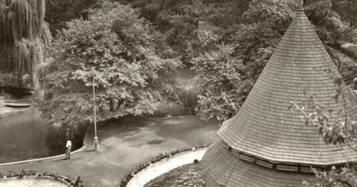
Lake Abrau
The lake is enough large sizes, with an area of approximately 0.6 km 2, the water in it is heated to a fairly high temperature. For this reason, it is very comfortable to swim in the lake in summer. Until now, scientists have not been able to solve the mystery of the origin of this lake. “The failure” - this is exactly what the exact translation of the meaning of the name of the lake means - could have appeared due to a shift in the mountain layers. It is also possible that this is the remnant of a fresh sea. There are many living in the pond different types fish
Another mystery is hidden in the water drainage. Abrau collects water from the river and underwater sources, but there is no visible water flow from the lake. There is a version that excess water simply evaporates, but is this true?
 Lake Abrau.
 Author: Skif-Kerch – own work, CC BY-SA 4.0, https://commons.wikimedia.org/w/index.php?curid=62570998
The lake does not have vegetation, which is found in almost every enclosed body of water, and the freshness of the water from the lake is beyond doubt. This circumstance is an argument in favor of the hypothesis of the relationship between the lake and the sea. Not far from the lake there is another small reservoir called Bam. They are now breeding lotuses. If the wind blows from the lake, the aroma of lotuses is felt long before you approach the water.
Stories about the lake
About all the famous mysterious places legends are formed. Lake Abrau has three of them.
- The first legend tells about the love of a Circassian girl and a poor guy. The girl could not contradict her parental prohibition and grieved for her beloved. The poor thing was surrounded by stupid people who saw the purpose of life only as pleasure and idle entertainment. Therefore, God punished them - one day the settlement went underground. The young orphan grieved and cried so much that a stream formed from her tears, filling the hole with tears. This is how the lake appeared. The girl wanted to drown herself in it, but could not. She managed to walk across the water straight to the opposite shore, where her lover was waiting for her.
- The second legend tells of a harlot who was imprisoned in rocks as punishment and was forced to swear on the welfare of her village. But a shepherd passing nearby radically changed the girl’s plans. The village fell into the ground, and the harlot cried until the gorge that appeared was filled with tears. The legend ends just as happily as the first.
- The third legend tells about a dragon living at the bottom of a reservoir. The sun's rays reflect off the surface of his body, and the lake turns a wonderful turquoise color. In the dark, under the light of the moon, a path forms on the surface of the water. Some see in the path the traces of a girl, an unfortunate drowned woman. And some say that this is a reflection from a dragon's crest.
 Abrau-Durso. Author: Vyacheslav Rebrov, CC BY 3.0, https://commons.wikimedia.org/w/index.php?curid=60200751
 In addition to these fabulous legends, there are still quite real story, which is associated with the treasure. During the Second World War, when the Germans tried to break through to the Caucasus, an order came to drown the entire supply of sparkling wine from the factory cellars in the waters of the lake. At that time there were more than tens of thousands of bottles there. The decision was made to prevent the enemy from celebrating their victory with the best champagne in the country. After the end of the war, more than one attempt was made to find this treasure, but, unfortunately, they were all unsuccessful. There is reliable information that the champagne was flooded, but no one can determine its location, and the lake reliably keeps its secret.
Champagne factory: old times
After the tragic events described in the legends, the Circassians decide not to populate the lands near the lake. A lot of time passed, the Caucasian wars ended and Russians settled in these areas. Prince Lev Golitsyn liked these lands, and he asked permission to form a settlement near the lake.
In the place where the Abrau-Durso plant now stands, there used to be impenetrable forest thickets and a roaring river flowing into the lake. At the special commission, at the suggestion of F.I. Geiduk, it was decided to engage in viticulture in these lands.
Thanks to the tenacity and steadfastness of Heyduk and Prince Golitsyn, a factory was built in this place in 1870. The first grape vines were brought. They took root well and became the basis for all subsequent vineyards. At first, only vintage wines were made here. And already in the twentieth century they began to produce champagne. The first 13,000 bottles marked the beginning of the champagne factory's success.
Events took place when the plant was on the verge of shutting down. The revolution, the war with the Germans, the collapse of the USSR - all this hit the plant hard, causing irreparable damage to both the equipment and the premises of the plant. A certain period of time passed, and there were people, such as the founders of the plant - Golitsyn and Geiduk, who were engaged in the revival of traditions. We were busy restoring production and again giving people the opportunity to enjoy the taste of great wines.
Abrau-Durso plant: our time
Now the plant produces some of the best champagne wines in Russia, using classical technologies in production. When making wines, the best grape varieties are taken, growing directly next to the plant. Also, grapes are additionally supplied from a number of other places and even other states.
Interesting fact: the main stages of production are still done by hand. Golitsyn always insisted that only women can methodically perform the same operations every day. Only they can hear the wine that is ripening. That’s why even now the bulk of the plant’s workers are women. They deserve enormous gratitude for their skill and patience. The quality of the wines is no worse than Italian or French.
 On the territory of the plant.
Author: kasparova2
The largest freshwater lake in the Krasnodar Territory is Lake Abrau (from the Abkhazian “Abgarra” - failure), located on the Abrau Peninsula, 14 km. northwest of the city of Novorossiysk. Its length is about 2600 m, width - 600 m, area on average - 1.6 square meters. km., and the depth is about 10 m. Comfortably located among majestic mountains, overgrown with relict trees, Abrau looks incredibly picturesque and will captivate anyone who sees it with its fabulous landscape.
The mysterious lake keeps many secrets related to its origin and to this day scientists debate about its origin. According to one hypothesis, the reservoir appeared due to the collapse of limestone voids formed as a result of their washing out by groundwater. Another hypothesis states that Abrau is a remnant of a once-existing freshwater sea. The third is that the lake was formed during the Flood. However, each of the hypotheses has its own contradictions, so scientists to this day cannot come to a consensus about the origin of Abrau.
According to one of ancient legends, passed down here from mouth to mouth, a rich tribe of Adyghe people once lived on the site of the reservoir. A rich man's daughter fell madly in love with a local shepherd, but her parents were against the young people seeing each other. The girl’s father, in anger, repeatedly repeated that it would be better for his village to sink into the ground than for his only daughter to even once meet a poor shepherd. One day, during festive games, the rich people began to throw bread cakes into the river instead of clay plates, which angered Allah, who sent them all underground along with the village. The girl managed to escape to her lover the day before, so she survived. Returning back, at the site of her native village, she saw a huge pit filled with water. Heartbroken over the death of her parents and her native village, the girl sobbed for a long time and uncontrollably, and from her tears a stream formed, which has survived to this day. Unable to bear the loss, she threw herself into the water, but failed to drown. Instead, she walked across the water from one shore to the other, where she was met by her beloved, with whom she quickly forgot her grief. And at the place where the girl walked across the lake, on a clear moonlit night, her traces are clearly visible - an inexplicable flickering, the origin of which scientists cannot explain.
Now, on the site of the once existing settlements, there is a beautiful lake, where people come from everywhere to relax, go fishing, or just enjoy the magnificent landscape. Its aquatic vegetation is represented by thickets of sea and lake reeds and reeds; crustaceans live in its plankton, and crayfish, amphipods, and freshwater crabs live in its bottom fauna. In the waters of Abrau there are a huge number of fish species, which, despite the rather muddy bottom of the reservoir, feel great. Today, Abrau is home to trout, silver and golden crucian carp, rudd, minnow, golden ofra, carp, white carp, largemouth bass, bream, tench, ram, sabrefish, silver carp and Abrau sprat, better known as “sausage”. Since 79 of the last century, the reservoir has been recognized as a regional natural monument, and therefore today it is not possible to travel on it in motor boats. It is allowed to move only by oars, and fishing only with a fishing rod or spinning rod. Fishing on the lake is permitted throughout the year, with the exception of the spring spawning period from March 1 to May 31.
Mountain Lake Abrau is truly stunning and a wonderful place to relax, and the fishing here is so amazing that thousands of fishermen come here every year dreaming of a big catch.
Abrau is the largest freshwater lake in the Krasnodar Territory, located in the southwest of the region on the low-mountain Abrau Peninsula, 14 km from Novorossiysk. The village of Abrau is located on the shore. As part of Russia, active agricultural and recreational development of its shores began in 1872. A natural monument since 1979.
The greatest depth is about 11 meters, with an average depth of 5.8 meters. The area is 0.6 km2, the drainage area is 20.3 km2.
History of the study of Lake Abrau
In 1870, on behalf of the emperor, to study the lake, a special commission was created of agronomists and engineers to inspect the surroundings of the lake, Abrau, which concluded the “royal decree on the establishment of a new special appanage estate, giving it the name “Abrau-Durso”. In 1872, following the advice of French winemakers, vineyard cultivation began in the vicinity of the lake, which, however, had a negative impact on the hydrography of the lake itself, due to increased erosion of the coastal slopes of the mountains. Researcher of the Azov-Black Sea shores V.P. Zenkovich noted:
"Even more interesting large lake Abrau, framed by a ring of vineyards. It is located in a deep valley where an unknown obstacle has stopped the flow of water..."
Aerial photography of Lake Abra
Hydrography of Lake Abrau
This is the second largest mountain lake in the Greater Caucasus (after Lake Kazenoyam in Dagestan). The length of Abrau is more than 3,100 m, the greatest width is 630 m, the depth is 10.5 meters, the mirror area is 1.6-1.8 km². The drainage basin area is 20.3 km². The maximum depth is observed at the dam, but over the past century and a half it has decreased from 30 to 10.5 meters as a result of erosion of the surrounding banks after the construction of roads and the establishment of vineyards. The height above sea level is 84 m. The isthmus separating the lake Abrau from the Black Sea is small and less than 2 km wide.

Only the small Abrau River, about 5.3 km long, constantly flows into it, as well as a number of temporary watercourses, including local stormwater, which are fed mainly by precipitation and runoff from local enterprises. In addition, there are springs at the bottom. Most of the lake's catchment area (61%) is occupied by the river basin. Abrau; other watercourses flowing into the lake occupy 6.3 km² (31%), the remaining 1.6 km² (8%) is occupied by itself water mirror, which is also directly affected by precipitation. Not a single river flows from it, so formally it is considered the final (estuary). The water entering the lake is spent on evaporation, as well as on underground runoff, which occurs in the form of water filtration through the body of the dam. Therefore, it remains fresh and marsh vegetation is not developed in it. Due to the limestone dissolved in the water, its waters have a white-blue or emerald color and their transparency is low (about 1 m).
The lake region is dominated by a dry Mediterranean climate, which leaves an imprint on its hydrography: maximum levels waters in it are observed from November to March and are associated with precipitation in the form of rain and sleet. In summer there is low water.

Temperature regime of Lake Abrau
Abrau does not freeze even in winter. The minimum average monthly temperature of the surface layer of water in the lake near the shore reaches its annual minimum in January, but even then it is positive and on average equals +0.2º. A rapid increase in water temperature in the surface layer begins in April and continues until the end of July.
The maximum average monthly water temperature reaches an average of 24.8º, and from August the water begins to gradually cool. The absolute maximum temperature of the surface layer of water was recorded in 1954 and reached 29.8º.
Origin of Lake Abrau
Hypotheses about the origin of the lake are still quite controversial. It is fraught with mysteries related to its origin. Some scientists suggest that the basin was formed as a result of a karst failure, others - that it is a remnant of the ancient Cimmerian freshwater basin, and others associate this with huge landslides.
Although karst relief of a Mediterranean nature is common on the Abrau Peninsula, the theory of a karst sinkhole is unlikely for a number of reasons.
Firstly, the Abrau Mountains are relatively young.
Secondly, karst lakes are sinkholes and therefore usually have a round shape, and at Abrau it follows the contours of the river valley. Abrau rather resembles a typical dam reservoir with an expansion at the dam.
The landslide theory is also unlikely, since in the area of the Abrau dam, separating it from the sea, there are no high mountain peaks, from which impressive blocks could break off. As a result, it is most realistic to associate the origin of the lake with the earthquake that led to the displacement earth's crust in the area of the dam.

Fauna of Lake Abrau
Its fauna is unique. According to the research of V.A. Vodyanitsky, the plankton is dominated by the Caspian crustacean Heterocope caspia, and there is an endemic ectinosomal crustacean (Ectinosoma abrau). Among the bottom fauna there are also a number of organisms characteristic of estuaries or the Caspian Sea. These are the amphipods strong (Poptogammarus robustus), Korofiya, Botta's orchestia, the isopod - Nordmann's jera, Kovalevsky's mesomisis. Most of the bottom is populated by the red bloodworm (up to 250 specimens/m2) and the oligochaete tubifex (up to 400/m2).
Thus, the bottom fauna clearly shows the estuary-marine character of this relict lake. A small herring (Clupeonalla abrau) 8.5 cm long also lives in it. There are a lot of them in the lake; mysids serve as food for it.
The subject of the Russian Federation:
Krasnodar region
Date of creation:
Regional, water
Total area (ha):
Number of plots:

Enough has been written about him in local history literature. It is worth noting that this is the largest freshwater lake in the Krasnodar Territory. In size it exceeds the famous Ritsu. Its length is over 2600 m, maximum width 600 m, area 1.6 km2. The lake is fraught with mysteries related to its origin. Some scientists suggest that the basin was formed as a result of a karst failure, others that the lake is a remnant of the ancient Cimmerian freshwater basin, and others associate this with huge landslides. The mysterious Lake Abrau is located 14 km west of Novorossiysk, on the mountainous Abrau Peninsula.
If you compare Lake Abrau with famous lake Ritsa, you can see a lot in common: a mountainous landscape, approximately the same length (about 3 km) and the greatest width (up to 800 m). The area of Lake Abrau is 180, Ritsa is 132 hectares. Wooded mountains are majestically reflected here and there in the greenish mirror of the water. But you can immediately feel the difference in the relief, climate, vegetation, in the entire natural complex, associated with the height of the mountains and the different position of the lakes above sea level (Ritsa - 950, Abrau - 84 m). The peaks of the mountains around Lake Abrau are lower and more rounded, without sharp peaks, and the slopes are flat. Patches of eternal snow do not sparkle on them, pointed firs do not bristle, but a broad-leaved forest with curly crowns of oaks, maples and lindens reigns supreme. And the whole landscape looks calmer, softer. Both the climate and the water here are much warmer, so there are a lot of swimmers on the lake in the summer season.
From a hydrological point of view, the main difference between these two reservoirs is that Ritsa is flowing, and Lake Abrau is drainless. The small river Abrau, a number of springs and temporary watercourses flow into it, which collect water from atmospheric precipitation from an area of about 20 km2, and there is no surface flow from the lake. The water entering it is consumed for the most part for evaporation. This also affects the quality of water. The lake retains all the substances brought by the water, and the process of self-purification of the stagnant pool proceeds slowly. The transparency of the water does not exceed one meter, while in Ritsa it is 9 times more. Meanwhile, Lake Abrau serves so far as the only source of industrial, agricultural and domestic, including drinking, water supply for the village. It is clear that protecting the reservoir from pollution is of paramount importance here.
In December 1974, the executive committee of the regional Council of People's Deputies declared Lake Abrau a natural monument. The security certificate was awarded to the Novorossiysk Society of Hunters and Fishers. The “Safety Certificate” states that logging is not allowed in the lake basin, except for sanitary purposes. It is prohibited to set up tents and park cars on the shores, and it is not permitted to keep motor boats, except for one service. There are rangers constantly on duty on the lake who monitor fishing rules, cleanliness and order on the lake.
The main mystery of Ober Abrau is the origin of its basin. Geographical name Lake "Abrau" translated from Abkhaz means "failure".
Geologists suggested that the basin was formed as a result of a karst failure. However, acquaintance with the shores of the lake shows that they are composed of flysch of Upper Cretaceous age. In the cliffs, folded layers of sandstones, marls, mudstones and clays are exposed. This contradicts the hypothesis of a karst sinkhole origin of the lake. The morphological features of the basin also do not agree with this hypothesis. Karst lakes usually occur in groups. They are characterized by a rounded shape and a funnel-shaped bottom. Lake Abrau has none of these signs.
According to another hypothesis, Lake Abrau is a remnant of the Cimmerian freshwater basin, which existed on the site of the Black Sea at the end of the Neogene period, more than 1 million years ago. This hypothesis explains well the composition of the lake's fauna. It is home to carp, carp, rudd, American (largemouth) bass and others modern views fish But along with them there are also relict ones, for example herring. Among the bottom inhabitants there are a number of organisms characteristic of estuaries and the Caspian Sea. However, this hypothesis leaves open the question of the origin of the basin.
V.P. Zenkovnch, V.I. Budanov and V.L. Boldyrev, who in the 50s studied the origin of the relief of the coastal Black Sea zone, came to the conclusion that the defining feature of the structure of the shores of the Abrau Peninsula is ancient landslides - landslides formed during significantly lower sea level (40-50 meters below modern). When sea level began to rise at the end of the Neo-Euxinian time, abrasion intensified sharply and the balance of the slopes was disrupted. At the same time, the humid climate contributed to the loosening and sliding of rocks. Huge blocks of flysch with a volume of millions of cubic meters collapsed along the slopes in the form of mountain collapses. Similar phenomena occurred in river valleys. Lake Abrau is dammed by one of these giant landslides, blocking the river valley.
This hypothesis explains well the morphology of the coastal zone of the sea. However, at the site of the alleged collapse, which allegedly blocked the Abrau River, there is no high mountains, from which such a wide and high rubble could fall.
According to other scientists, movements of the earth's crust at the turn of the new era shook the Black Sea coast. Before the earthquake, the Abrau River flowed into the sea. As a result of the earthquake, the mountains moved, closed the mouth of the river and created a lake. The presence of several hypotheses for the origin of the lake indicates the complexity and unresolved nature of this issue. Most likely, the last two complement each other.
Now about the depth of the lake. Some new guidebooks indicate that its maximum depth reaches 30 m. After taking measurements, we did not find a depth of more than 10.5 m. Most deep place is located at the southern end of the lake, where both banks are high and plunge steeply into the water. Data on a 30-meter depth, apparently, migrated to modern guidebooks from the last century. And during this time, severe siltation and shallowing of the reservoir occurred.
The siltation process occurs, on the one hand, naturally, without human intervention. Each stream emerging after rain carries its own load of debris into the lake. And in rainy years, when the lake level is high, the steep banks are washed away and landslides break off them. On the other hand, human economic activity also contributes to the rapid siltation of a reservoir. During the post-war period, the cultivated lands of the state farm doubled. In this case, the vineyards are processed by machines to great depths and often along the slope. For these reasons, the loss of soil from the slopes has increased. And during the construction of the road around the lake, loose soil was dumped, again down the slope, and a considerable part of it ended up in the water.
Siltation is the most insidious “enemy” that threatens the existence of the lake. To stop this process, some precautionary measures are currently being taken. A sedimentation tank has been created at the northern end of the lake, at the mouth of the Abrau River. A special dam was built to cut off the shallow water from the rest of the lake. The shallow water will be deepened. Here, according to the designers, the dregs should settle to the bottom, and pure water flow into the lake through a span in the dam. The shores of the lake are leveled and strengthened with concrete, and the western steep slope, on which the vineyards used to be, is terraced for plantings of Crimean pine. The loss of soil from the terraced forested slope will be reduced.
The management of the winery state farm needs to pay attention to the strict implementation of measures for anti-erosion organization of the territory. Such a large amount of silt is now being carried away from the vineyards located on the mountain slopes that the settling tank will not be able to keep the lake from silting.