Most people know the ancient structure in Cambodia - Angkor Wat. This is perhaps the most advertised ancient architectural object for tourists. There are also lesser-known ancient temples (as the traditional history), located in this territory. This is a whole complex: Angkor Thom, Bayon, Ta Prohm, Phnom Bakheng, etc.

Link to map
As we see, the temples (we will call them by TI) are surrounded by colossal hydraulic structures - rectangular channels. And to the west of the complex, there is a rectangular reservoir called Western Baray
Data from Wikipedia: Western Baray is an artificial reservoir at Angkor in Cambodia, rectangular in plan and oriented east-west. Located west of Angkor Thom. The dimensions of the reservoir are 8000 m by 2100 m and a depth of 5 m. It could hold up to 80 million cubic meters of water. Western Baray is the largest baray in Angkor. Its construction probably began under Suryavarman I and was completed under King Udayadityavarman II. In the center of the bar artificial island West Mebon Temple is located.
Those. historians are not sure when they began to build this reservoir, which is why they say “probably.”
In our time, a water seal was built in the southern part of the dam, which made it possible to slightly raise the water level in the barai, thereby organizing a more rational use of water in the fields lying to the south. Today, the western part of the barai is filled with water all year round, and with the onset of the rainy season, the eastern part is also partially filled. Western Baray – popular place picnics and swimming of local residents.
To be honest, this inspired me to show this territory of Cambodia. Until that moment, I didn’t even think about looking at all this in Google maps, I thought that I wouldn’t see anything special there. And as it turned out, it was a shame that I didn’t do this earlier; there were more questions.


The first question that arises is: where is the soil from digging a reservoir, albeit not a deep one? The second question: why was it needed in such an area? After all, it was possible to dig up many small ones over a larger area (to collect water) and distribute them.
Island in the center of the pond

The island, like the reservoir itself, is oriented almost to the modern north. Practically, but according to Google maps – not quite to the north. There is some deviation.
In the center are the remains of the building
With ruins

From this western baray there is now a barely noticeable but formerly wide canal.
Now it is so silted that in its place there are fields:

Angkor Wat. The width of the channels is about 200m. Length – 1.5 km
North of Angkor Wat is the Angkor Thom complex, also surrounded by a canal, but already fairly silted, about 80m wide. But the perimeter of this canal is 3.2x3.2 km
This canal flows into it from the north
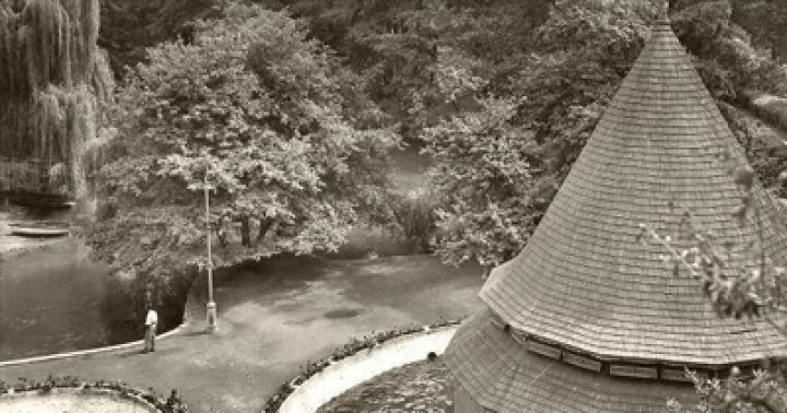
There is a whole group of buildings on the territory:
The jungle has a small area. Everything else is fields. The area outside Angkor is very densely populated
On the territory of Angkor Thom there is this pond in the shape of a man with his arms outstretched (or very similar to it):

Size: approximately 450x450m
Northeast of Angkor Thom we see a small area (along the perimeter of the surrounding canal) Preah Khan temple and another already silted rectangular reservoir:

Perimeter 3.5x0.9 km
In the center of the reservoir there is an island with a pond like this and a structure very similar to a fountain
The reservoir itself is in such thickets. Link to map
There is an even larger body of water nearby:

Perimeter 7x1.7 km
Fields on the expanses of the silted surface of a former reservoir
In the center of the former reservoir there is also a temple or structure:
The entire hydraulic complex is depicted
West of Angkor there are other similar objects:

Link on the map
In the center are the remains of the building. Perhaps the locals stole it for building materials
Another object:

Perimeter 600 x 600m. Link to map
Direction: not to modern north
Remains of buildings
Using Google maps in the vicinity, I found several more small silted reservoirs
The most detailed alternative version of the purpose of this entire complex is described by A. Makhov
He refers all this to the air defense system (air defense). Technical purpose. But very strange. Why such relief delights, bas-reliefs, etc.? At military facilities, everything is ascetic and without frills.
***
I will try to convey my opinion about finding such unnecessary-sized reservoirs (they could have simply dug deeper, but smaller in area).
It is known that Cambodian temples were built using building materials: laterite, sandstone, brick. There is a complete mystery with brick - it needs to be fired, but no kilns have been found. Sandstone - it needs to be mined somewhere and transported. Yeah, through the jungle. I think that this is not sandstone, but concrete. As in the examples
A construction kit made from ancient masonry blocks for modern restorers in Angkor. Agree, we need mountains to cut it all down there. And in the area there is only plain.
But laterite is worth dealing with.
As you can see, laterite is mined simply from under the feet. Most likely, this material for construction (laterite) was mined in the same way in Cambodia. And at the same time it was taken out at the sites of future rectangular channels. At the same time it was beautiful when it was filled with rainwater and protected from animals. And judging by this bas-relief:
In the past, not only elephants lived in the jungle
During the mass production of blocks, entire pits were formed, which were also filled with rainwater. And they, these quarries, are next to the temple complexes. Logistics are minimal. And we also received beautiful view to a reservoir, plus the availability of water during, say, droughts. Fish farming is also possible as a side use.
The laterite blocks themselves most likely petrified in air over the years (reaction with CO2). And initially, their cutting down (as in the photo above) took place with primitive tools such as a hoe. And not even necessarily made of iron.
The purpose of these temples remains a question to this day. After all, these are not residential premises. But this question applies not only to the temples of Cambodia.
Sra Srang, the largest body of water in Angkor, makes a strong impression not only at dawn, when the sun colors its waters and stones in crimson tones. In the light of day, the artificial lake, seemingly huge, forces the inquisitive mind to look for answers to many questions regarding the art of the chosen ones, brought to the highest degree of perfection. Such an ode to irrigation may seem too pompous, but the efforts of numerous research groups, who have been working for many years to study the phenomenon of the irrigation system of the Khmer Empire, have not yet led to a solution main secret. Today, no one can confidently answer how and why this system worked without pumps and lifting devices, sensors and actuators, computer software and local networks. Just a few minutes' drive along the excellent new road towards Siem Reap airport will lead you to where, despite centuries, destruction and disasters, part of it continues to serve the descendants of the brilliant builders a thousand years after its creation.
Even at the very end of the dry season, when the water moves away from the dam several tens of meters, the view of this man-made sea is stunning. Its ramparts are up to 100 meters wide at the base, and their height rises in the west to 20 meters. Now the reservoir is barely two-thirds full, but even this volume of water is difficult to comprehend. Surrounded by green forests, Western Baray stretches from horizon to horizon. In its center, a little to the right observation deck the main gateway, West Mebon sways in the waves, Bakheng Hill rises to the right, and further, to the east, one can see through the haze of Phnom Bok and a dark strip of forest on the slopes of the Kulen Mountains.
The current depth of the reservoir allows the accumulation of up to 80 million cubic meters of moisture. At the beginning of the 11th century, this figure, apparently, could have been almost twice as much. For many years it was filled only with rain, but after the construction of a dam in the area of the Ta Nei temple, some of the water from the Siem Reap River began to flow here again. Some researchers believe that baray was navigable. Up the Siem Reap River, which was incomparably fuller at that time, ships and barges from the Tonle Sap and even sea vessels from the Mekong Delta came here through a system of canals. Just eight hundred meters from the western gate of Angkor Wat were sea gate empires. These assumptions are still awaiting researchers, but the use of Western Baray as a naval seaplane base is an indisputable fact, since it was from here that Viktor Viktorovich Golubev flew over the Angkor region. Over the course of several months in 1932, he took aerial photographs of the territory of the archaeological park, which made it possible to confirm a number of brilliant hypotheses of the Russian scientist.
Judging by the ruins of the West Mebon Temple, which marks the exact geometric center of the reservoir, its construction should have been completed no later than the first quarter of the 11th century. Baray entered into the existing irrigation system and replaced the ditches that surrounded Yashodharapura on the eastern border. The traces of canals and land roads, the remains of buildings found near the Western Baray dam, structural elements, fragments of tiles, ceramics and copper products, examined based on the materials of Golubev’s photographs, allowed us to conclude that this region was densely populated even before the construction of the reservoir. This is confirmed by the texts of an accidentally discovered stele dating back to 713. According to the epigraphic inscription, Queen Jayadevi, the widow of King Jayavarman I, established the boundaries of the rice plots here that she granted to her subjects.
The ruins of the Ak Yom Temple suggest that at least one of the important sanctuaries sank under water or was buried under the thickness of the outer ramparts of Western Baray. The Sdok Kak Thoma stele, which tells the story of a family of clerics in the service of the Khmer kings from 802 to 1052, reports that Jayavarman II, between the construction of Hariharalaya and Mahendraparvata:
"...founded the city of Amarendrapur and its priest settled there to serve the king."
Georges Quedes suggested that Ak Yom, during the study of which the remains of a fence and buildings in the pre-Angkorian style were found, was the central temple of Amarendrapura. For its speedy construction, materials from even more ancient buildings were reused.
Today, Western Baray, in addition to its enduring role as a major hydraulic structure and historical monument, is also a favorite vacation spot for the local population. Magnificent sandy bottom, gently sloping shore, pure water attract hundreds of Khmer families here. It's noisy and fun most of the year.
It makes sense to combine an excursion here with a visit to the Ak Yom Temple, a boat or land trip to the West Mebon Temple, as well as a stunningly interesting trip to a silkworm farm.
Skeptics say that in the past there were no civilizations with advanced technologies and incredible structures. They try to explain every strange artifact or trace of the past from their point of view - they say, this was made by hand, and this is a natural formation.
However, there is such convincing evidence of the presence of advanced civilizations in ancient times that even the most convinced skeptics and rational scientists cannot refute them.
This archaeological site called Sahasralinga is located on the Shalmala River in the Indian state of Karnataka. When summer comes and the water level in the river drops, hundreds of pilgrims come here.

It got its name thanks to the numerous (sahasra = thousands) “Lingas” - stone carvings of the most varied shapes and sizes, carved on stones.
When the river level drops, various mysterious stone figures carved in time immemorial are exposed from under the water. For example, this is an amazing education. Will you claim that it is made by hand?

2. Barabar Caves
Barabar is the general name for a group of caves located in the Indian state of Bihar, near the city of Gaya. Officially, they were created in the 3rd century BC, again, from the point of view of historians, by hand. Whether this is so, judge for yourself.
In our opinion, making such a structure from hard stone - with high ceilings, with such smooth walls, with seams that a razor blade cannot penetrate - is very difficult these days.


3. Southern Stone Baalbek
Baalbek – ancient city, located in Lebanon. It has many different attractions. But what surprises most of all is the Temple of Jupiter with multi-ton marble columns and the Southern Stone - an evenly hewn block weighing 1,500 tons.
Who and how could have made such a monolith in time immemorial and for what purposes - science does not know the answers to this question.

4. Baray Reservoir
Western Baray is an artificially created reservoir in Angkor (Cambodia). The dimensions of the reservoir are 8 km by 2.1 km, and the depth is 5 meters. It was created in time immemorial. The accuracy of the boundaries of the reservoir and the enormity of the work performed are striking - it is believed that it was built by the ancient Khmers.

Nearby are no less amazing temple complexes– Angkor Wat and Angkor Thom, the layout of which is striking in its precision. Modern scientists cannot explain what technologies the builders of the past used.
Here is what Y. Iwasaki, director of the Geological Research Institute in Osaka, Japan, writes:
“Starting from 1906, a group of French restorers worked in Angkor. In the 50s French specialists tried to lift the stones back up the steep embankment. But since the angle of the steep embankment is 40º, after the first 5 m high step was built, the embankment collapsed. Eventually the French abandoned the idea of following historical technology and installed a concrete wall inside the pyramid to preserve the earthworks. Today we do not know how the ancient Khmers could build such high and steep embankments.”
5. Coombe-Mayo Aqueduct
Cumbe Mayo is located near the Peruvian city of Cajamarca at an altitude of about 3.3 km above sea level. There are remains of an ancient aqueduct here, which was clearly not made by hand. It is known that it was built even before the advent of the Inca Empire.

Interestingly, the name Cumbe Mayo comes from the Quechua expression kumpi mayu, which means “well-made water channel.” It is unknown what kind of civilization created it, but it is believed to have happened around 1500 AD.
The Coombe Mayo Aqueduct is considered one of the most ancient structures in South America.
Its length is about 10 kilometers. Moreover, if there were rocks along the ancient path for water, then unknown builders cut a tunnel right through them. Check out the incredible photos and videos of this structure below.


6. Peruvian cities of Sacsayhuaman and Ollantaytambo
Sacsayhuaman and Ollantaytambo are the remains of ancient structures in the Cusco region (Peru), within a huge archaeological park. The area of this park is 5000 square meters, but most of he was buried under an avalanche many years ago.

It is believed that these cities were built by the Incas using the most primitive tools. However, the huge stones of the fortress, tightly fitted to each other, as well as the even traces of cutting stones in both ancient cities, are surprising. The Incas themselves were amazed at the grandeur of these buildings.
The Peruvian Inca historian Garcilaso de la Vega wrote about the Sacsayhuaman fortress: “It amazes with the size of the stone blocks of which it consists; anyone who has not seen this himself will not believe that something can be built from such stones; they inspire horror in those who look at them carefully.”
Look for yourself at its remains and at the blocks from Ollantaytambo and see that it is simply impossible to create something like this manually, without the help of high technology.


7. Moonstone in Peru
Here, in the Cusco region, in the same archaeological park, there is a curious attraction - a stone called Killarumiyoc. This is a Quechua word that literally means "Moonstone". It is believed that this is a sacred place.
People come here for rituals, meditation and cleansing of the soul. Pay attention to its unusual, perfectly symmetrical shape and the incredible quality of finishing.


8. Al Naslaa Stone in Saudi Arabia
This famous cut stone called Al Naslaa is located in the Tabuk province of Saudi Arabia. A perfectly straight cutting line surprises all researchers - the surfaces on both sides are perfectly smooth.
Who exactly cut this stone and how remains a mystery. Scientists are sure that nature did its best here - they say, this is a perfectly straight line - this is a consequence of weathering. But this version seems untenable - there are no similar formations in nature.

9. Ishi-no-Hoden Stone
Near the Japanese city of Takasago there is a famous huge megalith Ishi no Hoden. Its weight is about 600 tons. It is known that it was created before our era. The stone is a local landmark - and looking at its photographs and ancient drawings, you understand why it is so popular.


10. Pyramid of Mikerin
The Pyramid of Mykerinus (or Menkaure) is located in Giza and is one of the Great Pyramids. Moreover, it is the lowest among them - only 66 m in height (half the size of the Cheops pyramid). But she strikes the imagination no less than her famous neighbors.
Huge monolithic blocks were used to build the pyramid, one of them weighing about 200 tons. It still remains a mystery how it was delivered to the construction site. The quality of finishing of the blocks outside and inside the pyramid, as well as the carefully crafted tunnels and internal chambers, is also surprising.


In this pyramid in the 19th century, a mysterious basalt sarcophagus was discovered, which it was decided to send to England. But on the way, the ship encountered a storm and sank off the coast of Spain.
However, this is still not a complete list of amazing sights, looking at which you want to rewrite the history books. And we will definitely talk about them in other publications on this topic.
Skeptical people agree that no civilizations previously existed on our planet, especially those that had developed technologies and themselves created stunning structures of various forms.
Skeptics, accustomed to criticizing everything, dismiss all bold statements in strange artifacts. modern man or natural processes.
But still, sometimes archaeologists discover something that even the most rational people cannot explain. We are talking about civilizations that were so developed for their time that it is impossible to refute them.
Saharaslinga complex
The Indian state of Karnataka, which is located on the banks of the Shalmana River, hides the Saharaslinga - an amazing archaeological complex. Summer is the tourist period in this area.
Pilgrims come here when the water level in the river drops and stone figures that were created many years ago appear before the human eye. Looking at these amazing natural new formations, it is difficult to say that they were created by human hands.
Southern Stone Baalbek

Lebanon also contains stunningly beautiful places. For example, the ancient city of Baalbek. It is full of beautiful places and vibrant attractions.
The temple of the god Jupiter deserves special attention. It amazes with high marble columns and the gigantic South Stone, which weighs 1.5 thousand tons.
Barabar Caves

This name hides a group of caves in India, the state of Bihar. Being close to Guy, they were created back in the 3rd century BC. And according to historians, people built them with their own hands. But it can be very difficult to believe in this.
The caves are amazing:
- high ceilings;
- seams through which even the thinnest blade will not pass;
- smooth rocks.
It’s hard to create something like this even today, with all the existing the latest technologies. As for how this was done thousands of years ago, one can only guess.
Baray Reservoir

This pond is one of the most beautiful places in Cambodia. It is located in the city of Angkor. The dimensions of the artificially created reservoir reach a depth of five meters and 8 meters in width. It was created in very ancient times.
There is a belief that it was built by ancient people - the Khmers. This grandiose creation amazes with the scale of work.
Nearby are Angkor Wat and Angkor Thom - a magnificent architectural heritage, stunning in the precision of its planning elements. Scientists today are unable to explain what technologies and techniques were used by the builders of that time.
Japanese geologist Yoko Iwasaki spoke on this matter. According to him, restorers from France have been working there since the beginning of the last century. They were never able to lift the stone slabs onto the embankment, which prompted them to install a concrete wall and not use the historical method.
Coombe-Mayo Aqueduct

The town of Cajamara, located in the famous Peru, flaunts a level of as much as 3.3 kilometers above the sea.
This area is simply extraordinary, because it was here that archaeologists discovered the ancient remains of an aqueduct. And we can safely say that it was definitely not created by people.

According to some information, it has been established that when the Incas created the empire, the Aqueduct already existed. Interesting fact: In Quechua, the name "Cumbe Mayo" roughly translates to "well-made water channel."
Of course, a specific date cannot be established, but archaeologists believe that it was erected more than 1.5 thousand years BC.

This stunning historical monument is called one of the most ancient of all that is in South America.
Ten kilometers long, the path consists of large rocks, but the builders were not afraid of them, and they cut a passage for water right through and along them. Apparently, they were not afraid of obstacles.
moon pebble

The pebble called “Killarumiyoc” is located in the archaeological park area of the Cusco region. Indians of the tribe under the cute name “Quechua” came up with this word, which literally should be understood as “ Moonstone" There is an ancient belief that the place is sacred.
The territory has an outlandish shape and stunning decoration. It remains unknown in what specific way and with the help of what technological processes such beauty was created so many years ago.
Al Naslaa Stone

In the Tabuk region, located in Saudi Arabia, hides a world-famous curiosity. A pebble that is perfectly cut continues to attract such increased attention - it is smooth and flawless, right on both sides.
Al Naslaa is shrouded in mystery, because absolutely nothing is known about its creation. A number of scientists are confident that the creator of the stone is truly omnipotent - nature itself created it as such, because such ideal lines could only be cut using twisting.

But such a theory is easily broken by real facts - no other such formations exist in nature. In any case, nothing of the kind has been discovered so far.
The cities of Sacsayhuaman and Ollantaytambo

Peru keeps a large number of secrets and mysteries, and archaeological finds always cause resonance, because no explanation has been found for how some things were formed. The same applies to the towns of Sacsayhuaman and Ollantaytambo.
The remains of these settlements found in the Cusco region. Until today, a territory of five thousand square meters has survived, and the lion's part has been erased over time.

There is a belief that these settlements were created by the ancient Incas. And in the hands of these builders there was nothing but the simplest tools.
But it’s hard to believe when you look at the large stones, which fit so tightly that they leave no gaps behind them, creating single structures. It’s also amazing how perfectly the stones in these cities were cut.
Many questions remain, and it is unlikely that anyone will ever be able to tell how these majestic structures were created, of which the Incas themselves were proud and amazed.

Peruvian scientists say that the fortress is amazing because of the huge blocks it was built from. People who haven't seen it with their own eyes can't believe it's even real.
And if you take a closer look, you can be completely horrified by the scale and unknown technology. It is incredible that man built the fortress with only his hands. This is impossible and it makes your blood run cold.
Ishi-no-Hoden Stone

Japan also keeps real secrets. Not far from the town of Takasago, you can see the large famous 600-ton megalith Ishi-no-Hoden.

No one will say the exact dates, but it was built exactly before our era. You only have to look at a photo of this stone once to want to look at it in real life. A local landmark awaits tourists to amaze them and shock them with its grandeur.
Pyramid of Mikerin

One of the most popular pyramids found its place in Giza. She is the smallest - only 66 meters, the same Cheops is twice as tall.
It was built many thousands of years ago, and like other pyramids, it raises questions, striking everyone who sees it. No one knows or understands how the 200-ton monoliths from which it was composed were brought.
It is also not clear how well the finishing work was done, how the tunnels and chambers were created inside. Legends about curses and mystical incidents associated with the pyramids are still preserved. And looking at these buildings, you can believe in anything.