Crimea today is the blessed land of the Crimean Peninsula, washed by the Black and Azov Seas. In the north there is a plain, in the south - the Crimean Mountains with a necklace near the coastal strip of seaside resort cities: Yalta, Miskhor, Alupka, Simeiz, Gurzuf, Alushta, Feodosia, Evpatoria and seaports - Kerch, Sevastopol.
Crimea is located within 44°23" (Cape Sarych) and 46°15" (Perekopsky Ditch) northern latitude, 32°30" (Cape Karamrun) and 36°40" (Cape Lantern) eastern longitude. The area of the Crimean peninsula is 26.0 thousand km the maximum distance from north to south is 205 km, from west to east – 325 km.
A narrow eight-kilometer strip of land to the north (Perekop Isthmus) connects Crimea from the continents, and 4-5 km - the width of the Kerch Strait in the east (the length of the strait is about 41 km) - separates it from the Taman Peninsula. The total length of the borders of Crimea exceeds 2,500 km (taking into account the extreme tortuosity of the coastline of the northeast). In general, the coasts of Crimea are little indented; the Black Sea forms three large bays: Karkinitsky, Kalamitsky and Feodosiya; The Sea of Azov also formed three bays: Kazantipsky, Arabatsky and Sivashsky.
The physical and geographical position of Crimea as a whole is distinguished by the following most characteristic features. Firstly, the location of the peninsula at 45° north latitude determines its equidistance from the equator and the North Pole, which is associated with a fairly large amount of incoming solar energy and a large number of hours of sunshine. Secondly, Crimea is almost an island. This is associated, on the one hand, with a large number of endemics (plant species that are not found anywhere except in a given area) and endemics (similar animal species); on the other hand, this explains the significant depletion of the Crimean fauna; In addition, the climate and other components of nature are significantly influenced by the marine environment. Thirdly, the position of the peninsula relative to the general circulation of the Earth’s atmosphere is especially important, leading to the predominance of westerly winds in Crimea. Crimea occupies a border position between the temperate and subtropical geographical zones.
The peculiarities of the transport and geographical position of Crimea in the past determined the nature of the population of the peninsula and the specifics of its economy. In the Middle Ages, Crimea was a kind of dead end on the path of many nomadic tribes. Many settled here and adopted the local languages, culture and religion.
The maritime environment of Crimea determined not only the peculiarities of external economic relations, but also the development of coastal recreation. Through the Danube and Dnieper rivers, Crimea has access to the ports of Central Europe, the Baltic and Scandinavian countries, and through the Don and the canal system of European Russia - to the Baltic and White seas, Caspian states.
A favorable feature of the economic and geographical position of Crimea is its proximity to the economically developed Kherson and Zaporozhye regions of Ukraine and to Krasnodar region Russian Federation.
The nature of Crimea is called a natural museum. There are few places in the world where diverse, comfortable and picturesque landscapes are combined in such an original way. They are largely due to the unique geographical location, geological structure, relief, climate of the peninsula. The Crimean Mountains divide the peninsula into two unequal parts. The large one - the northern one - is located in the extreme south of the temperate zone, the southern one - the Crimean sub-Mediterranean - belongs to the northern edge of the subtropical zone.
The flora of Crimea is especially rich and interesting. Wild higher plants alone account for more than 65% of the flora of the entire European part of the Commonwealth countries. Along with this, about 1000 species of foreign plants are cultivated here. Almost the entire flora of Crimea is concentrated in its southern mountainous part. This is truly a museum richness of flora.
The climate of most of Crimea is a temperate climate: mild steppe - in the flat part; more humid, characteristic of deciduous forests - in the mountains. The southern coast of Crimea is characterized by a sub-Mediterranean climate of dry forests and bushes.
Crimea, especially its mountainous part, thanks to its comfortable climate, saturation clean air, toned with phytoncides, sea salts, and the pleasant aroma of plants, it also has great healing powers. The depths of the earth also contain healing mud and mineral water.
Crimean peninsula provided with a large amount of heat not only in summer, but also in winter. In December and January, 8-10 times more heat per unit of earth's surface per day is received here than, for example, in St. Petersburg. Crimea receives the greatest amount of solar heat in the summer, especially in July. Spring here is cooler than autumn. And autumn is the best season of the year. The weather is calm, sunny and moderately warm.
True, sharp fluctuations in pressure during the day aggravate cardiovascular diseases in people who are not completely healthy. In Crimea, which is well supplied with heat, the biological productivity of plants, including agricultural crops, and the resistance of landscapes to stress largely depend on the amount of moisture. And the need for water is constantly increasing both among the local population and the national economy, primarily in agriculture and resorts. So water in Crimea is the true engine of life and culture.
A relatively small amount of precipitation, a long dry summer, and the spread of karst rocks in the mountains have caused the Crimea to be poor in surface water.
Crimea is divided into two parts: a flat steppe with a very small number of surface watercourses and a mountain forest with a relatively dense river network. There are no large fresh lakes here. In the coastal strip of the Crimean plain there are about 50 lakes with a total area of 5.3 thousand km2.
In Crimea there are 1657 rivers and temporary watercourses with a total length of 5996 km. Of these, about 150 rivers are dwarf rivers up to 10 km in length. The Salgir River alone is more than 200 km long. The river network is developed extremely unevenly on the peninsula.
Depending on the direction of surface water flow, it is customary to divide the rivers of Crimea into three groups: rivers on the northwestern slopes of the Crimean Mountains, rivers on the southern coast of Crimea, and rivers on the northern slopes of the Crimean Mountains.
All rivers on the northwestern slopes flow almost parallel to each other. Until about the middle of their course, they look like typical mountain streams. The largest of them are Alma, Kacha, Belbek and Chernaya.
The rivers of the southern coast of Crimea are short, have very steep channel slopes, and are violent during floods.
In the west, in addition to the usually dry ravines and the Khastabash stream, the largest is the Uchan-Su River. Rapidly running down to the sea, it forms waterfalls in four places. The uppermost and largest of them is Uchan-Su (Flying Water).
The rivers of the northern slopes of the Crimean Mountains are distinguished by the fact that outside the mountains they deviate to the east and flow into the Sivash lagoon Sea of Azov. In the upper reaches of the river there is always water, but within the plains in summer their beds are often dry.
Salgir is the longest river in Crimea. Together with the Biyuk-Karasu tributary, it represents the largest water system in Crimea. The upper reaches of the Salgir are formed from the confluence of the Angara and Kizil-Koba rivers. Near the village of Zarechnoye, a large tributary, the Ayan, flows into the Salgir.
Salgir fills the large Simferopol reservoir, built in 1951-1955. Below Simferopol, the river receives right tributaries - the Beshterek, Zuya, Burulcha rivers, and 27 km from Sivash - Biyuk-Karasu. The Taiganskoye and Belogorskoye reservoirs were built on Biyuk-Karasu.
The population of Crimea is distributed unevenly across the territory. 50% of the republic's population lives on the coast. In 1991, 69% of the population lived in cities, and 31% of the population lived in rural areas. 43% of the Crimean population lives in four major cities: Sevastopol (371.4 thousand people in 1991), Simferopol (357 thousand people), Kerch (189.5 thousand people) and Evpatoria (113.3 thousand people).
Crimea is characterized by an increase in the number of cities and towns and relative stability of rural settlements. In recent years, cities such as Sudak, Krasnoperekopsk, Armyansk, and Shchelkino have appeared on the map of Crimea. The number of urban-type settlements is growing rapidly—more than doubling since 1959.
The bulk of the population of Crimea are workers (about 60 percent), office workers - 28, peasants - less than 11 percent.
Crimea has always been distinguished not only by its high proportion of urban population, but also high level literacy and education of residents. For every thousand inhabitants in cities there were 900, and in villages 730 people with higher, secondary specialized and secondary education.
The training of highly qualified specialists is carried out by 6 state higher educational institutions (Simferopol State University, Crimean Medical Institute, Crimean Agricultural Institute, Sevastopol Instrument-Making Institute, Crimean Institute of Environmental and Resort Construction, Crimean State Industrial Pedagogical Institute), two branches of universities - Kiev Economic University (in Simferopol) and the Kaliningrad Fishing University (in Kerch), as well as several commercial universities.
Military specialists are trained by the military institute in Sevastopol and the civil engineering school in Simferopol.
In recent years, colleges have been created on a commercial basis. 30 secondary specialized educational institutions are engaged in training specialists. Vocational schools train personnel in 120 specialties.
Academic institutes and cultural institutions operate in Crimea. In Simferopol there is the Crimean branch of the National Academy of Sciences of Ukraine, the production association "Efirmaslo", "KrymNIIproekt", in the village of Nauchny - the Crimean Astrophysical Observatory and others.
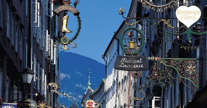
There are several professional theaters and a philharmonic society, an art gallery in Feodosia. A large number of newspapers are published. There are publishing houses “Tavrida”, “Tavriya”, “Krymuchpedgiz” and others. There are a large number of museums in Crimea, many of which are associated with the destinies of outstanding writers, artists, and scientists who lived on the peninsula.
The economic appearance of Crimea, its structure, and the nature of the location of production and population developed mainly in accordance with its natural and socio-economic conditions.
Until 1917, the republic's economy was predominantly agricultural. Gradually it developed into an industrial-agrarian one.
Crimea is distinguished by its diversified agricultural and recreational industries, the production of soda ash, titanium dioxide, sulfuric acid, technological equipment for the food industry, televisions, ocean-going ships, fish and fish products. In addition to mechanical engineering, the chemical industry, agriculture and recreation, sectors of specialization also include the food industry, producing grape wines, canned fruits and vegetables, and essential oils.
In the structure of industrial production, the leading place belongs to the food industry, followed by mechanical engineering and metalworking, the chemical industry, and the building materials industry.
Crimean agriculture is specialized in grain and livestock farming, viticulture, horticulture, vegetable growing, as well as in the cultivation of essential oil crops (lavender, roses, sage). The volumes of gross production of livestock and crop products are balanced.
Maritime transport is important for the republic. Export-import transportation of various cargoes is carried out through Crimean ports. The most important ports are Kerch, Feodosia, Yalta, Evpatoria. The largest port city is Sevastopol.
By air, Crimea is connected with all CIS countries and many foreign countries.
The recreational sector is one of the leading sectors of the republic. From Latin, recreation is translated as “restoration”, meaning the restoration of a person’s physical and psychophysiological conditions. The recreational sector includes: sanatoriums, boarding houses, houses and recreation centers, tourist hotels and tourist centers, campsites, children's camps. The recreational sector operates on beach, balneological and climatic resources, therapeutic mud, sea water, and landscape resources.
The sectors of Crimea's social infrastructure - public utilities, consumer services, public education, public catering, trade, healthcare, social security, culture, physical education, lending and insurance, science and scientific services - are distinguished by a high level of development.The Republic of Crimea occupies the territory of the Crimean Peninsula.
The territory of the Republic of Crimea is 26.1 thousand square meters. km.
Length: from west to east – 360 km, from north to south – 180 km.
Extreme points: in the south - Cape Sarych; in the west – Cape Priboyny; in the east – Cape Lantern.
The most important seaports are Evpatoria, Yalta, Feodosia, Kerch.
Related regions: Krasnodar region of the Russian Federation, Kherson region of Ukraine.
The climate of the peninsula differs in its different parts: in the northern part it is temperate continental, on the southern coast it has subtropical features. Crimea is characterized by a small amount of precipitation throughout the year, a large number of sunny days, and the presence of breezes on the coast.
The relief of the Crimean peninsula consists of three unequal parts: the North Crimean Plain with the Tarkhankut Upland (about 70% of the territory), the Kerch Peninsula and in the south - the mountainous Crimea stretches in three ridges. The highest is the Main Range of the Crimean Mountains (1545 m, Mount Roman-Kosh), consisting of individual limestone massifs (yayls) with plateau-like peaks, deep canyons. The southern slope of the Main Ridge stands out as the Crimean sub-Mediterranean. The Inner and Outer ridges form the Crimean foothills.
The Crimean peninsula is washed by the Black and Azov seas.
The natural reserve fund includes 158 objects and territories (including 46 of national importance, the area of which is 5.8% of the area of the Crimean Peninsula). The basis of the reserve fund is 6 nature reserves with a total area of 63.9 thousand hectares: Krymsky with the branch “Swan Islands”, Yalta Mountain Forest, Cape Martyan, Karadagsky, Kazantipsky, Opuksky.
Crimea is a peninsula richly endowed natural resources. Its depths and the adjacent shelf contain industrial deposits of iron ore, combustible gas, mineral salts, construction raw materials, oil and gas condensate.
Natural ones are more important recreational resources peninsula: mild climate, warm sea, healing mud, mineral waters, picturesque landscapes.
The largest rivers are Salgir, Indol, Biyuk-Karasu, Chornaya, Belbek, Kacha, Alma, Bulganakh. The longest river in Crimea is Salgir (220 km), the deepest is Belbek (water flow - 1500 liters per second).
There are more than 50 salt lakes in Crimea, the largest of them is Lake Sasyk (Kunduk) - 205 sq. km.
The population of Crimea as of January 1, 2013 is 1 million 965.2 thousand people. Including the economically active population is 970.3 thousand people, or less than 50% of the total population.
About 130 ethnic groups live in the Republic of Crimea. The largest ethnic groups are Russians (58.3%), Ukrainians (24.3%) and Crimean Tatars (12.1%).
Official languages: Russian, Ukrainian, Crimean Tatar.
Time zone: MSK (UTC+4).
Administrative-territorial structure: cities of republican significance - 11, districts - 14.
The capital of the Republic of Crimea is the city of Simferopol.
The representative body of the Republic of Crimea is the State Council of the Republic of Crimea.
The executive body of the Republic of Crimea is the Council of Ministers of the Republic of Crimea.
The Republic of Crimea has symbols: coat of arms, flag and anthem.
Crimea is located within 44o23′ (Cape Sarych) and 46o15′ (Perekopsky Ditch) northern latitude and 32o30′ (Cape Karamrun) and 36o40′ (Cape Lantern) eastern longitude. The area of the Crimean Peninsula is 26.0 thousand km2, the maximum distance from north to south is 205 km, from west to east – 325 km.
A narrow eight-kilometer strip of land in the north (Perekop Isthmus) connects Crimea with the mainland, and 4-5 km - the width of the Kerch Strait in the east (the length of the strait is about 41 km) - separates it from the Taman Peninsula. The total length of the borders of Crimea exceeds 2500 km (taking into account the extreme tortuosity coastline northeast). In general, the coasts of Crimea are little indented; the Black Sea forms three large bays: Karkinitsky, Kalamitsky and Feodossiysky; The Sea of Azov also forms three bays: Kazantipsky, Arabatsky and Sivashsky.
Physical-geographical position of Crimea generally distinguished by the following most characteristic features. Firstly, the location of the peninsula at 45° north latitude determines its equal distance from the equator and the North Pole, which is associated with a fairly large amount of incoming solar energy and a large number of hours of sunshine. Secondly, Crimea is almost an island. This is associated, on the one hand, with a large number of endemics (plant species found nowhere else except in this area) and endemics (similar animal species); on the other hand, this explains the significant deprivation of the Crimean fauna; In addition, the climate and other natural components are significantly influenced by the marine environment. Thirdly, the position of the peninsula relative to the general circulation of the Earth’s atmosphere is especially important, leading to the predominance of westerly winds in Crimea. Crimea occupies a border position between the temperate and subtropical geographical zones.
Features of the transport and geographical position of Crimea in the past determined the nature of the population of the peninsula and the specifics of its economy. In the Middle Ages, Crimea was a kind of dead end on the path of many nomadic tribes. Many settled here and adopted local languages, culture, and religion.
The maritime environment of Crimea determined not only the peculiarities of external economic relations, but also the development of coastal recreation. Crimea has access to ports through the Danube and Dnieper rivers Central Europe, Baltic and Scandinavia, and through the Don and the canal system of European Russia - to the Baltic and White Seas, the Caspian states.
A favorable feature of the economic and geographical position of Crimea is its proximity to the economically developed Kherson and Zaporozhye regions of Ukraine and the Krasnodar region of the Russian Federation.
State and territorial structure
The capital of the Autonomous Republic of Crimea is the city of Simferopol. The territorial-administrative structure of Crimea includes villages, urban-type settlements, and cities. Sevastopol has a special status as a “separate administrative unit”, but is an integral part of Crimea.
Languages used in Crimea– Russian, Ukrainian, Crimean Tatar.
The central figure of the Crimean coat of arms is a white (silver) griffin holding a shell with a blue (azure) pearl in its raised paw. The griffin (a winged lion with an eagle head) is a mythological creature - a symbol of the ancient cities of Chersonesus, Panticapaeum and others, and in later times - the cities of Sevastopol and Kerch.
Since ancient times, the griffin has been credited with protective properties. On the coat of arms of Crimea he is depicted as a symbol of the guardian and defender of the republic. The Blue Pearl symbolizes Crimea as a unique corner of the planet, the unity of all its peoples, religions and cultures.
The griffin is placed on the Varangian shield (small coat of arms) - a symbol of the intersection of important trade routes, and its red color is a symbol of courage, bravery and courage of the peoples of Crimea of all centuries.
The shield is supported by antique marble columns. The top of the coat of arms is the rising golden sun - a symbol of revival and prosperity, warmth and light.
Under the shield, wrapped in rings around the columns, there is a blue-white-red (the colors of the Crimean flag) motto ribbon with the inscription: “Prosperity in unity.”
Nature of Crimea
The nature of Crimea is called a natural museum. There are few places in the world where a variety of comfortable and picturesque landscapes are so originally combined. They are largely due to the unique geographical location, geological structure, relief, and climate of the peninsula. The Crimean Mountains divide the peninsula into two unequal parts. The large one - the northern one - is located on the extreme temperate zone, the southern one - the Crimean sub-Mediterranean - belongs to the northern edge of the subtropical zone.
Particularly rich and interesting vegetable world Crimea. Wild higher plants alone account for more than 65% of the flora of the entire European part of the Commonwealth countries. Along with this, about 1000 species of foreign plants are cultivated here. Almost the entire flora of Crimea is concentrated in its southern mountainous part. This is truly a museum richness of flora.
Climate of most of Crimea– this is a temperate zone climate: mild steppe – in the flat part; more humid, characteristic of deciduous forests - in the mountains. The southern coast of Crimea is characterized by a sub-Mediterranean climate of dry forests and bushes.
The Crimean peninsula is provided with a large amount of heat not only in summer, but also in winter. In December and January, 8-10 times more heat per unit of earth's surface per day is received here than, for example, in St. Petersburg.
Crimea receives the greatest amount of solar heat in the summer, especially in July. Spring here is cooler than autumn. And autumn - best season of the year. The weather is calm, sunny and moderately warm. True, sharp fluctuations in pressure during the day sharply aggravate cardiovascular diseases in people who are not entirely healthy.
In Crimea, which is well supplied with heat, the biological productivity of plants, including agricultural crops, and the resistance of landscapes to stress largely depend on the amount of moisture. And the need for water is constantly increasing both among the local population and the national economy, primarily in agriculture and resorts. So water in Crimea is the true engine of life and culture.
A relatively small amount of precipitation, a long dry summer, and the spread of karst rocks in the mountains have caused the Crimea to be poor in surface water. Crimea is divided into two parts: a flat steppe with a very small number of surface watercourses and a mountain forest with a relatively dense river network. There are no large fresh lakes here. In the coastal strip of the Crimean plain there are about 50 estuary lakes with a total area of 5.3 thousand sq. km.
In Crimea there are 1657 rivers and temporary watercourses with a total length of 5996 km. Of these, about 150 rivers are dwarf rivers up to 10 km in length. The Salgir River alone is more than 200 km long. The river network is developed extremely unevenly on the peninsula.
Depending on the direction of surface water flow, it is customary to divide the rivers of Crimea into three groups: rivers on the northwestern slopes of the Crimean Mountains, rivers on the southern coast of Crimea, and rivers on the northern slopes of the Crimean Mountains.
All rivers on the northwestern slopes flow almost parallel to each other. Until about the middle of their course, they look like typical mountain streams. The largest of them are Alma, Kacha, Belbek and Chernaya.
The rivers of the southern coast of Crimea are short, have very steep channel slopes, and are violent during floods.
In the west, in addition to the usually dry ravines and the Khastabash stream, the largest is the Uchan-Su River. Rapidly running down to the sea, it forms waterfalls in four places. The uppermost and largest of them (Flying Water).
The rivers of the northern slopes of the Crimean Mountains are distinguished by the fact that outside the mountains they deviate to the east and flow into Sivash, a lagoon of the Azov Sea. In the upper reaches of the river there is always water, but within the plains in summer their beds are often dry.
Salgir is the longest river in Crimea. Together with the Biyuk-Karasu tributary, it represents the largest water system in Crimea. The upper reaches of the Salgir are formed from the confluence of the Angara and Kizil-Koba rivers. Near the village of Zarechnoye, a large tributary, the Ayan, flows into the Salgir. Salgir fills the large Simferopol reservoir, built in 1951-1955. Below Simferopol, the river receives right tributaries - the rivers Beshterek, Zuya, Burulcha, and 27 km from Sivash - Biyuk-Karasu. The Taiganskoye and Belogorskoye reservoirs were built on Biyuk-Karasu.
Population of Crimea
The population of Crimea is distributed unevenly across the territory. 50% of the republic's population lives on the coast. In 1991, 69% lived in cities, 31% of the population lived in rural areas. 43% of the Crimean population lives in four large cities: Sevastopol (371.4 thousand people in 1991), Simferopol (357 thousand people), Kerch (189.5 thousand people) and Evpatoria (113.3 thousand people).
Crimea is characterized by an increase in the number of cities and towns and relative stability of rural settlements. In recent years, cities such as, Krasnoperekopsk, Armyansk, have appeared on the map of Crimea. The number of urban-type settlements is growing rapidly – more than doubling since 1959.
The bulk of the population of Crimea are workers (about 60 percent), office workers - 28, peasants - less than 11 percent.
Education
Crimea has always been distinguished not only by a high proportion of the urban population, but also by a high level of literacy and education of its residents. For every thousand inhabitants in cities there were 900, and in villages 730 people with higher, secondary specialized and secondary education.
The training of highly qualified specialists is carried out by 6 state higher educational institutions (Simferopol State University, Crimean Medical Institute, Crimean Agricultural Institute, Sevastopol Instrument-Making Institute, Crimean Institute of Environmental and Resort Construction, Crimean State Industrial Pedagogical Institute), two branches of universities - Kiev Economic University (in Simferopol) and the Kaliningrad Fishing University (in Kerch), as well as several commercial universities.
Military specialists are trained by the military institute in Sevastopol and the civil engineering school in Simferopol.
In recent years, colleges have been created on a commercial basis. 30 secondary specialized educational institutions are engaged in training specialists. Vocational schools train personnel in 120 specialties.
Academic institutes and cultural institutions operate in Crimea. There are several professional theaters and a philharmonic society, an art gallery in Feodosia. A large number of newspapers are published. There are a large number of museums in Crimea, many of which are associated with the destinies of outstanding writers, artists, and scientists who lived on the peninsula.
Economic appearance of Crimea
The economic appearance of Crimea, its structure, and the nature of the location of production and population developed mainly in accordance with its natural and socio-economic conditions.
Until 1917, the republic's economy was predominantly agricultural. Gradually it developed into an industrial-agrarian one.
Crimea is distinguished by its diversified agricultural and recreational industries, the production of soda ash, titanium dioxide, sulfuric acid, technological equipment for the food industry, televisions, ocean-going ships, fish and fish products. In addition to mechanical engineering, the chemical industry, agriculture and recreation, sectors of specialization also include the food industry, producing grape wines, canned fruits and vegetables, and essential oils.
In the structure of industrial production, the leading place belongs to the food industry, followed by mechanical engineering and metalworking, the chemical industry, and the building materials industry.
Crimean agriculture is specialized in grain and livestock farming, viticulture, horticulture, vegetable growing, as well as in the cultivation of essential oil crops (lavender, roses, sage). The volumes of gross production of livestock and crop production are balanced.
Maritime transport is important for the republic. Export-import transportation of various cargoes is carried out through Crimean ports. The most important ports are Kerch, Feodosia, Yalta, Evpatoria. The largest port city is Sevastopol.
Recreational economy is one of the leading industries of the republic. From Latin, recreation is translated as “restoration,” meaning the restoration of a person’s physical and psychophysiological conditions. The recreational facilities include; sanatoriums, boarding houses, houses and recreation centers, tourist hotels and camp sites, campsites, children's camps. The recreational sector operates on beach, balneological and climatic resources, therapeutic mud, sea water, and landscape resources.
Sectors of social infrastructure of Crimea- public utilities, consumer services, public education, public catering, trade, healthcare, social security, culture, physical education, lending and insurance, science and scientific services - are distinguished by a high level of development.
Borders and geographical location. The Autonomous Republic of Crimea (from 1954 to 1991 Crimean region) is part of Russia.
Administrative borders in the north run along the Perekopsky Val and Sivash. In the northeast of the peninsula there is a long sand spit - Arabat arrow, and its northern, wider half belongs to the Kherson region of Ukraine. And the opposite “corner” of Crimea is occupied by the hero city of Sevastopol, which has a special status and, for the most part, issues of economic life, is separate from the Crimean Republic.
The capital of Crimea, the city of Simferopol (about 400 thousand inhabitants), the center of business and cultural life, links together all the roads of the peninsula.
The equidistance of Crimea from the Equator and the North Pole, its border position at the junction of Europe and Asia, forever determined its role as a crossroads of peoples and civilizations with an extraordinary variety of natural and historical monuments, as well as modern economics and culture.
Square. 25 thousand square kilometers for an island or peninsula this is a lot. This is usually enough for the whole state. Crimea is slightly smaller than Belgium, Albania or Haiti, but larger than Israel, Cyprus, Lebanon, Jamaica. It can be noted that Crimea, like all these small countries, is distinguished by a variety of natural conditions, a combination of mountains and plains, is favorable for agriculture and has a convenient sea coast.
Relief. The plain Crimea differs little from the steppes of neighboring regions of Russia and Ukraine, but in the west they turn into the limestone ledges of Tarkhankut, and in the east into the hilly ridges of the Kerch Peninsula.
The Crimean Mountains stretch in three parallel ridges from Sevastopol to Feodosia for 150 kilometers. Their northern slopes are gentle, and their southern slopes are steep. The two lower ridges make up the Crimean foothills, cut into separate massifs by picturesque river valleys; and the Main Ridge stands as a continuous barrier, the height of which almost everywhere exceeds a thousand meters ( highest point Roman-Kosh, 1545).
The ridge hides a narrow strip of land from the cold winds at its southern steep cliff - the famous South coast Crimea.
Climate. The southern coast of Crimea from Cape Aya in the west to Mount Kara-Dag in the east is called the sub-Mediterranean Sea for the proximity of the main features of its climate (sunshine, air temperature, precipitation regime), flora and fauna to the coast Mediterranean Sea, subtropics. The northern, flat part of Crimea has a continental climate of the temperate zone.
Summer in Crimea is hot and sunny everywhere, dry - only sometimes with short refreshing showers. Its boundaries can be considered mid-May and the end of September; Autumn pampers you with quiet sunny days (even weeks), but also treats you with plenty of rain. Winter is not much different from autumn, but in the mountains it is simply a miracle: dry frosty air, clean fluffy snow - tens of thousands of Crimeans go on weekends to the areas of the Angarsk Pass and Ai-Petri Mountains. In spring, the deep-water Black Sea warms up near Yalta and Alushta more slowly than on the western or eastern coast of Crimea. Therefore, March and April with their lush flowering are especially good for west coast and in the Foothills.
The relative air humidity in Crimea is almost always and everywhere low - within 65 - 80%; it is easy to breathe here even in the heat. The Yalta region, according to long-term data, has the lowest relative humidity in Europe. The passion for exoticism and tourism to countries with a humid tropical climate has recently become literally unhealthy, especially for the cardiovascular system. It is worth recalling that for Europeans the dry subtropics are the healthiest climate.
Rare plants and animals, unique landscapes that the peninsula is so rich in, are under conservation protection. Their total area is about 700 square kilometers, which is more than 2.5% of the territory of Crimea, one of the highest indicators of reserve saturation for the CIS countries. Many of the protected areas are visited by tourists; here you are required to be especially careful about nature.
Population Crimea, including Sevastopol, is about 2 million 700 thousand people, this is quite a lot, its density exceeds the average, for example, for the Baltic republics by 1.5 - 2 times. In August, up to 2 million visitors are simultaneously on the peninsula.
Now the main part of the population is Russians, then Ukrainians, Crimean Tatars, a significant proportion of Belarusians, Jews, Armenians, Greeks, Germans, Bulgarians, Gypsies, Poles, Czechs, Italians. The small peoples of Crimea - the Karaites and Krymchaks - are small in number, but still noticeable in culture.
Russian continues to be the language of interethnic communication. Also official languages The republics are Ukrainian and Crimean Tatar.
Economy. Our cities are famous for mechanical engineering and instrument production. Crimea is one of the oldest granaries of the world. The gardens and vineyards of the sunny peninsula do not need special praise. And in terms of essential oil crops, Crimea simply has no equal. The food industry is of export importance. The honor of the Crimean brand is maintained by dozens of rural canning shops. Well, the finest Crimean muscats are the best in the world; wines of other brands also meet the most demanding taste.
Currency exchange. Currency exchange in Crimea has some peculiarities. Usually the most favorable exchange rate is in the center of Simferopol. The exchange rate at the railway station and at Simferopol airport is slightly lower. But the highest demand for currency is in Yalta and Alushta, so the exchange of hryvnia, dollar and euro is carried out there at the lowest exchange rate. Exchange offices are numerous and work almost without breaks or days off.