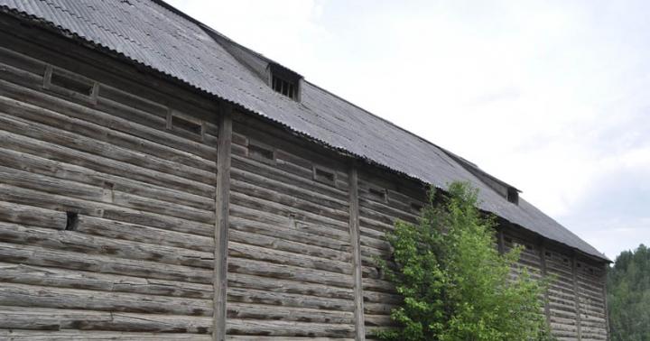
Solarshakti / flickr.com View of the snow-capped Himalayas (Saurabh Kumar_ / flickr.com) The Great Himalayas - view on the way to Leh from Delhi (Karunakar Rayker / flickr.com) You will have to cross this bridge if you are going to Everest Base Camp (ilker ender / flickr.com) The Great Himalayas (Christopher Michel / flickr.com) Christopher Michel / flickr.com Christopher Michel / flickr.com Sunset on Everest (旅者河童 / flickr.com) The Himalayas from a plane (Partha S. Sahana / flickr.com) Lukla Airport, Patan, Kathmandu. (Chris Marquardt / flickr.com) Valley of Flowers, Himalayas (Alosh Bennett / flickr.com) Himalayan Landscape (Jan / flickr.com) Bridge over the Ganges (Asis K. Chatterjee / flickr.com) Kanchenjunga, Indian Himalayas(A.Ostrovsky / flickr.com) Climber at sunset, Nepal Himalayas (Dmitry Sumin / flickr.com) Manaslu - 26,758 feet (David Wilkinson / flickr.com) Animal world Himalayas (Chris Walker / flickr.com) Annapurna (Mike Behnken / flickr.com) On the border of India and Tibet in Kinnaur Himachal Pradesh (Partha Chowdhury / flickr.com) A nice place in Kashmir (Kashmir Pictures / flickr.com) Abhishek Shirali / flickr.com Parfen Rogozhin / flickr.com Koshy Koshy / flickr.com valcker / flickr.com Annapurna Base Camp, Nepal (Matt Zimmerman / flickr.com) Annapurna Base Camp, Nepal (Matt Zimmerman / flickr.com)
Where are the Himalaya mountains, the photos of which are so amazing? For most people, this question is unlikely to cause difficulty, at least they will answer exactly on which continent these mountains stretch.

If you look at geographical map, then you can see that they are located in the northern hemisphere, in South Asia, between the Indo-Gangetic Plain (in the south) and the Tibetan Plateau (in the north).
In the west they pass into the Karakoram and Hindu Kush mountain systems.
The peculiarity of the geographical location of the Himalayas is that they are located on the territory of five countries: India, Nepal, China (Tibet Autonomous Region), Bhutan and Pakistan. The foothills also cross the northern edge of Bangladesh. The name of the mountain system can be translated from Sanskrit as “abode of snow.”
Height of the Himalayas
The Himalayas contain 9 of the 10 highest peaks on our planet, including the highest point in the world - Chomolungma, which reaches an altitude of 8848 m above sea level. Her geographical coordinates: 27°59′17″ north latitude 86°55′31″ east longitude. The average height of the entire mountain system exceeds 6000 meters.
Highest peaks of the Himalayas
Geographical description: 3 main stages
The Himalayas form three main stages: the Siwalik Range, the Lesser Himalayas and the Greater Himalayas, each higher than the previous one.
- Siwalik Range– the southernmost, lowest and geologically youngest step. It stretches for approximately 1,700 km from the Indus Valley to the Brahmaputra Valley with a width ranging from 10 to 50 km. The height of the ridge does not exceed 2000 m. Siwalik is located mainly in Nepal, as well as in the Indian states of Uttarakhand and Himachal Pradesh.
- The next step is the Lesser Himalayas, they run north of the Siwalik ridge, parallel to it. The average height of the ridge is about 2500 m, and in the western part it reaches 4000 m. The Siwalik Range and the Lesser Himalayas are strongly cut by river valleys, breaking up into separate massifs.
- Greater Himalayas- the northernmost and highest step. The height of individual peaks here exceeds 8000 m, and the height of the passes is more than 4000 m. Glaciers are widely developed. Their total area exceeds 33,000 square kilometers, and the total reserves fresh water they contain about 12,000 cubic kilometers. One of the largest and most famous glaciers, Gangotri, is the source of the Ganges River.
Rivers and lakes of the Himalayas
The three largest rivers of South Asia - the Indus, Ganges and Brahmaputra - begin in the Himalayas. The rivers of the western tip of the Himalayas belong to the Indus basin, and almost all other rivers belong to the Ganges-Brahmaputra basin. The easternmost edge of the mountain system belongs to the Irrawaddy basin.
There are many lakes in the Himalayas. The largest of them are Lake Bangong Tso (700 km²) and Yamjo-Yumtso (621 km²). Lake Tilicho is located at an absolute elevation of 4919 m, which makes it one of the highest in the world.
Climate
The climate in the Himalayas is quite varied. The southern slopes are strongly influenced by the monsoons. The amount of precipitation here increases from west to east from less than 1000 mm to more than 4000 mm.

On the India-Tibet border in Kinnaur Himachal Pradesh (Partha Chowdhury / flickr.com)
The northern slopes, on the contrary, are in the rain shadow. The climate here is arid and cold.
In the highlands there are severe frosts and winds. In winter, temperatures can drop to minus 40 °C or even lower.
The Himalayas have a strong influence on the climate of the entire region. They act as a barrier to the cold, dry winds blowing from the north, making the climate of the Indian subcontinent much warmer than neighboring Asian regions at the same latitudes. In addition, the Himalayas are a barrier to the monsoons, which blow from the south and bring huge amounts of rainfall.
High mountains prevent these moist air masses from flowing further north, making Tibet's climate very dry.
It is believed that the Himalayas played a significant role in the formation of the deserts of Central Asia, such as the Taklamakan and Gobi, which is also explained by the rain shadow effect.
Origin and geology
Geologically, the Himalayas are one of the youngest mountain systems in the world; refers to the Alpine folding. It is composed mainly of sedimentary and metamorphic rocks, folded and raised to a considerable height.
The Himalayas were formed as a result of the collision of the Indian and Eurasian lithospheric plates, which began approximately 50-55 million years ago. This collision closed the ancient Tethys Ocean and formed an orogenic belt.
Flora and fauna
The flora of the Himalayas is subject to altitudinal zonation. At the foot of the Siwalik range, the vegetation consists of swampy forests and thickets, locally known as “terai”.

Himalayan Landscape (Jan / flickr.com)
Higher up they are replaced by evergreen tropical, deciduous and coniferous forests, and even higher by alpine meadows.
Deciduous forests begin to prevail at absolute elevations of more than 2000 m, and coniferous forests – above 2600 m.
At an altitude of more than 3500 m, shrubby vegetation predominates.
On the northern slopes, where the climate is much drier, the vegetation is much poorer. Mountain deserts and steppes are common here. The height of the snow line varies from 4500 (southern slopes) to 6000 m (northern slopes).

Wildlife of the Himalayas (Chris Walker / flickr.com)
The local fauna is quite diverse and, like vegetation, depends mainly on the altitude above sea level. The fauna of tropical forests on the southern slopes is characteristic of the tropics. Elephants, rhinoceroses, tigers, leopards, and antelopes are still found here in the wild; monkeys are numerous.
Higher up you can find Himalayan bears, mountain goats and sheep, yaks, etc. In the highlands you can also find such a rare animal as the snow leopard.
The Himalayas are home to many different protected areas. Among them it is worth noting national park Sagarmatha, within which Everest is partially located.
Population
Most of the population of the Himalayas lives in the southern foothills and intermountain basins. The largest basins are Kashmir and Kathmandu; these regions are very densely populated, and almost all the land here is cultivated.

Bridge over the Ganges (Asis K. Chatterjee / flickr.com)
Like many other mountain regions, the Himalayas have great ethnic and linguistic diversity.
This is explained by the inaccessibility of these places, due to which the population of almost every valley or basin lived very separately.
Contacts even with neighboring areas were minimal, since in order to get to them, it is necessary to overcome high mountain passes, which in winter are often covered with snow, and they become completely impassable. In this case, some intermountain basin could be completely isolated until next summer.
Almost the entire population of the region speaks either Indo-Aryan languages, which belong to the Indo-European family, or Tibeto-Burman languages, which belong to the Sino-Tibetan family. Most of the population professes Buddhism or Hinduism.
The most famous people of the Himalayas are the Sherpas, who live in the highlands of Eastern Nepal, including the Everest region. They often work as guides and porters on expeditions to Chomolungma and other peaks.

Annapurna Base Camp, Nepal (Matt Zimmerman / flickr.com)
Sherpas have hereditary altitude adaptation, thanks to which even at very high altitudes they do not suffer from altitude sickness and do not need additional oxygen.
Most of the population of the Himalayas is engaged in agriculture. If there is a sufficiently flat surface and water, people cultivate rice, barley, oats, potatoes, peas, etc.
In the foothills and in some intermountain basins, more heat-loving crops are grown - citrus fruits, apricots, grapes, tea, etc. In the highlands, breeding of goats, sheep and yaks is common. The latter are used as a beast of burden, as well as for meat, milk and wool.
Sights of the Himalayas
The Himalayas are home to a wide variety of attractions. This region has a huge amount Buddhist monasteries and Hindu temples, as well as simply places considered sacred in Buddhism and Hinduism.

Valley of Flowers, Himalayas (Alosh Bennett / flickr.com)
Located in the foothills of the Himalayas Indian city Rishikesh, which is sacred to Hindus and is also widely known as the yoga capital of the world.
Another sacred Hindu city is Hardwar, located at the point where the Ganges descends from the Himalayas to the plain. In Hindi, its name can be translated as “gateway to God.”
Among the natural attractions, it is worth mentioning the Valley of Flowers National Park, located in the Western Himalayas, in the Indian state of Uttarkhand.
The valley fully lives up to its name: it is a continuous carpet of flowers, completely different from ordinary alpine meadows. Together with the Nanda Devi National Park, it is a UNESCO heritage site.
Tourism
Mountaineering and mountaineering are popular in the Himalayas. hiking over the mountains. From walking routes The best known trek is the Annapurna Circuit, which runs along the slopes of the mountain range of the same name in north-central Nepal.

Climber at sunset, Nepal Himalayas (Dmitry Sumin / flickr.com)
The length of the route is 211 km, and its altitude varies from 800 to 5416 m.
Sometimes tourists combine this trek with a hike to Lake Tilicho, located at an absolute elevation of 4919 m.
Another popular route is the Manaslu Trek, which runs around the Mansiri Himal mountain range and overlaps with the Annapurna Circuit.
How long it will take to complete these routes depends on the person’s physical fitness, time of year, weather conditions and other factors. In high altitude areas, you should not gain altitude too quickly to avoid symptoms of altitude sickness.
Conquering the Himalayan peaks is quite difficult and dangerous. It requires good preparation, equipment and requires mountaineering experience.
The Himalayas are undoubtedly the highest mountain structure in the world. It stretches over a distance of 2,400 meters from the northwest towards the southeast. Its western part reaches a width of 400 kilometers, and the eastern part is approximately 150 kilometers wide.
In the article we will look at where the Himalayas are located, in which states the mountain range is located and who lives in this territory.
Kingdom of the Snows
The pictures of the Himalayan peaks are mesmerizing. Many can easily answer the question of where on our planet these giants are located.
The map shows that they are located over a vast territory: starting from the northern hemisphere and ending along the way, they cross South Asia and the Indo-Gangetic Plain. Then they gradually develop into other mountain systems.
The unusual location of the mountains lies in the fact that they are located on the territory of 5 countries. The Himalayas can be boasted by the Indians, the Nepalese, the Chinese, the residents of Bhutan, and Pakistan, and the northern side of Bangladesh.
How the Himalayas appeared and developed
This mountain system, from a geological point of view, is quite young. It was assigned to the Himalaya coordinates: 27°59′17″ N latitude and 86°55′31″ E longitude
There are two phenomena that influenced the appearance of mountains:
- The system was formed mainly from sediments and rocks interacting in the earth's crust. At first they folded into peculiar folds, and then rose to a certain height.
- The formation of the Himalayas was influenced by the merger of two lithospheric plates, which began about 50 million years ago. Because of this, the ancient Tethys ocean disappeared.
Dimensions of the Himalayan peaks
This mountain system includes 10 of the 14 highest mountains on Earth, which have exceeded the 8 km mark. The highest of them is Mount Chomolungma (Everest) - 8,848 meters up. On average, all Himalayan mountains exceed 6 km.
In the table you can see which peaks the mountain system includes, their height and the location of the Himalayas by country.

Three main steps
The Himalaya mountains have formed 3 main levels, each of which is higher than the previous one.
Description of the Himalayan steps, starting with the lowest height:
- The Siwalik Range is the southernmost, lowest and youngest level. Its length is 1 km 700 meters between the lowlands of the Indus and Brahmaputra, and its width is from 10 to 50 km. The height of the Siwalik hill does not exceed 2 km. This mountain range is located mainly on the soil of Nepal, capturing the Indian states of Himachal Pradesh and Uttarakhand.
- The Lesser Himalayas are the second stage, going in the same direction as the Siwalik, only closer to the north. On average, their height is approximately 2.5 km and only in the west they reach 4 km. These two Himalayan steps have many river valleys that divide the massif into isolated areas.
- The Greater Himalayas are the third level, which is much further north and higher than the previous two. Some peaks here are much more than 8 km in height. And the depressions in the mountain ridges are more than 4 km. Multiple glacial accumulations are located over an area of more than 33 thousand km 2. They contain fresh water in a volume of about 12 thousand km 3. The largest and most famous glacier is Gangotri - the beginning of the Indian Ganges River.
Himalayan water system
The three largest South Asian rivers - the Indus, Brahmaputra and Ganges - begin their journey in the Himalayas. The western Himalayan rivers are part of the Indus River catchment, while all others are adjacent to the Brahmaputra-Gangetic basin. The easternmost side of the Himalayas belongs to the system Also in this mountain structure there are many naturally occurring reservoirs that do not have connections with other rivers, seas and oceans. For example, lakes Bangong Tso and Yamjoyum Tso (700 and 621 km 2, respectively). And then there is Lake Tilicho, which is located very high in the mountains - at around 1919 m, and is considered one of the highest in the world.
Extensive glaciers are another feature of the mountain system. They cover an area of 33 thousand km 2 and store about 7 km 3 of snow. The largest and longest glaciers are Zema, Gangotri and Rongbuk.

Weather
The weather in the mountains is changeable and is affected by geographical position Himalayas, their vast territory.
- On the southern side, under the influence of the monsoon, a lot of precipitation falls in summer - up to 4 meters in the east, up to 1 meter per year in the west, and almost none in winter.
- In the north, on the contrary, there is almost no rain at all; a continental climate, cold and dry, prevails here. High in the mountains there are severe frosts and strong winds. The air temperature is below -40 o C.
Temperature in summer time reaches -25 °C, and in winter - up to -40 °C. In mountainous areas, wind speeds of up to 150 km/h are often encountered. In the Himalayas, the weather changes quite often.
The Himalayan mountain structure also influences the weather of the entire region. The mountains act as protection from the freezing dry gusts of wind that blow from the north, so the climate in India is warmer than in Asian countries, which, by the way, are located in the same latitudes.
The weather in Tibet is very dry because all the monsoon winds that blow from the south and bring a lot of rain cannot cross the high mountains. All moisture-containing air volumes settle in them.
There is an assumption that the Himalayas also took part in the formation of the deserts of Asia, since they prevented the passage of rainfall.

Flora and fauna
Flora directly depends on the height of the Himalayas.
- The base of the Siwalik range is covered with swampy forests and terai (a kind of undergrowth).
- A little higher up, green, dense forests with tall stands begin; there are deciduous and coniferous plants. Further on there are mountain meadows covered with thick grass.
- Forests, which consist of deciduous trees and small shrubs, predominate at altitudes greater than 2 km. And coniferous forests are more than 2 km 600 meters.
- Above 3 km 500 meters the kingdom of bushes begins.
- On the northern slopes the weather is drier, so there is much less vegetation. Mostly mountainous deserts and steppes predominate.
The fauna is very diverse and depends on where the Himalayas are located and their position above sea level.
- The southern tropics are home to wild elephants, antelopes, tigers, rhinoceroses and leopards, and a very large number of monkeys.
- A little higher live the famous Himalayan bears, mountain sheep and goats, and yaks.
- And even higher up, snow leopards are sometimes found.
There are many nature reserves in the Himalayas. For example, Sagarmatha National Park.

Population
A significant part of people live in the southern Himalayas, whose height does not reach 5 km. For example, in the Kashirskaya and Kathmandu basins. These areas are quite densely populated, land almost all are cultivated
In the Himalayas, the population is divided into ethnic groups. It so happened that it was difficult to get to these places; people lived for a long time in isolated tribes with little contact with their neighbors. Often in winter, the inhabitants of a certain basin found themselves completely isolated from others, because it was impossible to get to their neighbors due to snow piles in the mountains.
It is known where the Himalayas are located - on the territory of five countries. Residents of the region communicate in two languages: Indo-Aryan and Tibeto-Burman.
Religious views also vary: some extol Buddha, while others worship Hinduism.
The Himalayan Sherpas live high in the mountains of Eastern Nepal, including the Everest region. They often work as assistants on expeditions: they show the way and carry things. They have adapted perfectly to the altitude, so even at the highest points of this mountain system they do not suffer from a lack of oxygen. Apparently, this is inherited at the genetic level.
The inhabitants of the Himalayas are mainly engaged in agricultural work. If the land is relatively flat and there is a sufficient amount of water in reserve, then peasants successfully grow potatoes, rice, peas, oats and barley. Where the climate is warmer, for example in depressions, lemons, oranges, apricots, tea and grapes grow. High in the mountains, residents keep yaks, sheep and goats. Yaks carry cargo, but they are also kept for meat, wool and milk.

Special values of the Himalayas
There are many attractions in the Himalayas: Buddhist and Hindu monasteries, temples, relics. At the foot of the mountains is the city of Rishikesh - sacred place for Hindus. It was in this city that yoga was born; this city is considered the capital of harmony of body and soul.
The town of Hardwar or the "Gateway to God" is another sacred place for the locals. It is located on the descent from the mountain of the Ganges River, which flows out onto the plain.
You can walk around national park"Valley of Flowers", which is located on the western side of the Himalayas. This area strewn with beautiful flowers is a UNESCO national heritage site.

Tourist travel
In the Himalaya mountain system, sports such as climbing and walking tours along mountain paths.
The most popular tracks include:
- The famous Annapurna Path passes the slopes of the mountain range of the same name in northern Nepal. The length of the journey is about 211 km. In height it varies from 800 m to 5 km 416 meters. Along the way, tourists can admire the high-mountain Lake Tilicho.
- You can see the area near Manaslu, which is located around the Mansiri Himal mountains. It partially coincides with the first route.
The travel time of these routes is influenced by the tourist’s preparation, time of year and weather. It is dangerous for an unprepared person to immediately climb to a height, as “mountain sickness” may begin. Besides, it's not safe. You need to be well prepared and purchase special equipment for mountaineering.
Almost every person knows where the Himalayas are and dreams of visiting there. Travel to the mountains attracts tourists from different countries, including from Russia. Remember that it is better to climb in the warm season, preferably in autumn or spring. In the Himalayas it rains in summer, and in winter it is very cold and impassable.
The Himalayan mountains extend for approximately 2,500 km across several Asian countries. Nine of the ten highest peaks in the world are located here, including Everest. The word "Himalaya" in Sanskrit means "abode of snow". Many of Asia's major rivers originate here. The Himalayas are the third largest deposit of ice and snow. It is also home to a large number of plants, birds and animals.
Description of the Himalayas
Probably the most popular reason why people travel to Tibet and Nepal is due to the desire to see the highest and most impressive mountain range in the world. No trip to these countries is complete without visiting the Himalayas, especially Mount Everest.
Over the centuries, a unique culture has developed here, which unites nature and people into one whole. This region is the birthplace of Buddha. It's full of sacred natural places such as secret valleys and high mountain lakes.
The Himalayas, home to various natural areas, face many challenges and governments are forced to provide for and protect their people natural heritage. Protected areas become isolated pockets, and scores of poachers destroy rare wildlife to fill the illegal market. The effects of global climate change are melting glaciers at a rate faster than ever recorded in human history, threatening a vital source of fresh water for billions of people in Asia.

Geomorphotectonic characteristics
The Himalayas are a crescent-shaped mountain range extending from the southern Indus Valley beyond Nanga Parbat in the west to Namjagbarw in the east. Its width varies from 350 km in the west to 150 km in the east. The majestic mountain range stands like a wall bordering the entire northern edge of the Indian subcontinent.
Geomorphologically, their most unique feature is their height. The Himalayas are famous for containing 10 of the 14 peaks above 8,000 meters.
An important geomorphotectonic feature is the sharp bend of the Himalayas and their associated mountain ranges, which connect to the Sulaiman and Kirthara ranges in the west. A similar sharp bend is observed at the eastern end, where the mountain range joins the northeastern Indo-Myanmar range represented by the Naga and Arakan Yoma mountains. These two sharp bends on either side are known as the "syntactic bends" of the Himalayan range. The highest peaks are located in different parts of the mountains, but most of them are concentrated in the central part.

Geophysical characteristics
They are as unique as the geomorphotectonic features of the mountain range. The most distinctive feature is the thickness earth's crust, which increases from about 35 to 40 km on the Indus-Ganges-Brahmaputra plains to 65-80 km over the Greater Himalayas. The thickness of the continental crust underlying the mountains is reflected in a pattern of negative gravity anomalies between > -150 and > −350 mGal along the entire length of the mountain belt.
Himalayan geomorphology reflects various aspects of structural geomorphological features that arose in response to orogenic forces (relating to the final stage of development of tectonically mobile zones of the earth's crust) that occurred during the relatively recent history of erosion. The mountain range is axially divided into several units, each of which has a distinct lithotectonic and geomorphological character and evolutionary history.
Division into zones
They are divided axially into the following five units. Each has distinctive lithotectonic characteristics and evolutionary history:
- Sub-Himalayas, where there is a belt of late Tertiary molasse deposits 10-50 km wide, which form the Siwalik group. This belt also includes the older Murree formations and their equivalent, Dharamshalas.
- The Lesser Himalayas, where there is a belt 60-80 km wide, which consists mainly of low-grade metamorphic rocks of the Proterozoic period. It is covered with layers of granite and metamorphic rocks.
- The Greater Himalayas contain a belt of predominantly Precambrian metamorphic rocks. And younger (Cenozoic), 10-15 km thick. This is also the area of greatest uplift.
- Trans-Himalaya: A belt of predominantly shelf (usually fossiliferous) late Proterozoic and Cretaceous sediments bounded by the Indus-Tsangpo Suture Zone (ITSZ), a relatively narrow belt of ophiolites and associated sediments. It is the junction of the Indian continental block with the Tibetan block. North of the ITSZ is a belt of 40-100 Ma granitoids known as the Trans-Himalayan batholithic granites.

Peaks
Mount Shisha Pangma is the fourteenth highest mountain in the world and the most high mountain, which is entirely located in the Himalayas of Tibet. Shisha Pangma is easy to reach. Good view the summit opens from the Tong La pass along the Friendship Highway. Thong La Pass rises to an altitude of up to 5,150 meters and on a clear day offers magnificent views of the mountains.
Cho Oyu is the sixth most high peak on the planet and rises to 8201 meters. It is located along the border of Tibet and Nepal. Beautiful views of Cho Oyu can be seen from Gokyo, a small village in the Nepalese Himalayas that can only be reached by one of the most beautiful trekking routes. It starts and ends in Lukla and takes about 12 days.
The city of Old Tingri in Tibet also offers beautiful views of this giant peak. From Old Tingri you can drive to base camp, where expeditions to Mt. begin. Of the 14 peaks on the planet that rise above 8,000 meters, Cho Oyu is considered the least difficult to climb. This peak was first conquered in October 1954.
Makalu is one of the most beautiful of the 14 eight-thousanders. It is located 19 km from Mount Everest along the Tibet-Nepal border at an altitude of 8485 meters. It was first conquered in 1955.
There are other famous peaks. These are Karakoru, Kailash, Kanchenjunga, Nanga Parbat, Annapurna and Manasklu.
The largest mountain in the world
Everest is the highest point of the Himalayas ( 8848 meters). This is the most high peak on the planet. It can be viewed from both the Nepal and Tibet sides. The Himalayas on both sides look stunning. The small mountain Kala Patthar in Nepal offers stunning views of Everest. To get to Kala Patthara, you need to start from the small village of Lukla. From Lukla, it takes about 7 or 8 days to trek to Gorak Shep, the closest base camp to Kala Patthar on the Everest side on the Nepal side. From Gorak Shep it will take 90 minutes to 2 hours of steep climb to reach Kala Patthar, which is 5545 meters high. However, Everest itself cannot be seen from the base camp on the Nepal side, although nearby Kala Patthara offers magnificent views.
The Nepalese and Sherpas call this mountain Sagarmatha, and the Tibetans call it Chomolungma (Chomolungma). Since the 1920s, many of the world's best climbers have attempted to scale Mount Everest, and May 29, 1953 marked the first successful ascent of Tenzing Norgay (Nepal) and Sir Edmund Hillary ( New Zealand).

Geography and ecology
They extend across the northeastern part of India. There is no clear answer to the question of which country the Himalayas are in: they pass through India, Pakistan, Afghanistan, China, Tibet, Bhutan and Nepal. They stretch for about 2400 km. The Himalayan range consists of three parallel ranges, often called the Greater, Lesser and Outer Himalayas.
The two peaks, Everest and 2K (Chogori, designated as the second peak of the Karakoram), tend to dominate the perception of the region. The Himalayas are rich in biodiversity. The climate ranges from tropical at the foot of the mountains to perennial snow and glaciers at the highest altitudes.
Nature
Here you can find several natural areas. They are discussed below.
- Mountain meadows and shrubs: they can be found at an altitude of three to five thousand meters. These areas typically have cold winters and mild summers, which encourage plant growth. Rhododendrons tower above the shrubs, while the alpine meadows immediately above offer a variety of flora during the warmer months. The snow leopard, Himalayan tahr, and musk deer live here.
- Temperate coniferous forests: In the northeast, temperate subalpine coniferous forests are found at altitudes ranging from two and a half to 4,200 meters. Situated in an inland valley, these forests are protected from harsh monsoon conditions by the surrounding mountain ranges. Mostly pine, hemlock, spruce and fir grow here. The fauna is represented by red pandas, takins and musk deers.
- Moderate deciduous and mixed forests. At medium altitudes, from two to three thousand meters, the eastern region contains broadleaf and coniferous forests. These forests receive almost 200 cm of annual rainfall, mostly during the monsoon season. In addition to oaks and maples, orchids, lichens and ferns grow here. During the cold season, you can find more than 500 species of birds that stop here during the migration period. Golden monkeys, langurs, also live here.
- Tropical and subtropical deciduous forests. They are located at a Himalayan altitude of 500 to 1000 meters along a narrow strip of the Main Himalayan Range. Due to the varied topography, soil types and rainfall levels, a wide variety of plants grow here. Subtropical dry evergreen forests, northern dry mixed deciduous forests, moist mixed deciduous forests, subtropical broadleaf forests, northern tropical semi-evergreen forests and northern tropical moist evergreen forests can be found here. wild nature includes many critically endangered species, including tigers and Asian elephants. More than 340 different bird species can be found in this region.

Rivers and glaciers
The Indus, Yangtze, Ganges and Brahmaputra originate in the Himalayas. All of them are major river systems in Asia. The main ones in the Himalayas are the Ganges, Indus, Yarlung, Yangtze, Mekong and Nujiang.
The Himalayas are the third largest deposit of ice and snow in the world after Antarctica and the Arctic. There are about 15,000 glaciers throughout the territory. The length of the Himalayan Siachen is 72 km. It is the largest glacier outside the poles. Other famous glaciers located in the Himalayas are Baltoro, Biafo, Nubru and Hispur.

What can you add to the description of the mountains? Please note a few interesting facts.
- The Himalayas were created by the movement of tectonic plates that pushed India into Tibet.
- Due to the large number of tectonic movements still occurring here, the mountains experience a lot of earthquakes and tremors.
- This is one of the youngest mountain ranges on the planet.
- Mountains influence air and water circulation systems and, accordingly, weather conditions in the region.
- They cover approximately 75% of Nepal's territory.
- Serving as a natural barrier for tens of thousands of years, they prevented early interaction between the inhabitants of India and the peoples of China and Mongolia.
- Everest was named after Colonel Sir George Everest, a British surveyor who lived in India in the early to mid-nineteenth century.
- The Nepalese name for Everest "Samgarmatha" translates to "Goddess of the Universe" or "Forehead of Heaven".
So, this article looked at the highest and most impressive mountain range in the world. This is the Himalayan range.
The Himalayas are a mountain system considered to be the highest in the world.
“Only mountains can be better than mountains.” Ever since school, everyone knows that the highest mountains in the world, as well as the most picturesque and mysterious, are the Himalayas.
Mythical Shambhala, mysterious and formidable big Foot- this is only a small part of myths and legends, hidden from us by eternal white ice mountain peaks.
Geographical location and characteristics
The vast area of Central Asia is home to the highest mountain system on the planet - the Himalayas, which translated from Sanskrit means “abode of snow.” They are located on the territory of the following states:
- People's Republic of China (Tibet region);
- Nepal;
- India;
- Pakistan;
- Bangladesh (small part of it).
The mountain range, stretching almost 2,400 km in length, was formed approximately 50-70 million years ago as a result of the movement and collision of the Eurasian and Indo-American tectonic plates. But, despite being so ancient in earthly years, by geological standards these mountains are still young. The process of growth of the Himalayas continues to this day, for example, the highest point on the planet - Mount Chomolungma (Everest) is growing by about 6 cm per year.

The peaks of the Himalayas, sharp as peaks, rise above the Indo-Gangetic valley and consist of three steps:
The Greater Himalayas are the highest part mountain range, rises 4 km or higher above sea level. By the way, in the Himalayas there are 10 of the 14 “eight-thousanders” - mountain peaks whose height exceeds 8 km, as well as the highest point in the world - Mount Chomolungma, as it is called local residents Everest, named after the surveyor George Everest, who determined the exact height of the peak in the mid-19th century. It was as much as 8848 m.
A little lower, at an altitude of 2-4 km above sea level, there are fertile valleys, for example, Kathmandu and Kashmir, alternating with mountain ranges. These are the so-called Lesser Himalayas. Pre-Himalayas, second name - Siwalik. These are the youngest and lowest elevations in the mountain system, their height does not exceed 2 km.
The area of the ice sheet, located mainly on the slopes of high mountains, is 33 thousand square kilometers. The largest glacier is Gangotri (26 km long), it gives rise to the Ganges, the sacred river of the Hindus. There are also many picturesque alpine lakes in the Himalayas, for example, Lake Tilicho is located at an altitude of 4919 meters!
Himalayas on the map

Rivers
The largest rivers on the planet such as the Indus, Ganges and Brahmaputra originate from the Himalayas and carry their stormy waters.
Climate
Monsoons carrying warm air from Indian Ocean, most years supply the southern slopes of the mountains with life-giving moisture. The same cannot be said about the northern slopes of the Himalayas. The warm southern air is unable to overcome the mountain heights, so there is an arid continental climate.
The air temperature in the mountains reaches -40 degrees Celsius in winter, and wind speeds sometimes reach as much as 150 km/h. The Himalayas rank third on the planet for the amount of snow and ice after the Arctic and Antarctic.
Flora and fauna of the Himalayas
Diversity flora The Himalayas are directly proportional to altitude. At the southern foot of the mountains there are real jungles, which here are called “terai”, a little higher they are replaced by tropical forests, then mixed, coniferous, and finally alpine meadows.

meadows in the Himalayas photo
On the drier and more deserted northern slopes, semi-deserts, steppes and mixed forests replace each other. Very valuable tree species grow in the Himalayas, such as dhak and sal trees. The boundaries of the ice sheet are approximately 6 km on the north side and 4.5 km on the south. Above 4 km, tundra-type vegetation is already found - mosses, dwarf shrubs, rhododendrons.
On the territory of Nepal there is the Sigarmatha National Park, which is an object cultural heritage UNESCO. Here is the highest peak in the world, everyone famous mountain Everest, and two eight-thousander peaks, as well as endemic species (rare and endangered species of animals and plants) such as the snow leopard (irbis), Tibetan fox, Himalayan black bear and others.

Himalayan sheep photo
On the southern side, rhinoceroses, tigers, and leopards live and feel very comfortable. The north is home to bears, antelopes, yaks, wild horses and mountain goats.
Population
It is worth saying a little about the population of this mountainous region, because it is quite diverse. Already 8000 BC these mountains were inhabited by tribes. Ancient Aryans lived in the south, Persian and Turkic peoples lived in the west, and Tibetan tribes lived in the east. They lived in isolated valleys, where they created their own state formations and closed ethnic groups.

In the 19th century, the Himalayas were the domain British Empire, and in 1947 - a zone of military conflict due to the division of India and Pakistan. The population is still engaged in subsistence farming. Cereals are grown on the damp southern slopes, and transhumance is practiced in drier and less fertile areas.
Development and interesting facts
Among all the eight-thousanders, Chomolungma has always been of particular interest. Local tribes did not climb its peaks for a long time, considering the mountain sacred. Everest was first conquered in 1953 by New Zealander Edmund Hillary and Sherpa (Sherpas are a people living in Eastern Nepal) Tenzing Norgay.
The first Soviet expedition took place in 1982. Since 1953, Everest has been conquered more than 3,700 times, however, there are other, sadder statistics - about 570 people died during the ascent. Besides Everest, the Annapurna mountain range is considered the most dangerous “eight-thousander”; the mortality rate among climbers for the entire time since the first ascent is as much as 41%! True, according to statistics for 1990-2008, Kanchenjunga (8586 meters above sea level) was considered the most dangerous peak, the mortality rate over these years was 22%.

flora of the Himalayas photo
The Himalayas are becoming more and more “inhabited” areas of the planet every year. The flow of tourists increases from season to season, which entails the development of infrastructure and the entire tourism system as a whole. Not long ago, the authorities of China and Nepal agreed on the development transport communication between their countries through the construction of a railway tunnel. It is expected to pass under the highest peak on the planet - Everest! Preparatory work on this project is already underway.
In 2011, a dinner party was held in the Himalayas at an altitude of 6805 meters! Seven climbers climbed to a record height, taking with them a table, chairs, equipment and food. Lunch still took place, despite the cold and strong wind. Initially, the climbing group wanted to have lunch at an altitude of 7045 meters, but hurricane winds did not allow this.
The Himalayan mountains are the largest mountain formations in the entire Globe. They are located in Asia and are the property of five different states. It is worth noting that this mountain formation is located on the continent called Eurasia. According to one source on the Internet, the highest point of the Himalayas is Mount Everest, reaching a height of more than 8800 meters.
The Himalayas are a large mountain system in southern Asia that forms a barrier between the plateau of Tibet in the north and the alluvial plains of the Hindustan Peninsula in the south.
They are part of Nepal, India, Pakistan, Tibet and Bhutan. The mountains are the highest in the world, reaching almost 9000 meters above sea level, with more than 110 peaks rising to an altitude of 7300 meters or more above sea level. One of these peaks, Everest (Tibetan: Qomolangma; Chinese: Qomolangma Feng; Nepali: Sagarmatha), is the highest in the world, at 8850 meters. The Himalayas separate the Indian subcontinent from the interior of Asia. The word Himalaya means home of snow.
The Himalayas are the largest mountain system on Earth. The Himalayas are located at the junction of Central and South Asia. The length of this system is 2900 km long and 350 km wide. These mountains are located in the Tibet Autonomous Region of China, India, Nepal, Pakistan, Bhutan and Bangladesh.
The question is very correct and necessary, now they give such an ugly education in schools that it is time to educate ourselves on the Big Question. The Himalaya mountain system is located in southern Asia and partly in Central Asia. These mountains are the ROOF OF THE WORLD because the highest peak there is Mt. EVEREST. Its height is 8848 meters.

If we talk about the continent where the Himalayas are located, then this continent is called Eurasia. To be more precise, these mountains are located in Asia, on the territory of five countries. Length Himalayan mountains- more than 2900 km and has an area of about 650 thousand square kilometers.
The Himalayas are the highest mountain system on Earth. It is located on the Eurasian mainland, between the Tibetan Plateau and the Indo-Gangetic Plain. The highest point of the Himalayas is Mount Everest (Qomolungma) - 8848 m above sea level.
The name Himalaya means Abode of Snows. The length of the mountain system reaches 2900 km, width - about 350 km.
The Himalayas are located on the lands of such powers as China, India, Nepal, Pakistan, Bhutan and Bangladesh.
Coordinates: 2949?00? With. w. 8323?31? V. d.?

The Himalayas are an entire mountain system, the length of which is about three thousand kilometers. The Himalayas are located in Eurasia, they cover many countries, including China, India, Pakistan, Bangladesh, etc. The highest mountain in this mountain system is Mount Everest.
The Himalayas, the abode of snow in Sanskrit, are located on the continent of Eurasia. The highest mountain system on Earth. The Himalayas separate the Tibetan Plateau in the north from the Indo-Gangetic Plain in the south. The Himalayas contain territories of China, Nepal, Bhutan, Pakistan, India, Sikkim and Ladakh.
The length of the mountain range is about 3 thousand kilometers, the width is approximately 350 kilometers. In the west it passes into the Pamir and Hindu Kush mountain systems.
On the territory of the Himalayas there is highest mountain on the planet - 8848 meters - Chomolungma (Everest), which means in Nepali Goddess Mother of Snows.
Fossils of fossil fish are found in the mountains, which suggests that the mountains were once the bottom of an ancient ocean.

Himalayas is the highest mountain system on planet Earth. The Himalayas are located on the Eurasian continent, on the border of Central and South Asia. Countries where the Himalayas lie: China, India, Nepal, Pakistan, Bhutan.