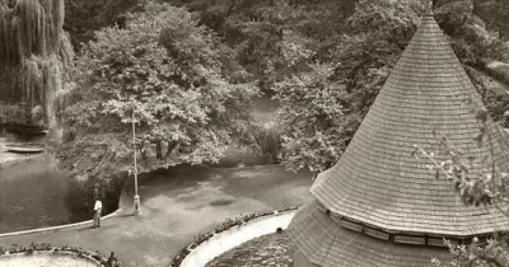
“Bienvenido a la Patagonia” (“Welcome to Patagonia”) reads the sign at Balmaceda Airport in Chile. There is something thrilling about this invitation not to a country or a city, but to a landscape that stuns the imagination, a place of myth-filled memoir and legendary exploration. An invitation to the region where Charles Darwin and Robert Fitzroy, William Henry Hudson and the Welsh colonialists, Antoine de Saint-Exupery and Bruce Chatwin - where they all made life-changing journeys.
There is still no agreement on where the fertile steppes of the Pampas end and the barren Patagonia begins, but for most people the northern border of Patagonia is the Colorado River. This is from the Argentina side. In Chile, the border runs much further south, roughly around the island of Chiloé, where the lake region dries up and the rugged coastline of Palena begins.
Patagonia is a huge triangle in the south South America– about 400,000 square miles ( approximately 1,035,996 square kilometers – approx. translator) – three quarters of which are in Argentina. The southernmost point is the Tierra del Fuego archipelago. The name Patagonia comes from the word “patagones”, a name given to the high local Tehuelches by Ferdinand Magellan at the beginning of the 16th century. It may have meant "large feet", but it is more likely that it was an allusion to the "dog-headed monster" from the Spanish chivalric romance Primaleon. Be that as it may, a mysterious-sounding name was chosen for the distant land.
And it's a fitting title. Patagonia comes down to a flight of fancy. Oddly enough, it is home to perhaps the seventh largest desert in the world. It is also home to a mostly flat strip of steppes and plateaus, occupying the largest part of Argentine Patagonia and affecting the Chilean provinces of Aisén and Magallanes. The province of Magallanes is home to two impressive glaciers, traces of the last ice age that crossed the Andes. Eastern Patagonia has some of the strongest winds in all of South America, while the west has some of the most beautiful tropical rainforests on the planet.
Patagonia is one of the wonders of the world. Its main features - the Torres del Paine National Park, southern right whales, which can be seen from the Peninsula Valdés, the Perito Moreno glacier - make a deep impression, but can detract from the grandiose and the diverse nature of the terrain of this region as a whole. For some travelers, the most memorable moments will not be the photogenic places recognized as the best, but the road between them: a huge dome of the sky, tufts of grass making their way through the desert, a lonely guanaco ( type of llama - approx. translator), watching from the top of the hill.
Some of these places deserve to be included in the list of untouched places in South America. From a practical point of view, tourism in this region is varied: off-road travel, golf, salmon fishing, cruising, horse riding, quad biking or skiing. If you need a break, remote (but increasingly luxurious) livestock farms are great opportunity read, drink good (Patagonian) wine and dine on delicious roast lamb. But keep in mind that Patagonia is unique place on Earth, where calm and the desire to move slowly are necessary. Geological time slows down here and hasty travelers will miss everything that matters.
When is the best time to go?
In the south of the fortieth parallel in South America there is a temperate climate and a truly harsh winter period. Best months for travel: from November to March (summer in the southern hemisphere). At this time, the average daily temperature fluctuates around 20 degrees in the Bariloche area and 13-15 degrees in Ushuaia and Punta Arenas. On the Argentina side, expect strong winds in the steppe areas; on the Chile side, the closer you are to the Pacific Ocean, the greater the chance of rain. Please note that January and February are busy holidays in South America, making November, December and March ideal for travel.

How to book?
Most people go on Patagonia tours - in small groups or with a personal guide - with tour operators handling all the boring work, like booking an overnight stay in Santiago or Buenos Aires after a long flight. They also do domestic flights, ground transfers and route development. A list of more than 40 specialized firms, from mid-budget operators to elite companies with the best reputation, can be found on the website of the Latin American Tourism Association. For those who want to travel on their own, we advise you to start with the wonderful website http://www.turismo.gov.ar/ and http://chile.travel/, and explore accommodation options and local service providers. Many can be booked by phone or email using credit cards. Always leave more time between flights and points on your route than you think you will need.
Which part of Patagonia should you choose?
Argentine Patagonia is a vast, open and fairly empty area. Most of it is occupied by scrub fields and steppes, while small towns (many of which have airports for small planes) are located along the coast and at the foot of the Andes. Tourism has been developing here since the 70s, when Patagonia attracted the attention of hippies and climbers. Over the past 20 years, many farms have opened their doors to travelers, and hotel chains have built new farm-like properties. Some regions - especially the provinces of Río Negro and Neuquén in northern Patagonia - are particularly popular with tourists from Argentina.
Some of the more remote towns look more like existential movie sets than tourist destinations, but southern city, Ushuaia, and the official capital of the Argentine mountain tourism, El Chaltén, you can find cute bars, restaurants, and fashionable hotels. Puerto Madryn, Bariloche, San Martín de los Andes and El Calafate are well-developed and, in season, busy centres. The best way visiting Argentina is about choosing an airport, region and/or national park and sticking to those goals. Truly adventurous travelers might want to rent a car and explore off-the-beaten-path areas. For example, Perito Moreno National Park (not to be confused with the glacier of the same name) or the atmospheric coastal towns of San Julián and Puerto Deseado.

Chilean Patagonia, like Chile, doesn't have much variety: wherever you go, you're equally close to the ocean and the Andes. In three weeks it is quite possible to explore the entire country.
The Lake District and Chiloé Island are tourism-rich regions with excellent campsites, paved roads, national parks and hot spring resorts. Puerto Montt is the starting point for a wide variety of Chilean fjord cruises and local ferries to Chaitén and the beautiful Pumalín Nature Reserve.
The province of Aisén in central Patagonia, long neglected, is now open to group tours and independent travelers, in addition, it is home to the second largest lake in South America - Lake General Carrera (Lago General Carrera). Punta Arenas is a city in Patagonia with rich history, it was colonized when the entire region was a desert area and remained a major port until the opening of the Panama Canal in 1914. The city's airport also opens up the opportunity to visit the Torres del Paine National Park and take cruises around Tierra del Fuego with the help of the excellent Chilean company Cruceros Australis.
Before you go
There is no mandatory vaccination for this region, but check your insurance. Books worth reading in advance, on the road or stopping at a lovely farm: Antoine de Saint-Exupéry's "Stars, Sand and Wind" about a pilot in Patagonia delivering mail at the risk of his life, and William Henry Hudson "Holidays in Patagonia" . It’s also worth visiting a well-designed website before your trip. http://www.interpatagonia.com/ .
What to take with you?
Take good binoculars - everything is very far away, and there are also a lot of birds there. Comfortable walking boots are an absolute must. sunscreen, and sunglasses will provide protection not only from the rays, but also from the wind. A panoramic camera or a camera with a panorama option will help you take better landscape photos.
Translation by Victoria Shipunova
March 2017. Six months have passed since returning from Nepal. It's time to set off on a new long journey! The mouse cursor, rotating a three-dimensional map of the Earth in search of potential places for a trip, froze over the southern part of South America: rugged coastlines (Norway came to mind), mountains, lakes, nature - it all looked promising...
But it was in these regions, called Patagonia, that the heroes of Jules Verne’s novel “The Children of Captain Grant” walked and found a lot of exciting adventures! I wonder if, 150 years after the journey of Paganel and his friends, it is possible to visit Patagonia on your own and for a reasonable amount of money?
A short search on the English-language Internet (in Russian detailed information not so much) - and all the necessary information was collected. As it turns out, Patagonia is quite popular among fans these days. hiking. The most picturesque places in Patagonia include El Chalten National Park, located in Argentina, and Torres del Paine National Park in Chile.
For lovers of comfort, El Chalten is recommended - there you can stay in the town of the same name El Chalten, live in a hotel, take light daytime walks around the surrounding area, and dine in restaurants in the evenings. The history of the founding of the town of El Chaltén is interesting: it so happened that there is no agreement between Argentina and Chile on the state border in that place, so the Argentines took the initiative and built a settlement to stake out the territory for themselves. Over time, the town turned into a famous tourist center. The main attraction of El Chaltén National Park is Mount Fitzroy (3405 m).
In a different national park- - there is practically no civilization, there are no towns like El Chaltén. But nature and animal world more varied. They write that tourists can even meet a puma if they are lucky (it is not specified who will be lucky, tourists or a puma, however, South American pumas seem to be considered less dangerous than their northern relatives). The central part of Torres del Paine Park is occupied by mountain range Peine, whose peaks are almost 3000 meters high. A trail runs along the southern slopes of the massif tourist route“W-track”, so named because the path follows the shape of the Latin letter W. The route is about 70 km long and takes 5 days to complete. There is a longer 8-day route, the so-called “O-track”, which circles the entire Paine massif. During the warm season, there are several camps in the national park, where tourists can stay overnight in houses with shared rooms for 8–10 people or in their own tents (pitting tents outside the camps is prohibited). In terms of picturesqueness, Torres del Paine is not inferior to El Chaltén.

In the mountains of Patagonia there is the third largest (after Antarctica and Greenland) ice massif on Earth, forming 47 large glaciers. You can get very close to some of the glaciers; in some places they even organize excursions with a walk on the surface of the glacier.

Perito Moreno Glacier in the Argentine part of Patagonia. The height of the ice layer above the water surface is about 60 meters
Traveling to the other side of the world with mountains, lakes, glaciers and pumas - who can resist such a combination? So, we decided to go to Patagonia 🙂 April should have been a good month for the trip: it’s autumn in the Southern Hemisphere, there aren’t many tourists anymore, but the cold hasn’t set in yet. We had enough free time and finances to visit only one of national parks, and after some thought we chose Torres del Paine - away from civilization and closer to nature. Now we’ll tell you how to get there - maybe readers who want to visit Patagonia on their own will find this information useful.
As of 2017, there are no direct flights from Russia to Argentina or Chile (or indeed to South America), so you will have to fly with a transfer at one of the airports in Western Europe or in Istanbul. The prices are steep - options were offered that cost from 50 to 70 thousand rubles for a round-trip ticket in economy class departing from St. Petersburg or Moscow. Probably, in the high summer season from December to February, flights are even more expensive. We bought tickets from the Dutch airline KLM: we flew to South America with a connection in Amsterdam, and back from with a connection in Paris (return flights were operated on behalf of KLM Air France). Travel time one way is approximately 3.5 + 13 hours.

Argentina, Chile and many other South American countries allow Russians visa-free entry for up to 90 days, which greatly simplifies preparations for the trip.
From Buenos Aires to Patagonia you can take a domestic flight to a small town (El Calafate), the flight time is about 3.5 hours. This route is operated by the Argentine airline Aerolineas Argentinas and the Chilean-Argentine-Brazilian Latam. The main attraction of El Calafate is the Perito Moreno glacier, photographed above. Tourist buses run from the city to the glacier.
Patagonia has a well-developed intercity bus service, and getting from El Calafate to the desired national park is not difficult. El Chaltén is located a 3-hour drive from El Calafate, Torres del Paine is a little further: first you need to make a 5-hour drive to the Chilean town (Puerto Natales), crossing the Argentine-Chilean border on the way, and then take a bus route Puerto Natales - Torres del Paine, specially designed to transport tourists to the national park. At least two bus companies in Patagonia can book tickets in advance online: Bus-Sur has a booking page on their website, and Turismo Zaahj accepts requests by email.
Patagonia can also be reached through Santiago, the capital of Chile. From Santiago to the city of Punta Arenas located in the very south of Patagonia, Latam and the budget airline Sky Airline fly, offering tickets at an attractive price of $50. From Punta Arenas to Puerto Natales can be reached in 3 hours by car. intercity bus. In 2017, it is planned to open an airport in Puerto Natales itself, after which getting to this town will become even easier.
Tourists who have a lot of time on their hands can arrive to Puerto Natales by ferry. Ferries run from the city of Puerto Montt to Puerto Natales by the shipping company Navimag. The ferry cruise takes 4 days, and judging by the photos available online, the views along the way are spectacular.

To hike in Torres del Paine National Park, you must reserve places online in the tourist camps along your route before your trip. Since 2017, such advance reservations have become mandatory as the national park administration, concerned about the increasing number of tourists, decided to limit the flow of visitors to a fixed number of places in the camps. Now tourists who do not show a reservation for each night of their stay in Torres del Paine may not be allowed into the park.

Map of the W-Track route in Torres del Paine National Park. Buses from Puerto Natales make stops at Laguna Amarga and Pudeto. You can get to the trek: from Laguna Amarga - by minibus or on foot, from Pudeto - by boat to the Paine Grande camp
Tourist camps in Torres del Paine are divided between Vertice Patagonia, Fantastico Sur and CONAF, a non-profit organization that manages nature reserves and national parks in Chile. Vertice Patagonia and Fantastico Sur offer guests accommodation in a dorm or tent, hot showers and meals, which are paid separately and cost the same as lunch in a not the cheapest restaurant. CONAF camps are free, but the only services available are a tent site and a toilet. Reservations for any camp can be made on the respective company's website.

We had no problems reserving places in the camps - another plus of traveling outside the high season. The prospect of spending the night in dorm rooms did not arouse enthusiasm, so we decided to go with a tent - it was more interesting and romantic. As for food, the backpack won a convincing victory in the battle of wallet versus backpack, and in order not to carry additional weight in the form of food during the hike, we booked breakfast, lunch and dinner at the tourist camps - since such an opportunity was provided, it made sense take advantage of it.
When viewing information about Chile, we were very interested in the city (Valparaiso): unique architecture included in the list World Heritage UNESCO, narrow streets on steep hills, historical funiculars - and all this on the shore of the bay Pacific Ocean. I definitely wanted to visit Valparaiso, so a stop in this city was added to my trip plan. Valparaiso is two hours away by bus from Santiago. Buses leave two or three times an hour, we booked tickets with Turbus (the website is in Spanish, but everything was clear).

The final plan of our trip included the following points:
- Flight to Buenos Aires, sightseeing.
- Flight to El Calafate, trip to the Perito Moreno glacier.
- Transfer to Puerto Natales.
- Completing the 5-day W-Track route in Torres del Paine National Park.
- Return to Puerto Natales.
- Transfer to Punta Arenas.
- Flight to Santiago, trip to Valparaiso for 2 days.
- Return to Santiago, sightseeing, flight home.

Everything you need for such a trip: flights, transfers, hotels - can be booked online, without even leaving the couch. We only encountered the following minor difficulties:
- Online payment for Vertice Patagonia camps did not go through. A day later, everything fixed itself - apparently there were some temporary problems with the site.
- For some reason, the online booking form for the Bus-Sur bus company did not work. We complained to them via email (in English, because we don’t speak Spanish) - they responded promptly, prepared a reservation with payment via PayPal, and after payment they sent a voucher, upon presentation of which a ticket will be issued at the bus station ticket office.
- With the airline Aerolineas Argentinas, as we found out experimentally, you need to book tickets from the American website. On the airline's European website (it looked more modern), Russia was not in the list of countries, and when choosing any other country, payments with cards from Russian banks were not accepted. In the American version there were no problems with payment.
So, we have booked tickets, hotels and places in tourist camps. In addition to the equipment we already had, we purchased: a light tent, sleeping bags with the funny name Cat’s Meow and a comfort temperature of about 0°C, compact inflatable mats weighing 450 grams, allowing you to sleep on the ground even at sub-zero temperatures. Now all that remained was to look forward to the day of departure.
The idea of this trip was born at the end of last year - thinking about vacation plans for 2013, I decided to further expand the geography of travel and see something completely new, unknown, unusual, not forgotten by our mass tourism, but that makes it even more beautiful, interesting and alluring. South America is an ideal option in this regard. In December I bought a large illustrated book called “The 1000 Most best places Earth”, a couple of books on South America, read them in my spare time and sketched out several travel options for myself - with the main base points, transport connections and places that I would like to see.
Among all the countries in South America, Argentina is perhaps the most diverse and diverse in terms of nature, culture, atmosphere different corners country, so it was interesting to see it for the first time. You can come up with many interesting trips around Argentina - for example, our winter and the region New Year's holidays- an ideal time to explore the Strait of Magellan, visit Cape Horn and sea cruise to Antarctica: it’s summer here, high season. I have been dreaming about such a trip for a long time! A May holidays- an ideal and very comfortable time for overland trips to Argentina: here, by our standards, it is the beginning of November, for the most part very warm, but no longer suffocatingly hot, and in the south of the country in Patagonia, a fantastically beautiful, cool golden autumn is in full swing.
When planning this trip, I tried to see as much as possible in two weeks, visit different parts of the country, see different Argentina. As a result, I divided the trip into four segments (about three days each) - the north-west of the country and the Andes region (based in the city of Salta), the tropical east of Argentina (base point - Puerto Iguazu), and the south of the country, Patagonia (El -Calafate and the surrounding area), and the capital Buenos Aires, of course. :)) I traveled between these regions on local airlines, plus I bought tickets online in advance for “Tren a las nubes” (“Train to the Clouds”) - a unique tourist train departing from the city of Salta to the Andes along an ancient railway passing through the plateaus of altitudes up to 4200 meters. As for the rest, the traveler has complete freedom. :)))) And this is what came out of it:
Salta
Patagonia is a country of glaciers, lakes, islands, canals, fjords, mountain rivers, thousand-year-old forests and knocking winds... All the most interesting things in Patagonia are located along the shores of the oceans - Pacific and Atlantic - and along the chain of the Andes. You can drive hundreds of kilometers and not see anyone or anything at all.
Even the marked settlements on the map do not give confidence that there is active life in these places. Often it's just a couple of houses plus single animals nearby. All of Patagonia is cut into pieces like a pie, surrounded by wire fences. Moreover, no one lives in these endless territories except rabbits, sheep and guanacos. In the best case, after 200-300 kilometers you will come across a lonely farm, and that’s it. The distance between gas stations can easily reach 400-450 kilometers... However, first things first. So, we decided to start our journey through Patagonia with its very southern point- Tierra del Fuego...

When you find yourself in this place, everything becomes clear without signs...
WEATHER TOTALIZER
...The small town of Ushuaia, a hotel overlooking the Beagle Channel, hot coffee with fresh pastries and the feeling that adventure is beginning. However, our determination was slightly weakened when it turned out that snow, rain and strong winds were expected throughout the next week. Forecasts in Patagonia are unreliable, so locals don't pay much attention to them. True, some still place bets in bookmakers: whether it will come true or not. The climate in these places is harsh not only in winter, but also in summer. There are, of course, some days at the height of the season when the temperature rises above 15 degrees, but this is rather an exception. In winter, there is almost a polar night here, with relatively light only 4-5 hours a day. Glaciers descend from the mountains to the ocean and 300 days a year are usually rainy and cloudy. This is understandable, because from here to Antarctica is less than a thousand kilometers!

Penguins make nests between the roots of trees or dig holes right in the ground

There are up to 100 wives in the harems of fur seals, and everyone is loved
From a primitive whaling station in Indian territory, Ushuaia turned first into a convict colony where Russian anarchists lived out their days, and then into a modern tourist center. There are hotels here for every taste and budget. Shops selling high-quality camping equipment coexist with cheap electronics stores. Restaurants serve huge crabs weighing up to two kilograms with impressive claws. Once upon a time, Indian women caught them with their bare hands, but now production is carried out on a commercial scale. Every year, thousands of tons of these delicious beauties are exported to Europe, the USA and other countries. In the restaurants there, the price of delicacies rises to the skies, and in Tierra del Fuego they feed crabs almost at cost. Today, Ushuaia resembles the Klondike of the Gold Rush. There are travel agencies on every corner, ready to organize a trip to anywhere in Patagonia. Some people go to see penguins and seals, others take an SUV and travel far from civilization. Fishermen specially come here from Europe and Australia for a rich catch, and extreme sports enthusiasts are attracted by excellent ski slopes and Antarctic diving.

Mountains, glaciers, guanacos and wild mustangs - a classic picture of Patagonia
Note for travelers
The best time to travel to Patagonia is the Argentine spring or summer, that is, from November to March. Although even in summer the air temperature usually does not exceed 18 degrees. And the wind, of course. Warm clothes will not be superfluous.
There are no direct flights from Russia to Argentina; there are several options for flying from Moscow to Buenos Aires with a transfer in Europe. Most convenient: daily Air flights France via Paris, Iberia via Madrid and Lufhansa via Frankfurt. Alitalia routes via Rome and British Airways via London. The average flight duration, including connections, is about 23 hours. The official language is Spanish. The time difference with Moscow is 7 hours.
PETS' CORNER
The first point of our program was sea animals. A fairly large colony of seals and sea lions has chosen one of the islands near the lighthouse “at the end of the world,” described by J. Verne and replicated on local souvenirs. Despite their heavy build, the animals turned out to be active and very aggressive. Growling from time to time, the males gave each other a fair beating. The “young ladies” looked at this outwardly indifferently, turning first one side, then the other, but in their thoughts they probably imagined how they would make the winners happy.
Not far from the seals is the territory of the penguins. Magellanic penguins, and this is the most common species here, live in burrows, so the entire island is literally “mined” with pits, burrows and bird waste. There are a lot of penguins here, and you can watch them endlessly. Funny and clumsy, if they don’t like something, they start screaming hysterically and scurrying away at full speed. “Birds-people” are not at all afraid of people, and you can approach them at arm’s length. It was impossible to resist stroking the bird, but the attempt ended in failure: the penguin clearly did not like the familiarity, and, screaming heart-rendingly, he quickly and painfully pecked me. I had to limit myself to photography.

THE END OF THE WORLD
After getting acquainted with the animal world, it was time for auto adventures. Taking a Land Rover from one of the rental companies, we went to Tierra del Fuego National Park, where mountains, sea, forests and glaciers are amazingly combined. Much of the park is inaccessible to visitors, with only a few permitted trails. You can also take a ride on an exotic prehistoric train, which at one time carried... prisoners here. This road is considered the southernmost narrow-gauge railway in the world. Now the train has been converted into a tourist attraction, but until 1947 there was a huge prison here, and in the future national park, convicts cut down forest. In general, this is the official End of the World, as the sign nailed to the sign says. After walking all day in the snow and rain, cursing all kinds of trekking, we decided that we would continue to travel exclusively by car. And the next morning we set out towards the large lake on Tierra del Fuego.
PATAGONIA-TROPHY
The good asphalt road ended after 50 kilometers, after which a dirt road began, gradually becoming worse and worse. After three dozen kilometers it ended too. The road simply turned into a deep rut. Periodically slipping and sliding into holes and puddles, overcoming beaver dams, we moved in a lower gear. We stormed slippery slopes and fell into ravines. Our guide Ignassio tried his best to impress and asked to drive. Having sat down in the driver's seat, he turned on the gear, opened the door and... left the cabin. Putting on a carefree face, he walked alongside her, whistling. But after several “Ladogas” you won’t surprise us so easily! And we started telling him about Russian off-road...

The water temperature in the mountain rivers of Patagonia does not exceed 7-10 °C
Soon we found ourselves on the shore of the lake - the destination of the route. The beauty was extraordinary! The forest was amazing: evergreen beeches interspersed with conifers, shrubs adjacent to deciduous trees. And what were the unusual flag trees worth, which changed the shape of their crown under the influence of constant winds... Autumn painted everything in bright colors, slightly softening them with pastels. The lush crowns were set off by beards of moss and lichen fanning out from the branches and trunks, and freshly fallen snow covered the ground like eider down. After driving a little more, we came across a “piano in the bushes” - a hunting hut with a stove and a couple of canoes, where we could rest while Ignassio was preparing asado, a favorite national dish.

National Argentine dish - asado

A set of araucaria branches on fire drives away evil spirits

Port of Ushuaia. From here cruise ships leave for Antarctica
Note for travelers
Russians do not need a visa to Argentina. A Chilean visa for 90 days can be obtained directly at the border - within 10 minutes and free of charge (for comparison: in Moscow it will take a month and cost 75 dollars). Please pay attention to your luggage: any foodstuffs are prohibited, especially vegetables and fruits. All things are checked and x-rayed. When renting a car in Argentina, be sure to notify that you will be going to Chile - they will provide you with the necessary set of documents.

The best way to travel around Patagonia is by SUV
KINGDOM OF ICE
After driving around Ushuaia for a week, we flew to the middle of Patagonia, to El Calafate - a small settlement on the shores of Lake Argentino. The glaciers here are truly unique: they begin to form at an altitude of 1500 meters and descend to 200 meters. While in other parts of the world, ice masses are born at an altitude of no lower than two and a half kilometers.

After a long rain the sun came out...
There seems to be endless Brownian motion in Calafate. For everyone local resident there is a shop, a restaurant, a chocolate shop and a travel agency. This is a tourist Mecca with excellent infrastructure. People come here for the glaciers, Fitzroy Peak, icebergs and a convenient opportunity to visit Chile. By the way, Chilean and Argentine glaciers are declared by UNESCO as World Heritage of Humanity. In terms of scale, they are third after Antarctica and Greenland. In Los Glaciares National Park, which translates as “glaciers,” there are as many as 48 of these giant “refrigerators”! Perito Moreno is the most spectacular and unforgettable in Patagonia. Its age is more than 30,000 years. The ice here is in constant motion - it advances indomitably. And at a decent speed - about two meters per day. A giant glacier as tall as an 18-story building and a tongue six kilometers long crosses almost the entire lake. The pristine silence is broken by the roar of blocks breaking off and turning into icebergs. The feeling that you are standing next to the open door of a giant freezer, from which centuries-old cold emanates. The color of the ice is unusual and changes depending on the time of day and light. In the morning and afternoon it is blue, in the evening it becomes dark blue. A glacier excursion is only possible with a guide and wearing climbing crampons. An unforgettable walk! And as a bonus at the end of the route - a glass of whiskey with a thousand-year-old ice cube or a sip of the purest glacial water.

Baby whale skeleton as long as a large bus
RUTA 40
The best way to experience Patagonia is to cross it along the legendary and longest Pan-American Highway in the world. The length of this road is 48 thousand kilometers - more than the length of the equator! Starting in Tierra del Fuego and cutting through 15 countries, it ends almost in Alaska. Having once set off along this route from end to end, one American couple became so carried away that they rode for three years. On the way, their son was born and even managed to grow up a little. In Argentina, this road appears as Ruta 40. This is the ridge of the south from which the road “nerves” leading to cattle farms branch off. The Argentine part of “Pan America” is more than 5 thousand kilometers. It crosses 19 rivers, 27 passes, 13 lakes and salt marshes. Locals say that if you were able to drive it from north to south, then you saw the whole country. It must be said that Ruta 40 is not a highway at all: more than half of it is not covered with asphalt at all. Therefore, in almost every locality you will have three classes Pan American Highway passes through 15 countries: search for tire service, gas station and store. And most likely in this sequence - verified!

From El Calafate with glaciers to the El Chaltén National Park and the legendary Fitzroy Peak (3405 m) you can reach it along the 40th. At the very foot of Fitzroy is the town of El Chalten (translated as “smoking mountain”), the site of a settlement of the Tehuelche Indians. Before the Second World War, Fitzroy was considered one of the most inaccessible places in the south of the continent. Named after the captain of the HMS Beagle on which Darwin sailed, Fitzroy is one of the most difficult peaks in the world to climb. And either for reasons of increased extremeness, or from some other reason, there are no decent hotels or ATMs here. There are even problems with cellular communications. But there are campsites for 20-30 dollars and several bed & breakfasts for 50-80. Climbing was not part of our plans, and we limited ourselves to visiting several beautiful viewpoints in the mountains on the picturesque lakes Laguna de los Tres and Capri.
Note for travelers
In Chile and Argentina, American dollars are accepted for payment everywhere. Each store sets its own rate, sometimes it is unprofitable - pay attention. The dollar to Argentine peso ratio is 1 to 4. Credit cards are accepted in almost all stores and restaurants, but cash is preferred. You can often ask for a discount when paying in cash. And vice versa - in some places, when paying by card, 10% is added to the amount. There are ATMs, but not everywhere and only a few; some have a cash withdrawal limit of $150. Mobile communications work in cities, but in the prairies there is almost no connection.

SCARY BUT CUTE
The further route took us to Chile. Along the same 40th road from Calafate to the border is no more than 400 kilometers, however, most of The highway turned out to be gravel. The territory of the Chilean state is sandwiched between the Pacific coast and the Andes chain and is divided into three parts that are not connected to each other. In order for residents of southern Chile to get to the central or northern part, they need to travel through Argentina, take a ferry or fly by plane. The Chilean part of Patagonia also has its own calling card and pride - the Torres del Paine National Park ( Parque Nacional Torres del Paine). This is an extraordinary Andean mountain region, a biosphere reserve and a real treasure trove of wildlife. One of the most beautiful national parks protected by UNESCO. It owes its name to the granite “towers” of Torres, more than 2 thousand meters high. Here, among the mountains and dozens of lakes and rivers, almost all the landscapes of Patagonia are collected: scrub plains, rain forests, Magellanic tundra and high desert. Not to mention glaciers, waterfalls, rainbows and other beauties. Hunting has been prohibited here for half a century, and the animals are almost not afraid of humans. Such a variety of animals and birds is probably not found anywhere else in Chile. Here you can see the condor - the world's largest bird of prey with a wingspan of up to three and a half meters. According to the famous book, a condor carried one of Captain Grant's children into the sky. However, Jules Verne knew nothing about condors. In real life, they are very shy and usually sit quietly and wait for some small lame hare.
As a little boy, in my dreams I dreamed of going to the ends of the earth with the heroes of Captain Grant's Children. I had no idea where exactly this region was located, but this only filled my ideas about it with fantasy. Patagonia, just from this word the heart begins to beat faster, igniting a spark of excitement in a real traveler who is in love with the endless purity of real nature, where, after traveling hundreds of kilometers, you will not meet a single person.
Patagonia. I have traveled almost 2500 kilometers and walked 55 km along trekking trails in the mountains of Argentina and Chile. I don’t have enough words to describe my delight, and the photograph, unfortunately, will not convey even a tenth of the emotions and feeling of the surrounding reality while being there.
Patagonia. The south of South America, then only Antarctica, but I will definitely go there another time. I looked at the Il-76, operating regular flights to Antarctica and parked at Punta Arenas airport, with an eye to the future.
Like a good trailer for a bright blockbuster, endless glaciers and turquoise-colored lakes are already visible from the airplane window, of course, if you sit by the port window on the way from Santiago.
Patagonia. Between Argentina and Chile, on endless roads with perfect surface, but with dozens of oncoming cars in a couple of hours. With small automobile border crossings between countries. I have so much that I want to tell and show, but today I will start with an overview announcement, after which you will definitely and consciously want to visit these incredible places.
On the way to Patagonia, I had wonderful layovers en route in modern Berlin, stylish Madrid and hot summer Santiago. My longest Dreamliner flight, 14 hours of endless fun. Then flight to Puerto Montt and further to Punta Arenas in the south of the Latin American continent. But I’ll tell you about all these nuances and details later, but today it’s ONLY NATURE. It was nature that became the main goal for me on this trip.
Often without mobile communications and almost always without the Internet. There is nothing here that distracts you from the pleasure of perceiving the PRESENT.
But first, let us remember how Jules Verne describes Patagonia in his unforgettable book “The Children of Captain Grant”: “The Argentine pampas extend from 29° to 40° south latitude. The word "pampas" is Araucanian and means "plain of grass." This name is perfect for this region. The mimosa thickets of its western part and the luxurious grasses of the eastern part give it a unique appearance. All this vegetation takes root in a layer of earth, under which lies red or yellow clayey sandy soil. The American pampas are as special a geographical phenomenon as, for example, the savannas of the Great Lakes Country or the steppes of Siberia. The continental climate of the pampas has harsher winters and hotter summers than the climate of the province of Buenos Aires.”
So, let's start with a picture from an airplane.
Be sure to sit next to the left window on your flight from Santiago to Punta Arenas.
When arriving in Punta Arenas, I highly recommend that you rent a car. Huge distances can be covered by car much faster than by bus, but, most importantly, you often want to stop here every 10-15 minutes, which would be impossible by bus.
I ordered a car through an aggregator ECONOMYBOOKINGS.COM
.
And this is not for you to rent a car in Europe or the States... I will tell you about the nuances, roads, gas stations, special permission to cross the border to Argentina and other things in a separate post, but I note that communication with the rental company was carried out by the aggregator, which has a very efficient Customer Support.
The main roads in Patagonia have perfect surfaces and markings and virtually zero traffic.
They are both endlessly boring and incredibly interesting, an amazing combination.
Only a very strong side wind keeps me on my toes; I have never felt such a roll of the car while driving.
Secondary roads are gravel. All rental companies have a significantly higher deductible in case of car rollover or rollover; this is the most common accident on gravel roads.
Be sure to take the electric pump and repair kit with you from home.
And the small border crossings between Argentina and Chile are a completely separate and very interesting story :)
And local truck drivers are so harsh that they hang trophies on the back of their trucks:
The incredible Perito Moreno glacier in Argentina in Los Glaciares National Park.
With a very accessible infrastructure for tourists, you can almost touch the glacier with your hand.
The infrastructure of tourist bridges and paths reminded me very much of that at Iguazu Falls and also on the Argentine side, when inaccessible places become absolutely accessible to everyone.
The width of the Perito Moreno tongue is 5 km, the average height is 60 m above the water surface. The average depth is 170 m, the maximum is 700 m. The speed of its movement is 2 m per day (approximately 700 m per year). However, the mass loss is approximately the same, so (not taking into account small deviations) the glacier tongue has not retreated or advanced for 90 years.
And what a piercing blue color the ice is! Especially in those places where another “10-story building” of ice has just broken off with a roar:
I thought that 1-2 hours would be enough here, but I spent almost the whole day walking along numerous bridges and paths. The glacier does not let go, it is impossible to look away, you look at this ice mass as if spellbound.
Top of Fitzroy. Someone wrote to me in the comments in response to my statement that the Swiss Matterhorn is the most photogenic peak in the world, that Fitzroy is still more interesting. Having seen both peaks, I can’t say for sure which one is more photogenic, but the fact that mountains in different parts of the planet are completely different is indisputable.
The Fitzroy summit was first seen by Francisco Moreno on March 2, 1877, during his travels in Patagonia. He named the peak in honor of Captain Robert Fitzroy, commander of the British brig Beagle, who made a major contribution to the exploration of the sea coast of Patagonia, Charles Darwin worked on board the Beagle.
The road to El Chaltén, a small town where trekking routes start in the Fitzroy area and to its foot.
There are excellent trekking routes here, but the travel time can be safely multiplied by 1.5-2, because you want to take photos and stop almost every kilometer of the way.
After the last night at the Rio Negro campsite, you need to climb another 1.5 hours to the lakes and glaciers at the foot of Fitzroy. It takes your breath away, you want to scream with delight when you see these mountains at arm’s length:
And the Chilean side of Patagonia, National Park Torres Del Paine.
Here you can drive, walk, sail on a boat between the islands and to the glaciers. Changeable weather, thoroughly wet after a fresh spring shower, we walked up to the famous Torres battlements, and on the opposite side of the valley the bright sunset sun was shining:
Wake up at 4 am, get out of your warm sleeping bag and climb up the steep rocky slope again... To be the first to see the Torres light up.
I have not yet read how these mountains were formed, but I certainly have never seen such colors and such a structure of stone anywhere in the world.
Torres del Paine means "blue towers".
I often say that the most important thing in a hotel is the view from the window. But the most best view opens from the tent, of course!
Real wild nature near. Hares, hedgehogs, foxes, guanacos, rheas, many different birds. And penguins around Punta Arenas!
Even the woodpeckers in Patagonia are completely different!
It’s an indescribable thrill to bring a bottle of Chardonnay “Del Fin Del Mundo” (“Earth’s End”) with you in your backpack to the top and drink it during your hiking dinner!
In general, this is just an announcement... what follows will be incredibly interesting.
There will be several practical articles on how to organize such a trip to the End of the Earth on a very budgetary basis, because we only spent the night in a hotel once, the rest of the time we slept in a tent.
My partners on this incredible journey:
Credit card EVERYTHING from Renaissance Credit Bank .
This is an ideal card for travelers because it allows you to withdraw cash from any ATM in the world without commission!
And in addition, it opens a 62-day interest-free loan, which is also important when traveling, just in case.
To be continued...