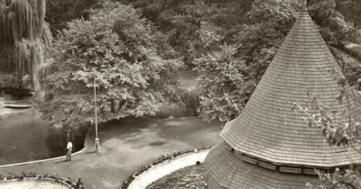
Sometimes the name of a particular geographical object accidentally encountered in the literature prompts a search for it in the area. This happened with Lake Samur, located in the Apsheronsky district of the neighboring region.
Yuri Kuzminykh
The desire to expand the Lago-Naki zone was one of the main reasons why we went to the vicinity of the village of Novye Polyany.
IN Krasnodar region summer doesn’t seem to be letting up. If you look at the foothill forests stretching to the southwest of Maykop, you will be reminded of the coming autumn by the yellow strands of birch and aspen trees, browned undergrowth and buckets of dogwood placed on the sides of the highway passing through populated areas and blueberries.
Behind the village of Shirvan, the roads leading to the Guam Gorge and the Pshekhi Valley, in the basin of which one of the largest natural reservoirs within the Wooded Range is hidden, diverge. We drive towards the village of Chernigovskoye and try to “calculate” the turn indicated on the maps as the starting point of the route leading to Samur Lake, lost among the forest.
We get to Novye Polyany, ask about the road local residents and return to the first kilometer sign from the fork. Here, a piece of a grader adjoins the asphalt, leading into the forest halls. While our small group of eleven people is drawn into the forest, let’s briefly talk about natural site, which I really want to find.
There is almost no information about this blue treasure in the literature. First short description dated 1888, when in the sixth issue of the “Collection of materials for describing the localities and tribes of the Caucasus” an article by V. Kobelyatsky “The Samurskaya village of the Kuban region of the Maykop district” was published. The remaining information is gleaned from the work of Yuri Efremov “In the Land of Mountain Lakes.”
The reservoir with an area of 46,000 m2 with a length of 340 m and a maximum width of 260 m is located at an altitude of 328 m above sea level, 10 km north of the village of Samurskaya, after which it is named. In plan, the lake has a complex configuration, externally resembling an amoeba with its four pseudopods-bays. Close to Samurskoe there are subsidiary formations - four lake reservoirs located at different altitude levels. The main water area lies in a basin with steep slopes covered with beech and oak forest. And only from the east the coast is low, swampy and reedy. The Beluzhka River flows near the lake, into which a stream flows, discharging lake waters into it...
But let's return from theory to practice. After 50 m from the asphalt, the grader turns into an ordinary road, disfigured by rainy times with deep ruts, which soon leads to a picturesque wasteland that appeared at the site of the felling. We go around it on the right and find ourselves in a fairly overgrown area, which, however, is very picturesque and rich in autumn gifts in the form of blackberries, thorns, wild pears and apples...
In one of the clearings we turn around: on the map the path goes around a certain hill. Instead of a more or less well-trodden road, we find ourselves on a road that was used for its intended purpose several decades ago. The further the track leads away from the split point, the more dense the surrounding area becomes.
 Yuri Kuzminykh
 During the Great Patriotic War and after it, forest felling was intensively carried out in the Absheronsk region. There were no tractors; logs were dragged to the nearest narrow-gauge railway by horses. The forest was cut down in a row, indiscriminately. Fortunately, Lake Samur was lucky - the industrial ax bypassed its immediate surroundings. Steep forest slopes and deep gullies stood in the way of the ruthless loggers, which we are now overcoming.
High humidity and heat cause the face and body to become covered with drops of sweat. It seems that a comparison with the tropics in this case would be quite appropriate...
Intuition tells me that we need to return. But the group is still inclined to joke: “If we don’t find the lake, we’ll inhale the scents of the forest”...
Whether it’s long or short, but after wandering along the bottom of a dry river, overcoming transverse beams every 50–100 meters, we make the unpopular decision to return to the clearing from which the ordeal began an hour and a half ago...
But we were not destined to get to that clearing. Taking a little to the right of the descent point, we come out onto a relatively flat watershed, along the center line of which stretches the most decent road we have passed today.
The cell phone “catches” the Internet, and we turn to the right, continuing to check the direction of movement with the map. About twenty minutes later the path leads to a clearing with the most beautiful floristic decoration. The main decoration of the grassy cover of the meadow is the cereals, which, with the mass of their panicles thrown up to a height of two meters, have suppressed their less powerful counterparts.
The road crossing the clearing climbs slightly upward, and after entering under the forest canopy it begins a smooth descent into the Beluzhka valley. Looking at the ferns that have gathered centuries-old beech trunks in a tight ring, you feel like you are in an enchanted forest.
Here comes a thin stream of water - life-giving moisture. What a fairy tale!..
 Yuri Kuzminykh
 From Beluzhka the road rises steeply, and, having passed the ridge, leads into a hollow, where among the emerald foliage there is a green swamp covered with duckweed - a harbinger of the main forest miracle. Around the next bend, the very object of our hopes and dreams appears - Lake Samur.
Along the path stretching along the shore we find ourselves in a clearing, in the middle of which, as if the interior of a forest kitchen is specially waiting for travelers, there is a table and stump chairs.
Now everyone plans their own leisure time. Those who immediately plunge into the water, since the water in the lake is still quite warm, those who start lunch, accompanied by traditional tea from the fire...
At three in the afternoon we head back.
Having reached the grain clearing, we continue to move straight along the road gradually descending to the west...
At one of the few forks, checking with the navigator, we take a left and find ourselves in a deep beam, where we notice a marking on one of the trunks. Having climbed the opposite slope, we find ourselves on a wasteland, noted in the report on the first part of the trip as a picturesque place, and after crossing an abandoned clearing we close the ring. There are two or three hundred meters left before the bus.
The distance to the lake from the highway, judging by the time and pace of walking, is about five kilometers.
Ahead of us lies a surprisingly warm Pshekha for September. We frolic on the river, relieving the burden of fatigue from the miles we have traveled.
,Samurskoye Lake
One of the main attractions of the Absheronsk region is Lake Samurskoe, the largest of all the lakes in the low-mid-mountain zone on the northern slope of the North-West Caucasus. Its area is 46,000 m2, length is 340 m, and maximum width is 260 m. It is located in the Pastbishchny Ridge area on the watershed of the Kurdzhips and Belaya rivers at an altitude of 328 m above sea level. The lake is located 10 km north of the village of Samurskaya. A well-paved path along the river gorge leads to it. Beluzhka (Hosako), flowing from the right into the river. Pshekha near the village of Samurskaya.
Samur Lake is very popular among residents of the Absheronsky district; you can relax there, catch fish and crayfish. It is not known to tourists, since there is almost no information about this mountain treasure in the literature. The only brief description is contained in the pre-revolutionary “Collection of materials for describing the localities and tribes of the Caucasus”, in the article by V. Kobelyatsky “The Samurskaya village of the Kuban region of the Maykop district” (1888. Issue 6). No one has yet explored this unique corner of nature. I first visited here 10 years ago. Then we managed to make a reconnaissance survey of the surroundings of the reservoir and take some measurements. However, it was not necessary to fully explore it. Therefore, in May 1988, the section of geology and geomorphology of the Krasnodar department of the Geographical Society of the USSR at Kuban State University organized a small expedition to study Lake Samurskoye. As a result of the work carried out, it turned out that it has a complex configuration in plan, externally resembling an amoeba with its four pseudopods - bays. Nearby nestled daughter formations - four lake reservoirs located at different altitude levels. The surprisingly complex shape of the lake and the presence of adjacent reservoirs suggest the unity of processes that contributed to the emergence of this conglomerate.
Lake Samur lies in a basin with steep slopes covered with beech and oak forest. And only on the east the shore is low, swampy and overgrown with reeds. Here a stream flows into the lake, which intricately winds through the forest plain, calmly carrying its waters into the water area of the reservoir and gradually increasing the sandy delta. On the southern side two capes jut into it. One of them, resembling a kind of appendix, was named Cape Vermis. It rises 5–6 m above the lake waters and has a very convenient clearing for setting up a bivouac with good review to the lake.
Hidden between the capes are two cozy bays, which we called the bays of Solitude and Tranquility. They are bordered by high banks with dense beech forest. Some of the trees bent over the water, while others fell into it, forming an incredible accumulation of snags and hummocks.
The north-western side is overgrown with reeds, and here a swampy bridge arose, fencing off part of the lake and thereby forming a closed reservoir with an area of 1800 m2 and a depth of 2 m. Among the reeds actively advancing on the water area of the reservoir, in summer time You can see a cluster of green frogs. For this reason, the lake received another name - Frog.
Local residents told us that Lake Samur is very deep and supposedly has two bottoms, with the upper one formed from trees that fell into the water area of the reservoir.
As our measurements showed, its maximum depth was 4.6 m. In all likelihood, this is one of the lowest levels we observed. Ten years ago the depth of the lake was about 6 m. Apparently, over the years its level has decreased, as evidenced by traces of higher water levels. There are two small basins in the reservoir, one in the middle, the other in Tranquility Bay. The bottom is muddy, heavily littered with fallen trees and their branches.
The color of the water is dark gray with a greenish tint, the transparency is low, in cloudy weather it barely exceeds 1 m. The latter is explained by the large amount of suspended organic matter, and the color of the water is determined by the presence of dark silt and fallen leaves at the bottom of the reservoir.
Near Lake Samur there are a number of other reservoirs of similar origin. 20 m to the northwest in a deep karst sinkhole lies Lake Mertvoe. Its area is 900 m2, the maximum depth does not exceed 4 m. It makes a depressing impression on visitors. The waters of the reservoir are dead, there is no vegetation, and no living organisms are visible either. This especially contrasts with the neighboring Frog Lake, whose waters are teeming with life. There is dead silence here, the dark gray water is always calm. Why is there no life here? We cannot answer yet. IN Dead Lake A stream flows in from Frog Lake, and the same stream flows out, which immediately buries itself in a deep ravine with a rocky bottom and small waterfalls - a real geological museum: outcrops of sandstones, dark blue clays and limestones. Below, near the mouth of the lake stream flowing into the river. Beluga whale, we found a huge ammonite - about 40 cm in diameter. This is a fossilized mollusk that lived several tens of millions of years ago at the bottom of a shallow Cretaceous sea.
Very close to Lake Samur on the western side there are three more forested, heavily overgrown and covered with green duckweed lake reservoirs with an area of 1800 - 3700 m2. All around is pristine forest chaos, a riot of tall grasses, a kingdom of frogs croaking incessantly around the clock.
According to T. Akatova’s definition, 9 plant species are common in Samur reservoirs: broad-leaved cattail, divergent rush, unnoticed burr, forest reed, southern reed, marsh reed, hornwort, horsetail, and lesser duckweed. They form 5 communities. The lesser duckweed community inhabits small lakes located next to the main lake. Pure thickets of hornwort form foci of overgrowth at a depth of 0.3 - 1 m.
The communities are similar in species composition with the dominance of broadleaf cattail and unnoticed hedgehog. Frontal foci of overgrowth 1–5 m wide stretch along coastline. In the waterlogged areas of the coast, in some places the divergent rush grows.
Making our way from one lake to another, climbing steep slopes, I immediately remembered the stories of Konstantin Paustovsky “The Meshcherskaya Side”. The same wilderness as Poganoe Lake, the same charm wildlife, covering you, and the same confusion of soul at the sight of pristine landscapes.
To understand and feel all this, you need to follow a cozy forest path, which either rises high up or drops down, to the shore, to the water itself. From here you can enthusiastically watch the quiet mirror-like surface of the forest wonder. It is especially remarkable from above.
Most of all we remember one May night spent in these places. When its dark blanket fell completely over the mountains, and bright stars lit up in the sky, a thin crescent moon hung low over the forest. A timid lunar path cut through the black surface of the water. The glow of a bright fire picked out the spreading beeches from the thick darkness; in the darkness of the night they looked especially powerful. Far in the west, lightning flashes occasionally flared, illuminating everything around for a moment.
The lake and its surroundings lived their own life, unknown to us. The frogs croaked deafeningly and discordantly in different voices. Somewhere in the forest thicket an owl screamed sadly and anxiously. From time to time, some indistinct rustling sounds, similar to sighs, were heard in the water area. Either fleeting gusts of wind disturbed the foliage of the trees, or fish splashed in the water.
Under the crackling and bright blazing of the fire, we listened in fascination to our random interlocutor from Neftegorsk, who had arrived here to go fishing. Zakhar (that was the name of the local old-timer) has been visiting his beloved Samur Lake for 30 years and knows a lot about it, the whole history of its development by local nature lovers.
During and after the war, intensive logging was carried out in this area. There were no tractors; logs were dragged to the narrow-gauge railway by horses. The forest was cut down in a row, indiscriminately. Fortunately, the lake was lucky - nature itself protected it. Steep forest slopes and deep gullies stood in the way of the ruthless loggers. The industrial ax bypassed this corner.
Zakhar’s favorite topic of conversation is fishing. From him we learned that there are a lot of fish in the lake - apparently and invisible. There are carp, crucian carp, and even the “wise gudgeon” here. Where did she end up in the mountain lake? Even before the revolution, a rich, enterprising Cossack Molchanov lived in these parts, and he raised fish in the lake. He delivered it to rich people's tables. But modern fishermen only catch small things on the hook - minnows and crucian carp. But it is very difficult to catch carp. Local fishermen catch it with nets. Not everyone succeeds. The next day, happiness smiled on us too. We managed to bring together a whole pot of small things, which was quite enough to cook a noble fish soup. There are also crayfish in Lake Samur. For them, this is paradise - a muddy bottom and numerous snags.
The data obtained during the study somewhat clarified the picture of the emergence of reservoirs. Once upon a time, in the depths of the mountain strata, there was an underground karst cavity formed in limestone. During a strong earthquake, the roof of this underground void collapsed, and lake depressions appeared on the surface, which were filled with water.
V. Kobelyatsky, who visited the outskirts of the village of Samurskaya, describes the earthquake he observed in January 1879: “Roofs cracked, dishes fell from shelves onto the floor. Two years later the earthquake repeated, but it was much weaker.”
Samur Lake and its surroundings have unique mountain landscapes. But so far they have not been reserved and are not included in the list of natural monuments. Krasnodar region. Apparently, the time has come to do this urgently in order to preserve this amazing corner of nature for posterity. In the meantime, numerous fishermen pollute the shores with garbage. I would like to remind everyone that in the end, such reckless use of nature can destroy a reservoir. This cannot be allowed.
The Achishkho phenomenon
There are many places on the map of the Krasnodar region that can be classified as unique monuments nature. Among them is the mountainous, mostly forested Achishkho ridge, between the river. Mzymta and its right tributary of the river. Achipse. Highest point Achishkho town 2345 m above sea level. Its rocky amphitheater dominates Krasnaya Polyana on the northern side, closing the upper reaches of the river. Rabies. At the top of the ridge, near the forest border, among overgrown lakes, the high-mountain weather station Achishkho (1880 m above sea level) is located. On the background mountain range The Chugush two-story stone weather station house looks very small.
What is the phenomenon of Achishkho? According to our ideas, this is due to the uniqueness of the high-mountain landscapes, the record snow content of the region and the uniqueness of the mountain lakes.
Achishkho has a surprisingly harmonious combination of lush alpine and subalpine herbs, emerald green beech forests, blue Lakes, covered with duckweed swamp vegetation. In summer, the meadows are filled with a carpet of primroses, hyacinths and fancy white snowdrops with long, elaborately curved petals, yellow-brown in the middle. And higher up, closer to the rocks, there are lush thickets of Caucasian rhododendron. Here you will enjoy a panorama of snow-capped mountains with huge cumulus clouds, intoxicating coolness, and surprisingly clean air.
An unforgettable route to the city of Achishkho. The trail starts from the weather station and runs along the edge of the ridge. On both sides of the path there are deep abysses. A waterfall falls from the steep wall of the cliff, which gives rise to the river. Achipse. Ahead is a mysterious rock circus with several white sheets of avalanche snowfields. And below, in the breathtaking depths, the white, tiny, matchbox-like houses of Krasnaya Polyana are drowning.
Until now, scientists have only hypotheses that explain the origin of the lakes in different ways. One of them connects the formation of lake basins with ancient glaciers, which plowed depressions here and deposited moraines, where reservoirs arose. Another hypothesis is tectonic, according to it, a line of tectonic cracks stretches along the ridge, transformed over many thousands of years into closed basins. Then they filled with water, creating a chain of lakes of varying sizes and depths.
Before the Great Patriotic War, 18 lake reservoirs at various stages of swamping were known on the Achishkho ridge. Only four have survived to this day. The rest are completely overgrown or visible with small “eyes” of water. Overgrowth occurred and continues to occur mainly with thickets of sedge or surface rafts. Dacian sedge and Austrian swampweed are often involved in overgrowing processes. The bottom surface is covered with peaty sediments on which aquatic mosses grow. After most of the water area is covered by rafts or thickets, a sphagnum cover begins to form. As a result, sedge-moss bogs are formed. Currently, a significant part of the water area not occupied by thickets of plants occurs in 4 lakes. Foci of overgrowth in all are of belt- or belt-solid type. For example, Lake Khmelevskogo is covered with thickets taking root at the bottom. According to aerial photographs (1954, 1972), as well as by comparing amateur photographs of researcher Yu. K. Efremov and maps made in 1984, it was possible to find out that the degree of overgrowth, as well as the configuration of plant foci on some lakes over the last 30 have remained virtually unchanged for years. Significant deviations occurred only on Lake Khmelevskoye.
The cleanest lake from algae and reeds is Lake Zerkalnoye near the Achishkho weather station. It is small - only 1000 m2, the maximum depth is also small - about 3 m. The lake lies in a basin and has an oval shape. The surface is free of algae, but the bottom is covered with them, like a fluffy carpet. The lake is almost never overgrown, and only along its banks is there sedge. Not a single stream flows into it, and not a single stream flows out of it. The water is fresh and tastes good. Apparently, the lake is fed by underground springs. The water temperature in summer reaches 20 – 25°C. But you can’t swim in it, since it is the only source of drinking water for the weather station workers. The lake is covered with snow and ice 9 months of the year. Naturally, fish and other living organisms cannot live in such harsh conditions.
All other lake reservoirs (and there are five of them in the area of the weather station) are completely overgrown.
In addition to the lakes mentioned above, there are others. To do this, it is logical to proceed from the camp site of the Ministry of Defense along the Achishkho ridge through Khmelevskie glades with access to the Achishkho weather station and then descend along the path leading to the shelter of this camp site, to Krasnaya Polyana.
It was here, among the forest, in the Khmelevsky glades, that the fading lakes hid. Their sad water areas covered with green duckweed remind of their former greatness. And even now, despite the hopelessness, they are not without originality. The poems of N. Zabolotsky speak best about the beauty of the forest lakes of the Achishkho ridge:
In a crown of water lilies, in a headdress of sedges, in a dry necklace of plant pipes, lay a piece of chaste moisture - a refuge for fish and a haven for ducks...
Jitaku Lake Valley
In the Western Caucasus, on the territory of the Caucasian State Biosphere Reserve, near the city of Pseashkho, at the source of the river. Urushten (the left tributary of the Malaya Laba River) has an amazing Dzitaku valley. It is unusual in its morphological appearance and unique in the manifestation of the natural processes that occur here.
Jitaku is located at an altitude of 1800 - 2000 m above sea level and belongs to the so-called trough-shaped valleys, which have a flat bottom and steep slopes. This shape was given to it by a glacier that lay here about 10 thousand years ago. As a rule, any valley is closed by a highly located circus or amphitheater with impregnable rocky peaks.
You won't see this in the Jitaku Valley. Suddenly, its gentle upper reaches break off into wild steep slopes towards the river basin. Laura. There, below, the impenetrable crooked forest is raging. There is no way there.
What happened to the upper reaches of this marvelous valley? Under certain conditions, the processes of river erosion can intensify, and the sources of the rivers begin to move backward, gradually destroying the watershed or the sides of the valley. If the river watershed has low heights, then it may soon be cut through river waters, and the sources of the river shift to the neighboring valley. The waters of the river in this valley can be stolen by an aggressor river invading from the other side. A similar thing happened in the river valley. Jitaku.
It originally flowed down this valley towards the river. Urushten. Apparently, after a powerful landslide that blocked the river valley. Dzitaku (near modern lakes), the river turned towards the sources of the river that crept here. Laura. In this way, rivers are able to intercept or steal water from each other.
Another thing is surprising. The Jitaku Valley is a through valley, or, scientifically speaking, a pass-type valley. This means that the Main Watershed of the Caucasus runs along the bottom of the valley, and in this case along the aforementioned landslide ridge, slightly rising above the bottom of the valley. The height of this watershed here drops to 1920 m, that is, this is the lowest point of the Main Range in the Western Caucasus.
Thus, in the Dzitaku valley you can imperceptibly, without any effort, cross the Main Watershed of the Caucasus, walking along the bottom, as, by the way, in other through valleys - Pseashkho, Aishkho, Tsegerker. The above has left its mark on the lakes that are located here. The Dzitaku valley is often called the lake valley, and this is no coincidence. On its gently sloping meadow bottom, the waters of eight lakes of varying sizes splashed out and were overgrown with marsh vegetation to varying degrees.
The most significant of them is Lake Bolshoye, which is located at an altitude of 1913 m above sea level, has an area of about 20,000 m2 and a maximum depth of up to 10 m. It owes its origin to the same avalanches that knocked out the lake basin and formed an arc-shaped avalanche around it a shaft, behind which there is another lake reservoir, but already completely overgrown with swamp vegetation. Lake Bolshoye is not overgrown. This is hampered by snow avalanches that periodically fall into its waters and splash out water along with bottom sediments.
Near Lake Dzitaku, in the depressions of the above-mentioned dam, four more small lakes lurk, occupying depressions in the landslide ridge that blocked the valley. One of them, which we called Two-Faced, is notable for the fact that it simultaneously drains onto both the northern and southern slopes, that is, into the basins of the Laura and Dzitaku rivers. This phenomenon is extremely rare in the Caucasus Mountains.
One day in August 1987, our photographer Sasha Tokarev, having climbed Mount Perevalnaya, saw below, near the confluence of the Dzitaku and Urushten rivers, in a golden autumn forest, a blue “eye” bordered by emerald swamp vegetation. In honor of the discoverer, the lake was named Tokarevsky. Its origin is also mysterious. Together with the staff of the Caucasus State Biosphere Reserve, a specialist in the vegetation of mountain lakes of the Caucasus, we tried to understand the mechanism of formation of this lake reservoir, whose area is about 1000 m2, depth about 2 m, located at an altitude of 1858 m above sea level on a slightly sloping swamp. The reservoir is contoured by a shaft of humus substance 0.5 - 1 m high.
What formed first: a swamp or a lake, what were the stages of its development? We have not yet found the answer to these questions.
Another surprise of the Jitaku Valley for us were the karst sinkholes on the sheep's foreheads, near the cliff into the Laura Valley. There are about a dozen of them here, of different sizes and shapes. And they are confined to marble outcrops. No one knew about their existence before. In one of these funnels is small lake– with a diameter of 10 m.
Noteworthy in the valley is the sphagnum bog, which is considered relict, that is. legacy of past eras. As it became known from the works of Valery Akatov, it has existed for almost 6.7 thousand years.
No less interesting is Lake Maloye (Pseashkho) above the mouth of the river. Dzitaku, along the river valley Urushten, near the Pseashkho pass at an altitude of about 2000 m above sea level. It is almost invisible from the path, since it is covered on the side by a vast avalanche hill covered with lush grass, and therefore remains unnoticed by travelers passing by. The beauty of the almost round blue “eye” can be appreciated by rising to the ten-meter height of the outlining avalanche shaft. By its origin, it also refers to avalanche lakes. Thanks to the enormous impact force (several tens of tons per square meter) of the falling mass of snow from the steep slope (more than 45°) of Perevalnaya, a deep hole was knocked out at the foot, which filled with water, and a lake was formed. Its depth, according to our measurements, was 16 m. The lake is outlined by a sharply defined crescent-shaped shaft formed by sediments thrown out by avalanches from the bottom of the lake reservoir.
Lake Acipsta
Achipsta is one of the most inaccessible and remote from settlements lakes of the Caucasian State Biosphere Reserve. It is located in the upper reaches of the river. Achipsty (left tributary of the Malaya Laba River), in the subalpine zone at an altitude of 1865 m above sea level.
The path to it is difficult and long. If you go from the Umpyr cordon in the valley of the river. Malaya Laba, then initially you should climb the road leading to the Alous pass. The most difficult section of the path begins from the deer meadows. From here there is a path along the river bank. Achips through numerous deep ravines, windbreaks and thorny bushes. A simpler route is from the Alous Pass to the Great Alous Lake along a high trail that runs above the forest border and numerous erosion cuts, through alpine meadows. In some places the trail gets lost in thick grass or rocky areas. You can also get to this lake through the Chelipsi pass from the upper reaches of the river. Clean (left tributary of the Malaya Laba river). But this pass is difficult to pass and requires some mountaineering skills.
The difficulties of the path are rewarded when, from the height of the mountain path, through the windows between the pines deep below, at the bottom of the valley, you see the blue canvas of the lake sparkling in the sun. In its waters, near the left side of the valley, a crescent-shaped island is unusually green. The closer you get to Acipsta, the more you are surprised and admire the art of nature that created this unique creation. Approaching the lake from below, from the valley, you involuntarily pay attention to the huge grassy bank blocking the river valley across. Achipsty. These are two avalanche cones formed during avalanches. Having clashed with each other, they formed an insurmountable barrier for the indomitable mountain river, thereby creating a vast lake reservoir with an area of 60,000 m2 and an average depth of 3 - 4 m. The dam is so vast that the river could not make its way through it and was forced to search the exit is somewhere deep below, in loose avalanche deposits.
The river flows into the lake. Achipsta, which originates high in the mountains and is fed by meltwater from glaciers and snowfields. By the end of summer the river becomes very shallow. This significantly affects the water regime of the lake. The water level drops sharply, thereby reducing the water surface area to 1/3, and sometimes by half. There were cases (according to foresters) when the lake disappeared completely. However, the reason for this phenomenal phenomenon is not entirely clear. This can happen both when there is a sharp decrease in the influx of water, and when it drains through an unknown underground valve that has opened.
Oh more high level water resembles a “fin” in the lower part and its former bottom, already overgrown with grass.
The water is quite cold. At the time of observation, with an air temperature of 14°C and clear weather, the water temperature did not rise above 10°C.
The lake is completely lifeless, no aquatic vegetation grows in it, phytoplankton and zoobenthos are almost completely absent, and there are no fish. The reason for this is the severity of the highland climate, long winters with prolonged ice cover and heavy snowfall in these places.
The lake is actively degrading. The river flowing into it carries a lot of suspended solids, which settle in the upper part, forming a vast delta. Its blade continues under water, the edge is clearly visible through the clear bluish water. According to our measurements, the rate of delta growth (the thickness of deposited sediments) reaches 14–15 cm per year. The lake is also destroyed by snow avalanches descending into its water area. There are four of them, and three of them contribute to the accumulation of loose material in the lake basin, thereby reducing its depth and water surface area. The fourth avalanche, coming down from a steep slope (about 50°) and having a larger avalanche collection than the other three, counteracts the degradation of the reservoir near its left bank. As a result of the impact of falling snow, a cone-shaped funnel (knockout hole) up to 10 m deep and a crescent-shaped avalanche shaft bordering it, which looks like an island in high water, was formed in this place. It has a very steep slope (45 - 50°) towards the knockout hole and a gentle opposite slope (slope 10 - 15°). Its surface is overgrown with thick grass, but there are many stones, individual torn trunks and branches of trees, thrown out, or rather, splashed here along with the water when an avalanche hit the knockout hole. Such avalanches occur in the most snowy winters (1976, 1979, 1987).
The country has a wide distribution of eternal snow, huge glaciers and deep-sea mountainlakes. More... meaning lakes. Soils, vegetation and animal world In close connection with geographical location countries, age, mountain ...
CLASSICAL BURMA + HOLIDAY IN NGAPALI for CHRISTMAS Temples of Yangon and Bagan Pindai caves mountain lake Inle ancient capitals of Burma Buddhist monasteries Mandalay beach holiday on the coast of the Bay of Bengal - Ngapali resort 12 days/11 nights
ProgramYangon and Bagan, Pindai Caves, mountainlake Inle, the ancient capital of Burma, Buddhist... Visiting the most famous monasteries in country: SHWENAN DAW KYAUNG, KUTHODAW Pagoda... Mustang, Tibet, India and many others countries and regions. Other tours to Myanmar...
Switzerland is a country in the heart of Europe with amazingly diverse landscapes and amazing nature - mountain, small. IN country two large lakes: freshwater Pligr and salty Somatr... springs, picturesque mountainlakes and beautiful beaches that attract thousands of tourists. Climate countries tropical, mid-annual...
Autumn...the rustling of leaves underfoot, a transparent forest and a clear November day. It was on such a day that the village residents took their next one-day trip to the lake with such a native name -Samurskoe. The first “opening of the season” was in the summer - several people from the village, adults and children, visited the mouth of the river. Matuzki - at the Matuzki waterfalls.
According to Yuri Vasilyevich Pchelintsev, a local historian and author of the book “There is such a corner in the Kuban – it’s called the Absheronsky district...”, “this lake has existed for a long time, although you won’t find it on every map. It is located on the Pastbishchny Ridge (328 m above sea level), next to Spire Mountain (407 m). Lake Samurskoye is the largest of all the lakes in the Northwestern Caucasus. The origin of the lake is karst-tectonic. Has a complex configuration. The banks are steep and completely covered with broad-leaved oak and beech forests, and the gently sloping banks are covered with reed and reed thickets. Its area is 65,000 sq.m., length 340 m., maximum width – 260 m, maximum depth – 4.6 m. The lake is located 7 km from the village of Samurskaya.”
You can walk, or you can drive part of the way.
Not far from the lake, on the approaches, you can make out the embankment for the railway track and imagine how a steam locomotive ran here, transporting timber and people. Next you need to cross the Beluzhka River, which is small, and you can easily cross it in boots. And now, a view of the lake opens up - beautiful and picturesque! I wanted to walk around it, to feel all the beauty and majestic silence. Or maybe it keeps some secret?
Old-timers from local residents tell a legend related to the origin of the lake.
Legend.
Once upon a time there was a small village on the site of the lake. And a beautiful girl lived in it. And then rumor brought the news of the girl’s beauty to the evil spirit of the forest. He turned into a beautiful young man and went to her. When the beauty saw him, she did not refuse immediately, as was the case with other suitors. But she didn’t give consent to stay with him.
And the spirit fell seriously in love with the girl and began to seek her favor. When the girl went on business to a neighboring village, he constantly accompanied her. They talked along the way, and the girl gradually got used to him. The spirit persuaded her to go with him to the places where he lives, the girl did not agree. She loved her family and the village very much and did not want to leave them.
The spirit was very angry because he could not conquer this proud beauty. He lured her into the forest, and sent disaster to the village and her relatives - he blocked a deep ravine and let thousands of springs flow from the mountains. Water quickly filled the resulting pit and hid everything that the girl loved so much.
When the girl returned from the forest, she saw a lake and many springs flowing into it. At that moment, the spirit opened up to her and said that he did all this. The girl begged him to return her family, but it was too late. The only thing he did was to plug all the springs so that the water would no longer fill the lake. And he disappeared.
The girl walked around the lake for a very long time and called her family. Her tears turned into a stream that flows into the lake. And the girl herself turned into a light haze that spreads over the lake every morning.
So we got to know Lake Samur and relaxed on its shores. We promise to continue to introduce you to the beautiful corners of our region.
Mirror surface Reflections Autumn gold
Light ripples Panorama Last autumn leaf
The reeds of the Beluzhka railway embankment rustled
Beluzhka River Maiden's Tears Creek
Absheronsky district is Lake Samurskoye, the largest of all the lakes in the low-mid mountain zone on the northern slope of the North-Western Caucasus. Its area is 46,000 m2, length is 340 m, and maximum width is 260 m. It is located in the Pastbishchny Ridge area on the watershed of the Kurdzhips and Belaya rivers at an altitude of 328 m above sea level. The lake is located 10 km north of the village of Samurskaya. A well-paved path along the river gorge leads to it. Beluzhka (Hosako), flowing from the right into the river. Pshekha near the village of Samurskaya.
Samur Lake is very popular among residents of the Absheronsky district; you can relax there, catch fish and crayfish. Tourists do not know it, since there is almost no information about this mountain treasure in the literature. The only brief description is contained in the pre-revolutionary “Collection of materials for describing the localities and tribes of the Caucasus”, in the article by V. Kobelyatsky “The Samurskaya village of the Kuban region of the Maykop district” (1888. Issue 6). No one has yet explored this unique corner of nature. I first visited here 10 years ago. Then we managed to make a reconnaissance survey of the surroundings of the reservoir and take some measurements. However, it was not necessary to fully explore it. Therefore, in May 1988, the section of geology and geomorphology of the Krasnodar department of the Geographical Society of the USSR at Kuban State University organized a small expedition to study Lake Samurskoye. As a result of the work carried out, it turned out that it has a complex configuration in plan, externally resembling an amoeba with its four pseudopods - bays. Nearby nestled daughter formations - four lake reservoirs located at different altitude levels. The surprisingly complex shape of the lake and the presence of adjacent reservoirs suggest the unity of processes that contributed to the emergence of this conglomerate.
As our measurements showed, its maximum depth was 4.6 m. In all likelihood, this is one of the lowest levels we observed. Ten years ago the depth of the lake was about 6 m. Apparently, over the years its level has decreased, as evidenced by traces of higher water levels. There are two small basins in the reservoir, one in the middle, the other in Tranquility Bay. The bottom is muddy, heavily littered with fallen trees and their branches.
The color of the water is dark gray with a greenish tint, the transparency is low, in cloudy weather it barely exceeds 1 m. The latter is explained by the large amount of suspended organic matter, and the color of the water is determined by the presence of dark silt and fallen leaves at the bottom of the reservoir.
Near Lake Samur there are a number of other reservoirs of similar origin. 20 m to the northwest in a deep karst sinkhole lies Lake Mertvoe. Its area is 900 m2, the maximum depth does not exceed 4 m. It makes a depressing impression on visitors. The waters of the reservoir are dead, there is no vegetation, and no living organisms are visible either. This especially contrasts with the neighboring Frog Lake, whose waters are teeming with life. There is dead silence here, the dark gray water is always calm. Why is there no life here? We cannot answer yet. A stream flows into Dead Lake from Frog Lake, and the same stream flows out, which immediately buries itself in a deep gully with a rocky bottom and small waterfalls - a real geological museum: outcrops of sandstones, dark blue clays and limestones. Below, near the mouth of the lake stream flowing into the river. Beluga whale, we found a huge ammonite - about 40 cm in diameter. This is a fossilized mollusk that lived several tens of millions of years ago at the bottom of a shallow Cretaceous sea.
Under the crackling and bright blazing of the fire, we listened in fascination to our random interlocutor from Neftegorsk, who had arrived here to go fishing. Zakhar (that was the name of the local old-timer) has been visiting his beloved Samur Lake for 30 years and knows a lot about it, the whole history of its development by local nature lovers.
During and after the war, intensive logging was carried out in this area. There were no tractors; logs were dragged to the narrow-gauge railway by horses. The forest was cut down in a row, indiscriminately. Fortunately, the lake was lucky - nature itself protected it. Steep forest slopes and deep gullies stood in the way of the ruthless loggers. The industrial ax bypassed this corner.
Zakhar’s favorite topic of conversation is fishing. From him we learned that there are a lot of fish in the lake - apparently and invisible. There are carp, crucian carp, and even the “wise gudgeon” here. Where did she end up in the mountain lake? Even before the revolution, a rich, enterprising Cossack Molchanov lived in these parts, and he raised fish in the lake. He delivered it to rich people's tables. But modern fishermen only catch small things on the hook - minnows and crucian carp. But it is very difficult to catch carp. Local fishermen catch it with nets. Not everyone succeeds. The next day, happiness smiled on us too. We managed to bring together a whole pot of small things, which was quite enough to cook a noble fish soup. There are also crayfish in Lake Samur. For them, this is paradise - a muddy bottom and numerous snags.
The data obtained during the study somewhat clarified the picture of the emergence of reservoirs. Once upon a time, in the depths of the mountain strata, there was an underground karst cavity formed in limestone. During a strong earthquake, the roof of this underground void collapsed, and lake depressions appeared on the surface, which were filled with water.
V. Kobelyatsky, who visited the outskirts of the village of Samurskaya, describes the earthquake he observed in January 1879: “Roofs cracked, dishes fell from shelves onto the floor. Two years later the earthquake repeated, but it was much weaker.”
Samur Lake and its surroundings have unique mountain landscapes. But so far they have not been protected and are not included in the list of natural monuments of the Krasnodar Territory. Apparently, the time has come to do this urgently in order to preserve this amazing corner of nature for posterity. In the meantime, numerous fishermen pollute the shores with garbage. I would like to remind everyone that in the end, such reckless use of nature can destroy a reservoir. This cannot be allowed.