Irina Vlasova
Target: instilling love for the native land.
Program content: Give an idea about Kuban River as the largest and most beautiful river Krasnodar region . Show the greatness of the river Kuban and the beauty of those places where it flows. Introduce: with a geographical map of the Krasnodar Territory, show on it the largest and most abundant river - Kuban: where it originates, where it flows; with the flora and fauna of the river. Foster a sense of pride in our great river.
Material: recording of the anthem of the Krasnodar region; geographic map Krasnodar region; photographs of fish, birds, wild animals living on Kuban River; set of pictures "Birds", "Fish"; video clip about Kuban River.
Progress of the lesson:
The first verse of the Krasnodar anthem sounds the edges:
Oh, Kuban, you are our Motherland!
Our age-old hero
High-water, free-flowing
You have spread out into all its breadth.
Guys, you have now listened to the first verse of the anthem of our region in which we live. What is the name of our region? (Krasnodar) What is another name for our region? (Kuban) How many of you know why they call it that? (due to the river Kuban) Right.
Look at the map of the Krasnodar region; a river flows through the entire territory of the region.
Its beginning is considered to be the confluence of two rivers Ullukam and Uchkulan, flowing from under the glaciers of Mount Elbrus. Length Kuban – 870 kilometers, of which more than 700 kilometers fall on the territory of the Krasnodar Territory. Look what a huge journey it takes river: first flows in the mountains, then through the forest-steppe, then through the steppe and flows into the Sea of Azov. The history of the river is very ancient, a lot has been written about it beautiful legends, listen to one of them.
A river has flowed from the North Caucasus Mountains since ancient times. Along the banks of the river, in the forests, lived a wonderful bird - Kuban. She was small, not very bright, but her voice sounded so that the sun rose in the soul of the one who heard it. Local residents loved to listen to the singing of this bird. Let's go, they said, to the river, Let's listen to the Kuban bird! Then they began to call the river Kuban in honor of this fabulous bird. Her voice still sounds on the river bank, but not everyone can hear it.
Vos-l: Today, guys, I suggest you go to trip along the Kuban River, on the boat. Come on in, take your seats, put on your life jackets, but before we go journey, let's remember the rules of behavior on river(don’t make noise, don’t throw garbage into the water and on the shore, don’t throw stones at frogs and birds) Is everyone ready? Let's start our journey.

(viewing slides accompanied by a story) In the upper reaches Kuban shallow, fast. In the middle and lower reaches its depth is significant, the banks become gentle. The vegetation of the banks is very diverse - reeds, reeds, and cattails grow here. Rich and diverse animal life world:
Rudd. A schooling fish of the carp family. On Kuban considered a trash fish.
Pike is common. This predator lives in coastal thickets, where it waits for its prey.
Roach lives in fresh waters and overgrown algae. Roach in the Azov-Black Sea basin is called ram
And in overgrown reservoirs there are golden crucian carp. It has a tall body of golden color, with a light belly. Silver crucian carp is no different from gold carp, only in color. Lives in the same places, eats the same.
Catfish is the largest fish in Russia. Its length is about three meters and its weight is about one hundred kilograms. It feeds on fish, frogs, and waterfowl.
Pike perch - Large fish of the perch family, in Azov they grow up to 10-15 kg. It feeds on fish, preferably with a narrow body.
Bream - moves in schools, mainly in deep places. It feeds on both plant and animal food.
Crayfish - feeds on algae and fresh aquatic plants. Crayfish hunt at night. During the day, it hides in shelters (under stones, tree roots, in holes or any objects lying on the bottom, which it protects from other crayfish. It crawls, crayfish, backing away. In case of danger, it stirs up the silt with the help of its caudal fin and swims away with a sharp movement.
Heron - there are several species of this bird - white, gray, yellow, red, as well as night herons and bitterns, both large and small. Herons are migratory birds; they feed on fish, frogs and small animals.
Great cormorants are also found in these parts - very large birds that live on estuaries. This is not an ordinary bird species, as their appearance is quite unusual. The cormorant has a long neck, black shiny plumage and wide wings. He eats about one and a half kilograms of fish per day. Cormorants are excellent swimmers and can dive well.
In the same places you can see the mute swan, whose weight can reach up to 13 kilograms, and its wing length is about 70 centimeters. Such swans practically do not make a sound, but simply hiss, hence the funny name. They feed on plant roots and small aquatic invertebrates.
The avocet bird also lives on lakes and ponds. This is a very beautiful bird, black and white in color, with long legs that have a bluish tint. It feeds on small invertebrates, which it obtains with the help of its long beak.
This bird has a massive body, long curved wings, a slightly downward curved beak and well-developed swimming membranes on its legs. Seagulls obtain food both on water and on land. They love to hunt for fish, shellfish, crustaceans, flying and aquatic insects, and can even destroy bird nests.
The pelican is clumsy, with a massive body, large wings, short thick legs with a wide membrane between the toes, and a short rounded tail. The neck is long, the beak has a hook at the end. On the underside of the beak there is a well-stretchable leather bag used for catching fish. Their color is light - white, grayish, often with a pink tint.
In the Krasnodar Territory, birds live on reservoirs, with interesting name Great Grebe, or as it is called differently, the great grebe. Great Grebe usually lives in thickets near water, and it deserves this name because its meat smells very strongly of fish. In general, this is a very beautiful bird - its back, neck and top of its head are dark brown, its cheeks are gray, and on its head there is a beautiful crest of a mixture of black and red feathers. She swims and dives very well, and builds her own nests in the water from reeds and cattails. If a great grebe leaves her nest, then, like a caring mother, she always covers it with aquatic plants to protect it from unexpected guests and the sun's rays. When her chicks appear, she carries them on her back for two whole weeks, sometimes going down to the water. The great grebe feeds on various mollusks and fish.
The jungle cat is larger than any of the domestic representatives cats: reaches 60-90 cm in length, weight from 8 to 12 kg. The body of the jungle cat is relatively short, the legs are high, the tail is not long (21-30 cm, and there are small tufts on the ears.
The jungle cat is perfectly adapted to living in dense thickets of reeds and thorny bushes along the low-lying banks of rivers, lakes and seas. The cat avoids open spaces, although in summer it constantly visits lumpy sands overgrown with saxaul near its habitat.
The otter leads a semi-aquatic lifestyle, swimming, diving and getting food in the water. An otter can stay underwater for 3-4 minutes.
It lives mainly in forest rivers rich in fish, less often in lakes and ponds. Found on the sea coast. It prefers rivers with whirlpools, with rapids that do not freeze in winter, with washed-out banks littered with windbreaks, where there are many reliable shelters and places for making burrows. Sometimes it makes its lairs in caves or, like a nest, in thickets near the water. The entrance holes of its burrows open under water.
In winter, when fish stocks are depleted and wormwood freezes, it is forced to wander, sometimes directly crossing high watersheds. At the same time, the otter descends from the slopes, rolling down on its belly and leaving a characteristic trace in the form of a gutter. On ice and snow it travels up to 15-20 km per day.
The otter feeds mainly on fish (carp, pike, trout, roach, gobies, and prefers small fish. In winter, it eats frogs, and quite regularly, caddis fly larvae. In summer, in addition to fish, it catches water voles and other rodents; in some places it systematically hunts waders and ducks.
Resurrection: Now let's make a stop, let's go to Sandy shore Let's relax and play. Physical education minute “We quickly went down to the river...”
Di "Listen and guess". Pictures of birds are hung on the board; children use the descriptions to find and name the birds.

Questions:
1. Clumsy, with a massive body, large wings, short thick legs with a wide membrane between the toes, a short rounded tail. The neck is long, the beak has a hook at the end. On the underside of the beak there is a well-stretchable leather bag used for catching fish. (pelican)
2. This bird has a massive body, long curved wings, a slightly downward curved beak and well-developed swim membranes on its legs. They love to hunt for fish, shellfish, crustaceans, flying and aquatic insects, and can even destroy bird nests. (gull)
3. There are several species of this bird - white, gray, yellow, red, as well as night herons and bitterns, both large and small. They feed on fish, frogs and small animals.
4. These birds practically do not make any sound, but simply hiss. They feed on plant roots and small aquatic invertebrates. (swan)
Di "Fisherman".

Children use a magnet rod to catch fish and name them.
Vos-l: Guys, it’s time for us to return to kindergarten, take your seats. I suggest once again admiring our beautiful river (video clip).
Vos-l: Guys, did you like our trip along the Kuban River? What do you remember, what new things did you learn? (discussion in progress)
Mountains, sea, caves, waterfalls, safari park, fresh air and a sea of impressions await you on the ecological route through the Krasnodar Territory and the Republic of Adygea.
Mountains, sea, caves, waterfalls, safari park - the dream vacation of many, many people. But in order to make it a reality, you don’t need much effort and time. About 2 weeks free from work and other activities, and the desire to spend several hours in a row behind the wheel. Don't forget about pleasant travel companions, without them car trip will be boring.
We suggest going to the south of Russia, to Krasnodar region, and capture Adygea. And the route will pass through Khosta, Sochi (Krasnaya Polyana), Dagomys, Lazarevskoye, Tuapse, Gelendzhik, Goryachiy Klyuch, Belorechensk, Maykop, the village of Dakhovskaya and the village of Guzeripl. The total length is 350 kilometers. Not all cities on the route are of interest to road travelers, but detailed description the path will help you not to stray from the intended course.
The nature in the travel destinations is amazing. The mountains delight the eye with all shades of green. In Kuban, the road either runs along the seashore or turns serpentine. Many travelers often fall behind their pre-planned travel schedule, because they constantly want to stop to photograph nature views.
IN summer time There is a lot of traffic in these places. Thousands of motorists with friends and families from different regions rush to different cities on the Black Sea coast to grab a piece of the southern sun. Therefore, traffic jams are common, especially due to those drivers who are not used to driving along serpentine roads. Length of the most difficult section mountain road, from Sochi to Dzhubga, 200 kilometers. But it also ends - it will be easier further.
Until you pass the Black Sea coast, you run the risk of being stopped by local traffic police officers everywhere. Especially if the car has license plates from a different region. We sympathize with Muscovites, residents of the Moscow region and St. Petersburg residents: these three are breaking records for the number of document checks.
The road along the entire route is excellent. But this is more typical for the Krasnodar region and the route to Maykop. In the Adyghe mountains, asphalt is replaced by a primer.
A pleasant feature of the route is a large number of gas stations along the way. Therefore, there is no need to think about the supply of gasoline. But you should still refuel not at the first “point” you come across, but at gas stations known good quality fuel. For example, on “ ”, especially since there will be many gas stations of this company along the route.
 Vorontsov caves in the Sochi region
Khosta (point of interest - Vorontsov Caves)
The first natural monument on the route is the Vorontsov Caves. This is probably the best thing in this place in the Krasnodar region. They are named after Count Illarion Vorontsov-Dashkov, the Russian governor in the Caucasus in 1905–1916.
To get to the caves from the city of Khosta (this is the Greater Sochi region), drive towards the village of Kalinovoe Ozero, behind which you will find picturesque tea plantations. There are a lot of ascents and descents, so your ears may get blocked. Stock up on lollipops; they make it easier to cope with constant pressure changes.
A special feature of the road to the Vorontsov Caves is the pigs and cows that graze on their own. Many animals lie right on the roadway. Be careful when driving around.
Then the asphalt road descends to the mountain river Vostochnaya Khosta and rises along a serpentine road to the village of Vorontsovka. By the way, excellent honey and homemade wine are prepared here. But the cave is ahead, so don’t be distracted by the tasting.
Closer to the Vorontsov Caves, the road enters a relict grove of tall eastern beeches. It's beautiful and impressive. You have to drive a few more kilometers, and when you see the monument to the fallen pilots, you can stop. 15 minutes on foot - and you are already at the Prometheus Grotto. And next to the cave, don’t forget to take a photo with hand-made pagan idols carved from stone and wood.
 Pagan idol at the Grotto of Prometheus. Khosta, Sochi district
Photo: from the Krasnodar Territory website
Pagan idol at the Grotto of Prometheus. Khosta, Sochi district
Photo: from the Krasnodar Territory website
Vorontsov caves (now private property) are one of the largest and longest in the Caucasus. Their total length is more than 11 kilometers, the height difference is 240 meters. The caves are not only a remarkable geological monument; in them, archaeologists have discovered numerous material evidence of the settlement of the Caucasus by primitive man, who lived here 15–20 thousand years ago. And in more remote branches of the system, remains of cave bears are still being found.
Before descending into the caves, take warm clothes with you, as all year round the temperature is the same there – about 12 degrees. Humidity – almost 100%.
And here are the impressions and advice from a car traveler who looked into the depths of the cave: “They are allowed inside in groups of 15 people, accompanied by a guide. With every step, the darkness in the cave thickens, the chirping of birds and the sound of the wind remain behind. We are all plunging into the realm of eternal darkness. Before us are high galleries and bizarre snail grottoes. It's hard to believe, but all the endless passages and huge halls are created by ordinary water. It’s not for nothing that they say that a drop wears away a stone. For hundreds of thousands of years, underground streams gnawed into the limestone, and small cracks turned into spacious passages and deep wells. Water still flows through the cave today, washing passages and building dams. Returning to the surface, you have a new appreciation for the sunlight, the beauty of forest flowers, the singing of birds and the bright colors of the Caucasus Mountains.”
The duration of the tour of the Vorontsov Caves is 4 hours. There are 2 kilometers to go.
 Krasnaya Polyana. peaks of the Caucasus mountains Photo: Shutterstock
Sochi (point of interest – Krasnaya Polyana)
The only things better than mountains are mountains. Therefore, after visiting the Vorontsov Caves, we are going for a new portion of impressions - now to Krasnaya Polyana.
Distance - 50 kilometers: 10 - from Khosta to Sochi, and 40 - from the capital of the 2014 Winter Olympics to Krasnaya Polyana.
Drivers, be careful on the road. There are pitfalls on the road - junctions. It's very easy to miss if you miss the sign. GPS navigators rarely work correctly in those places. And all because of preparations for the Olympics. Updates to satellite gadgets do not keep pace with the pace of road construction work. One of the motorists, Andrei, became hostage to the junctions that were incomprehensible at first glance: “The road junction after Sochi was seriously dumbfounding. Firstly, the size. Secondly, ornateness. And there are corresponding signs there. They were probably drawn by an artist. What the corner arrows mean is roughly clear. But what the snake-shaped arrows mean is absolutely unclear. But, having missed the necessary turn and rode around the circle one more time, we still jumped out onto the track we needed on the second run.”
 Cable car in Krasnaya Polyana Photo: Shutterstock
It’s better to go to Krasnaya Polyana early. First, there is less congestion. Secondly, if you decide to ride the cable car, you cannot get to all levels due to early closure. Please remember that boarding for stage four stops at 3:40 p.m.
At each stage of the cable car you need to get off and transfer to the new lift. There is a cafe or bar at all stops. The higher the rise, the stronger the drinks on sale. The ascent takes about an hour - an average of 15 minutes for each stage.
For those who are afraid of heights, Krasnaya Polyana will be scary. An autotourist we already know, Andrei, shares his impressions: “When you go up, there are no particularly extreme sensations. So, at a level of 1.5 to 5 meters, you can reach the ground and even with your feet you can reach the bushes. But when you descend, it’s already breathtaking.”
And one more feature of Krasnaya Polyana is that even in the summer it’s chilly there without warm clothes. On many peaks the temperature drops to zero degrees. In some places you can see snow. And don't forget sunscreen. Alpine tan, according to many tourists, “sticks unnoticed, so it’s easy to get burned.”
And in Krasnaya Polyana there are very high prices for food and drinks. Therefore, when traveling to this place, take more money. It’s better not to delay your holiday here, as the cost hotel rooms also high. Plan about 4 hours to personally conquer this Krasnodar peak and explore the local beauties.
 Kiselyov's Rock. View from the sea. Tuapse
Photo: from the Krasnodar Territory website
Kiselyov's Rock. View from the sea. Tuapse
Photo: from the Krasnodar Territory website
Tuapse (point of interest - Kiselev Rock)
The further path lies along the coast through Dagomys and Lazarevskoye. The destination of the route for this day is the city of Tuapse. The distance from Sochi to it is 142 kilometers.
Tuapse is famous for its unique natural monument - Kiselev Rock. It is named after the artist A. A. Kiselev, who painted local landscapes at the beginning of the twentieth century.
But the rock is known not only for the name of the famous artist. Remember the movie "The Diamond Arm"? And the fishing episode? It was filmed exactly in the place where our route leads. Every year tourists set records for conquering the rock. And to be honest, this is not an easy task. Therefore, it is better to rest before visiting the attraction.
You can stay in a few hotels in Tuapse or in the private sector. Cost of daily accommodation: with comfort - from 1,500 rubles, in relatively spartan conditions (without a shower and toilet in the room) - from 500 rubles. But there are more places to eat in Tuapse - there are coastal cafes everywhere.
And to the Kiselev rock. It's a beautiful sight. Tourist Irina shares her impressions: “The facade of the rock is a sheer wall 46 meters high, going into the water and continuing there. The depth is decent. The coast around is like a huge layered pie: layers of sandstone and other harder rocks, alternating with each other, stretch in parallel coastline, forming in some places something like reefs in the water. And suddenly this bulk rises vertically. The edges of the rock are grooved, and the side facing the sea is perfectly smooth and strong, like concrete. Nearby, it is difficult to access when descending from above, but very picturesque (there is a passage along a stream that drops steeply onto rocky and almost vertical “steps”).”
 Tent on the beach Photo: Shutterstock
And now the maximum useful information: There are no springs near the rock. Therefore, tourists need to take water with them. This especially applies to those who set up a tent camp on the shore.
It is dangerous to be near the rock in bad weather. Traveler Victor was convinced of this: “It’s dangerous to pitch a tent under a rock - everything crumbles, water comes from the mountains. But there is also a risk on the beach, as the sea hits with waves. The tent can float.”
We hope that the weather on the days of your trip will be sunny and without precipitation. Therefore, when visiting the Kiseleva rock, take advantage of the recommendation of tourist Elena Kropotova and walk around the surrounding area. At the same time, you will learn a new way to the rock: “You can get to it along the shore from the beach. But there is a way through the heights. The fact is that in the recent past there was a missile launcher there military base. Now it is abandoned. But there are giant bunkers left, underground labyrinths, pillboxes, fortifications and caves.” Elena also suggests ways to return from the cliff: “There is an extreme route - through the cliff. Climb onto it, go through the forest and exit onto the highway. The second way is along the coast to Tuapse.”
After visiting the Kiselyov rock, it is worth spending one more night in Tuapse to regain strength, and then hit the road again.
Gelendzhik (points of interest – safari park, Parus rock)
From Tuapse to Gelendzhik 134 kilometers. The path is pleasant: the roads are wide and beautiful, the signs are clear. It is impossible to get lost here. Outside the window there will be wonderfully beautiful nature, but the driver cannot be distracted by it, because speed video recording devices have been installed along the entire section of the road. Closely monitor the headlights of oncoming drivers, who almost always warn of an “ambush.”
In Gelendzhik, it is better to start getting acquainted with the local nature in the safari park. It is located on the slope of the Markhot ridge. The park area is almost 160 hectares. The air there is crystal clear, and all because you find yourself in a deciduous and coniferous forest with clearings where there are many beautiful wildflowers.
In addition to its ecological purity, this natural corner has two more features: a zoo and cable car 1,600 meters long and a lifting height of 645 meters.
Tourist Alexander advises visiting the safari park in the morning, since it is hot during the day and the animals prefer to rest. Regarding tickets: they can be purchased separately for all types of entertainment, but there are also all-inclusive options. By the way, they are much cheaper.
 Rock Sail. Divnomorskoe Photo: ITAR-TASS
There is another one 20 kilometers from Gelendzhik unique monument nature. In the village of Praskoveevka you will find the Parus rock. Its height is 30 meters, length 25 meters and thickness about a meter. All this splendor rises directly from the water, starting on the shore. The rock is fraught with a mystery - a through hole with a diameter of about a meter. There is still no official explanation for this phenomenon. The second attraction of Praskoveevka is the clear sea. Many consider it the cleanest in the Gelendzhik region.
The downside is that in Praskoveevka you may experience difficulties with the quality of cellular communications. And don’t expect to find places here where you can relax with grandeur and music. The atmosphere in Praskoveevka is very peaceful.
If you want to spend a couple of days here, you can rent housing in the private sector. The cost varies from 350 to 1,500 rubles per day. Why such a range in prices? From the availability of conditions for comfortable living.
If you are drawn to where life is in full swing and shimmers with all the colors of the summer south, return to Gelendzhik. Here, after a day's wandering around local attractions, you can relax in a cafe or dance at night discos.
The cost of living in city hotels with all amenities is from 1,500 rubles per day. There are also cheaper ones - from 1,000 rubles, but the comfort is correspondingly less.
 Caucasus Mountains. Adygea Photo: Shutterstock
Adygea, village Dakhovskaya
The longest leg of the trip lies ahead – 284 kilometers. To find yourself in the Autonomous Republic of Adygea, neighboring the Krasnodar Territory, you need to drive through Goryachiy Klyuch and Belorechensk. The border between the regions is conditional - a regular checkpoint. Not everyone is stopped there, but if the car has a dull tint (which is against the rules of the road) or a young man of a very athletic build in sunglasses is sitting behind the wheel, be prepared for a wave of a striped baton. Someone will chuckle or even doubt this. But the experience of many road travelers crossing the border of Kuban and Adygea convinces of such features of the work of the local traffic inspectorate.
Next on the way is Maykop. Beautiful city. But since our trip is more ecological than cultural and educational, we are going to the mountains. The path lies to the village of Dakhovskaya. This place can be called the junction of civilization and nature. And this is how tourist Irina talks about living conditions after visiting Dakhovskaya: “There are many tourist centers here with two-story houses with 3 to 4 rooms with amenities. We paid 2,100 rubles for the room. This price includes breakfast in a cafe on site, without choice, but quite decent and varied. You can have lunch and dinner - everything will be prepared at the appointed time, you just need to announce your desire. All verandas offer magnificent views of the forested Mountain peaks. The houses have free parking for cars.”
 Waterfall on the Syuk River. Adygea Photo: Shutterstock
And now about what’s interesting in Dakhovskaya. If you prefer not to travel by car all the time, you can walk to a small farm with horse rentals. Cost – 150 rubles per hour. To do this you need to go through suspension bridge through the stormy mountain river Belaya. At a distance of 3–4 kilometers from the village with hotels and recreation centers, on the Syuk River, there is a waterfall. And above it, on the mountain, are the abandoned adits of the Nikel mine.
If you prefer car trips, visit the Khodzhokh Gorge. You will find it in the village of Kamennomostsky, neighboring Dakhovskaya. This unique place, where the river cut a kilometer-long canyon with a width of 5–7 meters and a depth of 40–60 meters. There is an entrance fee to the canyon. Along the way you will also see the Rufabgo waterfalls.
 Waterfall on the Malchepa River in Guzeripl, Adygea Photo: Shutterstock
Guzeripl village
The village of Guzeripl is located in the Maykop region at the foot of the Main Caucasus Range. The road leading to it is not easy; in some places the asphalt settles and collapses.
The village itself is small, but for eco-travel this is even an advantage. After crossing the bridge over the Belaya River, you enter the territory of the Caucasus Biosphere Reserve. Paid entrance. On its territory you will find a rich world of flora and fauna, as well as the largest dolmen in Adygea. There is an opinion: if you lean against it and make a wish, it will definitely come true.
On the Malchepa River in Guzeripl you will find a beautiful waterfall falling from the dam of an old hydroelectric power station. You can spend 2-3 days of vacation in the village. It’s easy to rent accommodation in one of 4 hotels or 2 campsites, or from local residents. Cost – from 1,000 rubles per day. Many tourists pitch tents right on the banks of the Belaya River. Products can be purchased at local shops. Don't expect a large selection, but everything you need is there.
Completion of the eco-trip
Still, it’s nice to get out into the mountains and to the sea. And not in order to spend time aimlessly lying in the sun, but for the sake of active rest. It’s no wonder that tours to ecologically clean areas with natural monuments are becoming increasingly popular. Residents of megacities miss real nature, the smell of flowers, forests, rivers and waterfalls, and in the Russian south there are a lot of such oases. And if you decide to take the route we propose, we will be very glad. We wish you a pleasant trip!
We thank Elena Kropotova for her help in preparing the material, as well as car travelers Andrey, Irina, Alexander, and Victor.
/ Kira Kalinina
7days.ruShchukina Olga Alekseevna, teacher, Kropotkin.
Educational area: cognitive development.
Kind of activity: directly – educational.
Age group: pre-school group.
Target: development of curiosity, formation of primary ideas about the small homeland and its nature.
Program content
Educational objectives:
Generate interest in cognitive activities;
introduce children to the Kuban River - the main body of water in the Krasnodar region, give an idea about its inhabitants and flora coastal zone.
Educational:
Develop curiosity, observation, attention;
develop interest in artistic expression, the beauty of poetic images and comparisons.
Educational:
To cultivate love for the small homeland and respect for its natural resources.
Preliminary work: Excursion to local history museum, looking at postcards with views of the city of Krasnodar. Examination of illustrations depicting trees, shrubs, plants, animals, fish, birds and other types of flora and fauna of the Krasnodar region. Excursions into nature. Reading works of fiction, learning songs and poems about the Krasnodar region.
Vocabulary work: Expand vocabulary by getting to know local natural objects.
Materials and equipment:“Motor ship”, multimedia projector, presentations: “Kuban open spaces”, “The fourth odd one. Fish"; tape recorder, sound recording of bird voices; illustrations depicting meadow plants, trees and leaf cards for these trees.
Progress of activities.
Educator:“Children, today we will go traveling along the river, which is the largest in our region.”
What is the name of our region? (Krasnodar or Kuban)
- And the most big river Kuban is also called... (Kuban).
The Kuban River originates in the Caucasus Mountains, on Elbrus and carries its waters thousands of kilometers to Sea of Azov. At first it flows through gorges.
- How else can you say about her? (rushes, splashes, runs, jumps, rolls, etc.)
- How does it flow? (Fast, swift, noisy, playful, etc.)
- Why? (Because of the rocks).
-Where does the river flow after coming down from the mountains? (On the plain).
The river connects the fertile right bank with the hills of the Kuban region.
- How does the river carry its waters here? (Smoothly, slowly, calmly, quietly, etc.)
— What part of Kuban do you think is convenient to travel in the mountains or the flat part? (In the flat part, since the ship will not be able to sail in the mountains).
You and I will swim to the end of the river.
— Where does the current of the Kuban end? (In the Sea of Azov).
To get on the ship, you need to go to the pier, which is located in our regional center... (Krasnodar). Let's remember what Krasnodar looks like to make it easier for us to navigate.
(This Big city With tall buildings. There are theaters, shops, museums, factories, parks, hospitals, exhibition halls, institutes, etc.)
We will go along Krasnaya Street to the embankment and board the ship.
Children pretend to be transport, move to the music room and take seats on the “ship”.
Educator: " Guys, look what beautiful view the Kuban expanses have opened up to us.” /Display of multimedia “Kuban open spaces”./
1 child: The sun soared over the fields.
The light swirls over the river,
And around, wherever you look -
The Kuban region, my native.
2nd child: Mighty mountains, steppe expanses.
The edge of the seaside coast.
Forests and glades, gardens and estuaries.
All this is our native Kuban.
Child 3: Mighty songs fly into the sky.
The open sky is blue.
And Russia has no more beautiful land,
What is ours - our native Kuban.
Educator: " Our Krasnodar has already been left behind, what can we see on the right side of the Kuban?” (Steppes plowed into fields where bread, vegetables, sunflowers, corn, sugar beets grow. Forest belts and gardens are planted there.)
- Children, look how many fish are splashing in the waters of the Kuban.
The game "Fourth wheel" is played. /Multimedia/
(Children name the fish and find an extra one that does not live in the Kuban River.)
Educator:“Children, if we look at the left bank, then there we will see beyond the Kuban plain. It's hilly. Near the mountains we see forests and groves where different trees and shrubs grow. Name them. (Oak, Linden, willow, maple, poplar, ash, chestnut, rose hip, hawthorn, hazel, thorn).
“And this is beech, hornbeam, dogwood, elderberry.”
Didactic game: “Recognize a tree by its leaf.”
Educator: Here we are sailing past the reserve, which is located on the right bank of the Kuban and is called “Red Forest”. The reserve is guarded by foresters and rangers. You cannot hunt in it or spoil plants. Let us get off the ship and walk very carefully and quietly through the forest so as not to scare away the animals that are hiding behind the trees and bushes.
-What animals do you see? (Wolf, bear, fox, hare, jackal, squirrel, roe deer, wild boar, raccoon dog, badger, aurochs, lynx, bison, hedgehog, mole, hamster, field mice).
- And look who lives there near the water? (Beavers, otters, muskrats, water rats, snakes, turtles).
A phonogram of forest noise and birdsong sounds.
Educator: " Let’s walk along the lawn and admire the meadow flowers.”
A didactic game is being played: “Name the plant”(according to the image).
(coltsfoot, oregano, knotweed, plantain, chamomile, marshmallow, St. John's wort, nettle, dandelion, clover).
Educator: " How many insects are there, name them.” (Dragonfly, wasp, bee, ant, grasshopper, butterfly, mosquito, fly, beetle, bumblebee)
Musical game: “Flowers and Bumblebees”(to the soundtrack).
Educator:“We’ll board the ship and sail along the river to the floodplains. Floods are formed from river overflows in low-lying areas. And now we are in the estuaries. Estuaries are small bodies of water connecting the sea and the river.
“Who do we see here?” (Geese, ducks, wagtails, herons, otters, muskrats).
Educator: Here is the Sea of Azov. Our journey ends. We saw how rich our region is. We will return home, we will remember the beauty of our native spaces, their inhabitants and remember that animals and plants decorate our lives and bring great benefits, so we must protect and protect them, not destroy them.
On the last day on the way to the sea, we drove through the Stavropol and Krasnodar territories. There are very few photos from this day.
A freshly repaired highway somewhere in the Stavropol region. I think I already said it, but it’s worth mentioning again that along our entire route across Russia (more than 3,000 kilometers), with a few exceptions, there were good or excellent roads. The exceptions were sections of roads being repaired and roads of regional importance in the Bryansk region (but they were also being repaired there).
Sunflower fields were often visible along the road.

Unusual bus stop pavilion.

Nicholas Church built in 1856 in the village of Dmitrievskoye (Krasnogvardeisky Stavropol region). In 1909, the population of the village reached almost 15 thousand people. There were three temples, several schools and colleges, dozens of shops. Now there are less than 3 thousand inhabitants.

Road repair.


Strong brick houses with a hipped roof behind solid fences are typical of Kuban. Many of them are still pre-revolutionary. The roof ridge is often decorated with an openwork metal strip.

“If there is a heaven in the world, this is...”

People here live comfortably. Many Kuban residents set up shops right in their backyards.

Krasnodar, where we stopped at the store. It seemed like a rich city.

We are leaving Krasnodar.

Highway M-4 leading from Moscow to Novorossiysk. When leaving Krasnodar, some passes through Adygea. There are many spontaneous markets on the roadsides where honey and the famous Adyghe cheese are sold.

Soon the mountains appear. Caucasus! Here he is short.

After the ascent, we overcome the Khrebtovy pass (360 m), thus crossing the Caucasian watershed and the border between Europe and Asia according to another version.

And descent. Already in the dark in front of Dzhubga we find ourselves in a large traffic jam. Here for the first time on this trip we saw a car with Belarusian license plates.

Late in the evening we finally reach the campsite in the Betta area.
Lesson topic: Traveling around the Krasnodar region.
Form: correspondence travel.
Purpose and objectives of the lesson:
Continue introducing students to nature small homeland.
To develop creative thinking and imagination of students through imaginative presentation of material.
To cultivate the emotional, volitional, moral qualities of the child’s personality.
To promote the development of the ability to research, analyze, compare, generalize.
Equipment:
Physical, administrative map of the Krasnodar region.
Multimedia support.
Materials for performing creative work.
PROGRESS OF THE CLASS
I. Organizational moment
My friend, what could be sweeter?
Priceless native land?
The sun seems brighter there
The golden spring is more joyful there,
Cooler light breeze,
More fragrant flowers,
The hills are greener there
There the flow sounds sweeter,
There the nightingale sings more sonorously.
Nikolay Yazykov
II. Announcement of the purpose and topic of the lesson
(SLIDES No. 1, 2 )
– During the lessons of Kuban studies, you and I discovered an amazing
peace of our region, noted the bright character traits of the Kuban Cossacks and came closer to the main goal of today's meeting. What attracts the Kuban land, what does it mean for Russia? I suggest you make a few tourist routes, to show everyone how our region is unique, which has always aroused genuine interest among people living outside its borders.
III. Main part.
1.Teacher's opening speech. Sightseeing tour of the Krasnodar region.
( SLIDES № 3, 4)
The Krasnodar Territory was formed on September 13, 1937 and united 13 cities and 71 districts with a population of 2 million 993 thousand people. It then included the Adygea Autonomous Region with six districts centered in the city of Maykop. In 1991, Adygea separated from the Krasnodar Territory, transforming into the Republic of Adygea within Russia.
As of the beginning of the 21st century. The Krasnodar Territory includes 38 administrative districts, 15 cities of regional and 11 regional subordination, 24 urban-type settlements, 178 rural settlements. The territory of the region is 76 thousand square meters. km. The length of the border is 1540 km. The region borders Rostov region And Stavropol Territory, the republics of Adygea and Karachay-Cherkessia. The state border runs along the perimeter of the Krasnodar Territory Russian Federation with Turkey, Ukraine, Georgia.
In terms of population, the Krasnodar Territory ranks third in the Russian Federation - more than five million people live in it. The population is multinational. Russians, Armenians, Ukrainians, Belarusians, Greeks, Jews, Germans, Circassians, and representatives of dozens of other nationalities and nationalities live here.
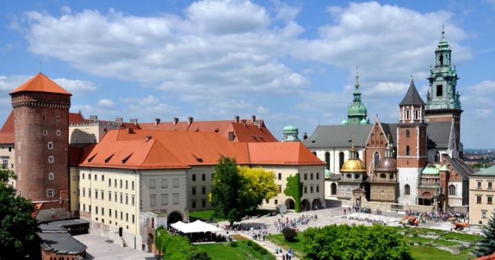
The administrative center of the region is Krasnodar with a population of about 800 thousand. The city was founded in 1793 by the Cossacks of the Black Sea Cossack Army and was named Ekaterinodar in honor of Empress Catherine 11. Currently, Krasnodar is a large industrial, industrial, educational and cultural center of the Krasnodar region.
2. Research multi-level group work with a physical, administrative map of the Krasnodar region (for 3rd grade)
Determine the number of districts into which the Krasnodar Territory is divided;
Find cities with airports:
Show sea cities ports;
Find the Republic of Adygea and its capital;
Determine the route by rail:
From Armavir to Krasnodar;
From Krasnodar to Timashevsk;
3. Route “Amazing nature of the region”
( SLIDE № 5)
Krasnodar region is the most South part Russia, which has long been called Kuban after the name of the river dividing the region into the northern - steppe - and southern - mountainous and foothill parts.
– The nature of the Krasnodar region is unique: it high mountains with forests, glaciers, caves. Mountain rivers first flow rapidly through gorges into wide plains. The steppes are endless, cultivated by the workers of the region. The shores of two seas form the border of Kuban from northwest to southwest. (SLIDE No. 3 )
The Krasnodar region is located within the Northwestern Caucasus. The length from north to south is 400 km. From west to east 360 km. The northern and central parts of the region are occupied by the Kuban Plain, and the southern by the Greater Caucasus Mountains. The uniqueness of nature lies in the diversity of landscapes and their alternation.
The Caucasus State Biosphere Reserve is also located on the territory of the Krasnodar Territory. This scientific natural complex occupies 236.5 thousand hectares and is part of the international network of biosphere reserves.
4. Route “Kuban – health resort of Russia”.
(SLIDE No. 6 )
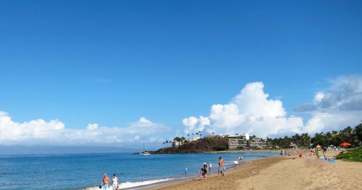
– How wonderful nature is, how it helps people. Beneficial climate, warm seas, unique natural mineral springs and healing mud, mountain and sea beauty - all this determined the direction of the Krasnodar Territory as the largest resort tourist region in Russia and the CIS.
The main seaside resorts Russia: Sochi, Anapa, Gelendzhik, Yeisk, Taman, as well as picturesque resorts in the foothills of the Caucasus: Goryachiy Klyuch, Apsheronsk, Krasnaya Polyana, Khadyzhensk.
– Beneficial climate and sea bathing are active natural biostimulants that, with the correct dosage, have a multifaceted therapeutic effect on humans.
Physical exercise.
5. Route "Olympic Kuban".
( SLIDE №7
Sochi is the capital of the 2014 Winter Olympic Games. This city will be transformed into one of them best resorts European scale. More than 250 objects will be built here using the latest architectural and construction technologies. These are sports palaces and modern hotels, medical rehabilitation, shopping and entertainment centers, numerous park recreation areas.
Sochi is a recognized international resort. One of the recognized sites is Krasnaya Polyana, a modern tourism center. The Mzymta Valley connects this wonderful corner with the Black Sea coast.
6. Creative task (individual, pair work)
– You can make a souvenir, a memorable gift for guests of our region. Display of works (optional).
IV. Summary of the lesson.(SLIDE No. 8 )
– The territory of the Krasnodar Territory is one of the unique corners of Russia. Fertile fields with endless expanses of grain, well-groomed rice paddies, prosperous Cossack villages, huge mirrors of man-made reservoirs, forests and mountains, the fishy Azov Sea and the Russian Black Sea coast- all this is the fertile Krasnodar region. There is another Kuban with its own unique culture, rich history. The most important asset of our region is its courageous, hardworking, cheerful and hospitable people.
V. Reflection.(SLIDE No. 9)
Continue the offer
Kuban is... ( open spaces, sea, mountains, nature, Winter Olympics, etc.)