Truly interesting trekking routes are not only about the path under your feet, but also rich story, and the culture of the place. National Geographic magazine named the 20 best trekking routes in the Epic Trail category.
Pilgrimage to Mount Kailash, Tibet
Best choice for: yogis and other seekers of spiritual enlightenment. Length: 51 km. Hindus believe that on the top of Kailash, at an altitude of 6680 meters, there is the abode of the god Shiva, where he meditates. According to the Vishnu Purana, the peak is a representation or image of Mount Meru, the cosmic mountain at the center of the Universe. The mountain is also a holy place for Buddhists, Jains (a branch of Hinduism) and followers of the ancient Tibetan religion Bon, who consider this unusual mountain to be the “heart of the world”, the “axis of the earth”. The mountain's summit remains unconquered, although in recent years the Chinese government has begun building a road to a sacred pilgrimage route known as kora. Just as the Earth circles around the luminary that gives it life, so Tibetan pilgrims circle around sacred mountain Kailash. Kora (ritual circumambulation) around Kailash. Most pilgrims and pilgrims reach Kailash specifically for the purpose of performing kora. Before starting the tour, make a wish.
Israel National Trail, Israel
Best choice for: long-distance trekkers interested in ancient and modern history. Length: 940 km
The iconic route, opened in 1995, offers glimpses of the sublime beauty of the Middle East's wildlife and the daily lives of modern Israelis, biblical sites and the cities of Tel Aviv and Jerusalem. The route allows tourists to see everything that is of great value to Jews and Christians. He's walking through the area Sharon, goes down to the lake Kinneret, runs parallel to the biblical Jordan River and reaches the Khatsbani stream in the very north of the country. The trail consists of 12 small parts, each of which is a self-sufficient route. As a one-day trekking, you can take a five-kilometer climb up the mountain Tavor (Tavor), To Basilica of the Transfiguration overlooking the Jezreel Valley, on Carmel Range, Mount Hermon, walks in the Galilee and Golan Heights. The biggest blessing here comes in the form of "trail angels" - volunteers willing to lend a helping hand and offer free lodging and food.
Cinque Terre (Five Lands), Sentiero Azzurro, Italy
Best choice for: families; romance seekers; lovers of Europe; older tourists.Length: 12 km. Travel time is 3-4 hours.
Start/Finish: Riomaggiore(Riomaggiore) – Monterosso(Monterosso al Mare). Both points are accessible by regular train services. No map needed, just follow coastline
. Sentiero Azzurro (Azure Path), like beads on a string, strings five towns: Riomaggiore, Manarola, Corniglia, Vernazza and Monterosso al Mare. Take a bottle of water with you, sunscreen, good appetite and hat.

Yoshida Trail, Mount Fuji, Japan
Best choice for: Those who want to take part in what is Japan's cultural tradition. Distance: There are several trails to Mount Fuji, but the most popular is The Yoshida trail is about 13 km long.
Many tourists would rank climbing Mount Fuji as one of their worst treks because of the crowds that can be encountered. The 3,776-meter volcano is the highest point in Japan, one of the most visited places in the world, with more than 300,000 tourists trying to reach the top every year. Regardless, it will be an unforgettable climb. You can stop for a snack or sit by the fire at huts along the way, and if you want to watch the sunrise at the summit, you'll likely be doing so with over a thousand new friends. Crazy experience? Of course not. But this can only be done once in a lifetime. Just remember what the Japanese say: "A wise man climbs Mount Fuji once in his life, only a fool climbs it twice." Tip: You won't avoid crowds, but there will certainly be fewer people ahead of you on the trail if you take a less traveled route to the summit, such as the Gotemba Trail, which is about 16 km long and has a vertical drop of 1,400 meters.

Drakensberg Mountains, South Africa/ Lesotho, Drakensberg Park
This is a big, long backcountry route with no real trail that requires outdoor skills and some familiarity with African backpacking. Many people travel here with guides. Length: Round trip 64 km, from Mont-Aux-Sources to Cathedral Peak. The Drakensberg Mountains are a mountain system located in South Africa, Lesotho and Swaziland. Highest point - Mount Thabana Ntlenyana (3482 m) in Lesotho. The Zulus (Zulu tribe) call them “Ukashlamba”, which means “ridge of peaks”. Dizzying cliffs of volcanic basalt rise above ancient sedimentary rocks. The Drakensberg Mountains are the highest mountain range in South Africa, which is crowned by an amphitheater - a stone wall a kilometer high and 5 kilometers long. This mountain range forms the natural border between South Africa and the state of Lesotho.

Laugavegur Route (Fimmvurduhauls Pass), Iceland
Best choice for: volcanologists and hikers who wish to admire the wild beauty of Iceland while spending the night in huts. Length: round trip approx. 80 kilometers. The opportunity to see what remains after a recent volcanic eruption is not the only thing that attracts tourists to these places. A quarter of Iceland's population says they believe in elves and other mythical creatures, and if you walk through the lava fields and mountains that you will encounter along this route, you will probably begin to believe in them too. These intricate landscapes feature the ice caps of two glaciers and a stretch of North Atlantic on the horizon. The road goes deep into Thorsmörk, a park where you can find trees rare for these places. The final section of the route leads to the village of Skógar and the gorge, where you can see a cascade of waterfalls, including one of the largest and the most beautiful waterfalls in Iceland Skógafoss. Shorter route: You can cover only 20-25 kilometers along the Fimmvurduhauls Pass, cross Thorsmörk Park and walk to the Skógafoss waterfall. It will take one day.

Way of Saint James (El Camino de Santiago), Spain
Best choice for: pilgrims and tourists who love long walks in Europe. Length: 760 kilometers. The main pilgrimage road, the Way of St. James, leads to the cathedral in the city of Santiago de Compostela in northern Spain, where, according to legend, the greatest relic of Spain is located, relics of the Apostle James, the heavenly patron of the country. During the Roman Empire and the Middle Ages it was a trade route. Due to its popularity and ramifications, the route had a great influence on the spread of cultural achievements in the Middle Ages. This route is still popular today and is considered one of the best hiking trails in Europe. Along the way, you can stop in small towns, listen to the stories of pilgrims, and enjoy a glass of local wine. If you're walking at night, be sure to look up at the sky: the Way of St. James runs parallel to the Milky Way. According to legend, the saint painted it in the sky to show Charlemagne the way to the Saracens. Saint James began to be considered the patron saint of travelers. The emblem of this saint is the image shells. Shells were a distinctive sign of pilgrims who entered the Way of St. James, sewn, for example, on clothes. Images of shells decorate buildings and the road along the entire route.

Trail Bigfoot, Bhutan
Best choice for: the most experienced extreme sports enthusiasts. Distance: more 320 kilometers, usually a 25-day trip. You must travel with Bhutan tour guides. The Sasquatch Path is one of the most difficult long treks on the planet. Although it covers just over 320 km, most of route lies above the most high points continental United States, crossing 11 passes over 4,900 m and climbing Rinchen Zoe La Pass (5,300 m). The track passes through places such as Laya, home of the Layap indigenous people, and village Tanza at 4,200 meters, where the guides swap horses for yaks to tackle even more challenging terrain ahead. Here, above the clouds, rise 7000-meter giants such as Zogophu Gamp and Masang Gang. Trek around the soaring peak of Jomolhari(7350m) is a challenging week-long adventure in the high Himalayas. The Dragon Trail takes five days and crosses the highlands between the city of Paro, where the country's international airport is located, and the capital Thimphu, which is famous for its lack of traffic lights. The Bhutanese government has introduced a minimum tariff of $250 per day for foreign tourists to stay in Bhutan. Although this price includes accommodations, expect to spend at least $8,000 on the Bigfoot trail. There is no budget options, and you cannot travel on your own.

Bibbulmun Trail, Australia
Best for: Just about everyone - from families to brisk walkers looking for an adventurous experience of south-west Australia. Length: 965 km from Kalamunda to Albany in Perth on south coast. The route is divided into 58 parts. There are 49 shelters along the trail for true hikers. Named after the indigenous peoples of the area, the Bibbulmun Trail offers the wonders of Australia's endemic flora and fauna. Starting in Kalamunda, 45 minutes east of Perth, the trail passes through eucalyptus forests where many snakes are found. Along the way you can also see many rare animals, poisonous cane toads. There is another social aspect to this route that makes it truly Australian. At campsites, you can meet tourists from all over the world and Australians who travel for weeks to test themselves and learn better unique places in which they live.

Copper Canyon, Mexico
Best choice for: those who want both see wildlife and local culture. Length: approx. 65 kilometers with a vertical height difference of 6 thousand meters.
Copper Canyon, about 1500 meters deep, one of best places for hiking, especially thanks thermal springs at its bottom, an ideal opportunity to recuperate during long hikes. The path through the canyon and back lies in places where there are rivers along the way, and requires skills in crossing such obstacles. There are also steep detour areas where ropes will be needed. The Tarahumara inhabited the canyons long before the conquistadors and continue to live there according to an ancient tradition.
The Undiscovered World also organizes trekking through the Copper Canyon in Mexico.
Western Highland Way (West Highland), Scotland
Best choice for: Anyone who is in decent shape and wants to feel taste of remote mountain regions. Length: 155 kilometers from Milngavie to Fort William.
The trail passes through the Scottish Highlands, which helped the Scottish Highlanders in ancient times to stop the onslaught of the Romans and maintain their independence throughout history. At times the route may seem very long, windswept, but along the way you can admire the rocky peaks and the fabulous Glencoe gorge, climb the Devil's Staircase pass (ascend 700 meters above sea level and descend) and pass by the calm Loch Lomond.

Great Himalayan Way, Nepal
Best choice for: seekers of epic adventures. Length: The Nepalese part of the route covers 1,700 kilometers in the high Himalayas and is divided into ten relatively easy sections. If the weather is good, the entire route can be completed in 4-6 months if everything goes according to plan. Although the concept of the Great Himalayan Route (GHR) is new, the trekking route has been around for a long time. In reality, the VGP is not a track, but a vision that connects the high mountain the path through the Himalayas - through India, Pakistan, Tibet, Nepal, Bhutan and - along existing footpaths and ancient routes of trade and pilgrimage. Although just a concept in other countries, Nepal has made the VGP a reality: a 1,600 km adventure-filled route that includes challenging trails near many of Nepal's 8,000-meter peaks, including Everest, Makalu, Dhaulagiri, Manaslu, Annapurna and Kanchenjunga. . Along the way, the trail passes famous peaks and passes, including a trio of passes Sherpani (6146 m), West Col (6148) and Amfu Labst (5845) between Everest and Makalu
"Unknown World" also organizes on various routes

Shipwreck Cove, Olympic Peninsula, Washington State, USA
Best choice for: Almost any traveler. It's an easy walk in good weather and perfect family adventure. The route goes mainly along the Pacific coast. Length: 3 2 kilometers from Rialto beach to the forestry on Lake Ozette. It’s not for nothing that the place was dubbed “Shipwreck Bay.” Walking up from Rialto Beach, you'll pass the Norwegian Memorial, erected in honor of the 18 young men who died and were buried here in the 1903 sinking of the sailing ship Prince Arthur, and the Chilean Memorial, burial site of dozens of other sailors who died in the 1920s. m as a result of the wreck of the ship WJ Pirrie. But not everything about this route is sad. The beaches, which are part of the Olympic Coast National Marine Sanctuary, are full of life and change. Spend a few days here and you'll feel as if you've traveled back to a time before America knew Europeans. There are many raccoons along the coast. It is better to hang food items higher at night.

Hayduke Trail, Utah and Arizona, USA
Best Choice: For those who love to hike alone in the wild, red rock lovers. Length: over 1300 kilometers, the path is divided into 14 sections. The trail runs through six national parks Colorado Plateau: Arches, Canyonlands, Capitol Reef, Bryce Canyon, Grand Canyon and Zion. It climbs to an altitude of about 3,480 meters on Mount Ellen near Capitol Reef, and then descends to the bottom of the Grand Canyon at an altitude of 550 meters.
If you can only do one of them, choose the second, covering 75 kilometers along the Colorado River and the Needles region of Canyonlands National Park. The trail crosses numerous highways and dirt roads, providing an opportunity to stock up on food and water.
"Unknown World" organizes
Benton McKay Trail, Georgia, Tennessee, North Carolina, USA
Best choice for: long-distance lovers walking routes who want to repeat the founder’s experience Appalachian Trail. Length: 480 kilometers
The lonely, steep, sometimes foggy trail begins at Springer Mountain in Georgia and crosses the Great Smoky Mountains National Park. Along the way there are eight protected areas, as the embodiment of its founder’s desire to preserve ecosystems without human intervention. This is a route for creative tourists. Because begins and ends on the Appalachian Trail and crosses it before entering national park The Great Smoky Mountains, forming a big figure of eight, allow hikers to experience different routes.

International Appalachian Trail, USA, Canada, Greenland, Scotland, Spain, Morocco
Best for: Hikers with experience on the Appalachian Trail and looking for new adventures with a love of geology. Length: The modern route is about 3 thousand kilometers long from the terminus of the Appalachian Trail in Maine to where the North American Trail ends at Crown Head (Newfoundland). Appalachian Trail- an attempt to connect the ancient mountain range, which crossed part of Pangea more than 200 million years ago before splitting into several mountain ranges. What remained of these peaks in North America became the famous Appalachian Mountains of the United States, but few who have walked the American Appalachian Trail would be willing to acknowledge that the mountains continue into Canada and would not stop there. The remains of those mountains stretch from Labrador to Greenland and further to the European continent - Scotland, France, Spain, and even through Gibraltar to Morocco. MAT may be symbol of globalism of the new millennium

Trek Santa Cruz, Cordillera Blanca, Peru
Best choice for: Travelers South America and those who are interested Inca experience; lovers of high-mountain hiking routes other than the Himalayas. Length: more 48 km. While the Himalayas get the majority of the attention when it comes to high altitude trekking, the Cordillera Blanca in Peru offers solitude with big mountains with much less hassle compared to routes in Asia. It is also a less touristy alternative for those going to Machu Picchu The Road of the Incas.

Route Laugavegur, Iceland
Suitable for: volcanologists and hikers who want to admire the wild beauty of Iceland.
Distance: about 80 kilometers. One of the most popular hiking tourist routes in Iceland was closed when the Eyjafjallajökull volcano began to erupt in the spring of 2010, blocking all air traffic over the Atlantic and Europe. A quarter of Iceland's population claims to believe in elves and other fairy tale characters, and if you walk through the lava fields and see the mountains along the route, you'll probably start to believe in them too. With the ice caps of two glaciers and the stretch of the North Atlantic on the horizon, these intricate landscapes will blow your mind. The road goes deep into Tormerk, a park where you can find very few trees, which are very rare in these places. Along the way you can meet well-equipped huts and many local residents. The final stretch of the route leads to the village of Skógar and the gorge, where you can see one waterfall after another, including the stunning giant waterfall Skógafoss, 60 meters high. If the volcano does erupt, this route will be closed again or changed, so it's worth going to Iceland before it's too late.
Main hiking routes in Russia and the CIS countries- this is a selection best routes for tourists who prefer to walk through unexplored places on our planet.
Hiking routes - who are they for?
Hiking is a very special type of travel.
Hiking is a special type of travel
Such journeys require remarkable preparation, enormous strength of spirit and will. An ordinary unprepared person, after the first kilometers covered on his own two feet, will think a dozen times whether or not to travel on foot in the future. Previously, I myself walked along some routes, covered dozens of kilometers along them, saw a lot beautiful places, received a huge number of positive emotions. On some hikes I took friends with me, along several routes, where the path was not the longest or most difficult, my friend and I took our classmates.
Hiking Russia
- Kola Peninsula
The climate of the peninsula ranges from subarctic maritime (northwest of the peninsula) to moderately cold (centre, southwest and east of the peninsula). Most of this territory of Russia is located beyond the Arctic Circle and consists of terraces, mountains (rising more than 800 meters above sea level), depressions, reservoirs (rich in a variety of fish) and plains of numerous lakes and swamps. Climatic conditions The peninsulas provide the opportunity to enjoy the polar day (solstice) in summer, and the aurora in winter.
- Karelia
This region is called a “pioneer” in active recreation and tourism in Russia. Cleanest air, mixed forests with rich flora and fauna, rivers and lakes, attract tourists from all over the world. The climate varies throughout the territory from maritime to continental. The territory of Karelia is composed of hilly plains turning into highlands, lake basins, ramparts (up to 2 km high and up to 200 meters wide), kamas.
- Komi Republic and Arkhangelsk region
The Arkhangelsk region is located along the coast of the Arctic seas, which makes the climate varying from subarctic to maritime to temperate continental. The island part of the territory and some areas of the coast are classified as a district Far North. The territory is a plain with hills on the coast, depressions and lakes in the continental part (Summer Mountains of the Onega Peninsula), creating chains of mountain ranges, hills in the south (Konosha-Nyandoma Upland), low mountains with peaks up to 450 meters high in the east (Timan) and plateaus (ridges) in the west of the region (Wind Belt). The region has a huge number of rivers and lakes. Particularly large lakes and rivers are Lacha, Kenozero, Kozhozero and Northern Dvina, Onega, Mezen and Pechoga. The forest area of the region is presented in the form of mixed forests. It should be noted that such famous nature reserves as the Pinezhsky Nature Reserve, Vodlozersky National Park and Kenozersky National Park are located here.
The Komi Republic is a continuous forest area, since forests occupy almost 70% of its entire territory. The famous Pechora-Ilychsky Nature Reserve (the territory is represented by forests that have never been subject to anthropogenic impact from humans) and the Yugyd Va National Park are protected by UNESCO and included in the list of “Virgin Forests” of the Komi Republic. The climate is temperate continental. The terrain is flat, changing in places to mountains, washed by rivers.
- Leningrad and Vologda regions
The Leningrad region is located on the territory of the Russian Plain, with small hills up to 150 meters above sea level, and lowlands on the coast Lake Ladoga And Gulf of Finland. The climate is Atlantic-continental. Nature – mixed forests, rare species of animals and plants, glacial lakes, rocks, caves and moraine ridges.
The Vologda region is called the region of “white stone cities”, located in the northeast of the East European Plain. The relief is hills, alternating with lowlands and hills. The region is full of lakes, rivers and swamps.
Ural trails
The Urals are a chain of mountains stretching between the East European and West Siberian plains, dividing the continent into Europe and Asia. The climate is sharply continental in the mountains, changing to temperate on the plains. Ural Mountains can be divided into areas:
- Polar Urals (Konstantinov Kamen mountains and the upper reaches of the Khulga River),
- Middle Urals (up to the Yurma Mountains)
- Southern Urals (from the Yurma Mountains to the southern borders of Russia).
The relief of the Urals is plateaus, hills and plains.
Walking through the European territory of Russia
The territory of the European part of Russia is divided into federal districts:
- Central,
- Northwestern,
- Southern
- Privolzhsky.
Hiking in Russia is of course not limited to the routes listed below.
 Russia has many routes for lovers of hiking tours
But the lion's share of them falls on the European part of Russia. The diversity of natural conditions, large extent, flat nature of the terrain and other indicators of commonality make it possible to combine them into a single hydrographic region. Natural conditions due to the extent of the area with a change in geographical landscapes from north to south. The northern part, passing through Kazan - Ufa, belongs to the forest zone. The southwestern part is mixed, deciduous and coniferous forests, and the northeastern part is taiga. The territory is also dominated by forest-steppes, steppes, lakes and swamps. The relief is a hilly plain with small hills over 200 meters above sea level. In the east, the plain is bordered by the Ural Range, the central part is represented by the Central Russian Upland, in the south the Donetsk Ridge with heights reaching 370 meters above sea level, in the southeast there is a vast depression adjacent to the Caspian Sea (Caspian Lowland) and in the northern part there are basins of the upper Dnieper, Upper Volga and Kama. The climate is continental, but due to the extent of the region, climatic conditions vary. Climatic differences are manifested in changes in the landscape from taiga in the north and mixed forests in the northwest to steppes and semi-deserts in the south and southeast.
Southern Siberia
This region of Russia consists of mountain ranges that form the watershed of the Irtysh, Yenisei and Ob rivers. Climatic conditions are a transition from sharply continental winters to short, hot summers. The landscape of Southern Siberia can be divided into five relief belts:
- The Alpine high mountain belt is the most high peaks Altai, Stanovoye Highlands, Tuva and the Barguzinsky ridge with a height of more than 2500 meters with glaciers and snowfields
- Mid-mountain belt - prevails over most of Southern Siberia, the height of the ridges reaches 2000 meters, and in some places 2200 meters
- Low-mountain belt - represented by ridges of hills turning into foothill plains. An example is Transbaikalia.
- Plain - undulating plains on the ridges of Eastern Altai, Sayan and Northern Transbaikalia
- Intermountain belt of basins - steep slopes of ridges with glaciers
Khabarovsk region
It is located in the eastern part of Russia, washed from the southeast by the Sea of Japan, separated from Sakhalin Island by the Tatar and Nevelsky Straits, and includes several islands. Climatic conditions vary from north to south (from continental to subtropical) depending on proximity to the sea and landscape. The landscape is mountain ranges (Sikhote-Alin, Pribrezhny and Dzhugdzhur) and a plateau up to 2500 m high. The Khabarovsk Territory is unique in that it is a “country of taiga”. Light-coniferous taiga covers almost the entire region from north to south, where it turns into spruce-fir taiga.
The territory of the region is rich in rivers, lakes and waterfalls (more than 100), which indicates the diversity of flora and fauna, nature reserves, caves and archaeological sites. Island part Khabarovsk Territory— light-coniferous and dark-coniferous taiga. The main inhabitants are birds that fly here to reproduce.
Exploring Primorye
The region is located in the southeastern part of Russia and is washed by the Sea of Japan. Its territory is represented by lowlands in the west, turning into mountains in the central and eastern parts of the region. Temperate and monsoon climate. The region's attractions include caves and waterfalls, nature reserves and parks (national and natural), rivers and lakes with pure water. The landscape of the region - rocky peaks with snow caps, rocky slopes and wooded slopes, smoothly turning into plains, steppes and swamps. The forests are mostly mixed and coniferous-deciduous with interlacing lianas.
Sakhalin island
Sakhalin Island is the most large island Russia along east coast Asia, washed Pacific Ocean, Okhotsk and Seas of Japan. The geographical position of the island makes the climate temperate monsoon turning into maritime. The island has a huge number of rivers and streams, lakes and waterfalls, mineral springs with healing mud, volcanoes, sites of primitive inhabitants, natural (Moneron Island) and archaeological (more than 250), monuments (about 1000 cultural and historical heritage sites) and geothermal springs. The richness of the flora and fauna is amazing.
Kurile Islands
Part Sakhalin region includes the Kuril Islands, consisting of a chain of small islands (more than 30) with a length of 1200 km. The islands have a maritime climate with high humidity. The territory mainly consists of mountains (volcanoes), mineral springs, natural (Kurilsky Nature Reserve) and archaeological monuments. The length of the islands from north to south represents the diversity of nature. Due to the harsh climate in northern islands the flora is shrubs, and on the southern islands there are coniferous forests and broad-leaved trees. One of the attractions southern islands is magnolia and bamboo.
Kamchatka
Kamchatka is located on the Kamchatsky Peninsula, which is famous for its volcanoes (more than 1000, of which 29 are active), geysers, and on the islands Karaginsky and Komandorsky. There are many rivers and lakes on the peninsula, which originate at the foot of mountains and glaciers. The peninsula is divided by two ridges: the Sredinny (the longest) and the Eastern, between which is the Central Kamchatka Lowland. The coastal climate of the peninsula is dominated by a maritime climate, while the central and northern parts are dominated by a continental climate. Vegetable world peninsula - coniferous and sparse birch forests, cedar and alder dwarf trees, meadows and moss tundra. The fauna is diverse and amazing.
Magadan region, Chukotka
The Magadan region is located along the coast Sea of Okhotsk in Northeast Russia. The region is characterized by a subarctic climate, turning into a marine one. The region consists of mountains (in the North they are called Sopki) and plateaus, such as: the Verkhoyansk ridge, the Oymyakon and Upper Kolyma highlands, the Yanskoye, Yukagir and Elga plateaus. The forest occupies most of the territory and consists of evergreen forests and relict poplar forests.
Chukotka is the most severe and mysterious region in the entire territory of Russia. Most of the territory is located beyond the Arctic Circle. Chukotka is located on the entire Chukotka Peninsula and adjacent islands. The subarctic climate gives way to marine on the coast and continental in the interior. Permafrost covers the entire Chukotka region. Most of the peninsula is mountain and arctic tundra with shrubs, lichens, grasses and mosses. Light coniferous and relict poplar forests are occasionally found. The peninsula consists of several natural areas(arctic desert, typical and southern tundra, forest-tundra and deciduous taiga) which explains the great diversity of flora and fauna.
Such natural phenomena as the Northern Lights and winter, lasting 10 months, do not occur anywhere else.
Caucasus (Western and Eastern parts)
The Caucasus is a mountainous region of Eurasia, located between the Azov, Black and Caspian seas.
You can watch a great video about hiking 4 categories of difficulty in the Caucasus.
I have always admired the guys who walk such routes. The landscape of the mountains depends on the height and distance from bodies of water. Starting from swamps and glacial forests in the center and west and moving to high-mountain semi-deserts, steppes and meadows in the south. Mountain forest - fir and spruce forests. The Caucasus mountain system is divided into three regions:
- Western Caucasus (mid-mountain and high-mountain ranges covered with snowfields and glaciers). For example, Arkhyz and Sofia waterfalls),
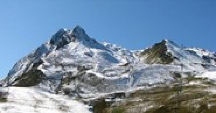
- Central Caucasus (the highest peaks exceeding 5,000 meters above sea level. For example, Elbrus)
- Eastern Caucasus (low-height mountains running from the mountain from Kazbek to the Absheron Peninsula).
Hiking – Crimea
The relief of Crimea ranges from plains in the East to hills and mountain ranges in the South-West of the republic. Nature is rich in mixed forests, pine forests, steppes and forest-steppes. Most of the country has a temperate continental climate, turning into a Mediterranean climate. south coast Crimea (Crimean Peninsula).
The main destination of tourism in that region is Crimea. Therefore, it is not surprising that
 Tourists in Crimea could always find stunningly beautiful places
and has always been popular. Mountain Crimea is interesting for its historical and archaeological cultural monuments (cities and monasteries in caves, medieval fortresses), palaces, waterfalls, salt lakes (about 50) and landscapes. A distinctive feature of Crimea is the smooth transition from mountains to flat steppes, the change from cool air to sea breeze.
Kazakhstan and Central Asia
The relief of the territory of Kazakhstan is highlands, lowlands, hills and plains with endorheic basins. The climate is mainly sharply continental. The mountain system is represented by the ridges of the Mangystau Mountains, deserts in the Balkhash-Alakol depression, and the Saryarka upland.
We have truly magnificent places in Kazakhstan in their beauty. Having walked many routes, I was convinced of this more than once. I invite everyone to come and see this for themselves.
Most of Central Asia (Kyrgyzstan, Tajikistan, Turkmenistan, Uzbekistan) is occupied by semi-deserts and deserts, which indicates an arid climate. IN mountain range Central Asia includes: the Ustyurt plateau, the Turan lowland, the Turgai plateau, the Kazakh small hills, the mountains: Kopetdag, Pamir-Alai, Tien Shan, Dzungarian Alatau, Saur and Tarbagatai. The relief of the territory of Central Asia can be divided according to its constituent states:
- KAZAKHSTAN: plains from the Volga to Altai and from Western Siberia to the oases and deserts of Central Asia;
- KYRGYZSTAN: Tien Shan ranges with valleys and basins;
- MONGOLIA: vast desert and semi-desert plains; in the west and southwest there are mountains; in the southeast the Gobi Desert;
- TAJIKISTAN: Pamir and Alai Mountains; Fergana Valley (western part) in the north, Kofarnikhon and Vakhsh valleys in the southwest;
- TURKMENISTAN: hilly or flat sandy desert with dunes, merging into mountains along the border with Iran;
- UZBEKISTAN: flat sandy deserts with dunes; wide and flat, valleys abundantly irrigated by the Amu Darya, Syr Darya and Zeravshan rivers; Fergana Valley (eastern part) surrounded by the mountains of Kyrgyzstan.
Tien Shan
Tien Shan (“Heavenly Mountains”) is a mountain range located in Middle and Central Asia. The main part of the Tien Shan is located in Kyrgyzstan, the northern and western ranges are in Kazakhstan, and the southwestern part of the Tien Shan is in Uzbekistan and Tajikistan. Geographically, the Tien Shan Mountains are divided into regions:
- Northern (Kyrgyz Range, Kungey-Alatau, Ketmen, Chu-Ili Mountains, Trans-Ili Alatau and Issyk-Kul)
- Western (Chatkal, Sandalash, Pskem, Maidantal, Ugam, Fergana and Atoynok ranges)
- Eastern (Kuylyu, Akshiyrak, Dzhetymbel, Naryn-Too, Borkoldoy and At-Bashy ranges),
- Central
- Internal (valleys covered with moraine sediments, covered with grass, which creates conditions for pastures (syrts)).
The Tien Shan ranges are characterized by mountain-glacial relief, which indicates a sharply continental climate. Vegetable and animal world individual areas of the Tien Shan Mountains varies significantly depending on climatic and relief features.
Republic of Belarus
The republic is located in Eastern Europe, which indicates a temperate continental climate with mild winters and warm summers. The terrain is flat and in some areas becomes elevated. Nature, rivers and forests, attract tourists from all over the world. The routes pass through nature reserves and national parks with minimal impact on the surrounding nature.
The tourist’s path passes along specially equipped paths. Examples are such parks as “Narochansky”, “” and Polessky Reserve.
Carpathians - Ukraine
The Carpathians are a mountain range in Central Europe, passing through states such as Hungary, Slovakia, Ukraine (which is why I decided to insert an overview of the Carpathians in this article), Poland, Serbia, Romania and part of Austria, the peaks of which are covered with glaciers. The total length of the chain is 1600 km. The relief is represented by turbulent rivers, forests and meadow valleys.
All mountain range can be divided into alternating climatic zones: Highlands (cold with high humidity), middle mountains (moderate cold), Carpathian region (warm and moderately humid), Lowlands (high humidity) and Transcarpathia (warm and humid). The climate is generally temperate continental, sometimes warm due to the frequent presence of the Atlantic cyclone.
Well, it seems to me that I covered almost all the main hiking routes Russia and CIS countries. Go, explore, admire the great nature and beautiful views.
If anyone has anything to add, I would also be grateful for comments. And please share the article materials with your friends using the social network buttons.
Soon I will add materials on many hiking routes. therefore, subscribe to site updates so as not to miss them.
For those who love hiking, kilometers of road and a hiking backpack behind them, “old lady” Europe has prepared a lot of interesting things. In almost every country there are several dozen popular and not so popular trekking routes.
Choose strong boots and hit the road!
St. Olaf's Trail
Sweden - Norway
Immersion in the northern nature and culture of Scandinavia awaits all travelers who decide to walk all or part of St. Olaf's Way. It starts in the Swedish city of Selanger and ends in the GothicNidaros Cathedral in Trondheim, Norway. The trail was abandoned for a long time, but after the joint efforts of the Swedish-Norwegian authorities, it was mapped and marked in the area, opening a fascinating page of its cultural heritage for pilgrims and tourists. The route runs through forests, farmland, waterfalls to the symbol of Norway - the fjords. Medieval churches, monasteries, traditional family farms complete the overall picture.
Story
St. Olaf is known throughout the Scandinavian countries. In the 11th century, he became the first king of Norway to unite its regions into a single state. A lot of effort was spent on Christianizing the country and fighting paganism. Olaf's innovations met resistance from the old nobility, and soon he had to flee from Norway to Novgorod. In 1030, the king tried to regain the Norwegian throne, but was killed in battle. He was buried in the Nidaros Cathedral, and a year after his death he was canonized. Thus, the path of St. Olaf repeats the last journey of the Norwegian king Olaf II through the Scandinavian lands.
Route length
The length of the route through two countries, from coast to coast, is 564 km. It is divided into several sections, for each of which developed detailed maps. In terms of time, completing the entire route takes 25-30 days. Many travelers complete the journey in parts, others only complete the final section, which leads from Stiklestad through forests and agricultural fields to Trondheim (7 days).
Suitable season
Due to the features geographical location The trekking season in Norway is short – from June to September. Most pilgrims complete the journey by the end of July to attend the Feast of St. Olaf. It lasts several days, and during this time Trondheim hosts many cultural events: medieval festivals, market days, exhibitions and concerts.
Helpful information
The St. Olaf Trail is marked with special markers and is easy to follow. Accommodations are located along the entire route - from budget campsites and farms to comfortable hotels. The most economical option is to take a tent. Of course, it will become an additional burden, but it will give complete freedom in choosing a place to relax. All points where you can have a snack and replenish supplies of food and water are marked on the maps, so a map and compass are a must-have for every tourist. You can use the route planner and find out details on the websites Pilegrimsleden and Pilegrim.
Blue trail
Italy
The Cinque Terre National Park in Italy attracts millions of tourists every year. Hundreds walking routes run through its picturesque terrain. One of the most famous is the “Blue Trail,” which connects small coastal villages and winds along the Mediterranean Sea.
Attractions
Former fishing villages - Monterosso, Vernazza, Corniglia, Manarola, Riomaggiore - are located a short distance from each other. Bright village houses hidden in the rocks near the water, old castles, ancient buildings, vineyards and unforgettable landscapes will give you many pleasant impressions. The trail passes close to small beaches and coves, many of which are wild and secluded.
Route length
The Blue Trail is designed for travelers of all ages. Most of the route is on flat terrain, making it suitable for families with children and elderly people. The entire 12 km journey can be completed in 4-5 hours, or you can split it into two days, stopping overnight in one of the coastal villages. The main road has many small branches that are also worth a walk.
Suitable season
From mid-March to mid-October, the Cinque Terre experiences stable, dry weather, conducive to hiking. But July and August are the hottest months. During the other half of the year, the trail may be closed to the public due to prolonged rains and small landslides.
Helpful information
There is a fee for walking the trail. The cost varies between 5-8 euros, the ticket price depends on the number of open sections of the road. During high season, hotels and private pensions are in demand, so it is recommended to book a room in advance.
Ring of Kerry
Ireland
You can see the real Ireland with its Celtic folklore, fairytale forests, ancestral castles and hospitable locals on a trip around the Ring of Kerry. This is a circular route through the beautiful countryside of County Kerry, in the southwest of Ireland. The untouched nature of the region has always been especially attractive to tourists; this road is the most popular tourist destination in the country after Dublin.
Attractions
Most of the route winds along the coast Atlantic Ocean, That's why panoramic views and beaches are constantly found. There are also small fishing villages where you can take a break and drink a pint of beer. In addition to pleasing landscapes, travelers will see many medieval churches, fortresses, monasteries and other historical and cultural sites. Main attractions of the route:
- The town of Killarney with the national park of the same name located nearby;
- Muckross Abbey and Ross Castle;
- 19th-century mansion Muckross House;
- Derrynan House;
- The village of Sneem and the ancient fort of An Shteg.
Route length
The Ring of Kerry is a 179km road starting in Killarney and traveling clockwise to Kenmare and beyond. You can travel along the route by car, bicycle, motorcycle, tourist bus or on foot. Buses run during the summer season and stop only at the main points of the route. The excursion takes 5-6 hours.
For pedestrians, the Ring of Kerry stretches up to 215 km. The road goes a little higher than the highway, offering beautiful scenery to travelers.
The walking time depends on the degree of physical fitness and the body’s ability to walk for several hours in a row. But, in general, you should count on 9 days.
The path is divided into 9 sections: Killarney - BlackValley - Glencar - Glenbeigh - Cahirciveen - Waterville - Caherdanie - Sneem - Killarney. The route is marked on the ground by a walking man or yellow arrows.
Suitable season
You can walk along the Ring of Kerry at any time of the year. Snow occasionally falls during the winter months. You should also be prepared for rain. The weather in Ireland is changeable, so seeing all 4 seasons in one day is an absolutely everyday occurrence.
 Ring of Kerry route
 Helpful information
There is no shortage of restaurants, cafes, hostels, hotels and other tourist infrastructure in this region. They are marked on the map, which can be obtained from tourist offices. Entrance to a number of cultural sites is paid. If you plan to visit each of them, it is better to buyspecial card . It entitles you to free admission to all cultural heritage sites in Ireland for a year. detailed information about the route And .
GR 20
France
Enjoy the beauty and natural wealth The Mediterranean island of Corsica is possible on the GR 20 route. Thanks to the coniferous forests, alpine meadows and mountainous sections along the way, it is called the most exciting trek in Western Europe. Corsica has 128 mountain peaks, so mountain lovers will especially like it here.
Story
The route was laid in the 70s of the 20th century, when Corsica faced an acute problem of population outflow into the interior of the island. The goal was to “revive” the mountain pastures and prevent the ancient transhumance routes between villages from disappearing. Soon a national park was created, and a little later the trail gained well-deserved fame among local residents and tourists.
Route length
GR 20, which is 180 km long, crosses the island from north to south and consists of two sections. The northern part starts in Calenzana and ends in Vizzavona. Due to its steep slopes and uneven paths, it is considered more challenging, but also more scenic. The southern section stretches from Vizzavona to Conca and is convenient for beginner trekkers. The entire route takes about 15 days of travel.
Suitable season
The best time to hike the GR 20 is from June to September. The road requires tourists to be in excellent physical shape and have the skills to walk over rough terrain. In the off-season, the weather worsens and becomes unpredictable, which is dangerous for beginners. During the winter season, the route can only be used by experienced skiers with a guide, as most of the road is covered with snow.

Helpful information
The road is marked with red and white rectangles on rocks, boulders and trees. However, it is easy to lose your way, so it is better to take maps of the area with you. Throughout the route, every 4-8 hours there are mountain huts (shelters) that offer basic accommodation and meals. The hut features one large room with wooden bunks and mattresses. Places are filled on a first-come, first-serve basis. There is a special area for tents fenced nearby; pitching a tent in other areas of the park is not allowed. The cost of accommodation and food varies, on average it is 15 euros for a bed in a house and 6 euros per person when staying in a tent.
GR 20 is a real hike where you can’t get by with just strong boots, so it’s worth deciding in advance on the list of necessary things and arriving at the beginning of the path prepared. Information for hikers about the nuances of the route and its updates has been collected Online .
Lycian Way
Türkiye
Walking Mediterranean Turkey along the Lycian Way is an option for those who want to avoid crowded beaches and hyped tourist attractions. Instead, the route is filled with landscapes of the Taurus Mountains, azure bays, rocky canyons, orange groves and picturesque ruins of ancient cities.
Story
Lycia is ancient civilization, which many millennia ago was located on the southern coast of modern Turkey. For a long time, Lycia remained autonomous, later became a province of the Roman Empire, and after the 11th century it was conquered by the Seljuks. The Lycian tombs, carved into the rocks, are the best preserved from those times. They are easy to spot while moving along the trail. In addition, you can see with your own eyes:
- the ancient cities of Phaselis and Olympos;
- natural attractions - Butterfly Valley and Goynuk Canyon;
- the famous lights of the Chimera, forever burning on Mount Yanartash;
- the pilgrimage town of Mira and the Church of St. Nicholas (known in Orthodoxy as St. Nicholas the Wonderworker);
- picturesque coastal villages of Kabak, Oludeniz, Cirali;
- endless Patara beach and much more.

Route length
The Lycian Way runs 540 km from Fethiye to Antalya. It runs between the mountains and the coast along goat paths and footpaths. Sometimes there are steep and rocky slopes. The starting point is in the village of Oludeniz, a two-hour drive from Dalaman airport. The final point is located near international airport in Antalya. The entire route lasts 29 days, but travelers usually choose to travel only a few sections of the road. Some of them lie close to populated areas and are suitable for day trips.
Suitable season
The best time to complete the route is April-June and September-November. Summer in Lycia is too hot and tiring for long walks, and in winter there can be prolonged rain.
Helpful information
The Lycian Trail signpost is a red and white rectangle. On winding sections of the road, rocks and stones are generously marked; on a flat path, signs are less common. The wrong direction is marked on the ground with a red cross. Although a map is considered unnecessary for short walks, it will come in handy for longer distances. It contains the necessary information: places to stay for the night, settlements, sources of drinking water. Every 10 km there are small villages, equipped campsites or private boarding houses where you can spend the night. But on some sections of the route, your own tent is the only option for rest, so you should carefully study the information before going on a hike.
More useful details about the trail and tips for tourists can be found .

King's Path (Kungsleden)
Sweden
For the harsh northern nature and ringing silence, you need to go to Sweden. Kungsleden is one of the most famous hiking trails in this Scandinavian country, which runs beyond the Arctic Circle through fabulous Lapland. Pine, birch and spruce forests, glaciers, mountain rivers and massifs - all the natural diversity of this region is presented on the Royal Trail.
Attractions
Kungsleden owes its origins to the Swedish Tourism Association, which since the beginning of the 20th century has been trying to make the country's Arctic landscapes accessible to local and foreign tourists. The route runs along picturesque mountains Lapland and crosses:
- Abisko National Park with the station of the same name. IN winter time this place becomes a center of pilgrimage for tourists who come from all over the world to admire the northern lights;
- the most high mountain Sweden - Kebnekaise;
- mountain villages of Hemavan and Tärnaby;
- treasures of Lapland: National parks Stora Sjöfallet, Pieljekaise and Sareks.
Route length
About 440 km of trail stretches between the villages of Abisko in the north and Hemavan in the south. The route is divided into 4 sections (Abisko-Singi-Kvikkjokk-Ammarnäs-Hemavan), each of which involves one week of travel. The most popular tourist part of the trail is the section between Abisko and Kebnekaise.
Suitable season
The summer season, which is considered the best period to conquer the route, lasts from mid-June to the end of September. In winter, namely from mid-February to the end of April, the trail can be passed on skis or snowmobiles. During the off-season, the weather can be unpredictable due to early or late snowfall.

Helpful information
The trail stands out in the area, and its inconvenient sections are well equipped. Boardwalks cover overly marshy soil, bridges have been built between mountain rivers, and ferries operate between lakes in the summer months. Almost along the entire route there are huts where you can wait out the bad weather, spend the night and cook food. Or pitch a tent nearby for a small fee. Detailed information about the route is located
Despite the ever-increasing number of cars on the roads, flights, sea cruises, hiking remains popular among travelers. This is one of the types of sports tourism and an excellent opportunity to travel around the world.
The “sports” name for hiking is trekking. It allows you to visit the most unexplored and inaccessible corners of the globe.
If we talk about the sports component of hiking trips, then, by analogy with, they have 6 levels of difficulty. Thus, categories 1–3 are weekend hikes, and the highest category 6 implies the presence of serious obstacles on the route - mountain passes or gorges, deep rivers, rocks, etc. It is noteworthy that by doing hiking professionally, you can receive the title of master of sports. 
Currently hiking developed throughout the continental part of the Earth, and even in Antarctica. But it is most popular in Europe, the Himalayas and North America. And if people travel around Europe and America, first of all, to see new places, then climbing Chomolungma (the peak of the Himalayas) is far from an easy walk. Hiking in the Himalayas allows one to challenge oneself, overcome difficult climbs and enjoy stunning views.
Slovenia is ideal for hiking trips. This small country has it all: and beautiful mountains The Alps, and amazing nature, and cities with interesting architecture, and the stunning mountain Lake Bled with a small church on an island...
In order to cross the dwarf country of Liechtenstein, you will need no more than 1 day. After all, the area of this state is only 100 square kilometers the most picturesque mountainous area between Austria and Switzerland. And one of the hiking routes in Liechtenstein from the Swiss to the Austrian border is only 12 kilometers.
Traveling through Northern England along Alfred Wainwright's route is a walking classic. You will cross the UK from west to east, much of the route passing through countryside and moorland. 
The Dublin-Dingle walking route will allow you to get acquainted with the beauties of Ireland. For about 10 days you will travel through green valleys, coasts, and mountainous areas.
Some of the best hiking trails are located in France. There are about two hundred thousand kilometers of trails and routes throughout the country. You will be able to walk the paths of Brittany, wander along the rivers, visit the peaks of the Cevennes, etc. While traveling around the country, you will constantly encounter white and red GR signs on your way - roads for long trips are marked there. hiking, as well as yellow PR signs - they indicate roads for walking and hiking.
Benefits of Hiking
Affordable price. By traveling on foot, you save impressive amounts on travel. In addition, you can sleep in an open-air tent, eat in non-tourist places - a great opportunity to see the world for literally pennies.
- Do not miss:
Cognition. To get to know the spirit of a city or country, seeing its main attractions is not enough. After all, the main flavor is in residential areas, in bazaars, in cafes and restaurants where they eat local residents. You can get off the hiking trails and admire the area in its true form, observe nature, and relax your soul.
freedom of choice. Walking tourism does not tie you to the schedule of planes, trains or electric trains. You can change your route at any time, linger in places you like, and visit attractions that were not included in the original plan.
Simplicity. Hiking is simpler than other types of travel in many ways. So, crossing the border on foot is much faster than by car. And, living in a tent, you don’t have to leave it at 12 noon, like hotel room.
- Read also:

Disadvantages of Hiking
Lack of comfort. Of course, traveling in the seat of an airplane or car is more comfortable than traveling on your own. And a hotel room, whatever one may say, is more comfortable than a tent. But if you are not picky in terms of amenities, this is not a problem at all.
Physical training. Hiking requires a certain level of physical fitness. Those who lead a sedentary lifestyle, move little and hardly run, will get tired on the first day.
Link to weather conditions . Every tourist wants it to be warm and sunny during his trip. But, if for automobile and bus tours rain is more or less acceptable, then walking for several hours in the cold and in pouring rain is a very dubious pleasure.
- This is interesting:
Despite the disadvantages, hiking is a healthy lifestyle and a unique opportunity to see the most interesting places our planet, while spending very little money.
Trekking is walking tourism, usually involving group movement over slightly rough terrain. Trekking can include mountain ascent/descent, forest crossings, and snowy areas, so this is often an option for experienced tourists, and it requires preliminary preparation.
Why France?
What are the advantages of trekking tours in France? What makes this country attractive? active tourists from all over the world? The answer is simple - wild nature The country and its ancient culture are so diverse that any traveler will find a place to suit his taste: from the snow-capped peaks of the Alps to quicksand Normandy, from majestic medieval castles to caves with ancient cave paintings. France equally combines cultural and natural wealth.
The best French trekking routes
There are countless walking routes offered by operators. We have selected some of the most interesting ones:
- Natural Park of Neuvielles;
- Corsican route;
- Valley of Miracles;
- Tour du Mont Blanc.
If you are particularly attracted to the Pyrenees, then your trekking tours to France may well begin in Neuvielles. The mountain route, which practically never drops below 2000 m, will demonstrate the idyllic harmony and beauty of the Pyrenees. The high mountain pastures near the Gler mountain shelter will introduce you to ancient cattle trails, here you can learn about the life of modern shepherds and taste local cheeses. The most impressive panorama on the route opens from the top of the Turon du Neuvielle.
The Corsica route among professionals is called GR20 and involves traveling through the Corsican mountain range. The pearl of this route are the Pozins of Bastelica - miniature lakes with which some mountain meadows are dotted. Pozins appeared due to glacial activity 8000 years ago. Another unusual attraction on a Corsican trekking tour is the ancient Tragget sheepfold, demonstrating the region's pastoral history.
The Valley of Wonders is a place in the middle part of the Alps where many cave paintings from prehistoric eras were found, of which over forty thousand have already been discovered here. This trekking route is especially interesting for those tourists who expect not only alpine beauty from their trip, but also unusual cultural sites.
The classic route along the Mont Blanc ridge involves traveling through the territory of three countries: France, Switzerland, Italy. Numerous passes, mountain gorges, the peaks create a charming atmosphere of a mountain hike, and constantly opening views of Mont Blanc from various angles confirm the majesty of this massif. Overnight stays are planned in picturesque villages and mountain hotels. This tour is so popular that it even hosts the annual Mont Blanc Ultra Trial, where trekking pros compete to complete the route against the clock.