Many good and truthful books are dedicated to Fersman, a scientist and citizen, teacher and mentor of creative youth; Streets in Moscow and Apatity are named after him; oil-bearing structure in the Caspian Sea; rare minerals fersmanite and fersmith, first discovered in the Khibiny Mountains. The titles of Fersman Prize laureates are awarded to scientists who have made a significant contribution to the development of mineralogy and geochemistry.
In the memoirs of contemporaries who were lucky enough to work and communicate with Fersman, we see a “bright, noble image of a wonderful man with a beautiful soul, a poet of science and a singer of stone, a temperamental researcher and generator of ideas, the author of “Entertaining Mineralogy,” who was the pride of our science, a patriotic scientist, the successor of Mendeleev's determination, who introduced new ideas into chemical technology, a remarkable contribution to crystallography, a fiery beacon of knowledge, a great mineralogist, a tireless traveler and geographer, the discoverer of the Khibiny Mountains, an inspired propagandist of science, a wise mentor of subsoil researchers, our Russian gem, a brilliant guide who persistently called for collecting and accumulate facts, study, protect and use nature.ʺ
What has just been said about the bright personality of A.E. Fersman’s words are not my words: they are only a small part of what was borrowed from the compilers of the book of memoirs “Life and Work,” released on the 80th anniversary of his birth.
Ten years later, “Problems of Mineral Raw Materials” was published, also on the occasion of Fersman’s anniversary. In this collection, the memoir genre is already noticeably inferior to the generalizing articles of prominent scientists about the post-Fersman stage of the development of geology. And finally, the author of these lines together with the first president of the Russian Academy of Natural Sciences D.A. Mineev for the 100th anniversary of A.E. Fersman is dedicated to the monograph “New Khibiny Apatite Deposits”, which tells about the continuation of the discoveries and explorations he began in the Khibiny Mountains.
The most memorable pages of his biography are associated with the Khibiny: ʺ Among all the experiences of the past, among the various pictures of nature and human economic activity, the most vivid in my life were the impressions from the Khibiny of an entire scientific epic, which for almost twenty years filled all my thoughts, owned my entire being, tempered my will, awakened new scientific thought, desires, hope. Only through perseverance and stubbornness, only through enormous work on the Khibiny mountains could we achieve results in this land of wonders, a country that, like in a fairy tale, revealed its riches to us.
INTRODUCTION...
The first one and a half hour route A.E. Fersman to the outlying Mannepahk hill in 1920 became the initial milestone of systematic exploration of the subsoil Kola Peninsula, which attracted his close attention until the end of his life. Then there were hundreds of other difficult routes to the Khibiny Mountains, Monchetundra, Kovdor, Afrikanda, and other ore points, routes recorded in diaries, “tied,” as geologists say, to place and time, but that first and accidental one remained imprinted only in Fersman’s memory.
However, is it random?
In December 1919, in hungry and cold Petrograd, the leaders of the Russian Academy of Sciences A.P. Karpinsky and A.E. Fersman, “concerned about the best use of all forces applied to the study of the North,” developed a strategy for studying natural resources northern expanses of Russia. They addressed an open letter to all scientists who had previously worked for vast territory from Spitsbergen to Chukotka, to assist in this enterprise with your participation or advice.
To a meeting in old mansion Authoritative experts on the Russian North, in total more than 70 prominent scientists, gathered at the Russian Geographical Society in Demidovsky Lane. Under the chairmanship of 36-year-old A.E. Fersman from May 16 to May 24, 1920, ten hours a day, 77 reports were heard on geology and ancient mining, animal and fisheries, on nature and domestic experience in the development of the North, on population and handicrafts...
A few days after this, a resolution of the Council of Labor and Defense was issued on the completion and operation of the Murmansk railway. Soon, a government commission of specialists from the Academy of Sciences (A.P. Karpinsky, A.E. Fersman), the Geological Committee (A.P. Gerasimov) and the Geographical Society (Yu.M. Shokalsky) left Petrograd for Murman by a special train for personal survey to assess the nearest ways of developing the region.
On the fourth day, on the night of June 9, the train arrived at Imandra station. Taking advantage of the forced stop to refuel the locomotive with firewood, Fersman made the first ascent of Mount Mannepahk. The gaze of Fersman, an unsurpassed mineralogist, opened amazing world stone: ʺIn the gray monotonous nature, among the rocks with gray lichens and mosses, there is a whole range of rare minerals: blood-red or cherry eudialytes, sparkling sparkles of astrophyllite like gold, bright green aegirines, purple fluorspars, golden sphenes..., and you can’t count that motley pictures of the colors that nature has endowed this gray corner of the earth with.
Upon returning to Petrograd, Fersman began preparing an expedition to the Khibiny Mountains.
Igor Vladimirovich Davidenko - geologist, Doctor of Science - in his poem dedicated to Fersman, describes his impressions of the first route to the Khibiny Mountains:
On that route, he encountered strange stones that he could not read about in the most complete reference books. The young academician throws up his hands in surprise - I have never met anyone like him. And science doesn’t know anyone like that! We'll be back here. We'll come with a bunch of scientists! Let the Khibiny mountains wait for us a little! This was reconnaissance before the attack. This was in the twentieth year. You can, of course, believe in chance, in blind luck. But luck favors the brave, those who are ready to find! Fersman was one of those. And from the past, begun, that distant route has outlined the paths in our time.
"STRANGE EXPEDITION TO THE TUNDRA"
Upon returning to Petrograd, Fersman turned to the Council of the National Economy with a request for assistance in organizing an expedition to the unexplored Khibiny Mountains. Here is the text of this statement, printed on St. Petersburg University letterhead:
“This is to certify that, under the leadership of Professor of Mineralogy, Academician A.E. Fersman, an expedition is being organized to Murman in the Khibiny Mountains for geological and mineralogical work in granite massifs for the purpose of extracting minerals, minerals for the needs of the university, the Academy of Sciences and for ongoing work at the university. Due to the difficult work in the tundra and the critical condition of the travelers’ shoes, the dean of the Faculty of Physics and Mathematics asks for 12 pairs of boots and galoshes for the expedition of 20 students, specialists in geology and mineralogy, for a month.”
Dean A.E. Fersman
Next came a list of “those in need of shoes”; among them the names of E.M. Bonstedt, E.E. Kostyleva, N.N. Gutkova, other active participants in the annual Fersman expeditions to the Khibiny Mountains, a total of 11 names. The statement wandered around the offices of the Council of Economic Affairs of Moscow for a long time until it returned to the Petrograd Complaints Bureau, crowned with a mocking resolution: “A strange expedition to the tundra of 11 women and 1 man.” And yet the expedition took place.
Over two weeks of cold September, a group of enthusiasts explored the peaks of the Uts-Khibiny (Fersman used the toponymy of Wilhelm Ramsay, who called the western ridges the Small (Uts) Khibiny, and the eastern ridges the Greater (Shur) Khibiny), collected a rich collection of minerals weighing 25 pounds (this was a women's team !), in between difficult routes, we gave popular science lectures to the small population of the Imandra and Khibiny railway stations, who were not spoiled by communication with representatives of the capital’s science.
...Our old “heater” - a freight car - was either coupled or unhooked from overloaded trains, which were hardly pulled by worn-out locomotives. For ten days we dragged ourselves from Petrograd to Khibiny and from here we went to the mountains...

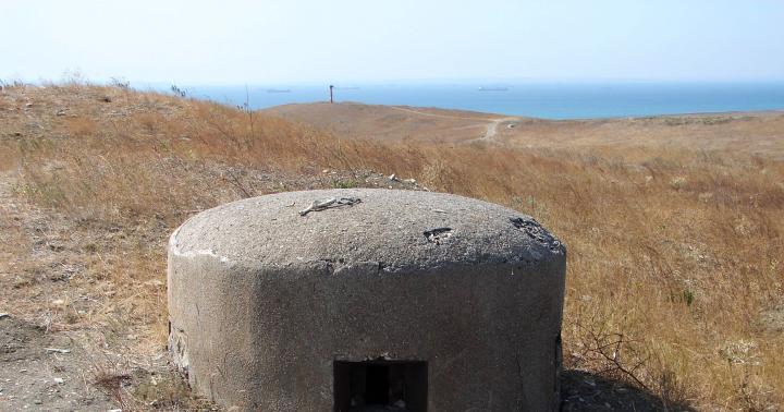
Beginning of August 1921. Photo taken by A.E. Fersman. Near the "heatbox" food is cooked in a cauldron. Pom. the head of the Khibiny expedition Boris Mikhailovich Kupletsky, Ekaterina Evftikhievna Kostyleva and Elsa Maksimovna Bonstedt. (From Kamenev’s archive.)
Funds for the expedition were pooled together, with its leader contributing a large share. ʺThe complete lack of shoes and insufficient provisions did not allow extending excursions and undertaking new routesʺ, note in Fersman's diary. This means that the official from the Complaints Bureau limited himself to a bold mockery, but did not give out the shoes. And although the expedition was not financially secure, was not equipped with equipment, Fersman prepared for it, read travel notes predecessors of Russian geographers of the last century: A.F. Middendorf, N.V. Kudryavtsev, Finnish geologists Wilhelm Ramsay, Alfred Chilman, French mineralogist Charles Rabo. By right of a pioneer, he named the mountain peaks after them. True, these names did not catch on: then there was no geographical maps, and Fersman could not know that these mountains have original Lapland names: Yumyechorr, Chasnachorr, Putelichorr, Iidichvumchorr.
Reading now these records, which have become a bibliographic rarity, you discover another feature of Fersman the scientist: being a pioneer and knowing that others would follow in his footsteps, he did not limit himself to presenting geological observations, describing pegmatite veins and the minerals that compose them. Addressing tourist readers, he explains to them where it is better to cross a mountain river, which slope is easier to reach the top, how to choose convenient place for overnight stay:
“In our footsteps, along the paths of our first expeditions, others will follow, and let the Khibiny massif, proudly standing out above the forests, lakes and swamps of the Kola Peninsula, become a center of tourism, a school of science and life.”
During scientific expeditions, the geographical and geological maps compiled at the end of the last century by V. Ramsay, V. Gakman and A. Petrelius were refined; observations were made of landforms, climatic conditions, Aboriginal customs were studied.

MAP OF THE KHIBINY MOUNTAINS BY V. RAMZAY. 1887-1892.
The atmosphere of camaraderie and brotherhood, generally characteristic of scientific teams headed by A.E., helped the excursionists, as they called themselves, to overcome the difficulties and hardships of nomadic life. Fersman. Between the older “fersmanoids” and the younger “fersmanites” there were familiar relationships, painted in the soft tones of friendship, kindness, mutual assistance and care for each other. Every Khibiny citizen, regardless of which clan he belonged to, had a funny nickname, which, however, did not replace the patronymic name in business relations. For his rapid mobility, Fersman himself was called “Ball Lightning” or, according to the usual abbreviations of that time, “Glavnachem”, that is, “Chief Chief”.
KHIBINY DAYS AND “FRIDAYS”
These friendly ties did not break during the winter office period, “when our entire Khibiny youth team, having barely returned from one expedition, was already beginning to prepare for the next,” Fersman recalled. “Khibiny Fridays” were traditional, where scientific and personal impressions of the past season were discussed, plans for the coming summer were outlined, amateur poets Terentyev, Gladtsyn, Kupletsky read their works intended for “internal use”.
IN lost valley, by the forgotten stream
Under the cover of the peak there is a trace of Lapp habitation.
The path winds imperceptibly between the hummocks of the swamps.
An inconspicuous trail of deer leads to the surface of the lake...
Sometimes “Fridays” were replaced by cultural trips to the theater (on March 27, 1923, Fersman, Kessler, Elsa (E.K. Bonstedt), V.A. (Unkovskaya) and others were at the Mariinsky Theater; we watched Talanin’s “Minion” with the participation of Wilhelm Meyer, Balashov, Robert Korzhevsky , Molchanov, entry in the diary of B.M. Kupletsky).
On one of these “Fridays,” a famous scientist and philologist was invited from Czechoslovakia, Jiri Horak, who arrived in Petrograd to accompany a special cargo - six wagons of food and clothing collected by the Prague Committee for Assistance to Russian Scientists in Need.
At that time of famine, the Central Commission for the Improvement of the Living Life of Scientists (TseKUBU), led by M. Gorky, operated; its Petrograd branch (PetroKUBU) was skillfully headed by A.E. Fersman. His hectic responsibilities included the distribution of meager food rations and personal items donated by civilized Europe among poor scientists. This scrupulous mission of A.E. Fersman performed honestly, disinterestedly, without complaints even from the disadvantaged.
In the article “Petrograd Impressions,” I. Gorak writes that he was pleasantly surprised by the activity of Petrograd scientific life, high level research, a large program of expeditions, especially to the North. During our stay in Petrograd from November 3 to 20, our Russian friends showed us exceptional attention and truly brotherly affection. On the evening of November 13, we visited the Geographical Institute, headed by A.E. Fersman. This outstanding mineralogist, known to our specialists (he met in Prague with Prof. Slavik), this summer, this year, with several students, went far to the North, to the Kola Peninsula, to explore the Khibiny massif, a mighty mountain range in a harsh desert region. We were invited to a “club night” dedicated to travel reports. Many students and professors gathered in the spacious hall. One of the expedition members (it was I.N. Gladtsyn), in a brief but very informative review, outlined a theory explaining the change in the color of natural waters, supplementing well-known views with personal observations; Fersman’s student, also a participant in the expedition (E.M. Bonstedt) made a scientific description of new minerals, which attracted the attention of listeners; the third speaking poet (A.V. Terentyev) read poems written on the slopes of the Arctic mountains, around friendly camp fires. The poems attracted me with their fresh spontaneity of observation and completeness of form.
In conclusion, the leader of the expedition spoke. He gave an overview of the entire trip and showed photographs. A scientist with a broad outlook, a witty polemicist, he captivatingly outlined a forgotten region, on which, even on clear days, lies the shadow of eternal Arctic silence. At the same time, Fersman has an innate and therefore irresistible humor. How the small events of the expedition, the progress of research work and the cheerful life in the tents came to life in his story!
What a teacher! What a wonderful relationship he has with his students! How the faces of the students brightened when the teacher talked about the difficulties of the journey! And they were significant, because food and all the equipment had to be carried on oneself, right up to the most remote camp, and on the way back the stone collections were even more heavy. Students and a professor competed to achieve an endurance record: who would complete the most routes, carry loads, and climb the most high peak and I must say that the academician himself achieved the highest results.
How cozy it was in the hall! It seemed that the elders and the younger ones forgot about the difficulties at these moments. The holy fire of scientific inspiration shone in their eyes, the breath of spring and youth filled the hall, which was truly a workshop of humanity. I said to myself: this is how a school is created in the noble, beautiful sense of the word, only from such loosened soil does a spreading tree of traditions grow, in the fresh shade of which talents bloom... Of course, the Geographical Institute founded by Fersman is still young and does not have the traditions that the highest are proud of schools in the West. However, in one thing he is ahead of many of them: his leader managed to unite talented youth around himself, whose selfless teacher, adviser and friend he wants and knows how to be. He put his organizational talent into the service of mercy, heading the Commission for Assistance to Needy Scientists. Always calm, smiling, full of faith in the future of the Russian people, whom he loves with deep, conscious love, Fersman works without rest, because he voluntarily took on responsibilities that would be more than enough for many.
Soon, Czech colleagues equipped Russian scientists scientific library, including 743 publications in various fields of knowledge.
THE PATH TO DISCOVERY
It would be untrue to say that the Fersman expeditions of the 1920s were initially aimed at discovering apatite deposits. They had only a scientific focus and were conducted with the aim of studying mineral diversity and replenishing the museum collections of the Academy and the university.
Soon, applications for mineral exhibits began to arrive from Germany and America. Among the discovered minerals there are many new ones, unknown to science: ramsaite, hackmanite, fersmanite and fersmith, kupletskite, labuntsovite, sherbakovite, gerasimovskite, bornemanite, named after the pioneers of the study of Khibiny and Lovozero.

Over the years, experience in expeditionary research accumulated, the narrow scientific interests of the early period acquired a practical orientation, and the work itself became organized and disciplined. The anticipation of new discoveries inspired me and gave me fresh strength. And this day has come.
ʺThe night is unusually cold (about -5°C), and there is frost in the morning. We set out, quite tired, into the valley between two spurs of Kukisvumchorr. We turned sharply around the spur and entered a wide valley, bluntly ending in a rather steep, but not very high pass. Walking along the left green slope, at a distance of approximately one km, we crossed a tributary that descended steeply from the Kukisvumchorr slope. In the outflows of this tributary there are a large number of green blocks up to one pound weighing apatite rock, often of a layered nature. Due to lack of time and fatigue, we could not look for the main exits of apatite veins, apparently very accessible., from Fersman's diary of August 30, 1921.
The discovery of accumulations of unrounded rock fragments serves for the geologist as a sure sign of its bedrock occurrence higher up the mountainside. The Kukisvumchorr deposit was discovered 5 years later by Alexander Nikolaevich Labuntsov.
Khibiny (Kild. Umptek) - the largest mountain range on the Kola Peninsula. Geological age is about 350 million years. The peaks are plateau-shaped, the slopes are steep with isolated snowfields.
However, not a single glacier was discovered in the Khibiny Mountains.
The highest point is Mount Yudychvumchorr (1200.6 m above sea level).
In the center are the Kukisvumchorr and Chasnachorr plateaus.
At the foot are the cities of Apatity and Kirovsk.
At the foot of Mount Vudyavrchorr is the Polar-Alpine Botanical Garden-Institute.

The Khibiny Mountains combine features of regional and local mountain climate. The outer slopes of the mountains experience a significant softening influence of the climate of the surrounding plains, and the microclimate of the central part of the massif is much more severe. There is snow in the mountains from October to June.
The polar night lasts 42 days. Frequent cyclones, sudden changes atmospheric pressure. In the open spaces of the peaks, winds can blow at speeds of up to 50 m/s. From August to mid-April you can observe the northern lights.
Summer is short, in the mountains there are 60-80 days without frost. In the foothills, the period with an average daily temperature above 10 °C lasts about 70 days. Summer also sees maximum precipitation. The polar day lasts 50 days.
In the Khibiny, precipitation falls from 600-700 mm in the valleys, to 1600 mm of precipitation on the mountain plateaus. Throughout the year, precipitation is distributed almost evenly, a little more in summer, a little less in winter. In summer, about 20% of days are without precipitation with an average precipitation of 2 mm/day, in winter only 10% with an average precipitation of 1.5 mm/day. Khibiny, Khibiny Mountains 
Flora and fauna
Flora Khibiny is very valuable. A large number of species included in the “red books” of various ranks grow on the territory of the massif.
The fauna of terrestrial vertebrates of the Khibiny mountain range includes 27 species of mammals, 123 species of birds, 2 species of reptiles, 1 species of amphibians. Almost all mammals of the Murmansk region are represented here. Some of them are classified as protected or endangered.
Geology
The Khibiny alkaline massif is an intrusive body of complex shape and composition large sizes. The age according to the helium-lead method is determined to be Carboniferous and is 290 ± 10 million years. A characteristic feature of the Khibiny massif is its circular (in plan) structure, which has a number of analogies among some other alkaline massifs. The rock complexes that make up the massif form arcs, as it were, folded into each other, open to the east, which is explained by the intrusion of magma along alternating circular and conical faults.
About 500 minerals are currently found on the territory of the Khibiny massif, dozens of which are of practical value, 110 are not found anywhere else. Such a concentration of a huge amount of minerals in a limited area has no analogues in any place globe. The unique geochemistry of the Khibiny massif leads to the accumulation of rare minerals and creates deposits of completely new minerals. Khibiny, Khibiny Mountains 
Rock complexes that make up the Khibiny massif:
complex of khibinites and endocontact nepheline syenites,
complex of trachytoid khibinites,
rischorrite complex,
complex of ijolite-urtites, malignites and lujavrites,
complex of medium-grained nepheline syenites,
foyait complex.
Within the Khibiny massif, unique [source not specified 558 days] mineral associations were found that are not typical for other alkaline rock massifs, including topaz and spinel. In the xenoliths of Mount Eveslogchorr there is a manifestation of blue sapphire - a gemstone of the highest category.
Long Lake, Khibiny 
Mining
Khibiny mountains.
The largest deposits of apatite-nepheline ores are located on the territory of the Khibiny massif.
The following mines are currently operating: Kirovsky (Kukisvumchorr and Yukspor deposits), Rasvumchorrsky (Apatite Circus and Rasvumchorr plateau deposits), Central (Rasvumchorr plateau), Vostochny (Koashva and Nyorkpahk deposits) and the recently opened Oleniy Ruchey (Koashva deposit). Mining is carried out both underground and open pit. The number of open-pit mining operations is decreasing and soon the development of deposits will be carried out only by underground methods.
The main minerals mined in the Khibiny are: apatite, nepheline, sphene, aegirine, feldspar, titanomagnetite. Previously, lovchorrite was mined.
Expeditions and travelers
1840 A. F. Middendorf.
1887-1892 V. Ramsay, A. Chilman, A. Petrelius and others.
1880 N.V. Kudryavtsev.
1907 M. M. Prishvin.
1914 construction of the Murmansk railway begins.
1920 Academician A.E. Fersman discovered rare alkaline minerals.
1925-1926 A. N. Labuntsov discovered large deposits of apatite.
1930 Construction of an apatite-nepheline processing plant (ANOP-1) began on the shore of Lake Bolshoy Vudyavr.
2012 Oleniy Ruchey mining and processing complex was opened in the eastern part of Khibiny, on the shore of Lake Umbozero.
Currently, the Khibiny Mountains are popular among mountain and ski tourists, as well as climbers. To overcome them both in summer and winter, good physical preparation of the participants is necessary. However, most passes are non-category, or have 1-2 categories. All Khibiny passes can be divided into two types - saddle and gorges. Khibiny, Khibiny Mountains
Highest peaks:
Peaks
Height
Categorical
Yudychvumchorr 1200.6 m in winter 1A, in summer n/c -
Chasnachorr 1189 m -
Putelichorr 1111 m in winter 1A, in summer n/c -
An interesting fact is that until a certain time, Mount Chasnachorr (1189 m) was considered the highest point of the Khibiny. Although even now on the Internet there are often resources in which Chasnachorr is indicated as the highest point. No less interesting is this fact: according to various sources, the height of Mount Yudychvumchorr ranges from 1200 to 1206 meters.
Mount Yudychvumchorr 
KHIBINY OBJECTS
Yudychvumchorr (Kild: “humming mountain”) is a mountain with steep walls and a flat top, located on the Kola Peninsula in the southwestern Khibiny block. Height 1200.6 meters. From the south and southeast, Yudychvumchorr is limited by the deep valley of the Malaya Belaya River, and from the west by the valley of the Fersman stream. It is the highest point of the European Arctic of Russia.
Yudychvumchorr is sometimes also called Mount Fersman, in honor of the Khibiny researcher, the famous Soviet geochemist and mineralogist Alexander Evgenievich Fersman.
Kukisvumchorr is a mountain range on the Kola Peninsula. The largest of those included in the Khibiny Mountains. The highest point is Mount Kukisvumchorr (1143 m above sea level). Located in the center of Khibiny. It is composed of nepheline syenites. The mountain slopes are steep, covered with forest-tundra vegetation. The peaks are flat and rocky. In the northern part there are two glaciers. The Vudyavryok River flows along the western side of the massif. The Tulyok and Kuniyok rivers originate on the massif. At the foot of the mountains there are lakes Bolshoy Vudyavr and Maly Vudyavr. Lake Akademicheskoe is located in the mountains. In the foothills there is a remote area of Kirovsk with the same name, where apatite-nepheline ores are being developed.
On the southern slope of Mount Kukisvumchorr is located the eponymous ski resort, which hosts annual freeride competitions.
On October 21, 2010, a man-made earthquake with a magnitude of 3.2 occurred in the Kukisvumchorr microdistrict. Tremors were also felt in Murmansk. The earthquake caused only minor damage to a nearby mine.
Kukisvumchorr pass 
Chasnachorr (Sami - Woodpecker Mountain) is a mountain range located in the western part of the Khibiny. The second highest mountain is 1189 m.
The mountain limits the basins of the valleys of the Meridional Stream from the east (connects with the meridional ridge of Poachvumchorr), the Kuniyok River and the Petrelius Stream from the west. In the north it is separated from Mount Indivichvumchorr by the South Chorgorr pass, and in the southwest it joins the highest plateau Yudychvumchorr. The most difficult passes of the Khibiny Mountains are located on this bridge: Fersman and Krestovy. The Chasnayok River originates in the northern cirque of the mountain. The highest point is a plateau. The mountain is bounded on the north, east and south by steep walls.

KHIBINY PASSES
South Chorgorr town, Lake Imandra 
view from Mount Kukis, great moon 
Malaya Belaya River, Northern Lights 
Lake Imandra from the Aku-Aku pass 
Fersman Pass is a pass in the Murmansk region, height - 974 m above sea level. It is located in the western part of the Khibiny between the peak of Fersman and the Yudychvumchorr plateau, connecting the valleys of the Meridional Stream and the Small White River. Named in honor of the Soviet geochemist and researcher Khibiny - Alexander Evgenievich Fersman.
Risyok River Khibiny, Khibiny Mountains 
REPORT ON HIKING AND MOUNTAIN TRIP TO KHIBINY
Mining report tourist trip II c.s. in the Khibiny Mountains
Date: July 14 - August 2, 2006
Route book No. 177-04/3-216
Head: Olkhovskaya I.G. (Moscow)
1. Background information about the hike
Organization: GOU DDYUTE YuOUO DO Moscow, GOU Secondary School No. 1037 "Lingua".
District: Southern.
Trekking area: Kola Peninsula, Khibiny Mountains.
Type of tourism: mountain.
Hiking difficulty category: second.
Route thread: Moscow - st. Apatity - Kirovsk - PSS Base - lane. Northern Lyavochorr (n/k, 713) - lane. Vysoky (1A, 1125) - lane. Northern Rischorr (n/k, 875) - PSS Base - lane. Southern Rischorr (n/k, 895) - lane. Nameless (1A, 925) - lane. Takhtarvumchorr (1B, 1093.8) - lane. Western Petrelius (n/k, 846) - lane. Orliny (1B, 1105) - st. Khibiny - Apatity - Moscow.
Route length: 127.5 km.
Duration of the trip: from July 14 to August 2, 2006.
Duration of the active part: 12 days.
Route book No. 177-04/3-216.
Tourist opportunities of the area
In Khibiny you can do hiking up to IV KS, mountain - up to III KS.
The passes Alyavumchorr Vostochny, Alyavumchorr, Burevestnik, Krestovy, Polnochny, Crack have a category of 2A in the summer and allow you to do this.
Khibiny and mountaineering region. Classified routes from 1B to 4B have been laid to the peaks of Takhtarvumchorr, Vudyavrchorr, Yumyechorr. The Murmansk publishing house "Sever" has published a catalog describing these routes.
Khibiny is a very popular ski area. Here you can plan routes to CS III. However, beginner ski groups must be prepared for a categorized route, have experience in cold overnight stays, and be able to operate in avalanche conditions.
Khibiny is a developing ski area. Directly from Kirovsk you can take the ski lifts and go to the ski slopes. There are hotels, developed private sector. The slopes are rolled by snowcats.
Options for entering and exiting the route
The main mode of transport for access and exit is the railway, which passes through the city of Apatity and further along the western edge of Khibiny (the eastern shore of Lake Imandra). After the city of Apatity, within the Khibiny, there are stations: Khibiny, Nepheline Sands and Imandra.
We traveled to Apatity by train No. 212. Departure from Moscow at 1.17. morning from Leningradsky station, arrival in Apatity the next day at 10.16. The fare is 1047 rubles. Back on it, No. 211. Departs from Apatit at 21.25, arriving in Moscow at Leningradsky Station at 4.40 am. The fare is 1140 rubles.
By prior arrangement from Moscow by phone at the railway station in Apatity, we were met by a ZIL 130 from the Kirov PSO and dropped off at the travel area, to Lake Goltsovoye. It cost us 2,500 rubles for a group of 14 people.
The city of Apatity is connected by bus to Kirovsk ( southern part Khibiny) and with the village of Koashva (eastern part of Khibiny).
There is an airport in Apatity that is capable of receiving planes from distant places. There are currently no regular passenger flights from Moscow.
Several bus numbers run from Apatity to Kirovsk. Of these, only one number (101) comes from the railway station. If you travel by other numbers, you need to change to route 101 or route 8 in the center of Apatity (near the Sever store). The fare is 6 rubles.
Getting from Apatity to Imandra station quickly is not easy. There are only two electric trains - Apatity-Olenegorsk (at 7 am) and Olenegorsk-Apatity (at 4 pm). Highway, as you know, there is no there. That is why you have to leave more time for this section.
From Khibiny station you can get to Apatity by bus, which runs every day at 15.00. and at 17.00. The bus journey takes 40 minutes, the fare is 34 rubles. 80 kopecks. Also by the work train, which runs on weekdays at 17.00.
Other railway travel options: from Moscow and back there are three trains from Moscow to Murmansk. No. 15/16, 111/112, 181/182.
Information about the possibility of organizing pick-up along the route
Of course, the main possibility of organizing a delivery is connected with the PSS base. Another possibility is the MGU station, if the route passes there. You can always leave the cast simply in the stones, but for this it must be properly prepared. Those. in boxes and always in plastic bags in case of rain. Of course, we must not forget the location of the drop and better camouflage it.
We planned to place three drops in three different locations. But on the way to the base, the rescuer warned us that at the moment There is a bear wandering around in those places and it can ruin the supply. Therefore, we left only one drop-off in the rocks (under the descent from the Bezymyanny pass), and took the other two to the Kuelpor base. We decided that it was better to run the extra kilometers than to be left without food.
By prior arrangement from Moscow by telephone at the railway station in Apatitikh, we were met by a ZIL 130 from the Kirov PSO and dropped off at the travel area, to Lake Goltsovoye. It cost us 2,500 rubles for a group of 14 people.
waterfalls under Marchenko peak 
3. Organization of the trip
Route selection
The group made a mountain hike II KS. The Khibiny region was chosen as the area for the trip due to the presence in the group of three inexperienced participants who joined the Edelweiss school tour section in the 2005-2006 academic year. The rest of the participants have quite a decent tourist experience: mountain I KS in the Khibiny, mountain II KS in the Sayans.
The majority of participants were in Khibiny not for the first time. Therefore, when constructing the route, passes were chosen that we had not yet been to. Many sections are planned to be traversed without a trail.
In 2004, while making the 1st KS mountain hike, we conducted a snow lesson under the Orliny Pass (1B), but we could not go to the pass itself. Now, during the II KS campaign, we could pass the pass we liked and was uncharacteristic for the Khibiny. Also, we could afford to visit other difficult passes.
In 2005, Gromov V.V. released a classifier of passes in the Khibiny Mountains, consisting of 93 passes. In it, the Eagle Pass has another name - the Baltic Passage, the Krestovy Pass - Skalisty, it is not entirely clear where the Krutoy Pass is located (or is it the Eagle Pass?). What pass is meant by the name Vysoky? We wanted to find answers to these and other questions.
Alternate and emergency route options
Alternate options were provided:
Instead of the Vysoky pass (1A) there are the Nakhodka (1A) and Yuzh.Partomchorr (n/a) passes.
Instead of the Krutoy (1B) and Fersman (1B) passes, the Southern Chorgorr (n/k, 850) and 60 Let Oktyabrya (1B) passes.
Spare options allow you to maintain the declared category.
Emergency route options allow you to leave the area in the easiest way in the shortest possible time. short time(see overview map of the hiking area). In our case, this is from the area of the Northern and Southern Lyavochorr, Northern and Southern Rischorr passes, and the Orliny pass - to the PSS base. They can help with transport and take you to Kirovsk. From Vysoky - through Northern Portomchorr to the base. From the Bezymyanny pass - to Kirovsk. From the Orliny, Fersman passes - to the Khibiny station. From Khibiny station you can take a bus or work train to Apatity. An emergency exit can be accomplished within a day.
Mount Rischorr Khibiny, Khibiny Mountains 
5. Technical description route
Explanations for the technical description
In the text, river banks and valley sides are referred to as orographic, unless otherwise noted. Transitions took 25 minutes each, unless further explained. MN is a place to spend the night. On simple scree slopes with a steepness of up to 200, self-belaying with an ice ax or alpenstock was used everywhere.
First walking day.
Apatity station - Kirovsk - PSS base - Lake Goltsovoye - approach to the Northern Lyavochorr pass (n/k, 713).
Overnight at an altitude of 400 m.
Elevation gain -200 m.
Height drop - 0 m
Kilometers - 4.8 km.
CHW - 40 min.
On July 15, train No. 212 Moscow - Murmansk arrived at the Apatity station at 10:00 am. We were met by 3IL 130 from the PSS base. We went to Kirovsk. In Kirovsk we stopped at Lenin Square near the Pochta stop. They gave 2 telegrams: to SYUTur and to DDYUTE. We went to the pharmacy and bought hiking boots for the participant in a sports store for 1,800 rubles. We bought bread for the first 3 days.
Then we went to the PSS base, leaving drop-off point No. 1 along the way at the descent from the Bezymyanny pass. We arrived at the Kuelporr base, checked in with the rescuers, left two drops Nos. 2 and 3. A total of 11 boxes.
We passed Lake Shchuchye and stopped on the right bank of Lake Goltsovoye beyond the confluence of the river. Lyavoyok is on the right as you go into the lake. The driver did not go any further because... There is no road along the lake. It is possible for the machine to move along sandy shore lakes. But also quite close. Also, we were afraid to drive past the valley we needed. Therefore, we landed immediately after crossing the strait between two lakes. At 15.00 we got up for lunch.
At 17.00 we leave from lunch. We move along Lake Goltsovoye on the right bank along the way without a path along the edge of the lake (photo No. 1). We have to cross the mouth of the river. North Lyavoyok, which flows into the lake on the right along the way. The mouth consists of 4 branches, which we cross by fording. The ford is simple, ankle-deep, the width of the arms is 2-3 meters. We cross them in walking shoes. We go to the Northern Lyavochorr pass not along the bed of the Sev River. Lyavoyok, because there is no trail there. There is dense crooked forest all around. Therefore, we move further north along the lake another 1 km to the road marked on the map. As a guide to this road, you can use the bay in Lake Goltsovoye on the left along the western side of the lake, almost opposite the road. We get on the road and move along it one crossing (25 minutes), we go out to the Sev River. Lyavoyok, let's take a break. During this transition we come across three places for overnight stays. You can't stand anywhere, because... The river valley is narrow and rocky. All around there are crooked forests, mixed forest, low birches, pine trees, deep moss litter, last year's berries (lingonberries). There are no lingonberries for this year yet. Shiksha has not yet matured, but is just beginning. Blueberries are also just starting - we arrived early. We walk another 15 minutes and find a place to spend the night. These are rocky areas in the river valley; you can also put up tents directly in the forest. We decide not to miss it, because there may be no further places. And to the Northern Lyavochorr pass there are still about 3 km. At 18.30. We stop for the night. Water from the river. There is firewood in the forest.

July 16.
Second walking day.
Northern Lyavochorr Pass (n/k, 713) - valley of the Kaljok River.
Overnight at an altitude of 700 m.
Elevation gain -313m to the pass + 100 m across the ridge + 100 m to MN = 513m
Height drop - 200 m.
Kilometers - 8.4 km
CHW -2h 05 min.
Departure at 10.00. From MN we continue along the road. In fact, this road leads under the Central Lyavochorr pass (1A, 909), but before the confluence of the streams under the Northern and Central Lyavochorr passes, you can use it to approach the Northern Lyavochorr pass. Photo No. 2 shows how the spur of the Lyavoyok peak (1047.1) divides the valley: to the left - to the Northern Lyavochorr, to the right - to the Central. From MN this is one transition, i.e. 25 minutes.
After another 15 minutes we approach the foot of the spur of the Lyavoyok peak. The road goes to the right along the way, towards the Central Lyavochorr (f. No. 3) and its pass takeoff is visible. And we leave the road to the left, moving along a barely noticeable path along medium and small scree along the bottom of the valley for 10 minutes. From here there is a view of the pass saddle (photo No. 4). After another crossing we are at the pass (photo No. 5). Passage takeoff 200m long, steepness 200 - 250, fine scree. The saddle is wide, the tour is in the central part. From the pass there is a view into the valley of the Kaljok River. From the pass we go down a little, go around the peak of Lyavoyok (1047.1), leaving it on the right along the way. We traverse a slope covered with small and medium scree, with a steepness of 200. In two transitions we reach a depression in the ridge between the Lyavoyok peak on the right along the route and the peak 905 m on the left. Thus, we climbed the spur from the top of Lyavoyok. It is 100 meters higher than the North Lyavochorr pass. From it you can see that from the peak of 905.0 m there is a road to the valley of the Kaljok River.
We, traversing the slopes of Mount Lyavoyok, descend to the upper reaches of the Kaljok River. From the slopes of Lyavoyok there is a view of the upper reaches of the Kaljok valley, to Mount Lyavochorr and to the Southern and Central Lyavochorr passes.
An abandoned oil rig is visible below. Not far from it, closer to the water, we will camp for the night.
It's steep to go straight down. The slope is covered with small scree, length 200 m, steepness 500-550. Therefore, we traverse a little to the left and come out to the road leading from the peak of 905.0 m. We walk along it to the first water (this is Kaljok) and have a snack. From the pass to this place there are 4 treks of 25 minutes each.
We climb the left (orographically) bank of the Kaljok River along a dirt road leading to the tower. We go through one passage, during which the boys accidentally hit a stone and get a partridge for food. You have to stop for the night at the tower, as there is firewood for cooking next to it. As the next day showed, there was nowhere for such a large group to stand higher. But you can find a place for one or two tents during one more transition. We get up for the night at 17.00. Water from the river, firewood can be collected around the abandoned tower. Quite a large rocky flat area.
July 17.
Third walking day.
Vysoky Pass (1A, 1125) - approach to the Northern Rischorr Pass (n/k, 875.)
Overnight at an altitude of 440 m.
Elevation gain - 425 m to the pass + 200 m to the ridge = 625 m.
Height drop - 625 m in length. r. Maivaltajoka+ 260 m in dol. r. North Kaskasnynyok=885 m.
Mileage -14.4 km.
Time period - 2h20 min for ascent + 2h 30 min for descent.
We left the MN from the tower at 10.00. We move along the road, but during the first 10-15 minutes. it's over. There is a river, but from time to time it goes under the rocks. Snowfields lie on one side or the other. In one trek we reach the descent from the Central Lyavochorr pass. On the moraine, under the pass, you can put up 1-2 tents - in some places there are small pebbles, water comes to the surface in some places. The moraine is composed of medium and large stones.
We pass another crossing; ahead we see the confluence of streams that give rise to the Kaljok River. It is clear that you need to go either left or right. To the left - to the top of Lyavochorr (1188.6), to the right - to the Vysoky pass (1A, 1125), that is, the South Lyavochorr pass. Orographically this name is more logical. We are going to the Vysoky pass, so we went to the right. From below, the takeoff of the pass seemed low, but long and gentle (200m, steepness 200). But after climbing it, a huge plateau of the Lyavochorr peak opens ahead (photo No. 11), along which we walked for 2 passages until a view into another valley opened up. This is the valley of a stream flowing into the river. Maivaltayok. At the pass at 13.10. 2 notes were taken: 2003, 2005. In one of them it is written that this is Southern Lyavochorr, and in the other - High.
Thus, the climb to the pass is simple. 1And he is on the other side, along which we are going down. On the descent, the slope is 300 m long, 30-350 steep, composed of medium and large scree. The stones are sharp. We descend, following the rules of movement in rock-fall-hazardous areas, self-insurance with an ice ax, and wearing helmets. The general direction of descent is left-down. There is no path. The entire slope is strewn with parts of a crashed plane. Based on the spare parts we took, we concluded that this happened in 1985 -1986. The descent took 25 minutes.
Under the pass, during the descent, there are two lakes. One, further away, can be seen immediately from the pass. Another - approximately from the middle of the pass takeoff. One thing is marked on the map. At the second, distant lake, at 1400 we have a snack.
We left from a snack at 1530. Our next pass is Northern Rischorr. The slopes of the valley are quite gentle, up to 200, covered with small scree. Therefore, we do not go down into the Maivaltayok valley, but traverse the eastern slopes of Portomchorr (1081), leaving the mountain on the right. We are moving without a path. After two crossings we reach a stream flowing from under Northern Portomchorr. We cross it over the rocks. From here its saddle is clearly visible.
Continuing to traverse the slope, we go around the city of Portomchorr from the south over two transitions. We move along a simple scree slope with a steepness of up to 200. Thus, we went around the mountain from the south.
We come to a steep descent into the valley of a stream flowing from under the South Portomchorr pass. This is the left tributary of the river. Kaskasnuyok. The steepness of the slope is about 300 - 350, the length of the section is 200 m, the elevation difference is 120 m, covered with small scree. Using self-belay with an ice ax, wearing helmets, we descend the slope to the stream along a serpentine road, cross the stream on the rocks and on the right bank at 1900 we camp for the night on a flat rocky and grassy area. No firewood, water from a stream.
July 18.
Fourth walking day.
Northern Rischorr Pass (n/k, 875) - PSS base.
Overnight at an altitude of 280 m.
Elevation gain - 435 m.
Height drop - 595 m.
Kilometers -10.8 km.
CHW - 4 hours 10 minutes.
From MN we climb the spur from the peak of 1083m in one trek (25 minutes) and descend to the river flowing from under the Umbozersky pass (n/k, 527). This is the left tributary of the Northern Kaskasnuyok. We cross it over the stones. In two transitions we cross the spur of the Rischorr peak (1017.9 m), traversing its slopes. The slopes are covered with small scree, in places overgrown with mosses and lichens. By traverse we go out into the gorge of the Northern Rischorr pass. From the right side of the gorge you can see the pass saddle of the Northern Rischorr. In 10 minutes we approach the pass takeoff. In the lower part it is a scree slope, 200-300 steep, small moving scree. We first move along it to the snowfield, then we go out onto the snowfield. It is more convenient to walk on it than on moving scree. The snowfield is 200 m long, with a steepness of 200 - 300. When moving along the snowfield, the first steps hit. The ascent to the pass from under the pass takes 20 minutes. We ascend to the pass at 12.50. We go straight to the tour. The tour is made of large stones, with a ski pole sticking out of it. We take a note from a group of teachers led by S.V. Ustinov. from DDYUTE Southern Administrative District of Moscow. They were here on July 15 of this year (i.e. three days ago) and passed it in the other direction - to Umbozero.
The Rischorra gorge is narrow and long, clogged with snow. The height of the walls - rocks of the gorge is 7 m, length is 300 m.
We pass the pass saddle and emerge from the pass gap. It starts to rain. We descend into the Rischorra valley. Almost immediately from the pass the trail begins, which we follow. The descent into the Risjok valley takes place along a simple scree slope with a steepness of 200. We descend in two steps of 25 minutes each. and we go out to a dirt road. The forest zone begins here. We go down the road. Along the right bank of the Risjok River for 1 hour, from 14.00 to 15.00, and we come to the intersection with the road leading to the PSS base. We turn right, walk 300-400m, 10 minutes, exit to the PSS base.
At the base we are located in a house with a stove. Accommodation in rescue houses costs 120 rubles per person for one day. You can order a bathhouse. 1 hour - 300 rubles.
The Ramsay Hotel was built and operates on the territory of the PSO. But the prices are much higher.
July 20.
Fifth walking day.
PSS base - South Rischorr pass (n/k, 895) - Lake Akademicheskoye - approach to the Bezymyanny pass (1A, 925).
Overnight at an altitude of 420 m.
Elevation gain -615 m.
Height drop - 475 m.
CHW - 4 hours 35 minutes.
Because of the rain, we postpone the departure until 1200. Because of the fog, only the nearest mountains are visible. We go to the South Rischorr pass (n/k, 895) along the road familiar to us from the descent from the Northern Rischorr pass. It goes along the right bank of the river. In one hour (the backpacks are light - we took food for three days, until the next transfer) we reach the crossing point over the Risyok River, where the road forks. Turn left to Northern Rischorr, right to Southern Rischorr. We go to the right.
After one more transition (up to 1400) we approach the pass takeoff (200-300, length 250m, rock-talus) of Southern Rischorr (photo No. 21). There is a path to the pass. In 40 minutes we climb to the pass. A tour in the central part of the pass, a bench around it, two memorial plaques. It's snowing and windy. So we quickly take pictures and go downstairs.
Our next pass is Bezymyanny (1A, 925). That's why we don't go down to the river valley. Kaskasnyunyok, and by traverse we go out to Lake Akademicheskoye, then we traverse the eastern and southern slopes at 905m and find ourselves in the valley of the Tulyok River.
The stated route planned to climb to a plateau above the lake. However, the weather and its forecast are bad. Visibility is limited (500 m). Therefore, we decided not to climb the plateau.
We descended into the river valley and immediately came across a path going towards the Bezymyanny pass. We stood above the forest line on grassy areas next to the path. Below, 400 m, crooked forest can be seen. There is no point in going down to him, because... This is a loss of height and the grass and bushes will only make you even more wet. Because The rain didn't stop, everything around was wet. And possible firewood too. We cook dinner on the burners, water from the river. We set up the tents in tandem and cook between them, because... rain and wind. The pass is covered with fog from time to time.
July 21.
Sixth walking day.
Valley of the Tulyok River - Bezymyanny Pass (1A, 925 m) - Maly Vudyavr Lake.
Overnight at an altitude of 360 m.
Elevation gain -505 m.
Height drop - 565 m.
Mileage -12 km.
CHW -5 hours.
In the morning there is rain and strong wind. The attendants get up at 9.00. We cook in the vestibule under the awning. The food on duty is delivered to the tents.
July 22.
Seventh walking day. Midday.
Excursion to PABS - 23 km of Kirovsk - approach to the Takhtarvumchorr pass.
Overnight at an altitude of 500 m.
Elevation gain -40 m (from PABS to MN) + 140 m (approach to the pass).
Height drop - 40 m (from MN to PABS).
Kilometers - 18 km, counting 14.4 km.
CHW -3 hours 20 minutes.
July 23
Eighth walking day.
Per. Takhtarvumchorr (1B, 1093) - valley of the Malaya Belaya River.
Overnight at an altitude of 400 m.
Elevation gain -593 m.
Height drop -693 m.
Mileage -12 km.
CHW -6 hours 15 minutes
Exit from MN from the forest border at the stream crossing at 10.00. We go above the stream on the right side of the valley along the middle scree, in some places we come across large boulders. Traversing the slope. In 2 transitions, by 11.30, we approach the pass takeoff. This is a rock-talus slope with a steepness of 300 and a length of 250 m. The total length of the pass takeoff is 500-550 m. In the lower part it is a rock-talus slope with a steepness of 300 and a length of 250 m. First we move along small and medium scree, 1 transition. We approach a snow patch 100 m long, with a steepness of 300-450. The snowfield occupies almost the entire width of the pass takeoff. As long as it is possible to walk to the right of him along the rocks, we go.
The depth of the snowfield is waist-deep and higher. And to the right of it there is no longer scree, but rocks, and wet ones at that. Therefore, we further move along the snowfield, hanging one vertical railing 40 m long. Participants wear harnesses. Attached to the railings with a gripping knot. They work in helmets and gloves. Poles with lanyards on hand, ice axes secured. There is one person at a time on the railing. The steepness of the snowfield in some places reaches 450. The rope was secured to a large stone. Deputy The leader climbs a rocky section and attaches a rope to a large stone for the group to move across the snowfield. The leader hits the steps when moving through the snowfield. Participants climb the steps using a handrail with a self-belaying grip knot.
After leaving the first snowfield, a scree area appears on the right, along which movement is possible. We move along it 15 m, bypassing the snowfield and reaching a rocky-talus area. This is where the group gathers because... The scree is quite mobile, the slope is dangerous for rockfalls. It is likely that stones will hit the lower participants who are climbing the snowfield. Therefore, we gather a group over the first snowfield. We continue moving up along small and medium scree. The length of this section is 200 m, the steepness is 300. Traces of a descent path are visible on the shallow scree, but it is inconvenient to climb it.
We go out to the second snowfield. It also takes up the entire pass takeoff from the rocks on the left to the rocks on the right. It’s easier to move along it than on the rocks, so we go out again onto the snowfield. Its steepness is 300, its length is 100m. We pass the second snowfield without railings, the first one hits the steps. Self-belaying is carried out with an alpenstock or an ice ax. The second snowfield leads to a pass saddle. It is long, as you can see from the map. This pass is also called the Dragon's Gap. The pass saddle is a fairly long gap, 400m long. The pass saddle is clogged with snow in places.
From the pass we go straight down. The pass takeoff on this side is a rocky scree slope, covered with medium, and in places small, scree. In its middle part there is a snowfield, which can easily be walked around on the right along the way. The length of the slope is 300-350m, the steepness is 300. The descent takes one transition (25 minutes). Already from the descent we saw a lake below, where we plan to stop for a snack. After 2 transitions we descend to it at 16.20. It starts to rain. We pull up the awning. While passing through the pass, the rain started and stopped several times. After a snack, we move 3 times along the moraine along the stream on the right bank. The moraine is composed of medium-sized stones. There is no path. We go to the border of the forest and the valley of the M. Belaya River.
The descent to the river passes through crooked woods, which we cross in 10 minutes. We ford across the river. The ford is not difficult, the depth is 20-30 cm. A huge number of mosquitoes happily greet us at the river. After the crossing, we go 100 meters deeper into the forest and come out onto a very crowded path leading to the circus of the Western, Eastern Petrilius and Ramsay passes. We immediately meet a children's group cheerfully walking to Ramsay at 21.00. evenings. We go up 200m along the path, we find very good place for the night and set up camp. There is sufficient firewood in the forest, because... This is no longer crooked forest. Water from M. Belaya. It's raining again. Time 21.00.
waterfall on the Tulyok river 
July 24.
Ninth walking day.
Valley of the Malaya Belaya River - Western Petrelius Pass (n/k, 846) - valley of the Petrelius River. Radial access to the base.
Overnight at an altitude of 600m.
Elevation gain -446 m.
Height drop - 246 m.
Kilometers - 21.6 km, counting 10.8 km (to the lake).
CHV -3 hours 15 minutes (to the lake).
July 25.
Day. Return from the PSS base.
Part of the group returns from the base along a route already known to it, bringing food.
Days spent in a camp near the Eagle Pass due to bad weather conditions. Visibility from 50 to 150 m.
July 28.
Tenth walking day.
The upper reaches of the Petrelius River - approach to the Eagle Pass (1B, 1105).
There was no overnight stay at altitude.
Elevation gain -100 m.
Height drop - 0 m.
Kilometers -1.5 km.
CHW - 1 hour.
July 29.
Eleventh walking day.
Eagle Pass (1B, 1105) - valley of the Malaya Belaya River.
Overnight at an altitude of 300 m.
Height gain - 405m.
Height drop - 480 m.
Kilometers -9.6 km.
CHHV - ascent to the pass 3 hours 40 minutes + descent to the sites 1 hour + descent to the valley. Malaya Belaya 1 hour 20 minutes = 6 hours.
We put on systems, prepare ropes, gripping knots, carabiners, and put on crampons. There are only three pairs of cats, so they are dressed by the deputy. a leader who will go first and hang the railings, and two participants. The leader walks second along the railing and hits the steps, sometimes with boots, sometimes working with an ice ax. Participants climb the railings with a self-belay with a gripping knot, wearing mittens, and a helmet on their head.
A pass takeoff 400m long, steep 300-45?, snowy, in places rocky and scree. The entire bottom is not visible.
Along the middle scree we approach the snowfield. The scree, as if with a tongue, wedges itself into the snowfield. Its length is 100m, its steepness is 30?.
Our ropes are two 40 m each, two 30 m each. The deputy goes first. leader. This is the strongest and most experienced participant. He wears crampons, with a self-belay with an ice ax and a self-release along the railing. They are attached to the station on an ice ax.
We fasten the first rope on the rock with a loop, on the right as we go. By the way, there is already someone’s noose on it. But we hang ours.
From the snowfield we go out to the right along the path to a rocky scree area with a steepness of 35? - 40?, and gather a group. Since everyone comes up one at a time, this process takes about 30 minutes. Fog blows in from time to time. Strong wind, drizzle. There is a small patch free of snow where you can sit a group. In order not to freeze, we cover ourselves with an awning. While we are waiting, we hang a third rope 30 m long. Again with an ice axe. We don’t hang the fourth one right away, since everyone will need to gather in that place while waiting for the ropes from below. Until the last of the 14 people pass the previous railing and bring it back. And in that place on the snowfield there is nowhere to sit. There is no shelter from the piercing wind with rocks. In addition, almost everyone’s feet are already wet from the snow. Therefore, we gather the group here, after the second rope, and not after the fourth.
After the last participants arrive with ropes and ice axes, we begin the upward movement again. We walk along 3 ready-made railings of 30 m, then 2 ropes of 40 m each and another 30 m. We fasten everything with ice axes, they go in up to the head.
We find ourselves across the width, in the middle part of the snowfield. All equipment is used. On the rocks to the right you can see a place where you can gather the group again. We point a horizontal railing from a 10 m loop towards the rocks to the right and go out onto a rocky scree area ().
We walk along the rocks (steepness 30?) 70 m to a small open area and gather a group. We cover ourselves with an awning. We don’t go further up until all the participants have arrived, so as not to shower the lower participants with stones. Since the rocks are wet, the stones do not stick to them. If not for this circumstance, it would have been possible to climb even higher by 100 m. There is a grotto in the rock, a shelter in which you can gather a group. We no longer hang groups of ropes from the place of the second collection. We walk along the rocks, along the border of the snowfield, 100 m past this grotto and come out again onto the snowfield with a steepness of 20?. The first one hits the steps. We walk 70 m like this with a self-belay with an ice ax and go out to the pass saddle.
July 30.
Twelfth walking day.
Valley of the Malaya Belaya River - st. Khibiny - st. Apatity.
Overnight at an altitude of 160 m.
Elevation gain - 0 m.
Height drop - 140 m
Kilometers - 7.2 km.
CHW - 2 hours.
Get up at 10.00. At this place, where the road crosses the river from the right bank to the left, the river spills into two branches, going around the island. The Malaya Belaya River can easily be forded at this point. First one sleeve, then the other. But part of the group does not want to get their “wandering” shoes wet, so we decide to cross the river. In addition, one participant is sick. It is not advisable for him to wet his feet in cold water. They took almost everything from the patient’s backpack.
We begin organizing the crossing at 11.20. From the island to the other side. There are trees both here and there.
We cross ourselves, backpacks separately (). At 12.10 the whole group is on the other side. It takes 10 minutes to collect equipment, and at 12.20 we leave along the road to the west, to the Khibiny station.
The road goes through a mixed forest. We walk three passages of 40 minutes each and reach the first country houses of the village near the Khibiny station. Since today is Sunday, we meet mushroom pickers, from whom we learn that today it is better to leave by bus at 17.00. in Apatity. In general, it runs on Tuesdays, Thursdays, Saturdays, Sundays at 15.00 and 17.00. The fare is 34 rubles 80 kopecks. The work train runs on weekdays; it arrives in Imandra at 17.00. But it often happens to him that he is late; it can take 3 or 4 hours to travel from Imandra to Apatity.
8. Conclusions and recommendations
Selecting an area and route line
When choosing the area and hiking route, we were guided by the following considerations. The area should not be very remote and not very difficult, because... the group has three inexperienced members. At the same time, the route should have interesting passes for more experienced participants. Since the area is not new to us, we had to look for difficult passes where the main part of the group was not. Place them on the route thread, taking into account the organization of transfers. As a result, we passed little-visited passes in the Khibiny Mountains. These are Southern Lyavochorr (Vysoky (1A, 1125)), Takhtarvumchorr (1B, 1093), Orliny (1B, 1105).
We set ourselves the goal of clarifying the name and location of some passes. During the hike, we found out that the Vysoky pass (1A, 1125) is the South Lyavochorr pass. Located in the southern part of the Lyavochorr mountain massif.
The estimated location of the Krutoy Pass (1B, 1030) was photographed from both sides () and marked on the route map of the Orliny Pass (1B, 1105).
Due to bad weather conditions, we lost time waiting under the Eagle Pass and did not visit the Fersman Pass.
Crossing the Eagle Pass was the culmination of the entire trip. It turned out to be the most difficult weather conditions both from a technical point of view, but also the most interesting and memorable. The time to complete the pass can be reduced if you go through it in teams and if each participant has cats. But to Khibiny, few people take cats with them for each participant, because... Snow passes are still not typical for this area.
Interesting objects
The hiking area is known as one of the largest in the world for the extraction of apatite and other minerals, from which a lot of useful things and objects can be made. For example, facing tiles, glasses, cups and much more that surrounds us in everyday life. And the extraction of ore in quarries itself is technologically interesting. You can learn about all this at the Mineralogical Museum in Kirovsk.
The history of the development of the area is connected with exploration work, which is reflected in the names of the passes in honor of the geologists who worked in the area. For example: Ramsay, Petrelius, Arsenyev. There is a memorial plaque at Ramsay Pass. On the road to Maly Vudyavr Lake there is a brick monument on the site of the first research station for the study of Khibiny at Moscow State University under the leadership of Academician A.E. Fersman. She continued to work even during the Great Patriotic War.
Unique is the Polar Alpine Botanical Garden in an area of 23 km. This is one of the highest botanical gardens in the world. We definitely recommend everyone to visit there. Botanical Garden offers visitors a number of excursions: to the Tropical Greenhouse, "Introduction of Plants and Greening of Arctic Cities", " Ecological trail, geographers", which introduces the altitudinal zonation of the vegetation cover of the Khibiny Mountains.
The most favorable time to visit this area is late July - early August. At this time, blueberries, blueberries, and many mushrooms ripen. And already the mosquitoes and midges have subsided.
We caught the beginning of the ripening of the berries, although if we had gone later, we would have been able to eat them only at the beginning and end of the hike, because... the rest of the time they were above the forest line.
Everyone had a mosquito net and mosquito repellent spray with them. It should be noted that there are significantly fewer mosquitoes above the forest line.
Performed by Olkhovskaya I.G.
__________________________________________________________________________________________
SOURCE OF MATERIAL AND PHOTO:
Team Nomads
http://www.khibiny.net
http://skazmurman.narod.ru/
http://www.hibiny.com
M. M. Prishvin “Khibiny Mountains”
Fersman A.E. Travels for the stone. - M.: Publishing House of the USSR Academy of Sciences, 1960.
Petition to the Minister of Natural Resources and Environment of the Russian Federation S.E. Donskoy: Prevent the resumption of the conflict in the Khibiny Mountains
Features of passing the Khibiny passes in winter
Classifier of obstacles in sports tourism. Khibiny Tundra of the Kola Peninsula. List of passes. Arsenin Pass.
"Tourist travels around the Kola Peninsula", O. Slavinsky, V. Tsarenkov, FiS Publishing House, 1965.
Mysteries of the Kola Peninsula
Wikipedia website
http://www.photosight.ru/
http://www.skitalets.ru/mountain/2007/khibiny_olkhovskaya06/
On the territory of the Murmansk region they support the sky high ridges Khibiny Mountains, or Khibiny Tundra. They are located in the center of the Kola Peninsula and are more than 100 kilometers away from the Barents Sea and 80 kilometers from the White Sea. Since ancient times, the Khibiny Mountains have been a mysterious region where no human has ever set foot. The only inhabitants of the mountains, animals, walked freely on the wild slopes and in the dense forests. Their freedom continued until the twentieth century, when humanity took the first steps towards developing the deserted region.
At the beginning of the last century, science became seriously interested in the Khibiny Mountains. Several expeditions were carried out by outstanding scientists, among them geologist Wilhelm Ramsay, spectrographer Viktor Gakman, botanist Oswald Chilman and their colleague surveyor Alfred Petrelius. Traveling throughout the Kola Peninsula, the researchers paid enough attention to studying the new, unexplored Khibiny region.
The result of their trips were scientific articles that caused a stir among scientists around the world. These articles became the basis for many scientific discoveries. The Khibiny turned out to be so rich that discoveries continue today. The names of the discoverers will be remembered forever; they are immortalized in the names of rivers and mountains of the Kola Peninsula. In the Ramsay Gorge travelers can rest, from the Gakmana stream a tired traveler can drink crystal mountain water, and a rock climber will enjoy climbing Mount Chilmana and the Petrelius Pass.
Study of Khibiny in the middle of the twentieth century
1916 was marked by the construction of a railway connecting the Khibiny region with St. Petersburg. The line began at the port of Romanov-on-Murman, where the sea never froze, and stretched along the western part of the Khibiny, to Petrozavodsk and the then capital of Russia. Among the first passengers on the railway line were scientists Alexander Evgenievich Fersman and Alexander Petrovich Karpinsky, who at that time headed the Russian Academy of Sciences, and Alexander Fersman was known as a promising young servant of science. They came to the Kola Peninsula with the goal of exploring the possibilities of developing the Khibiny.
It was planned to expand the territories acquired for farming, and the mountainous terrain attracted the state. The cold region touched the young Alexander Fersman’s soul, and he began exploring the region with great enthusiasm. The First World War and after Civil war in Russia his plans were thwarted, but at the end of hostilities the scientist returned to the Khibiny Mountains at the head of the expedition. His associates were geologists N.N. Gutkov, A.N. Labuntsov, B.M. Kupletsky, E.E. Kostyleva and many others.

Inscription on the memorial plaque: We were attracted by the desire not only to study this wonderful nature, but also to take possession of its wealth, subordinate them to the will of Soviet people and thereby revive this deserted, uninhabited region. Signature: Alexander Evgenievich Fersman.
1920- members of the USSR Academy of Sciences found hitherto unknown mineral substances in the foothills of the Khibiny Mountains. The discovery was accidental as this route was not planned. The commission came to the North to analyze the prospects for the development of new territories. Walk from railway station Imandra to the Khibiny Mountains was proposed by academician Alexander Fersman. As the head of the expedition, he convinced his colleagues to look at the geological composition of the mountainous area, as he was confident of their richness. The scientist was right. Subsequently, Alexander Fersman will write about how enthusiastic geologists, almost without equipment, food or warm shoes, began to explore uncharted lands.
In 1921 Active development of Apatite ore began near Mount Kukisvumchorr. Apatite deposits were found in that place. A year later, the so-called “Apatite Arc” was discovered, running through the Apatite Circus and the Kukisvumchorr, Rasvumchorr and Poachvumchorr mountains. At first, apatite deposits were not given due importance, but in 1923, geologists seriously thought about the benefits of mining the mineral.
1926 marked the beginning of the development of the apatite-rich foothills of Kukisvumchorr. Mining workers flocked to the peninsula.

Inscription on the memorial plaque: In 1930-1945, the first one in the Kola settlement was located at this place. scientific station of the USSR Academy of Sciences " Tietta"The organizer and leader of which was Academician Alexander Evgenievich Fersman.
In 1929 The Apatit trust was created to mine apatite in the Khibiny Mountains. With the help of Alexander Fersman, the city of Khibinogorsk was founded, which became the center of the mining industry in the Murmansk region. The academician thought for a long time about the name of the settlement. The options offered were Karpinsk, Tundra, and Polyarny. But Khibinogorsk, according to the scientist, was most suitable for the harsh city, preserving its unity with the mountains. In 1934 it was renamed Kirovsk, and the young city was located near Lake Bolshoy Vudyavr.
New villages and stations grew near Khibinogorsk, their names became an echo of the main wealth of the region: Titan, Apatity, Nepheline Sands and others.
There are many in Russia beautiful mountains. One of them is the Khibiny Mountains. Once here, you will see stunning snowy peaks, clean lakes, noisy waterfalls, mountain...
From Masterweb
11.06.2018 02:00There are many beautiful mountains in Russia. One of them is the Khibiny Mountains. Once here, you will see stunning snowy peaks, clear lakes, noisy waterfalls, mountain tundra and even the northern lights. Let's find out where the Khibiny Mountains are located and why they are interesting.
Geographical location
To get into it unique place, you need to go to the Murmansk region. The Khibiny Mountains are located on the Kola Peninsula, in its very center. On both sides they are limited by lakes - Imandra and Umbozero. There is always snow on the steep slopes, because the massif is located beyond the Arctic Circle (67th parallel). Forest-tundra is adjacent.
Initially the mountains were called Umptek. Translated from the language of the local residents, the Sami, this means “a place where reindeer come to die.” However, later another name took root - Khibiny (“plateau”). The shape of the array resembles two horseshoes, one of which is nested inside the other. From space it looks very much like a huge stone flower.
Formation
Khibiny - ancient mountains located on the territory of Russia. They are believed to be about 390 million years old. The formation of the massif occurred in several stages. Initially, where the Khibiny Mountains are located now, powerful streams of hot magma flowed. Giant volcanoes gradually cooled, laying down the main forms of the plateau.
The second stage was glaciation. It began 1 million years ago. Glaciers advanced from Scandinavia, and this happened more than once. They smoothed out crystalline protrusions, cut wide valleys and narrow winding cracks, which later became rivers.
The last glaciation (Valdai) occurred about 100 thousand years ago. The mountains turned out to be completely filled with ice, as evidenced by the huge boulders on the rocky peaks. The apogee was observed 20 thousand years ago, and then gradual melting began.
The third stage of the formation of the Khibiny Mountains has not yet been completed. It is characterized by tectonic uplift. It is known that 20 million years ago the mountains rose 500 m above the surface of the earth. After 15 million years, this height doubled. Over the past 10 thousand years, the massif has grown by 20 m. Every year the mountains rise by 0.3-1.2 mm. Sometimes this process is accompanied by earthquakes, mostly weak.
Relief
The Khibiny Mountains rise above the surrounding hilly plain by an average of 800-1100 m. The structure of the massif is circular. The plateau is dissected by deep faults earth's crust, which diverge radially from the Poachvumchorr ridge. Valleys divide the mountains into separate, fairly large blocks. They, in turn, are divided into smaller areas by less significant gorges. Steep ledges descend towards Lake Imandra.

There are no peaked peaks in the Khibiny Mountains. All of them are plateau-shaped. The slopes are steep, without ledges, many of them are covered with glaciers and snowfields. Through valleys are U-shaped, smoothed during glaciations (so-called troughs). Huge boulders remained on the surface of the plateau. It is also worth noting the large number of ancient glacial cirques and cirques (steep bowl-shaped depressions on the slopes). The youngest gorges are almost vertical, going several tens of meters deep. The sun's rays never reach their bottom.
Peaks
The height of the Khibiny Mountains does not exceed 1206 m. The highest point is the Yudychvumchorr peak ("humming mountain"). According to other sources, it is slightly lower - 1200.6 m. Yudychvumchorr received its name because of the strong winds that constantly blow on its flat top, as if cut with a knife. Climbing here, you can see almost all the plateaus and mountain ranges.
For a long time, another peak was considered the highest point of the Khibiny Mountains - Chasnachorr (“woodpecker mountain”). It soars up to 1189 m. Today it holds an honorable second place. The third highest mountain is Putelichorr ("mass of alien people"). It rises into the sky at 1111 m.
But for the local residents - the Samami - it is relatively sacred low mountain Aykuaivenchorr (1075 m.). Its name translates as “head of the mother of God.” If you look at her from a distance, you can see a woman's face facing the heavens.

Geology
The Khibiny Mountains are composed mainly of nepheline syenites, a crystalline alkaline rock of igneous origin. Associated minerals are apatites containing phosphorus. The Khibiny apatite deposit is considered the largest in the world.
The massif has a ring structure. The rock complexes form arcs, nested within each other and open on the eastern side. This is explained by the intrusion of magma between alternating faults.
The mountains are called a natural museum of minerals. There are about 500 of them in total. Interestingly, 110 minerals are not found anywhere else. Some of them are not typical for massifs composed of alkaline rocks. Examples include topaz and spinel. In addition to apatites and nepheline, micas, ores of copper, iron, nickel and some other metals are of practical value. Outcrops of rare minerals, in particular blue sapphire, used in the jewelry industry, were discovered on Mount Eveslogchorr.
Climatic conditions
The Khibiny Mountains are located beyond the Arctic Circle, so the average annual temperature here is minus 0.1 °C. The polar night begins on December 10 and ends on January 3. Polar day lasts from May 31 to July 13. Summer and spring here are cool and quite late. Snow begins to melt at the end of April, when temperatures rise above 0 °C. The frost-free period in the mountains lasts no longer than 60-80 days.
The average summer temperature is +12 °C. On the hottest days it can rise to +30 °C and above. Usually this weather is accompanied by thunderstorms. However, after the sun there may come a sharp cooling down to minus 1-4 degrees and wet snow.

From September to April local residents admiring the northern lights. The snow cover finally falls in early November. Winters in the Khibiny are warm, which is explained by its proximity to the Barents Sea. Its waters are warmed by the Gulf Stream. Average temperature is -11 °C, but at the tops it is usually 10-15 degrees colder. Mountain avalanches occur quite often, posing a serious danger to tourists.
The average annual precipitation in the valleys is 600-700 mm. On mountain peaks this number increases to 1600 mm. The winds blow very strong and gusty. Their average speed exceeds 5 m/sec. Instantaneous gusts can reach 60-80 m/sec. They are capable of blowing away a person standing on the edge of a plateau.
Flora and fauna
The Khibiny Mountains look very picturesque in the photo. Their slopes are covered with evergreen forests, moss and reindeer moss. Vegetation changes with increasing altitude. The foothills of 300-400 meters are covered in coniferous forests with a predominance of spruce and pine. Then the birch forest rises up about 100 m. After it the tundra zone begins. It is represented by lichens and small shrubs: crowberry, lingonberry, bearberry, blueberry. After the first frost, the leaves of the plants become brightly colored, creating an amazing multi-colored carpet.

As the height increases, the plants thin out and are replaced by rocky embankments. Here and there you can see patterns of green, gray or yellow lichens. The flora of the mountains is valuable; many plants are listed in the Red Book. Animal world represented by 27 mammals. There are only 3 species of reptiles, 1 species of amphibians. Most of the birds are found in the mountains - 123 species.
Exploring the mountains
For a long time the Khibiny remained unexplored. Academician Lepekhin wrote about them for the first time, who in 1772 visited the Kola Peninsula and studied its central part. He notes that steep gorges may hide minerals. In the summer of 1834, mining engineer Shirokin began exploring the Western slope of the Khibiny.
In 1891-1892, an expedition led by geologist V. Ramsay arrived on the peninsula. She studied the area in detail over two seasons, collected a lot of geological information and compiled a map of the mountains. Further exploration of the region was prevented first by the world war and then by the revolution.
Only in 1920 did the next scientific and fishing expedition, led by A. Fersman, arrive on the Kola Peninsula. They discovered previously unknown minerals. Already in 1921, the development of apatite ores began near Mount Kukisvumchorr. A year later, it became clear that the Khibiny deposits were much richer than originally thought.
Industrial development
1926 is considered the official date for the discovery of large deposits on the Rasvumchorr plateau. From that time on, miners began to flock to the Kola Peninsula. In 1929, the Apatity trust was created. A year later, construction of the enrichment plant began. In 1931, the city of Khibinogorsk was founded, later renamed Kirovsk.

In the Khibiny Mountains, ore mining was brought to normal production. In 1966, a New City appeared near Kirovsk, now called Apatity. Villages were actively created. In 2012, the Northwestern Phosphorus Company built on the shores of the lake. Umbozero Oleniy Ruchey Mining and Processing Plant. The construction of another mine was planned, which caused outrage among the local population. An environmental movement has begun. People demanded to ban further development and recognize the Khibiny as a national park. This was completed in 2018.
Holidays in Khibiny
Many climbers flock to the Kola Peninsula in the summer. There are routes of varying difficulty, up to category 5B. But most passes have 1-2 categories. There are almost always shelves in the rocks for overnight stays; the danger of rocks is low. The descents are simple and picturesque. Many easy routes have been developed for hikers, allowing them to fully enjoy the beauty of northern nature.

Open in winter ski slopes on the mountains Aykuaivenchorr and Kukisvumchorr. Sports lovers can go skiing, snowboarding or colorful buns. Extreme sports enthusiasts choose off-piste descents through virgin fields, the steepness of which can reach up to 55°, or along avalanche flows. Of course, such entertainment is associated with enormous risk. Just like the winter ones hiking in the Khibiny mountains. Instead, tourists are offered exciting excursions on snowmobiles.
We hope that now you will not be confused when looking at the atlas. The Khibiny Mountains seem small on the map, but in fact this is a harsh region fraught with a lot of dangers. Despite this, it attracts people with its beauty and unusual combination of rocks, marshy areas and clear northern lakes.
Kievyan Street, 16 0016 Armenia, Yerevan +374 11 233 255
See Veronika Strogonova’s film “Khibiny”; https://www.youtube.com/watch?v=RzkxT-oPPdY
The largest mountain range of the Kola Peninsula is the Khibiny Mountains. The peaks are plateau-shaped, the slopes are steep, highest point- Mount Yudychvumchorr (1200.6 m). In the area of the Khibiny massif, geologists have identified about 500 minerals, dozens of which are of practical value, 110 are not found anywhere else.
The main mined minerals: apatite, nepheline, sphene, aegirine, feldspar, titanomagnetite. Apatite is a raw material for the production of phosphate fertilizers, phosphorus and phosphoric acid; it is used in ferrous and non-ferrous metallurgy, as well as in the production of ceramics and glass. The mineral is rarely used by jewelers; widespread use in jewelry is impossible due to the fragility of this stone.
The first explorer of Khibiny was the Finnish geologist V. Ramsay (Wilhelm Ramsay), in expeditions of 1887-1892. maps of the area were compiled, geology and mineralogy were studied; then no research was conducted for 25 years. In 1920-32 The USSR Academy of Sciences conducted planned studies of the Khibiny massif, led the expeditions of Acad. A.E. Fersman. In 1930, economic development of this area began, the Apatit trust was organized, which was engaged in mining.
Reference
Wilhelm Ramsay (Finnish Wilhelm Ramsay, 1865-1928) - Russian and Finnish geologist, foreign corresponding member of the USSR Academy of Sciences (1925), professor of geology and mineralogy at the University of Helsingfors, from 1924 to 1927 - professor of mathematics and natural sciences.
1) Existing etymology
Toponymy of Khibiny
http://eco-apatity.jimdo.com///-/
At the beginning of the 16th century. Moscow land surveyors began drawing up “blueprints” of the border regions of Rus'. Among others, a map was compiled “Karelian and Lop lands to the Murmansk Sea”. It has not survived to this day, but it is known that Lake Imandra and the “Budrinsky Mountains” on its shore were marked on it. Probably, the name of the mountains comes from the word “budra” - this is what the Pomors called a plant that grew in Kandalaksha Bay. Later the mountains began to be called Khibiny. It is believed that this name came from the word “khiben” (presumably of Finnish origin), which was used on the Kola Peninsula and in the Arkhangelsk region, and it meant “flat hill, plateau.”
2) Researchers about the toponymy of the region
A) A.A. Minin, I.F. Popov, V.I. Shakhnovich. Brief overview place names tourist areas Kola Peninsula; http://www.kirovsk-hibinogorsk.ru/toponimika.html
“The toponymy of the peninsula is characterized by polynomy: often the same geographical feature has up to 4-5 Sami plus 1-2 Russian names, often not even related in meaning. This is explained by the existence of 4 dialects and 6 dialects in the Sami language, which differ significantly from each other. According to A.A. Minina's multiple names are common to 18% of all geographical objects Kola Peninsula".
B) Vasiliev S.B. Toponyms of the Khibiny region; http://nick-k56.livejournal.com/311186.html
“Similar names of Khiipin, Khippin or Khibiny first appeared on maps and in written sources at the end of the 19th century. The history of this toponym is complex. There is a high probability that he is not of Sami origin, but of Finnish origin and appeared not so long ago. A clear confirmation of this can be seen in the book of Revda local historian V.A. Likhachev “Drawings of Kanozer”, which contains fragments from German atlases of 1891 and 1911. On the first we see the name “Umbdek”, on the second – “Umptek”, in brackets – “Chibina”. The widespread use of the second name was recorded only after the expedition to the Khibiny of the Finnish scientist V. Ramsay in 1887, who did not hide the fact that the mountains had the Sami name Umpteg.”
2) Topography
Map of Lake Imandra and the Khibiny Mountains on the Kola Peninsula, compiled by the expedition of V. Ramsay in 1891 http://www.kolamap.ru/img/1892/1892_.html
1891 “Karte ;ber den imandra-see und das umptek oder chibin; gebirge auf der Halbinsel Kola.” Translation: "Map through Lake Imandra and umptek or Khibiny mountains on the Kola Peninsula"; terms "umptek = chibin;" have no translation (meaning).
3) Use of oronym (name of mountains) in Russian
National Corpus of the Russian Language
The graph of the frequency of use of the term in the NKR shows that the oronym “Khibiny” was not used in the Russian literary language until 1923.
* G. N. Boch. Excursion to the North (1926): “In the very center of the Kola Peninsula, at 67°35"; 67°55" N. w. and 3° 56"-4° 41" E. from Pulkovo, between two picturesque lakes; Imandra and Umpyavr, the Khibiny mountain range rises. ... This group is not isolated, we meet it in other alkaline massifs of Greenland, Christiania, Arkansas or the Ilmen Mountains of the Urals; only the Khibiny Mountains are the grandest of these massifs and should be considered as the largest alkaline massif in the world.”
* N.P. Kolpakova. Tersky Coast (1936): “In 1923, a small agricultural stronghold was organized at the Khibiny station.” Note the station is shown on the Soviet map of 1925.
It is obvious that the first mentions of the oronym “Khibiny” in the Russian literary language are associated with the construction of the Murmansk railway (1916-1917), 170 thousand people worked on its construction, incl. 10 thousand Chinese from Manchuria, 2 thousand Kazakhs, 40 thousand prisoners of the Austrian army and 500 Canadians. With the commissioning of the railway, the economic development of this sparsely populated region began, and the oronym spread.
4) Generalization and conclusions
* The Khibiny mountain range is not shown on old maps, for the first time the double name Umptek-Chibin; recorded on the map of V. Ramzai in 1891, the massif has been shown on foreign maps since 1911, on Soviet maps of Khibiny since 1935. http://www.kolamap.ru/img/1935/1935.html
* In the Russian literary language, the term has been fixed since 1923, the oronym Khibiny has no meaning in European languages, the connection of graphics and phonetics with the content of the term has not been established.
* Khibiny is a mountain range composed of various rocks, i.e. stone (mineral or rock of natural origin). Therefore, to look for an oronym in graphic form, you need to find a term containing the meaning - stone, hard as stone, petrification.
Conclusion
Most likely, the oronym Khibiny was launched into special geological and literary circulation by the Finnish geologist V. Ramsay around 1891. It is advisable to consider the term in connection with Hebrew terminology and biblical images, because it is not explained in other languages.
5) Hebrew terminology and biblical image
A) Terminology
Let's put the term in a form close to Hebrew grammar and highlight the root - KHIBINY - X+IBIN+Y. The corresponding Hebrew root is instantly revealed - IBEN to turn into stone, to make hard as a stone. Derived form from the noun EVEN stone.
* KHIBINY = KHIBINY = Hebrew. HE he article (determines an object that is one of a kind or well known) + IBEN make hard as a stone, turn into stone; petrification (from EVEN).
* Hebrew EVEN stone (in various senses).
Meaning of the oronym
Most likely, in the name KHIBINA, geologist V. Ramzai expressed the idea (in the language of God) about the wealth of minerals found in this mountain range, the meaning is a unique petrification (Stone). About 500 minerals have been identified, 110 are not found anywhere else.
Note: the article, “Ha (ha) is a attributive member in the Hebrew language, used as a prefix to nouns, adjectives and participles to indicate that we are talking about a known, specific object, and corresponds to the Arabic particle al, German - der, die, das, French le, la, etc.” (see GA in EEBE).
B) Biblical image
* Job 38:6: “On whom are its foundations built, or who laid the cornerstone (EVEN) of it.”
* Isaiah 28:16: “Therefore thus saith the Lord God: Behold, I lay a stone (EVEN) for the foundation of Zion, a tried stone (EVEN), a tried stone, a precious stone, a sure foundation: he that believeth in it shall not be put to shame.”
* Zechariah 4:7: “Who are you, great mountain, before Zerubbabel? you are a plain, and he will carry out the cornerstone (EVEN) with noisy exclamations: “Grace, grace upon him!”
Thus, by establishing the time when the oronym Khibiny began to be used (1891), the professional environment (geology) in which this special term was used, and by using the biblical term and image in decipherment, we received the content (meaning) of the oronym.